Atlantic OceanGuernsey, Isle of Man, Jersey, United Kingdom and Ireland
54°00′N 4°00′W
British Isles
The British Isles are an archipelago in the North Atlantic Ocean off the north-western coast of continental Europe, consisting of the islands of Great Britain, Ireland, the Isle of Man, the Inner and Outer Hebrides, the Northern Isles (Orkney and Shetland), and over six thousand smaller islands.

Chart
Overview
The British Isles are an archipelago in the North Atlantic Ocean off the north-western coast of continental Europe, consisting of the islands of Great Britain, Ireland, the Isle of Man, the Inner and Outer Hebrides, the Northern Isles (Orkney and Shetland), and over six thousand smaller islands. They have a total area of 315,159 km2 (121,684 sq mi) and a combined population of almost 75 million, and include two sovereign states, the Republic of Ireland (which covers roughly five-sixths of Ireland) and the United Kingdom of Great Britain and Northern Ireland. The Channel Islands, off the north coast of France, are normally taken to be part of the British Isles, even though geographically they do not form part of the archipelago. Under the UK Interpretation Act 1978, the Channel Islands are clarified as forming part of the British Islands, not to be confused with the British Isles. The oldest rocks are 2.7 billion years old and are found in Ireland, Wales and the north-west of Scotland. During the Silurian period, the north-western regions collided with the south-east, which had been part of a separate continental landmass. The topography of the islands is modest in scale by global standards. Ben Nevis, the highest mountain, rises to only 1,345 metres (4,413 ft), and Lough Neagh, which is notably larger than other lakes in the island group, covers 390 square kilometres (151 sq mi). The climate is temperate marine, with cool winters and warm summers. The North Atlantic drift brings significant moisture and raises temperatures 11 °C (20 °F) above the global average for the latitude. This led to a landscape that was long dominated by temperate rainforest, although human activity has since cleared the vast majority of forest cover. The region was re-inhabited after the last glacial period of Quaternary glaciation, by 12,000 BC, when Great Britain was still part of a peninsula of the European continent. Ireland was connected to Great Britain by the British-Irish Ice Sheet before 14,000 BC, and was not inhabited until after 8000 BC. Great Britain became an island by 7000 BC with the flooding of Doggerland. The Gaels (Ireland), Picts (northern Great Britain) and Britons (southern Great Britain), all speaking Insular Celtic languages, inhabited the islands at the beginning of the 1st millennium BC. Much of Brittonic-occupied Britain was conquered by the Roman Empire from AD 43. The first Anglo-Saxons arrived as Roman power waned in the 5th century, and eventually they dominated the bulk of what is now England. Viking invasions began in the 9th century, followed by more permanent settlements and political change, particularly in England. The Norman conquest of England in 1066 and the later Angevin partial conquest of Ireland from 1169 led to the imposition of a new Norman ruling elite across much of Britain and parts of Ireland. By the Late Middle Ages, Great Britain was separated into the Kingdom of England and Kingdom of Scotland, while control in Ireland fluxed between Gaelic kingdoms, Hiberno-Norman lords and the English-dominated Lordship of Ireland, soon restricted only to the Pale. The 1603 Union of the Crowns, Acts of Union 1707 and Acts of Union 1800 aimed to consolidate Great Britain and Ireland into a single political unit, the United Kingdom of Great Britain and Ireland, with the Isle of Man and the Channel Islands remaining as Crown Dependencies. The expansion of the British Empire and migrations following the Irish Famine and Highland Clearances resulted in the dispersal of some of the islands' population and culture throughout the world, and rapid depopulation of Ireland in the second half of the 19th century. Most of Ireland seceded from the United Kingdom after the Irish War of Independence and the subsequent Anglo-Irish Treaty (1919–1922), with six counties remaining in the UK as Northern Ireland. As a term, "British Isles" is a geographical name and not a political unit; nevertheless, there are objections to its usage in relation to Ireland due to the political interpretation of the word "British". The Government of Ireland does not officially recognise the term and its embassy in London discourages its use. "Britain and Ireland" is used as an alternative description, and "Atlantic Archipelago" has also seen limited use in academia, as has "Anglo-Celtic Isles". In official documents created jointly by Ireland and the United Kingdom, such as the Good Friday Agreement, the term "these islands" is used.
From Wikipedia, CC BY-SA 4.0
Census, cataloged
- Major islands2
- Minor islands435
- Islets3,122
- Rocks & skerries8,455
Major islands
Great Britain
- Area
- 218,685 km²
- High point
- 1,345 m
Great Britain is an island in the North Atlantic Ocean off the north-west coast of continental Europe, consisting of the countries England, Scotland and Wales, which comprise most of the United Kingdom.
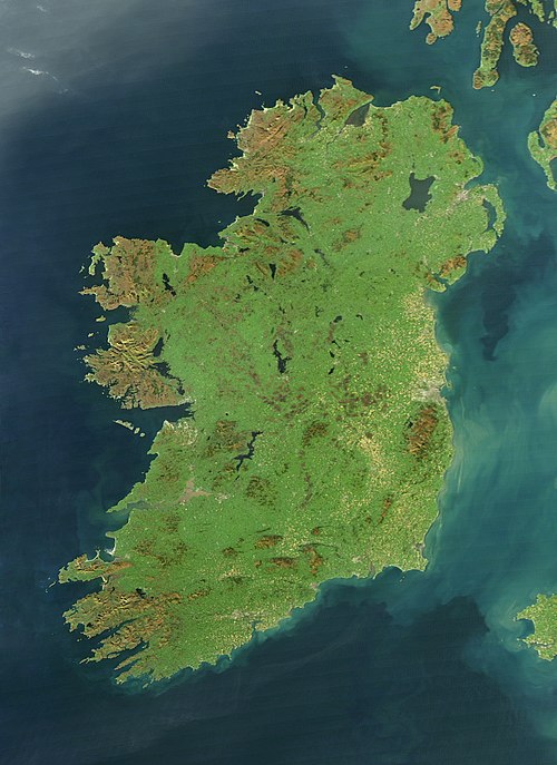
Ireland
- Area
- 83,553 km²
- High point
- 1,039 m
Ireland is an island in the North Atlantic Ocean, in Northwestern Europe. Geopolitically, the island is divided between the Republic of Ireland (officially named Ireland – a sovereign state covering five-sixths of the island) and Northern Ireland (part of the United Kingdom – covering the remaining sixth).

Minor islands

Lewis and Harris
- Area
- 2,149 km²
- High point
- 799 m

Isle of Skye
- Area
- 1,636 km²
- High point
- 992 m

Mainland
- Area
- 953 km²
- High point
- 450 m

Isle of Mull
- Area
- 885 km²
- High point
- 966 m

Anglesey
- Area
- 680 km²
- High point
- 178 m
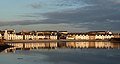
Islay
- Area
- 618 km²
- High point
- 491 m
Isle of Man
- Area
- 571 km²
- High point
- 621 m

Mainland
- Area
- 531 km²
- High point
- 275 m

Isle of Arran
- Area
- 430 km²
- High point
- 874 m

Jura
- Area
- 365 km²
- High point
- 785 m
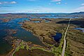
North Uist
- Area
- 319 km²
- High point
- 347 m
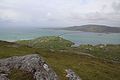
South Uist
- Area
- 307 km²
- High point
- 620 m

Yell
- Area
- 212 km²
- High point
- 210 m

Achill Island
- Area
- 148 km²
- High point
- 688 m

Hoy
- Area
- 144 km²
- High point
- 481 m

Jersey
- Area
- 120 km²
- High point
- 143 m

Unst
- Area
- 120 km²
- High point
- 285 m

Rùm
- Area
- 107 km²
- High point
- 812 m
Tiree
- Area
- 79 km²
- High point
- 140 m

Benbecula
- Area
- 77.7 km²
- High point
- 124 m
Coll
- Area
- 74.3 km²
- High point
- 103 m

Guernsey
- Area
- 63.6 km²
- High point
- 110 m

Raasay
- Area
- 62.4 km²
- High point
- 494 m

Barra
- Area
- 58 km²
- High point
- 383 m

Sanday
- Area
- 49.7 km²
- High point
- 65 m

South Ronaldsay
- Area
- 49.7 km²
- High point
- 118 m

Westray
- Area
- 48.6 km²
- High point
- 169 m

Rousay
- Area
- 47.2 km²
- High point
- 250 m

Colonsay
- Area
- 41 km²
- High point
- 143 m

Fetlar
- Area
- 40.5 km²
- High point
- 159 m

Holy Island
- Area
- 34.8 km²
- High point
- 220 m

Stronsay
- Area
- 33.9 km²
- High point
- 45 m

Eigg
- Area
- 29.7 km²
- High point
- 393 m

Eday
- Area
- 27.7 km²
- High point
- 102 m

Bressay
- Area
- 27.6 km²
- High point
- 226 m

Shapinsay
- Area
- 27.4 km²
- High point
- 65 m

Valentia Island
- Area
- 26.3 km²
- High point
- 320 m

Scalpay
- Area
- 24.7 km²
- High point
- 396 m

Lismore
- Area
- 21.8 km²
- High point
- 124 m

Great Bernera
- Area
- 20.4 km²
- High point
- 79 m

Whalsay
- Area
- 19.5 km²
- High point
- 122 m

Ulva
- Area
- 18.5 km²
- High point
- 313 m

Muckle Roe
- Area
- 17.2 km²
- High point
- 172 m

Scarba
- Area
- 14.5 km²
- High point
- 449 m

Rathlin Island
- Area
- 14.4 km²
- High point
- 134 m

Gigha
- Area
- 14.3 km²
- High point
- 100 m

Luing
- Area
- 14.2 km²
- High point
- 94 m

Taransay
- Area
- 13.9 km²
- High point
- 267 m

Seil
- Area
- 13.6 km²
- High point
- 146 m

Foula
- Area
- 13 km²
- High point
- 418 m

Kerrera
- Area
- 12.1 km²
- High point
- 189 m
Great Cumbrae
- Area
- 11.5 km²
- High point
- 132 m

Canna
- Area
- 11.2 km²
- High point
- 210 m

Scarp
- Area
- 10.6 km²
- High point
- 308 m

Soay
- Area
- 10.1 km²
- High point
- 138 m
Berneray
- Area
- 10 km²

Inishbofin
- Area
- 9.9 km²
- High point
- 89 m

Rona
- Area
- 9.7 km²
- High point
- 125 m

Vatersay
- Area
- 9.4 km²
- High point
- 190 m

Flotta
- Area
- 9.4 km²
- High point
- 57 m
Burray
- Area
- 9 km²
Baleshare
- Area
- 9 km²

Papa Westray
- Area
- 8.6 km²
- High point
- 46 m

Iona
- Area
- 8.5 km²
- High point
- 101 m

Alderney
- Area
- 8.2 km²
- High point
- 90 m

Fair Isle
- Area
- 8.1 km²
- High point
- 217 m

Papa Stour
- Area
- 8.1 km²
- High point
- 87 m

Pabbay
- Area
- 7.9 km²
- High point
- 196 m

North Ronaldsay
- Area
- 7.7 km²
- High point
- 22 m

Eriskay
- Area
- 7.4 km²
- High point
- 185 m

Grimsay
- Area
- 7.3 km²
- High point
- 28 m

West Burra
- Area
- 7.1 km²
- High point
- 63 m

Scalpay
- Area
- 6.8 km²
- High point
- 104 m

St Mary's
- Area
- 6.4 km²
- High point
- 51 m

Eilean Shona
- Area
- 6.4 km²
- High point
- 265 m

Mingulay
- Area
- 6.4 km²
- High point
- 273 m

Hirta
- Area
- 6.3 km²
- High point
- 430 m

Egilsay
- Area
- 6 km²
- High point
- 37 m

Ronay
- Area
- 5.6 km²
- High point
- 112 m
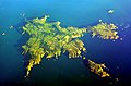
Sark
- Area
- 5.3 km²
- High point
- 114 m

Muck
- Area
- 5.2 km²
- High point
- 137 m

Oronsay
- Area
- 5.1 km²
- High point
- 93 m

East Burra
- Area
- 5 km²
- High point
- 81 m

Gometra
- Area
- 4.6 km²
- High point
- 155 m

Shuna
- Area
- 4.5 km²
- High point
- 90 m
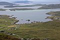
Sandray
- Area
- 4.3 km²
- High point
- 207 m

Wiay
- Area
- 4.1 km²
- High point
- 102 m
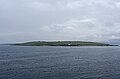
Graemsay
- Area
- 3.9 km²
- High point
- 62 m

Vementry
- Area
- 3.7 km²
- High point
- 90 m

Island of Stroma
- Area
- 3.7 km²
- High point
- 53 m

Isle of Ewe
- Area
- 3.6 km²
- High point
- 68 m
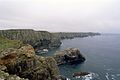
Tory Island
- Area
- 3.6 km²
- High point
- 59 m

Isle of Noss
- Area
- 3.3 km²
- High point
- 181 m

Handa Island
- Area
- 3.3 km²
- High point
- 123 m

Island of Danna
- Area
- 3.2 km²
- High point
- 52 m

Tanera Mòr
- Area
- 3 km²
- High point
- 124 m

Wyre
- Area
- 3 km²
- High point
- 31 m

Tresco
- Area
- 3 km²
- High point
- 34 m

Vaila
- Area
- 3 km²
- High point
- 91 m

Hascosay
- Area
- 2.8 km²
- High point
- 28 m

Fara
- Area
- 2.8 km²
- High point
- 42 m

Trondra
- Area
- 2.8 km²
- High point
- 59 m

Gairsay
- Area
- 2.7 km²
- High point
- 100 m
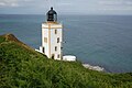
Holy Island
- Area
- 2.6 km²
- High point
- 314 m

Vallay
- Area
- 2.6 km²
- High point
- 34 m

Pabbay
- Area
- 2.5 km²
- High point
- 171 m

Seaforth Island
- Area
- 2.5 km²
- High point
- 217 m

Ramsey Island
- Area
- 2.5 km²
- High point
- 136 m
Uyea
- Area
- 2.4 km²
- High point
- 50 m
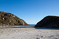
Erraid
- Area
- 2.4 km²
- High point
- 73 m

Fuday
- Area
- 2.3 km²
- High point
- 89 m

Oldany Island
- Area
- 2.3 km²
- High point
- 102 m

Boreray
- Area
- 2.2 km²
- High point
- 56 m

St Martin's
- Area
- 2.2 km²
- High point
- 46 m
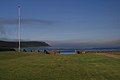
Calf of Eday
- Area
- 2.2 km²
- High point
- 54 m
Papa Little
- Area
- 2.1 km²
- High point
- 82 m

Barra Head
- Area
- 2.1 km²
- High point
- 193 m

Lunga
- Area
- 2 km²
- High point
- 94 m

Ceann Ear
- Area
- 2 km²
- High point
- 15 m

Gruinard Island
- Area
- 2 km²
- High point
- 104 m

Càrna
- Area
- 1.9 km²
- High point
- 170 m

Eilean Mòr
- Area
- 1.9 km²
- High point
- 112 m

Sanday
- Area
- 1.9 km²
- High point
- 59 m

Ensay
- Area
- 1.9 km²
- High point
- 49 m

Mousa
- Area
- 1.8 km²
- High point
- 43 m

Wiay
- Area
- 1.8 km²
- High point
- 61 m

Kirkibost
- Area
- 1.7 km²
- High point
- 17 m

Isle Martin
- Area
- 1.6 km²
- High point
- 119 m

Killegray
- Area
- 1.6 km²
- High point
- 45 m

Shuna Island
- Area
- 1.6 km²
- High point
- 71 m

Out Skerries
- Area
- 1.5 km²
- High point
- 43 m

Hellisay
- Area
- 1.5 km²
- High point
- 72 m
Flodaigh
- Area
- 1.5 km²

Eilean Fladday
- Area
- 1.4 km²
- High point
- 41 m
Fora Ness
- Area
- 1.4 km²
- High point
- 100 m

Isle Ristol
- Area
- 1.4 km²
- High point
- 69 m
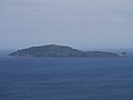
Sanda Island
- Area
- 1.4 km²
- High point
- 123 m

Faray
- Area
- 1.3 km²
- High point
- 30 m

Eilean Mhealasta
- Area
- 1.3 km²
- High point
- 77 m

Pabay
- Area
- 1.3 km²
- High point
- 27 m

Eilean Liubhaird
- Area
- 1.3 km²
- High point
- 75 m
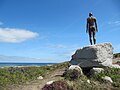
Herm
- Area
- 1.3 km²
- High point
- 73 m

Garbh Eileach
- Area
- 1.3 km²
- High point
- 107 m

West Linga
- Area
- 1.2 km²
- High point
- 49 m

Longa Island
- Area
- 1.2 km²
- High point
- 70 m

Ceann Iar
- Area
- 1.2 km²
- High point
- 19 m

Priest Island
- Area
- 1.2 km²
- High point
- 72 m

Bryher
- Area
- 1.2 km²
- High point
- 42 m

Little Bernera
- Area
- 1.2 km²
- High point
- 37 m

Torsa
- Area
- 1.1 km²
- High point
- 62 m

Rona
- Area
- 1.1 km²
- High point
- 108 m

St Agnes, Isles of Scilly
- Area
- 1.1 km²
- High point
- 15 m

Eilean nan Ròn
- Area
- 1 km²
- High point
- 74 m
Glimps Holm
- Area
- 1 km²
Hunda
- Area
- 1 km²

Pabaigh Mòr
- Area
- 1 km²
- High point
- 65 m

Hildasay
- Area
- 1 km²
- High point
- 28 m

Gighay
- Area
- 0.99 km²
- High point
- 95 m

Soay
- Area
- 0.97 km²
- High point
- 376 m

Eilean Rìgh
- Area
- 0.96 km²
- High point
- 55 m

Ailsa Craig
- Area
- 0.96 km²
- High point
- 340 m

Eorsa
- Area
- 0.96 km²
- High point
- 94 m
Orasaigh
- Area
- 0.91 km²
- High point
- 22 m

Swona
- Area
- 0.91 km²
- High point
- 38 m

Eilean Chaluim Chille
- Area
- 0.9 km²
- High point
- 39 m

Cava
- Area
- 0.89 km²
- High point
- 36 m

Boreray
- Area
- 0.86 km²
- High point
- 384 m

Balta
- Area
- 0.86 km²
- High point
- 42 m

Fuaigh Mòr
- Area
- 0.86 km²
- High point
- 66 m

Bigga
- Area
- 0.86 km²
- High point
- 33 m

Tanera Beag
- Area
- 0.86 km²
- High point
- 49 m

Garbh Eilean
- Area
- 0.85 km²
- High point
- 160 m

Auskerry
- Area
- 0.85 km²
- High point
- 18 m

Muldoanich
- Area
- 0.83 km²
- High point
- 154 m
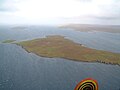
Samphrey
- Area
- 0.81 km²
- High point
- 29 m

Papa Stronsay
- Area
- 0.8 km²
- High point
- 10 m
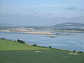
Mugdrum Island
- Area
- 0.8 km²
- High point
- 5 m
Fuiay
- Area
- 0.79 km²
- High point
- 107 m

Little Colonsay
- Area
- 0.76 km²
- High point
- 60 m

Eynhallow
- Area
- 0.73 km²
- High point
- 39 m
Eilean Chearstaidh
- Area
- 0.72 km²
- High point
- 35 m
St Ninian's Isle
- Area
- 0.72 km²
Hermetray
- Area
- 0.71 km²
- High point
- 35 m

Oxna
- Area
- 0.71 km²
- High point
- 32 m

Horse Island
- Area
- 0.69 km²
- High point
- 56 m

Gunna
- Area
- 0.67 km²
- High point
- 33 m

Stromay
- Area
- 0.66 km²
- High point
- 13 m

Eilean Tigh
- Area
- 0.66 km²
- High point
- 111 m

Island Macaskin
- Area
- 0.65 km²
- High point
- 65 m

Calve Island
- Area
- 0.65 km²
- High point
- 18 m

Linga Holm
- Area
- 0.63 km²
- High point
- 17 m

Cara Island
- Area
- 0.63 km²
- High point
- 51 m

Linga
- Area
- 0.63 km²
- High point
- 69 m

South Havra
- Area
- 0.62 km²
- High point
- 42 m

Texa
- Area
- 0.61 km²
- High point
- 50 m

Lunga
- Area
- 0.6 km²
- High point
- 103 m

Isle of May
- Area
- 0.6 km²
- High point
- 50 m

Copinsay
- Area
- 0.6 km²
- High point
- 67 m
Rocks & skerries
On the chart above, at its closest zooms.
Listing 200 of 12014; the rest are on the chart.
Figures
Comparative heights
- Great Britain: 1,345 m
- Ireland: 1,039 m
- Isle of Skye: 992 m
- Isle of Mull: 966 m
- Isle of Arran: 874 m
- Rùm: 812 m
- Lewis and Harris: 799 m
- Jura: 785 m
- Achill: 688 m
- Isle of Man: 621 m
- South Uist: 620 m
- Raasay: 494 m
- Islay: 491 m
- Hoy: 481 m
To the same scale
Islands by area
Groups within
Overlapping groups
Photographs

Drought in Great Britain. Image taken on August 11, 2022


Ford at Redmire

The former Athlone Midland station


Jeff Schmaltz, MODIS Land Rapid Response Team, NASA GSFC / Public domain


Satellite pictures of British Isles at 12:50 UTC April 8, 2017

Sources
Facts
Photographs
- Iss067e253753 lrg. Astronaut photograph ISS067-E-253753 was acquired on August 11, 2022, with a Nikon D5 digital camera using a focal lengt / Public domain
- Cloud-free Europe ESA17486464 (British Isles). European Space Agency / Attribution
- Ford at Redmire - geograph.org.uk - 4459893. John Walton / CC BY-SA 2.0
- The former Athlone Midland station (geograph 5345516). Gareth James / CC BY-SA 2.0
- British Isles Banner. Jim Linwood / CC BY 2.0
- Volcanic ash sweeping across northern Europe. Envisat satellite / CC BY-SA 3.0 igo
- Smoke from the Alberta Wildfires Reaches British Isles (NESDIS 2019-06-04). NOAA / Public domain
- British Isles (MODIS 2019-09-23). MODIS Land Rapid Response Team, NASA GSFC / Public domain
- British Isles (MODIS 2018-03-01). Jeff Schmaltz, MODIS Land Rapid Response Team, NASA GSFC / Public domain
- Great Britain and Ireland - Envisat. Envisat satellite / CC BY-SA 3.0 igo
- British Isles on April 8, 2017. NASA, MODIS / LANCE / Public domain
- United Kingdom satellite image bright. Unknown author / Public domain