English ChannelGuernsey and Jersey
49°26′N 2°21′W
Channel Islands
Guernsey (land mass)
Part of British Isles
The Channel Islands are an archipelago in the English Channel, off the French coast of Normandy. They are divided into two Crown Dependencies: the Bailiwick of Jersey, which is the largest of the islands; and the Bailiwick of Guernsey, consisting of Guernsey, Alderney, Sark, Herm and some smaller islands.

Chart
Overview
The Channel Islands are an archipelago in the English Channel, off the French coast of Normandy. They are divided into two Crown Dependencies: the Bailiwick of Jersey, which is the largest of the islands; and the Bailiwick of Guernsey, consisting of Guernsey, Alderney, Sark, Herm and some smaller islands. Historically, they are the remnants of the Duchy of Normandy. Although they are not part of the United Kingdom, the UK is responsible for the defence and international relations of the islands as it is for the other Crown Dependency, the Isle of Man, and the British Overseas Territories. The Crown Dependencies are neither members of the Commonwealth of Nations, nor part of the European Union. They have a total population of about 171,916, and the bailiwicks' capitals, Saint Helier and Saint Peter Port, have populations of 33,500 and 18,207 respectively. "Channel Islands" is a geographical term, not a political unit. The two bailiwicks have been administered separately since the late 13th century. Each has its own independent laws, elections, and representative bodies (although in modern times, politicians from the islands' legislatures are in regular contact). Any institution common to both is the exception rather than the rule. The Bailiwick of Guernsey is divided into three jurisdictions – Guernsey, Alderney and Sark – each with its own legislature. Although there are a few pan-island institutions (such as the Channel Islands Brussels Office, the Director of Civil Aviation and the Channel Islands Financial Ombudsman, which are actually joint ventures between the bailiwicks), these tend to be established structurally as equal projects between Guernsey and Jersey. Otherwise, entities whose names imply membership of both Guernsey and Jersey might in fact be from one bailiwick only. For instance, The International Stock Exchange is in Saint Peter Port and therefore is in Guernsey. The term "Channel Islands" began to be used around 1830, possibly first by the Royal Navy as a collective name for the islands. The term refers only to the archipelago to the west of the Cotentin Peninsula. Other populated islands located in the English Channel, and close to the coast of Britain, such as the Isle of Wight, Hayling Island and Portsea Island, are not regarded as "Channel Islands".
From Wikipedia, CC BY-SA 4.0
Census, cataloged
- Major islands2
- Minor islands8
- Islets140
- Rocks & skerries285
Major islands
Jersey
- Area
- 120 km²
- High point
- 143 m
Jersey ( JUR-zee; Jèrriais: Jèrri [ʒɛri]), officially the Bailiwick of Jersey, is an autonomous and self-governing British Crown Dependency in Northwestern Europe 14 miles (23 km) off the Cotentin Peninsula of north-west France.
Guernsey
- Area
- 63.6 km²
- High point
- 110 m
Guernsey ( GURN-zee; Guernésiais: Guernési) is the second-largest island in the Channel Islands, located 27 miles (43 km) west of the Cotentin Peninsula, Normandy.


Minor islands

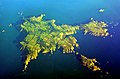
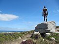


Rocks & skerries
On the chart above, at its closest zooms.
Listing 10 of 435; the rest are on the chart.
Figures
Comparative heights
To the same scale
Groups within
Photographs

Jethou, private island in Channel Islands between Guernsey and Herm

The islands of Sark and Brecqhou. Photo by Henry Johnson (2009).

Elizabeth Castle Island St Helier Insel Jersey Channel Islands United Kingdom - Foto 2017 Wolfgang Pehlemann P1170258.jpg

Gulls at Channel Islands

Date: 2018-06-30 Sensor: MSI on Sentinel-2B Resolution: 10m RGB Composites: True color, Band 4-3-2

Cruise ships at St- Peter Port, Guernsey

A picture of Braye Road station on the Alderney Railway in the Channel Islands in 2025.

Platform Gilda off Ventura, CA in the Channel Islands.

Cobo Bay, Guernsey

George VI Homes La Route de St Aubin St Helier

Channel Islands: looking north from Jersey. From left to right: Jethou, Herm, Sark Photo taken by Man vyi with Canon PowerShot A40 on 22/5/2005
No machine-readable author provided. Man vyi assumed (based on copyright claims). / Public domain
Sources
Facts
Photographs
- Jethou, island in Channel islands. Mramoeba / CC BY-SA 4.0
- Sark and Brecqhou. Professional academic writer / CC BY 4.0
- Elizabeth Castle Island St Helier Insel Jersey Channel Islands United Kingdom - Foto 2017 Wolfgang Pehlemann P1170258. Wolfgang Pehlemann / CC BY-SA 3.0 de
- Gulls at Channel Islands - Flickr - GregTheBusker. Greg Schechter from San Francisco, USA / CC BY 2.0
- Channel Islands by Sentinel-2. Copernicus Sentinel-2, ESA / CC BY-SA 3.0 igo
- Cruiseships guernsey. Kmtextor / CC BY-SA 4.0
- Braye Road station 2025. Grandtubetrains / CC0
- PlatformGilda1. AetherbandPhotography / CC BY-SA 4.0
- Cobo Bay, Guernsey (49557681971). Andrew Milligan sumo / CC BY 2.0
- George VI Homes Jersey 202112. Jèrriais janne / CC BY-SA 4.0
- Jethou Herm Sark viewed from Jersey. No machine-readable author provided. Man vyi assumed (based on copyright claims). / Public domain
- Channel islands banner La Moye golf club Jersey. Man vyi / CC0