Herm
Haerme, Hermas
49°28′N 2°27′W
Herm (Guernésiais: Haerme, ultimately from Old Norse armr 'arm', due to the shape of the island, or Old French eremite 'hermit') is one of the Channel Islands and part of the Parish of St Peter Port in the Bailiwick of Guernsey. It is located in the English Channel, north-west of France and south of England.

Terrain
49°28′N 2°27′W
Overview
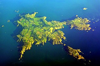
Herm (Guernésiais: Haerme, ultimately from Old Norse armr 'arm', due to the shape of the island, or Old French eremite 'hermit') is one of the Channel Islands and part of the Parish of St Peter Port in the Bailiwick of Guernsey. It is located in the English Channel, north-west of France and south of England. It is 2,183 m (7,162 ft) long and under 873 metres (2,864 ft) wide; oriented north–south, with several stretches of sand along its northern coast. The much larger island of Guernsey lies to the west, Jersey lies to the south-east, and the smaller island of Jethou is just off the south-west coast. Herm was first discovered in the Mesolithic period, and the first settlers arrived in the Neolithic and Bronze Ages. Many tombs from that period remain today, the majority in the north of the island. The island was annexed to the Duchy of Normandy in 933, but was transferred to the English Crown with the division of Normandy in 1204. It was occupied by Germany in the Second World War and was the target of Operation Huckaback, but was largely bypassed. Herm is currently managed by Herm Island Ltd. The company was formed by Starboard Settlement, which acquired Herm in 2008, following fears during the sale of the island that the 'identity' of the island was at threat. Herm's harbour is on its west coast. There are several buildings of note in the vicinity, including the White House, St Tugual's Chapel, Fisherman's Cottage, The Mermaid pub and restaurant, and a small primary school with about eight pupils. During a busy summer season, up to 100,000 tourists visit the island, arriving by one of the catamaran ferries operated by the Trident Charter Company. Cars are banned from the island, as are bicycles, although quad bikes and tractors are allowed for staff and luggage transport, respectively.
From Wikipedia, CC BY-SA 4.0
Chart
Nearest islands
Also in Channel Islands




Also in British Isles

Great Britain
218,685 km²▲ 1,345 m
Major islands

Ireland
83,553 km²▲ 1,039 m
Major islands

Lewis and Harris
2,149 km²▲ 799 m
Minor islands

Isle of Skye
1,636 km²▲ 992 m
Minor islands

Mainland
953 km²▲ 450 m
Minor islands

Isle of Mull
885 km²▲ 966 m
Minor islands

Anglesey
680 km²▲ 178 m
Minor islands

Islay
618 km²▲ 491 m
Minor islands
Photographs

"Another Time XI" by Antony Gormley at Le Petit Monceau on Herm, facing nothing.

Stone cross at the "Mystery Grave" in Herm, Channel Islands.

Hiking path along the south-eastern coast of Herm, Channel Islands.

The Rosaire Steps (alternate ferry landing for low tide) in Herm, Channel Islands.

Herm Island, Rosaire Steps

Ferry Trident VI from Herm entering Saint Peter Port harbour

Robert's Cross, prehistoric grave, Herm Island

Caquorobert Island (Channel Islands), seen from Herm

Robert's Cross, prehistoric grave, Herm Island

Herm Island, Coastline with Belvoir Beach and Shell Bay

Port de Herm Marée basse

Herm 2
Sources
Facts
Photographs
- Antony Gormley's "Another Time XI" on Herm - facing nothing. Erik1980 / CC BY-SA 3.0
- Herm Mystery Grave. Daniel Kraft / CC BY-SA 3.0
- Herm path south-east. Daniel Kraft / CC BY-SA 3.0
- Herm Rosaire Steps 20160905. Daniel Kraft / CC BY-SA 3.0
- Herm Rosaire Steps. Unukorno / CC BY-SA 3.0
- Saint Peter Port - Trident VI 20260809-01. Pymouss / CC BY-SA 4.0
- Herm Roberts Cross. Unukorno / CC BY-SA 3.0
- Caquorobert. Unukorno / CC BY-SA 3.0
- Roberts Cross Herm. Unukorno / CC BY-SA 3.0
- Herm Island Coast. Unukorno / CC BY-SA 3.0
- HermPortMB. Christian Pinatel / CC BY-SA 3.0
- Herm 2. Dickelbers / CC BY-SA 3.0