Atlantic OceanUnited Kingdom
58°00′N 7°00′W
Hebrides
Part of British Isles
The Hebrides are the largest archipelago in Scotland and the British Isles, off the west coast of the Scottish mainland. The islands fall into two main groups, based on their proximity to the mainland: the Inner and Outer Hebrides.

Chart
Overview
The Hebrides are the largest archipelago in Scotland and the British Isles, off the west coast of the Scottish mainland. The islands fall into two main groups, based on their proximity to the mainland: the Inner and Outer Hebrides. These islands have a long history of occupation (dating back to the Mesolithic period), and the culture of the inhabitants has been successively influenced by the cultures of Celtic-speaking, Norse-speaking, and English-speaking peoples. This diversity is reflected in the various names given to the islands, which are derived from the different languages that have been spoken there at various points in their history. The Hebrides are where much of Scottish Gaelic literature and Gaelic music has historically originated. Today, the economy of the islands is dependent on crofting, fishing, tourism, the oil industry, and renewable energy. The Hebrides have less biodiversity than mainland Scotland, but a significant number of seals and seabirds. The islands have a combined area of 7,285 km2 (2,813 sq mi), and, as of 2011, a combined population of around 45,000.
From Wikipedia, CC BY-SA 4.0
Census, cataloged
- Major islands6
- Minor islands262
- Islets2,517
- Rocks & skerries6,981
Major islands
Lewis and Harris
- Area
- 2,149 km²
- High point
- 799 m
Lewis and Harris, or Lewis with Harris, is the largest island in Scotland. It is the main island of the Outer Hebrides, around 24 miles (39 km) from the Scottish mainland.
Isle of Skye
- Area
- 1,636 km²
- High point
- 992 m
The Isle of Skye, or simply Skye, is the largest and northernmost of the major islands in the Inner Hebrides of Scotland. The island's peninsulas radiate from a mountainous hub dominated by the Cuillin, the rocky slopes of which provide some of the most dramatic mountain scenery in the country.
Isle of Mull
- Area
- 885 km²
- High point
- 966 m
The Isle of Mull, or simply Mull, is the second-largest island of the Inner Hebrides of the west coast of Scotland.
Islay
- Area
- 618 km²
- High point
- 491 m
Islay is the southernmost island of the Inner Hebrides of Scotland. Known as "The Queen of the Hebrides", it lies in Argyll and Bute just south-west of Jura and around 40 kilometres (22 nautical miles) north of the Northern Irish coast.
Jura
- Area
- 365 km²
- High point
- 785 m
Jura ( JOOR-ə; Scottish Gaelic: Diùra) is an island in the Inner Hebrides of Scotland, adjacent to and northeast of Islay.
North Uist
- Area
- 319 km²
- High point
- 347 m
North Uist (Scottish Gaelic: Uibhist a Tuath) is an island and community in the Outer Hebrides of Scotland.


Minor islands
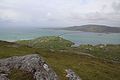
South Uist
- Area
- 307 km²
- High point
- 620 m

Rùm
- Area
- 107 km²
- High point
- 812 m
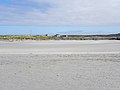
Tiree
- Area
- 79 km²
- High point
- 140 m

Benbecula
- Area
- 77.7 km²
- High point
- 124 m
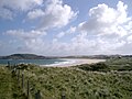
Coll
- Area
- 74.3 km²
- High point
- 103 m

Raasay
- Area
- 62.4 km²
- High point
- 494 m

Barra
- Area
- 58 km²
- High point
- 383 m

Colonsay
- Area
- 41 km²
- High point
- 143 m

Eigg
- Area
- 29.7 km²
- High point
- 393 m

Scalpay
- Area
- 24.7 km²
- High point
- 396 m

Lismore
- Area
- 21.8 km²
- High point
- 124 m

Great Bernera
- Area
- 20.4 km²
- High point
- 79 m

Ulva
- Area
- 18.5 km²
- High point
- 313 m

Scarba
- Area
- 14.5 km²
- High point
- 449 m

Gigha
- Area
- 14.3 km²
- High point
- 100 m

Luing
- Area
- 14.2 km²
- High point
- 94 m

Taransay
- Area
- 13.9 km²
- High point
- 267 m

Seil
- Area
- 13.6 km²
- High point
- 146 m

Kerrera
- Area
- 12.1 km²
- High point
- 189 m

Canna
- Area
- 11.2 km²
- High point
- 210 m

Scarp
- Area
- 10.6 km²
- High point
- 308 m

Soay
- Area
- 10.1 km²
- High point
- 138 m
Berneray
- Area
- 10 km²

Rona
- Area
- 9.7 km²
- High point
- 125 m

Vatersay
- Area
- 9.4 km²
- High point
- 190 m
Baleshare
- Area
- 9 km²

Iona
- Area
- 8.5 km²
- High point
- 101 m

Pabbay
- Area
- 7.9 km²
- High point
- 196 m

Eriskay
- Area
- 7.4 km²
- High point
- 185 m

Grimsay
- Area
- 7.3 km²
- High point
- 28 m

Scalpay
- Area
- 6.8 km²
- High point
- 104 m

Eilean Shona
- Area
- 6.4 km²
- High point
- 265 m

Mingulay
- Area
- 6.4 km²
- High point
- 273 m

Hirta
- Area
- 6.3 km²
- High point
- 430 m

Ronay
- Area
- 5.6 km²
- High point
- 112 m

Muck
- Area
- 5.2 km²
- High point
- 137 m

Oronsay
- Area
- 5.1 km²
- High point
- 93 m

Gometra
- Area
- 4.6 km²
- High point
- 155 m

Shuna
- Area
- 4.5 km²
- High point
- 90 m
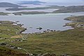
Sandray
- Area
- 4.3 km²
- High point
- 207 m

Wiay
- Area
- 4.1 km²
- High point
- 102 m

Isle of Ewe
- Area
- 3.6 km²
- High point
- 68 m

Handa Island
- Area
- 3.3 km²
- High point
- 123 m

Island of Danna
- Area
- 3.2 km²
- High point
- 52 m

Tanera Mòr
- Area
- 3 km²
- High point
- 124 m

Vallay
- Area
- 2.6 km²
- High point
- 34 m

Pabbay
- Area
- 2.5 km²
- High point
- 171 m

Seaforth Island
- Area
- 2.5 km²
- High point
- 217 m
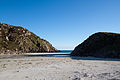
Erraid
- Area
- 2.4 km²
- High point
- 73 m

Fuday
- Area
- 2.3 km²
- High point
- 89 m

Oldany Island
- Area
- 2.3 km²
- High point
- 102 m

Boreray
- Area
- 2.2 km²
- High point
- 56 m

Barra Head
- Area
- 2.1 km²
- High point
- 193 m

Lunga
- Area
- 2 km²
- High point
- 94 m

Ceann Ear
- Area
- 2 km²
- High point
- 15 m

Gruinard Island
- Area
- 2 km²
- High point
- 104 m

Càrna
- Area
- 1.9 km²
- High point
- 170 m

Eilean Mòr
- Area
- 1.9 km²
- High point
- 112 m

Sanday
- Area
- 1.9 km²
- High point
- 59 m

Ensay
- Area
- 1.9 km²
- High point
- 49 m

Wiay
- Area
- 1.8 km²
- High point
- 61 m

Kirkibost
- Area
- 1.7 km²
- High point
- 17 m

Isle Martin
- Area
- 1.6 km²
- High point
- 119 m

Killegray
- Area
- 1.6 km²
- High point
- 45 m

Shuna Island
- Area
- 1.6 km²
- High point
- 71 m

Hellisay
- Area
- 1.5 km²
- High point
- 72 m
Flodaigh
- Area
- 1.5 km²

Eilean Fladday
- Area
- 1.4 km²
- High point
- 41 m

Isle Ristol
- Area
- 1.4 km²
- High point
- 69 m
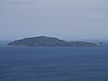
Sanda Island
- Area
- 1.4 km²
- High point
- 123 m

Eilean Mhealasta
- Area
- 1.3 km²
- High point
- 77 m

Pabay
- Area
- 1.3 km²
- High point
- 27 m

Eilean Liubhaird
- Area
- 1.3 km²
- High point
- 75 m

Garbh Eileach
- Area
- 1.3 km²
- High point
- 107 m

Longa Island
- Area
- 1.2 km²
- High point
- 70 m

Ceann Iar
- Area
- 1.2 km²
- High point
- 19 m

Priest Island
- Area
- 1.2 km²
- High point
- 72 m

Little Bernera
- Area
- 1.2 km²
- High point
- 37 m

Torsa
- Area
- 1.1 km²
- High point
- 62 m

Rona
- Area
- 1.1 km²
- High point
- 108 m

Pabaigh Mòr
- Area
- 1 km²
- High point
- 65 m

Gighay
- Area
- 0.99 km²
- High point
- 95 m

Soay
- Area
- 0.97 km²
- High point
- 376 m

Eilean Rìgh
- Area
- 0.96 km²
- High point
- 55 m

Eorsa
- Area
- 0.96 km²
- High point
- 94 m
Orasaigh
- Area
- 0.91 km²
- High point
- 22 m

Eilean Chaluim Chille
- Area
- 0.9 km²
- High point
- 39 m

Boreray
- Area
- 0.86 km²
- High point
- 384 m

Fuaigh Mòr
- Area
- 0.86 km²
- High point
- 66 m

Tanera Beag
- Area
- 0.86 km²
- High point
- 49 m

Garbh Eilean
- Area
- 0.85 km²
- High point
- 160 m

Muldoanich
- Area
- 0.83 km²
- High point
- 154 m
Fuiay
- Area
- 0.79 km²
- High point
- 107 m

Little Colonsay
- Area
- 0.76 km²
- High point
- 60 m
Eilean Chearstaidh
- Area
- 0.72 km²
- High point
- 35 m
Hermetray
- Area
- 0.71 km²
- High point
- 35 m

Horse Island
- Area
- 0.69 km²
- High point
- 56 m

Gunna
- Area
- 0.67 km²
- High point
- 33 m

Stromay
- Area
- 0.66 km²
- High point
- 13 m

Eilean Tigh
- Area
- 0.66 km²
- High point
- 111 m

Island Macaskin
- Area
- 0.65 km²
- High point
- 65 m

Calve Island
- Area
- 0.65 km²
- High point
- 18 m

Cara Island
- Area
- 0.63 km²
- High point
- 51 m

Texa
- Area
- 0.61 km²
- High point
- 50 m

Lunga
- Area
- 0.6 km²
- High point
- 103 m

Eileach an Naoimh
- Area
- 0.59 km²
- High point
- 70 m

Isay
- Area
- 0.59 km²
- High point
- 28 m
Flodaigh Mòr
- Area
- 0.57 km²
- High point
- 26 m

Eilean an Taighe
- Area
- 0.55 km²
- High point
- 124 m
Tahay
- Area
- 0.55 km²
- High point
- 63 m
Keallasay More
- Area
- 0.55 km²
- High point
- 9 m

Eilean Meadhonach
- Area
- 0.54 km²
- High point
- 51 m

Eilean Dubh Mòr
- Area
- 0.52 km²
- High point
- 50 m

Longay
- Area
- 0.51 km²
- High point
- 66 m

Stuley
- Area
- 0.51 km²
- High point
- 38 m
Stockinish Island
- Area
- 0.51 km²
- High point
- 44 m
Sgeotasaigh
- Area
- 0.5 km²
- High point
- 57 m

Eilean Trodday
- Area
- 0.49 km²
- High point
- 42 m

Inch Kenneth
- Area
- 0.48 km²
- High point
- 44 m
Soay Mòr
- Area
- 0.45 km²
- High point
- 35 m
Keallasay Beg
- Area
- 0.45 km²
- High point
- 12 m

Eilean Dubh
- Area
- 0.44 km²
- High point
- 85 m

Shillay
- Area
- 0.43 km²
- High point
- 78 m

Lingay
- Area
- 0.43 km²
- High point
- 96 m

Eilean Mullagrach
- Area
- 0.42 km²
- High point
- 45 m
Unnamed island
- Area
- 0.42 km²
- High point
- 23 m

Nave Island
- Area
- 0.4 km²
- High point
- 31 m
Flodday
- Area
- 0.39 km²
- High point
- 41 m

Harlosh Island
- Area
- 0.38 km²
- High point
- 53 m

Ornsay
- Area
- 0.37 km²
- High point
- 43 m
Bernera Island
- Area
- 0.37 km²
- High point
- 55 m
Insh Island
- Area
- 0.37 km²
- High point
- 66 m

Fiaraidh
- Area
- 0.36 km²
- High point
- 31 m
Vacsay
- Area
- 0.36 km²
- High point
- 32 m
Unnamed island
- Area
- 0.34 km²
- High point
- 48 m

Orosay
- Area
- 0.33 km²
- High point
- 34 m

Lingeigh
- Area
- 0.31 km²
- High point
- 83 m

Eilean Mhuire
- Area
- 0.31 km²
- High point
- 89 m
Eilean Flodigarry
- Area
- 0.31 km²
- High point
- 53 m

Groay
- Area
- 0.31 km²
- High point
- 23 m

Dùn
- Area
- 0.31 km²
- High point
- 178 m

Staffa
- Area
- 0.3 km²
- High point
- 42 m

Tarner Island
- Area
- 0.3 km²
- High point
- 64 m
Calbhaigh
- Area
- 0.29 km²
- High point
- 16 m

Easdale
- Area
- 0.29 km²
- High point
- 31 m

Fuaigh Beag
- Area
- 0.29 km²
- High point
- 66 m
Unnamed island
- Area
- 0.29 km²
- High point
- 8 m
Triallabreac
- Area
- 0.29 km²
- High point
- 21 m
Vaccasay
- Area
- 0.28 km²
- High point
- 16 m
Dubh Eilean
- Area
- 0.28 km²
- High point
- 15 m

Orsay
- Area
- 0.28 km²
- High point
- 25 m

Fladda
- Area
- 0.28 km²
- High point
- 23 m
Unnamed island
- Area
- 0.27 km²
- High point
- 7 m
Eilean Orasaigh
- Area
- 0.27 km²
- High point
- 46 m

South Ascrib
- Area
- 0.27 km²
- High point
- 38 m
Sursaigh
- Area
- 0.27 km²
- High point
- 25 m
Eilean Iasgaich Mòr
- Area
- 0.27 km²
- High point
- 18 m
Fodragaigh
- Area
- 0.26 km²
- High point
- 16 m
Glas-leac Mòr
- Area
- 0.26 km²
- High point
- 27 m
Soa
- Area
- 0.26 km²
- High point
- 11 m

Eilean Chathastail
- Area
- 0.26 km²
- High point
- 35 m

Bac Mòr
- Area
- 0.25 km²
- High point
- 67 m
Staffin Island
- Area
- 0.25 km²
- High point
- 16 m
Keava
- Area
- 0.25 km²
- High point
- 26 m
Fladda Chuain
- Area
- 0.24 km²
- High point
- 25 m

Sibhinis
- Area
- 0.24 km²
- High point
- 11 m
Eilean Fada Mòr
- Area
- 0.23 km²
- High point
- 26 m
Rubha Fiola
- Area
- 0.23 km²
- High point
- 29 m
Oronsay
- Area
- 0.23 km²
- High point
- 49 m
Gilsay
- Area
- 0.22 km²
- High point
- 23 m
Cliasay More
- Area
- 0.22 km²
- High point
- 16 m
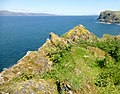
A' Chùli
- Area
- 0.22 km²
- High point
- 37 m
Eilean nan Each
- Area
- 0.22 km²
- High point
- 54 m
Gairbh Eilein
- Area
- 0.21 km²
- High point
- 18 m
Eilean Thòraidh
- Area
- 0.21 km²
- High point
- 47 m

Eilean Mòr
- Area
- 0.2 km²
- High point
- 15 m
Torogay
- Area
- 0.2 km²
- High point
- 12 m
Fiola Meadhonach
- Area
- 0.2 km²
- High point
- 30 m
Eilean Mor
- Area
- 0.2 km²
- High point
- 17 m
Flodday
- Area
- 0.2 km²
- High point
- 43 m
Eilean Iomarsaigh
- Area
- 0.2 km²
- High point
- 9 m
Soay Beag
- Area
- 0.19 km²
- High point
- 36 m
Siolaigh Mòr
- Area
- 0.19 km²
- High point
- 27 m
Wiay Beg
- Area
- 0.19 km²
- High point
- 21 m
Unnamed island
- Area
- 0.19 km²
- High point
- 24 m
Eilean na Cille
- Area
- 0.18 km²
- High point
- 21 m
Orasay Island
- Area
- 0.18 km²
- High point
- 9 m
Eilean Mòr
- Area
- 0.18 km²
- High point
- 5 m
Floddaybeg
- Area
- 0.18 km²
- High point
- 28 m
Tannray
- Area
- 0.18 km²
- High point
- 38 m
Eilean Beag
- Area
- 0.18 km²
- High point
- 35 m
Eilean a'Chalmain
- Area
- 0.17 km²
- High point
- 33 m
Eilean Mòr
- Area
- 0.17 km²
- High point
- 11 m
Eilean Dubh Beag
- Area
- 0.17 km²
- High point
- 38 m
Rocks & skerries
On the chart above, at its closest zooms.
Listing 200 of 9766; the rest are on the chart.
Figures
Comparative heights
- Isle of Skye: 992 m
- Isle of Mull: 966 m
- Rùm: 812 m
- Lewis and Harris: 799 m
- Jura: 785 m
- South Uist: 620 m
- Raasay: 494 m
- Islay: 491 m
- Scarba: 449 m
- Hirta: 430 m
- Scalpay: 396 m
- Eigg: 393 m
- Boreray: 384 m
- Barra: 383 m
To the same scale
Islands by area
Groups within
Overlapping groups
Photographs

View of the Skye Bridge. The road bridge connects the Isle of Skye with the Scottish mainland. Skye is the largest island in the Inner Hebrides.

Jura seen from Bunnahabhain

Looking South over the Quiraing on the Isle of Skye.

Landschaft nahe der Ortschaft Kildalton, im Hintergrund der Berg Beinn Sholum.


U.S. Marine Corps photo by Cpl. Anakin Smith / Public domain

U.S. Marine Corps photo by Cpl. Anakin Smith / Public domain

Hebridean Beach

Algae and Rocks, Hebrides

Iona and Staffa Inner Hebrides

A865 near Aileodair, North Uist, Outer Hebrides, Scotland
Sources
Facts
Photographs
- 00 2355 Skye Bridge - (Scotland). W. Bulach / CC BY-SA 4.0
- Jura seen from Bunnahabhain - panoramio. Bjarne Henning Kvaal… / CC BY-SA 3.0
- South over the Quiraing, Isle of Skye - 2. Colin / CC BY-SA 4.0
- Scotland Argyll Bute Islay Kildalton Landscape 04. MSeses / CC BY-SA 4.0
- 1-57 ADA Supports Formidable Shield 25 (9038344). U.S. Army 10AAMDC by Sgt. Yesenia Cadavid / Public domain
- 1-57 ADA Supports Formidable Shield 25 (9038345). U.S. Army 10AAMDC by Sgt. Yesenia Cadavid / Public domain
- U S Marines Load KC-130 for Movement to Scotland (9042847). U.S. Marine Corps photo by Cpl. Anakin Smith / Public domain
- U S Marines Load KC-130 for Movement to Scotland (9042850). U.S. Marine Corps photo by Cpl. Anakin Smith / Public domain
- Hebridean Beach (3955231397). Kristi Herbert / CC BY 2.0
- Flowing green, Hebrides, Scotland. Hartmut Schmidt Heidelberg / CC BY-SA 4.0
- Iona and Staffa Inner Hebrides (6143877775). dun_deagh / CC BY-SA 2.0
- A865 near Aileodair Aerial 02. PaulT (Gunther Tschuch) / CC BY-SA 4.0