Atlantic OceanUnited Kingdom
57°46′N 7°01′W
Outer Hebrides
Na h-Eileanan Siar
Part of Hebrides
The Outer Hebrides or Western Isles, sometimes known as the Long Isle or Long Island, is an island chain off the west coast of mainland Scotland.

Chart
Overview
The Outer Hebrides or Western Isles, sometimes known as the Long Isle or Long Island, is an island chain off the west coast of mainland Scotland. It is the longest archipelago in the British Isles. The islands form part of the archipelago of the Hebrides, separated from the Scottish mainland and from the Inner Hebrides by the waters of the Minch, the Little Minch, and the Sea of the Hebrides. The Outer Hebrides are considered to be the traditional heartland of the Gaelic language. The islands form one of the 32 council areas of Scotland; since 1998, the area has used only the Gaelic form of its name, including in English language contexts. The council area is called Na h-Eileanan an Iar ('the Western Isles') and its council is Comhairle nan Eilean Siar ('Council of the Western Isles'). Most of the islands have a bedrock formed from ancient metamorphic rocks, and the climate is mild and oceanic. The 19 inhabited islands had an estimated population of 25,770 in 2025, and there are more than 50 substantial uninhabited islands. The distance from Barra Head to the Butt of Lewis is roughly 210 kilometres (130 mi). There are various important prehistoric structures, many of which pre-date the first written references to the islands by Roman and Greek authors. The Western Isles became part of the Norse kingdom of the Suðreyjar, which lasted for over 400 years, until sovereignty over the Outer Hebrides was transferred to Scotland by the Treaty of Perth in 1266. Control of the islands was then held by clan chiefs, principal amongst whom were the MacLeods, MacDonalds, and the MacNeils. The Highland Clearances of the 19th century had a devastating effect on many communities, and it is only in recent years that population levels have ceased to decline. Much of the land is now under local control, and commercial activity is based on tourism, crofting, fishing, and weaving. Sea transport is crucial for those who live and work in the Outer Hebrides, and a variety of ferry services operate between the islands and to mainland Scotland. Modern navigation systems now minimise the dangers, but in the past the stormy seas in the region have claimed many ships. The Gaelic language, religion, music and sport are important aspects of local culture, and there are numerous designated conservation areas to protect the natural environment.
From Wikipedia, CC BY-SA 4.0
Census, cataloged
- Major islands3
- Minor islands132
- Islets1,529
- Rocks & skerries4,586
Major islands
Lewis and Harris
- Area
- 2,149 km²
- High point
- 799 m
Lewis and Harris, or Lewis with Harris, is the largest island in Scotland. It is the main island of the Outer Hebrides, around 24 miles (39 km) from the Scottish mainland.
North Uist
- Area
- 319 km²
- High point
- 347 m
North Uist (Scottish Gaelic: Uibhist a Tuath) is an island and community in the Outer Hebrides of Scotland.
South Uist
- Area
- 307 km²
- High point
- 620 m
ɪʃtʲ ə ˈtʲes̪] ; Scots: Sooth Uist) is the second-largest island of the Outer Hebrides in Scotland. At the 2022 census it had a usually resident population of 1,650, a decrease of 104 since 2011.


Minor islands

Benbecula
- Area
- 77.7 km²
- High point
- 124 m

Barra
- Area
- 58 km²
- High point
- 383 m

Great Bernera
- Area
- 20.4 km²
- High point
- 79 m

Taransay
- Area
- 13.9 km²
- High point
- 267 m

Scarp
- Area
- 10.6 km²
- High point
- 308 m
Berneray
- Area
- 10 km²

Vatersay
- Area
- 9.4 km²
- High point
- 190 m
Baleshare
- Area
- 9 km²

Pabbay
- Area
- 7.9 km²
- High point
- 196 m

Eriskay
- Area
- 7.4 km²
- High point
- 185 m

Grimsay
- Area
- 7.3 km²
- High point
- 28 m

Scalpay
- Area
- 6.8 km²
- High point
- 104 m

Mingulay
- Area
- 6.4 km²
- High point
- 273 m

Hirta
- Area
- 6.3 km²
- High point
- 430 m

Ronay
- Area
- 5.6 km²
- High point
- 112 m
Sandray
- Area
- 4.3 km²
- High point
- 207 m

Wiay
- Area
- 4.1 km²
- High point
- 102 m

Vallay
- Area
- 2.6 km²
- High point
- 34 m

Pabbay
- Area
- 2.5 km²
- High point
- 171 m

Seaforth Island
- Area
- 2.5 km²
- High point
- 217 m

Fuday
- Area
- 2.3 km²
- High point
- 89 m

Boreray
- Area
- 2.2 km²
- High point
- 56 m

Barra Head
- Area
- 2.1 km²
- High point
- 193 m

Ceann Ear
- Area
- 2 km²
- High point
- 15 m

Ensay
- Area
- 1.9 km²
- High point
- 49 m

Kirkibost
- Area
- 1.7 km²
- High point
- 17 m

Killegray
- Area
- 1.6 km²
- High point
- 45 m

Hellisay
- Area
- 1.5 km²
- High point
- 72 m
Flodaigh
- Area
- 1.5 km²

Eilean Mhealasta
- Area
- 1.3 km²
- High point
- 77 m

Eilean Liubhaird
- Area
- 1.3 km²
- High point
- 75 m

Ceann Iar
- Area
- 1.2 km²
- High point
- 19 m

Little Bernera
- Area
- 1.2 km²
- High point
- 37 m

Rona
- Area
- 1.1 km²
- High point
- 108 m

Pabaigh Mòr
- Area
- 1 km²
- High point
- 65 m

Gighay
- Area
- 0.99 km²
- High point
- 95 m

Soay
- Area
- 0.97 km²
- High point
- 376 m
Orasaigh
- Area
- 0.91 km²
- High point
- 22 m

Eilean Chaluim Chille
- Area
- 0.9 km²
- High point
- 39 m

Boreray
- Area
- 0.86 km²
- High point
- 384 m

Fuaigh Mòr
- Area
- 0.86 km²
- High point
- 66 m

Muldoanich
- Area
- 0.83 km²
- High point
- 154 m
Fuiay
- Area
- 0.79 km²
- High point
- 107 m
Eilean Chearstaidh
- Area
- 0.72 km²
- High point
- 35 m
Hermetray
- Area
- 0.71 km²
- High point
- 35 m

Stromay
- Area
- 0.66 km²
- High point
- 13 m
Flodaigh Mòr
- Area
- 0.57 km²
- High point
- 26 m
Tahay
- Area
- 0.55 km²
- High point
- 63 m
Keallasay More
- Area
- 0.55 km²
- High point
- 9 m

Stuley
- Area
- 0.51 km²
- High point
- 38 m
Stockinish Island
- Area
- 0.51 km²
- High point
- 44 m
Sgeotasaigh
- Area
- 0.5 km²
- High point
- 57 m
Soay Mòr
- Area
- 0.45 km²
- High point
- 35 m
Keallasay Beg
- Area
- 0.45 km²
- High point
- 12 m

Shillay
- Area
- 0.43 km²
- High point
- 78 m

Lingay
- Area
- 0.43 km²
- High point
- 96 m
Unnamed island
- Area
- 0.42 km²
- High point
- 23 m
Flodday
- Area
- 0.39 km²
- High point
- 41 m

Fiaraidh
- Area
- 0.36 km²
- High point
- 31 m
Vacsay
- Area
- 0.36 km²
- High point
- 32 m
Unnamed island
- Area
- 0.34 km²
- High point
- 48 m

Orosay
- Area
- 0.33 km²
- High point
- 34 m

Lingeigh
- Area
- 0.31 km²
- High point
- 83 m

Groay
- Area
- 0.31 km²
- High point
- 23 m

Dùn
- Area
- 0.31 km²
- High point
- 178 m
Calbhaigh
- Area
- 0.29 km²
- High point
- 16 m

Fuaigh Beag
- Area
- 0.29 km²
- High point
- 66 m
Unnamed island
- Area
- 0.29 km²
- High point
- 8 m
Triallabreac
- Area
- 0.29 km²
- High point
- 21 m
Vaccasay
- Area
- 0.28 km²
- High point
- 16 m
Unnamed island
- Area
- 0.27 km²
- High point
- 7 m
Eilean Orasaigh
- Area
- 0.27 km²
- High point
- 46 m
Sursaigh
- Area
- 0.27 km²
- High point
- 25 m
Eilean Iasgaich Mòr
- Area
- 0.27 km²
- High point
- 18 m
Fodragaigh
- Area
- 0.26 km²
- High point
- 16 m
Keava
- Area
- 0.25 km²
- High point
- 26 m

Sibhinis
- Area
- 0.24 km²
- High point
- 11 m
Gilsay
- Area
- 0.22 km²
- High point
- 23 m
Cliasay More
- Area
- 0.22 km²
- High point
- 16 m
Eilean Thòraidh
- Area
- 0.21 km²
- High point
- 47 m
Torogay
- Area
- 0.2 km²
- High point
- 12 m
Flodday
- Area
- 0.2 km²
- High point
- 43 m
Soay Beag
- Area
- 0.19 km²
- High point
- 36 m
Siolaigh Mòr
- Area
- 0.19 km²
- High point
- 27 m
Wiay Beg
- Area
- 0.19 km²
- High point
- 21 m
Unnamed island
- Area
- 0.19 km²
- High point
- 24 m
Eilean na Cille
- Area
- 0.18 km²
- High point
- 21 m
Orasay Island
- Area
- 0.18 km²
- High point
- 9 m
Eilean Mòr
- Area
- 0.18 km²
- High point
- 5 m
Floddaybeg
- Area
- 0.18 km²
- High point
- 28 m
Tannray
- Area
- 0.18 km²
- High point
- 38 m
Eilean Mòr
- Area
- 0.17 km²
- High point
- 11 m

Lingay
- Area
- 0.17 km²
- High point
- 51 m
Lingay
- Area
- 0.16 km²
- High point
- 26 m
Orasaigh
- Area
- 0.16 km²
- High point
- 19 m
Rosaigh
- Area
- 0.16 km²
- High point
- 39 m
Eilean Mòr
- Area
- 0.16 km²
- High point
- 88 m
Eilean Iasgaich Beag
- Area
- 0.15 km²
- High point
- 12 m
Vorogay
- Area
- 0.15 km²
- High point
- 4 m
Orasay
- Area
- 0.15 km²
- High point
- 8 m
An t-Eilean Leathann
- Area
- 0.15 km²
- High point
- 38 m
Orasaigh
- Area
- 0.15 km²
- High point
- 11 m
Cearstaigh
- Area
- 0.14 km²
- High point
- 46 m
Aird Orasay
- Area
- 0.14 km²
- High point
- 25 m
Bioruaslum
- Area
- 0.14 km²
- High point
- 68 m
Unnamed island
- Area
- 0.14 km²
- High point
- 4 m
Minish Island
- Area
- 0.13 km²
- High point
- 12 m
Garbh Eilean Mòr
- Area
- 0.13 km²
- High point
- 20 m
Sunamul
- Area
- 0.13 km²
- High point
- 4 m
Tavay Mor
- Area
- 0.13 km²
- High point
- 37 m
Floday
- Area
- 0.12 km²
- High point
- 18 m
Eilean Lingreabhaigh
- Area
- 0.12 km²
- High point
- 29 m
Eilean Mòr Lacasaidh
- Area
- 0.12 km²
- High point
- 37 m
Vacasay Island
- Area
- 0.12 km²
- High point
- 27 m
Bior-eilean
- Area
- 0.11 km²
- High point
- 3 m
Lingay
- Area
- 0.11 km²
- High point
- 17 m
Eilean Ornais
- Area
- 0.11 km²
- High point
- 23 m
Calbhaigh
- Area
- 0.11 km²
- High point
- 20 m
Maragaidh Mòr
- Area
- 0.11 km²
- High point
- 18 m
Cliasay Beg
- Area
- 0.11 km²
- High point
- 12 m
Garbh Lingay
- Area
- 0.11 km²
- High point
- 28 m
Stìolamair
- Area
- 0.11 km²
- High point
- 34 m
Ferramas
- Area
- 0.11 km²
- High point
- 15 m
Votersay
- Area
- 0.11 km²
- High point
- 8 m
Eilean Rosaigh
- Area
- 0.1 km²
- High point
- 51 m
Eilean Mòr
- Area
- 0.1 km²
- High point
- 9 m
Orasaigh Uisgeabhagh
- Area
- 0.1 km²
- High point
- 16 m
Fladday
- Area
- 0.1 km²
- High point
- 18 m

Sula Sgeir
- Area
- 0.1 km²
- High point
- 70 m
Unnamed island
- Area
- 0.1 km²
- High point
- 1 m
Àird Drobhanais
- Area
- 0.1 km²
- High point
- 20 m
Kisimul Castle
- Area
- —
size unknown
Rocks & skerries
On the chart above, at its closest zooms.
Listing 135 of 6250; the rest are on the chart.
Figures
Comparative heights
- Lewis and Harris: 799 m
- South Uist: 620 m
- Hirta: 430 m
- Boreray: 384 m
- Barra: 383 m
- Soay: 376 m
- North Uist: 347 m
- Scarp: 308 m
- Mingulay: 273 m
- Taransay: 267 m
- Seaforth: 217 m
- Sandray: 207 m
- Pabbay: 196 m
- Barra Head: 193 m
To the same scale
Islands by area
Groups within
Overlapping groups
Photographs

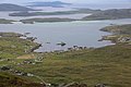
Bàgh Dhail Mhòr (Dalmore Bay) from Beinn Bheag

Beach at Garrynamonie

Beach by the hostel, Berneray

Beach at Cille Bhrìghde

Beach at Cleat

Beach, Baile Sear

Flowering machair, Hills of South Uist, Outer Hebrides.

"It's a long way to Muirneag!"

Beach, Baile Sear

Beach, Baleshare

Beinn Mhòr, Pabaigh Mòr

Beul an Toim
Sources
Facts
Photographs
- Bàgh Dhail Mhòr (Dalmore Bay) from Beinn Bheag - geograph.org.uk - 8399639. Michael Earnshaw / CC BY-SA 2.0
- Beach at Garrynamonie - geograph.org.uk - 7230117. Alan Pickup / CC BY-SA 2.0
- Beach by the hostel, Berneray - geograph.org.uk - 7319445. Hugh Venables / CC BY-SA 2.0
- Beach at Cille Bhrìghde - geograph.org.uk - 7322471. Hugh Venables / CC BY-SA 2.0
- Beach at Cleat - geograph.org.uk - 7326458. Hugh Venables / CC BY-SA 2.0
- Beach, Baile Sear - geograph.org.uk - 8330872. Richard Webb / CC BY-SA 2.0
- South Uist machair (timniblett). Tim Niblett / CC BY 2.0
- "It's a long way to Muirneag" - geograph.org.uk - 8398448. Michael Earnshaw / CC BY-SA 2.0
- Beach, Baile Sear - geograph.org.uk - 8330875. Richard Webb / CC BY-SA 2.0
- Beach, Baleshare - geograph.org.uk - 8330874. Richard Webb / CC BY-SA 2.0
- Beinn Mhòr, Pabaigh Mòr - geograph.org.uk - 8398749. Michael Earnshaw / CC BY-SA 2.0
- Beul an Toim - geograph.org.uk - 8333457. Richard Webb / CC BY-SA 2.0