Atlantic OceanUnited Kingdom
57°49′N 8°35′W
St Kilda
Hiort
Part of Outer Hebrides
St Kilda (Scottish Gaelic: Hiort) is a remote archipelago situated 35 nautical miles (65 kilometres) west-northwest of North Uist in the North Atlantic Ocean. It contains the westernmost islands of the Outer Hebrides of Scotland.

Chart
Overview
St Kilda (Scottish Gaelic: Hiort) is a remote archipelago situated 35 nautical miles (65 kilometres) west-northwest of North Uist in the North Atlantic Ocean. It contains the westernmost islands of the Outer Hebrides of Scotland. The largest island is Hirta, whose sea cliffs are the highest in the United Kingdom; three other islands (Dùn, Soay and Boreray) were also used for grazing and seabird hunting. The islands are administratively a part of the Comhairle nan Eilean Siar local authority area. The origin of the name St Kilda is a matter of conjecture. The islands' human heritage includes unique architectural features from the historic and prehistoric periods, although the earliest written records of island life date from the Late Middle Ages. The medieval village on Hirta was rebuilt in the 19th century, but illnesses brought by increased external contacts through tourism, and the upheaval of the First World War, contributed to the island's evacuation. Permanent habitation on the islands possibly extends back two millennia, the population probably never exceeding 180; its peak was in the late 17th century. The population waxed and waned, eventually dropping to 36 in 1930, when the remaining population was evacuated. Currently, the only year-round residents are military personnel; a variety of conservation workers, volunteers and scientists spend time there in the summer months. The entire archipelago is owned by the National Trust for Scotland. A cleit is a stone storage hut or bothy unique to St Kilda; there are known to be 1,260 cleitean on Hirta and a further 170 on the other group islands. Two different early sheep types have survived on these remote islands: the Soay, a Neolithic type, and the Boreray, an Iron Age type. The islands are a breeding ground for many important seabird species including northern gannets, Atlantic puffins, and northern fulmars. The St Kilda wren and St Kilda field mouse are endemic subspecies. It became one of Scotland's seven World Heritage Sites in 1986, and is one of the few in the world to hold joint status for both its natural and cultural qualities.
From Wikipedia, CC BY-SA 4.0
Census, cataloged
- Major islands2
- Minor islands2
- Islets13
- Rocks & skerries37
Major islands
Hirta
- Area
- 6.3 km²
- High point
- 430 m
Hirta (Scottish Gaelic: Hiort) is the largest island in the St Kilda archipelago, on the western edge of Scotland. The names Hiort (in Scottish Gaelic) and Hirta (historically in English) have also been applied to the entire archipelago.
Soay
- Area
- 0.97 km²
- High point
- 376 m
Soay (Scottish Gaelic: Soaigh) is an uninhabited islet in the St Kilda archipelago, Scotland. The name is from Old Norse Sauðey, meaning "island of sheep". The island is part of the St Kilda World Heritage Site and home to a primitive breed of sheep. Excluding Rockall, it is the westernmost point of the United Kingdom.

Minor islands
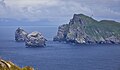
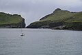
Islets
- Bradastac27 m · 0.8 ha
- Am Plastair15 m · 0.6 ha
- Sgarbhstac6 m · 0.4 ha
- Unnamed island12 m · 0.2 ha
- Gob na h-Àirde20 m · 0.2 ha
- Unnamed island6 m · 0.2 ha
- Unnamed island11 m · 0.2 ha
- Unnamed island23 m · 0.2 ha
- Unnamed island4 m · 0.2 ha
- Unnamed island2 m · 0.1 ha
- Unnamed island37 m · 0.1 ha
- Unnamed island14 m · 0.1 ha
Rocks & skerries
- Stac an Armin196 m · 0.06 km²
- Stac Lee172 m · 0.02 km²
- Stac Levenish38 m · 0.01 km²
- Soay Stac22 m · 0.01 km²
- Sgeir Cùl an Rubha2 m · 0.4 ha
- Mina Stac13 m · 0.3 ha
- Stac Biorach14 m · 0.2 ha
- Stac Dona4 m · 0.2 ha
- Sgeir nan Sgarbh27 m · 0.1 ha
- Unnamed island<0.1 ha
- Unnamed island<0.1 ha
- Unnamed island<0.1 ha
Figures
Comparative heights
- Hirta: 430 m
- Boreray: 384 m
- Soay: 376 m
- Stac an Armin: 196 m
- Dùn: 178 m
- Stac Lee: 172 m
- Stac Levenish: 38 m
- Bradastac: 27 m
- Sgeir nan Sgarbh: 27 m
- Soay Stac: 22 m
- Gob na h-Àirde: 20 m
- Am Plastair: 15 m
- Stac Biorach: 14 m
- Mina Stac: 13 m
To the same scale
Islands by area
| Hirta | 6.3 km² |
| Soay | 0.97 km² |
| Boreray | 0.86 km² |
| Dùn | 0.31 km² |
| Stac an Armin | 0.06 km² |
| Stac Lee | 0.02 km² |
| Stac Levenish | 0.01 km² |
| Soay Stac | 0.01 km² |
| Bradastac | 0.8 ha |
| Am Plastair | 0.6 ha |
| Sgarbhstac | 0.4 ha |
| Sgeir Cùl an Rubha | 0.4 ha |
| Mina Stac | 0.3 ha |
| Unnamed island | 0.2 ha |
| Gob na h-Àirde | 0.2 ha |
| Unnamed island | 0.2 ha |
| Stac Biorach | 0.2 ha |
| Stac Dona | 0.2 ha |
| Unnamed island | 0.2 ha |
| Unnamed island | 0.2 ha |
| Unnamed island | 0.2 ha |
| Sgeir nan Sgarbh | 0.1 ha |
| Unnamed island | 0.1 ha |
| Unnamed island | 0.1 ha |
| Unnamed island | 0.1 ha |
| Unnamed island | 0.1 ha |
| Unnamed island | <0.1 ha |
| Unnamed island | <0.1 ha |
| Unnamed island | <0.1 ha |
| Sgeir Dhomhnuill | <0.1 ha |
| Unnamed island | <0.1 ha |
| Giasgeir | <0.1 ha |
| Hamalan | <0.1 ha |
| Baghan | <0.1 ha |
| Unnamed island | <0.1 ha |
| Sgeir Mhòr | <0.1 ha |
| Sgeir na Caraidh | <0.1 ha |
| Unnamed island | <0.1 ha |
| Unnamed island | <0.1 ha |
| Unnamed island | <0.1 ha |
| Unnamed island | <0.1 ha |
| Unnamed island | <0.1 ha |
| Unnamed island | <0.1 ha |
| Unnamed island | <0.1 ha |
| An Torc | <0.1 ha |
| Na Bodhan | <0.1 ha |
| Unnamed island | <0.1 ha |
| Unnamed island | <0.1 ha |
| Unnamed island | <0.1 ha |
| Unnamed island | <0.1 ha |
| Unnamed island | <0.1 ha |
| Unnamed island | <0.1 ha |
| Unnamed island | <0.1 ha |
| Unnamed island | <0.1 ha |
Photographs

Soay, St Kilda, Outer Hebrides, Scotland

Rubha Challa, St Kilda

Boreray and Stac Lee

St Kilda from Uig

When the weather and sea conditions are favourable, tour boats will divert round the stacks.

St Kilda army base and older buildings

One of the stacks of the St Kilda archipelago, Scotland

Clash na Bearnaich

Great Skua (Bonxie) attacking Gannet near Stac an Armin (St Kilda)


St Kilda: the Hirta - Dùn gap

Ruabhal, St Kilda
Sources
Facts
Photographs
- Inselsoay. Olaf1950 / Public domain
- Rubha Challa, St Kilda - geograph.org.uk - 7560262. Hugh Venables / CC BY-SA 2.0
- Boreray and Stac Lee - geograph.org.uk - 3998465. Ian Stewart / CC BY-SA 2.0
- St Kilda from Uig - geograph.org.uk - 3103132. Gus Macdonald / CC BY-SA 2.0
- Turning to see St. Kilda's stacks. Erica Hume / CC BY-SA 4.0
- St Kilda army base and older buildings - geograph.org.uk - 2256949. Mick Crawley / CC BY-SA 2.0
- Stack St Kilda. Gajtalbot / CC BY 2.0
- Clash na Bearnaich - geograph.org.uk - 3749819. M J Richardson / CC BY-SA 2.0
- Great Skua attacking Gannet near Stac an Armin. Kognos / CC BY-SA 4.0
- Leaving St Kilda. Kingy64 / CC BY-SA 4.0
- St Kilda, the Hirta - Dùn gap - geograph.org.uk - 7984056. Michael Earnshaw / CC BY-SA 2.0
- Ruabhal, St Kilda - geograph.org.uk - 4181056. Rude Health / CC BY-SA 2.0