Atlantic OceanUnited Kingdom
56°30′N 6°00′W
Inner Hebrides
Part of Hebrides
The Inner Hebrides is an archipelago off the west coast of mainland Scotland, to the south east of the Outer Hebrides. Together these two island chains form the Hebrides, which experience a mild oceanic climate.

Chart
Overview
The Inner Hebrides is an archipelago off the west coast of mainland Scotland, to the south east of the Outer Hebrides. Together these two island chains form the Hebrides, which experience a mild oceanic climate. The Inner Hebrides comprise 35 inhabited islands as well as 44 uninhabited islands with an area greater than 30 hectares (74 acres). Skye, Mull, and Islay are the three largest, and also have the highest populations. The main commercial activities are tourism, crofting, fishing and whisky distilling. In modern times the Inner Hebrides have formed part of two separate local government jurisdictions, one to the north and the other to the south. Together, the islands have an area of about 4,130 km2 (1,594 sq mi), and had a population of 18,948 in 2011. The population density is therefore about 4.6 inhabitants per square kilometre (12 inhabitants per square mile). There are various important prehistoric structures, many of which pre-date the first written references to the islands by Roman and Greek authors. In the historic period the earliest known settlers were Picts to the north and Gaels in the southern kingdom of Dál Riada prior to the islands becoming part of the Suðreyjar kingdom of the Norse, who ruled for over 400 years until sovereignty was transferred to Scotland by the Treaty of Perth in 1266. Control of the islands was then held by various clan chiefs, principally the MacLeans, MacLeods and MacDonalds. The Highland Clearances of the 19th century had a devastating effect on many communities and it is only in recent years that population levels have ceased to decline. Sea transport is crucial and a variety of ferry services operate to mainland Scotland and between the islands. The Gaelic language remains strong in some areas; the landscapes have inspired a variety of artists; and there is a diversity of wildlife.
From Wikipedia, CC BY-SA 4.0
Census, cataloged
- Major islands4
- Minor islands129
- Islets997
- Rocks & skerries2,452
Major islands
Isle of Skye
- Area
- 1,636 km²
- High point
- 992 m
The Isle of Skye, or simply Skye, is the largest and northernmost of the major islands in the Inner Hebrides of Scotland. The island's peninsulas radiate from a mountainous hub dominated by the Cuillin, the rocky slopes of which provide some of the most dramatic mountain scenery in the country.
Isle of Mull
- Area
- 885 km²
- High point
- 966 m
The Isle of Mull, or simply Mull, is the second-largest island of the Inner Hebrides of the west coast of Scotland.
Islay
- Area
- 618 km²
- High point
- 491 m
Islay is the southernmost island of the Inner Hebrides of Scotland. Known as "The Queen of the Hebrides", it lies in Argyll and Bute just south-west of Jura and around 40 kilometres (22 nautical miles) north of the Northern Irish coast.
Jura
- Area
- 365 km²
- High point
- 785 m
Jura ( JOOR-ə; Scottish Gaelic: Diùra) is an island in the Inner Hebrides of Scotland, adjacent to and northeast of Islay.


Minor islands

Rùm
- Area
- 107 km²
- High point
- 812 m
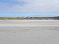
Tiree
- Area
- 79 km²
- High point
- 140 m
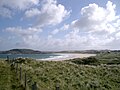
Coll
- Area
- 74.3 km²
- High point
- 103 m

Raasay
- Area
- 62.4 km²
- High point
- 494 m

Colonsay
- Area
- 41 km²
- High point
- 143 m

Eigg
- Area
- 29.7 km²
- High point
- 393 m

Scalpay
- Area
- 24.7 km²
- High point
- 396 m

Lismore
- Area
- 21.8 km²
- High point
- 124 m

Ulva
- Area
- 18.5 km²
- High point
- 313 m

Scarba
- Area
- 14.5 km²
- High point
- 449 m

Gigha
- Area
- 14.3 km²
- High point
- 100 m

Luing
- Area
- 14.2 km²
- High point
- 94 m

Seil
- Area
- 13.6 km²
- High point
- 146 m

Kerrera
- Area
- 12.1 km²
- High point
- 189 m

Canna
- Area
- 11.2 km²
- High point
- 210 m

Soay
- Area
- 10.1 km²
- High point
- 138 m

Rona
- Area
- 9.7 km²
- High point
- 125 m

Iona
- Area
- 8.5 km²
- High point
- 101 m

Eilean Shona
- Area
- 6.4 km²
- High point
- 265 m

Muck
- Area
- 5.2 km²
- High point
- 137 m

Oronsay
- Area
- 5.1 km²
- High point
- 93 m

Gometra
- Area
- 4.6 km²
- High point
- 155 m

Shuna
- Area
- 4.5 km²
- High point
- 90 m

Isle of Ewe
- Area
- 3.6 km²
- High point
- 68 m

Handa Island
- Area
- 3.3 km²
- High point
- 123 m

Island of Danna
- Area
- 3.2 km²
- High point
- 52 m

Tanera Mòr
- Area
- 3 km²
- High point
- 124 m
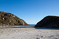
Erraid
- Area
- 2.4 km²
- High point
- 73 m

Oldany Island
- Area
- 2.3 km²
- High point
- 102 m

Lunga
- Area
- 2 km²
- High point
- 94 m

Ceann Ear
- Area
- 2 km²
- High point
- 15 m

Gruinard Island
- Area
- 2 km²
- High point
- 104 m

Càrna
- Area
- 1.9 km²
- High point
- 170 m

Eilean Mòr
- Area
- 1.9 km²
- High point
- 112 m

Sanday
- Area
- 1.9 km²
- High point
- 59 m

Wiay
- Area
- 1.8 km²
- High point
- 61 m

Isle Martin
- Area
- 1.6 km²
- High point
- 119 m

Shuna Island
- Area
- 1.6 km²
- High point
- 71 m

Eilean Fladday
- Area
- 1.4 km²
- High point
- 41 m

Isle Ristol
- Area
- 1.4 km²
- High point
- 69 m
Sanda Island
- Area
- 1.4 km²
- High point
- 123 m

Pabay
- Area
- 1.3 km²
- High point
- 27 m

Garbh Eileach
- Area
- 1.3 km²
- High point
- 107 m

Longa Island
- Area
- 1.2 km²
- High point
- 70 m

Ceann Iar
- Area
- 1.2 km²
- High point
- 19 m

Priest Island
- Area
- 1.2 km²
- High point
- 72 m

Torsa
- Area
- 1.1 km²
- High point
- 62 m

Eilean Rìgh
- Area
- 0.96 km²
- High point
- 55 m

Eorsa
- Area
- 0.96 km²
- High point
- 94 m

Tanera Beag
- Area
- 0.86 km²
- High point
- 49 m

Little Colonsay
- Area
- 0.76 km²
- High point
- 60 m

Horse Island
- Area
- 0.69 km²
- High point
- 56 m

Gunna
- Area
- 0.67 km²
- High point
- 33 m

Eilean Tigh
- Area
- 0.66 km²
- High point
- 111 m

Island Macaskin
- Area
- 0.65 km²
- High point
- 65 m

Calve Island
- Area
- 0.65 km²
- High point
- 18 m

Cara Island
- Area
- 0.63 km²
- High point
- 51 m

Texa
- Area
- 0.61 km²
- High point
- 50 m

Lunga
- Area
- 0.6 km²
- High point
- 103 m

Eileach an Naoimh
- Area
- 0.59 km²
- High point
- 70 m

Isay
- Area
- 0.59 km²
- High point
- 28 m

Eilean Meadhonach
- Area
- 0.54 km²
- High point
- 51 m

Eilean Dubh Mòr
- Area
- 0.52 km²
- High point
- 50 m

Longay
- Area
- 0.51 km²
- High point
- 66 m

Eilean Trodday
- Area
- 0.49 km²
- High point
- 42 m

Inch Kenneth
- Area
- 0.48 km²
- High point
- 44 m

Eilean Dubh
- Area
- 0.44 km²
- High point
- 85 m

Eilean Mullagrach
- Area
- 0.42 km²
- High point
- 45 m

Nave Island
- Area
- 0.4 km²
- High point
- 31 m

Harlosh Island
- Area
- 0.38 km²
- High point
- 53 m

Ornsay
- Area
- 0.37 km²
- High point
- 43 m
Bernera Island
- Area
- 0.37 km²
- High point
- 55 m
Insh Island
- Area
- 0.37 km²
- High point
- 66 m
Eilean Flodigarry
- Area
- 0.31 km²
- High point
- 53 m

Staffa
- Area
- 0.3 km²
- High point
- 42 m

Tarner Island
- Area
- 0.3 km²
- High point
- 64 m

Easdale
- Area
- 0.29 km²
- High point
- 31 m
Dubh Eilean
- Area
- 0.28 km²
- High point
- 15 m

Orsay
- Area
- 0.28 km²
- High point
- 25 m

Fladda
- Area
- 0.28 km²
- High point
- 23 m

South Ascrib
- Area
- 0.27 km²
- High point
- 38 m
Glas-leac Mòr
- Area
- 0.26 km²
- High point
- 27 m
Soa
- Area
- 0.26 km²
- High point
- 11 m

Eilean Chathastail
- Area
- 0.26 km²
- High point
- 35 m

Bac Mòr
- Area
- 0.25 km²
- High point
- 67 m
Staffin Island
- Area
- 0.25 km²
- High point
- 16 m
Fladda Chuain
- Area
- 0.24 km²
- High point
- 25 m

Sibhinis
- Area
- 0.24 km²
- High point
- 11 m
Eilean Fada Mòr
- Area
- 0.23 km²
- High point
- 26 m
Rubha Fiola
- Area
- 0.23 km²
- High point
- 29 m
Oronsay
- Area
- 0.23 km²
- High point
- 49 m
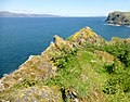
A' Chùli
- Area
- 0.22 km²
- High point
- 37 m
Eilean nan Each
- Area
- 0.22 km²
- High point
- 54 m
Gairbh Eilein
- Area
- 0.21 km²
- High point
- 18 m

Eilean Mòr
- Area
- 0.2 km²
- High point
- 15 m
Fiola Meadhonach
- Area
- 0.2 km²
- High point
- 30 m
Eilean Mor
- Area
- 0.2 km²
- High point
- 17 m
Eilean Iomarsaigh
- Area
- 0.2 km²
- High point
- 9 m
Eilean Beag
- Area
- 0.18 km²
- High point
- 35 m
Eilean a'Chalmain
- Area
- 0.17 km²
- High point
- 33 m
Eilean Dubh Beag
- Area
- 0.17 km²
- High point
- 38 m
Eilean nam Ban
- Area
- 0.17 km²
- High point
- 32 m
Eilean Mòr
- Area
- 0.16 km²
- High point
- 30 m

Eilean Garave
- Area
- 0.16 km²
- High point
- 18 m

Hyskeir
- Area
- 0.16 km²
- High point
- 7 m

Eilean nan Gobhar
- Area
- 0.15 km²
- High point
- 23 m
Eilean Heast
- Area
- 0.15 km²
- High point
- 17 m
Eilean Ornsay
- Area
- 0.15 km²
- High point
- 16 m

Mingay
- Area
- 0.14 km²
- High point
- 25 m
Eilea Dubh
- Area
- 0.14 km²
- High point
- 13 m
Unnamed island
- Area
- 0.14 km²
- High point
- 47 m
Eilean Dioghlum
- Area
- 0.14 km²
- High point
- 38 m

Eilean Mhic Coinnich
- Area
- 0.13 km²
- High point
- 16 m
Garbh Eilean
- Area
- 0.13 km²
- High point
- 59 m
Unnamed island
- Area
- 0.12 km²
- High point
- 11 m
Eilean Mhic Chiarain
- Area
- 0.12 km²
- High point
- 12 m
Brosdale Island
- Area
- 0.12 km²
- High point
- 32 m
Eag na Maoile
- Area
- 0.11 km²
- High point
- 11 m
Glas-leac Beag
- Area
- 0.11 km²
- High point
- 26 m
Eilean Arsa
- Area
- 0.11 km²
- High point
- 48 m
Corr Eilean
- Area
- 0.11 km²
- High point
- 24 m
Eilean Dubh
- Area
- 0.11 km²
- High point
- 42 m
Eilean a' Chùirn
- Area
- 0.11 km²
- High point
- 13 m
Eilean Dubh
- Area
- 0.11 km²
- High point
- 39 m
Guirasdeal
- Area
- 0.1 km²
- High point
- 24 m
Sgeir na h-Èireann
- Area
- 0.1 km²
- High point
- 10 m
Am Fraoch Eilean
- Area
- 0.1 km²
- High point
- 19 m
Eilean Geary
- Area
- —
size unknown
Eilean nan Gabhar
- Area
- —
size unknown
Rocks & skerries
On the chart above, at its closest zooms.
Listing 133 of 3582; the rest are on the chart.
Figures
Comparative heights
- Isle of Skye: 992 m
- Isle of Mull: 966 m
- Rùm: 812 m
- Jura: 785 m
- Raasay: 494 m
- Islay: 491 m
- Scarba: 449 m
- Scalpay: 396 m
- Eigg: 393 m
- Ulva: 313 m
- Eilean Shona: 265 m
- Canna: 210 m
- Kerrera: 189 m
- Càrna: 170 m
To the same scale
Islands by area
Groups within
Overlapping groups
Photographs

View of the Skye Bridge. The road bridge connects the Isle of Skye with the Scottish mainland. Skye is the largest island in the Inner Hebrides.

Isle of Canna, Scotland, seen from the neighbouring Rùm.

Jura seen from Bunnahabhain

Passing Sgeir Mhor


Landschaft nahe der Ortschaft Kildalton, im Hintergrund der Berg Beinn Sholum.

Photograph of the crannog at Loch an Dùin, on the Inner Hebridean island of Coll. The caption given at the source website reads: General view looking across the loch.

Sources
Facts
Photographs
- 00 2355 Skye Bridge - (Scotland). W. Bulach / CC BY-SA 4.0
- Isle of Canna. Robek / CC BY-SA 4.0
- Jura seen from Bunnahabhain - panoramio. Bjarne Henning Kvaal… / CC BY-SA 3.0
- Passing Sgeir Mhor - geograph.org.uk - 5910680. Andrew Wood / CC BY-SA 2.0
- Loch an Dùin, crannog (photo, c.1900) 2. Erskine Beveridge (1851–1920) / Public domain
- Scotland Argyll Bute Islay Kildalton Landscape 04. MSeses / CC BY-SA 4.0
- Inch Kenneth. Clydiee / CC BY 4.0
- Fladda. Clydiee / CC BY 4.0
- Loch an Dùin, crannog (photo, c.1900). Erskine Beveridge (1851–1920) / Public domain
- Loch Anlaimh and Eilean Anlaimh (photo, c.1900). Erskine Beveridge (1851–1920) / Public domain
- Inner Hebrides banner Ferry to Mull. AlasdairW / CC BY-SA 3.0