North SeaUnited Kingdom and Norway
59°00′N 3°00′W
Orkney
Orkney Islands
Part of British Isles
Orkney , also known as the Orkney Islands, is an archipelago off the north coast of mainland Scotland. The plural name the Orkneys is also sometimes used. Part of the Northern Isles along with Shetland, Orkney is 10 miles (16 km) north of Caithness and has about 70 islands, of which 20 are inhabited.

Chart
Overview
Orkney , also known as the Orkney Islands, is an archipelago off the north coast of mainland Scotland. The plural name the Orkneys is also sometimes used. Part of the Northern Isles along with Shetland, Orkney is 10 miles (16 km) north of Caithness and has about 70 islands, of which 20 are inhabited. The largest island, the Mainland, has an area of 523 square kilometres (202 sq mi), making it the sixth-largest Scottish island and the tenth-largest island in the British Isles. Orkney's largest settlement, and also its administrative centre, is Kirkwall. Orkney is one of the 32 council areas of Scotland, as well as a constituency of the Scottish Parliament, a lieutenancy area, and an historic county. The local council is Orkney Islands Council. The islands have been inhabited likely for at least 10,000 years, occupied by terminal Upper Palaeolithic and Mesolithic hunter-gatherers, and subsequently by Neolithic and Bronze Age farmers and later by Picts during the Iron Age. Orkney was colonised and later annexed by the Kingdom of Norway in 875 and settled by the Norsemen. In 1472, the Parliament of Scotland absorbed the Earldom of Orkney into the Kingdom of Scotland, following failure to pay a dowry promised to James III of Scotland by the family of his bride, Margaret of Denmark. In addition to the Mainland, most of the remaining islands are divided into two groups: the North Isles and the South Isles. The local climate is relatively mild and the soils are extremely fertile; most of the land is farmed, and agriculture is the most important sector of the economy. The significant wind and marine energy resources are of growing importance; the amount of electricity that Orkney generates annually from renewable energy sources exceeds its demand. Temperatures average 4 °C (39 °F) in winter and 12 °C (54 °F) in summer. The local people are known as Orcadians; they speak a distinctive dialect of the Scots language and have a rich body of folklore. Orkney contains some of the oldest and best-preserved Neolithic sites in Europe; the "Heart of Neolithic Orkney" is a designated UNESCO World Heritage Site. Orkney also has an abundance of marine and avian wildlife.
From Wikipedia, CC BY-SA 4.0
Census, cataloged
- Major islands5
- Minor islands43
- Islets46
- Rocks & skerries59
Major islands
Mainland
- Area
- 531 km²
- High point
- 275 m
The Mainland, also known as Pomona, is the main island of Orkney, Scotland. Both of Orkney's burghs, Kirkwall and Stromness, lie on the island, which is also the heart of Orkney's ferry and air connections.
Hoy
- Area
- 144 km²
- High point
- 481 m
Hoy (from Old Norse Háey, meaning "high island") is an island in Orkney, Scotland, measuring 143 square kilometres (55 sq mi) – the second largest in the archipelago, after Mainland. A natural causeway, the Ayre, links the island to the smaller South Walls; the two islands are treated as one entity by the UK census.
Sanday
- Area
- 49.7 km²
- High point
- 65 m
Sanday (, Scots: Sandee) is one of the inhabited islands of Orkney, which lie off the north coast of mainland Scotland. 5 sq mi), it is the third largest of the Orkney Islands. The main centres of population are Lady Village and Kettletoft.
South Ronaldsay
- Area
- 49.7 km²
- High point
- 118 m
South Ronaldsay (Scots pronunciation: [suθ ˈrɒnəltsiː], also [suθ ˈrɒnəldziː] sooth-RON-əlt-see) is one of the Orkney Islands off the north coast of Scotland. It is linked to the Orkney Mainland by the Churchill Barriers, running via Burray, Glimps Holm and Lamb Holm.
Westray
- Area
- 48.6 km²
- High point
- 169 m
Westray (Scots pronunciation: [ˈwɛstri] WEST-ree) is one of the Orkney Islands in Scotland with a usual resident population of a little over 550 people. Its main village is Pierowall, with a heritage centre, the 15th-century Lady Kirk church and pedestrian ferry service to nearby Papa Westray island.


Minor islands

Rousay
- Area
- 47.2 km²
- High point
- 250 m

Stronsay
- Area
- 33.9 km²
- High point
- 45 m

Eday
- Area
- 27.7 km²
- High point
- 102 m

Shapinsay
- Area
- 27.4 km²
- High point
- 65 m

Flotta
- Area
- 9.4 km²
- High point
- 57 m
Burray
- Area
- 9 km²

Papa Westray
- Area
- 8.6 km²
- High point
- 46 m

North Ronaldsay
- Area
- 7.7 km²
- High point
- 22 m

Egilsay
- Area
- 6 km²
- High point
- 37 m
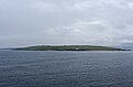
Graemsay
- Area
- 3.9 km²
- High point
- 62 m

Wyre
- Area
- 3 km²
- High point
- 31 m

Fara
- Area
- 2.8 km²
- High point
- 42 m

Gairsay
- Area
- 2.7 km²
- High point
- 100 m
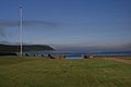
Calf of Eday
- Area
- 2.2 km²
- High point
- 54 m

Faray
- Area
- 1.3 km²
- High point
- 30 m
Glimps Holm
- Area
- 1 km²
Hunda
- Area
- 1 km²

Swona
- Area
- 0.91 km²
- High point
- 38 m

Cava
- Area
- 0.89 km²
- High point
- 36 m

Auskerry
- Area
- 0.85 km²
- High point
- 18 m

Papa Stronsay
- Area
- 0.8 km²
- High point
- 10 m

Eynhallow
- Area
- 0.73 km²
- High point
- 39 m

Linga Holm
- Area
- 0.63 km²
- High point
- 17 m

Copinsay
- Area
- 0.6 km²
- High point
- 67 m

Switha
- Area
- 0.47 km²
- High point
- 28 m

Muckle Skerry
- Area
- 0.42 km²
- High point
- 23 m
Lamb Holm
- Area
- 0.4 km²

Helliar Holm
- Area
- 0.39 km²
- High point
- 25 m

Rysa Little
- Area
- 0.38 km²
- High point
- 20 m

Muckle Green Holm
- Area
- 0.35 km²
- High point
- 27 m
Holm of Faray
- Area
- 0.34 km²
- High point
- 16 m
Holm of Scockness
- Area
- 0.3 km²
- High point
- 17 m

Holm of Huip
- Area
- 0.27 km²
- High point
- 16 m
Start Point
- Area
- 0.26 km²
- High point
- 7 m

Holm of Papa
- Area
- 0.26 km²
- High point
- 15 m

Brough of Birsay
- Area
- 0.21 km²
- High point
- 45 m

Damsay
- Area
- 0.2 km²
- High point
- 9 m

Sweyn Holm
- Area
- 0.19 km²
- High point
- 15 m

Calf of Flotta
- Area
- 0.18 km²
- High point
- 17 m

Sule Skerry
- Area
- 0.17 km²
- High point
- 18 m
Holm of Grimbister
- Area
- 0.17 km²
- High point
- 7 m
Corn Holm
- Area
- 0.14 km²
- High point
- 8 m
Holm of Houton
- Area
- 0.13 km²
- High point
- 11 m
Islets
- Rusk Holm6 m · 0.09 km²
- Holms of Ire7 m · 0.09 km²
- Kili Holm6 m · 0.08 km²
- Unnamed island13 m · 0.05 km²
- Outer Holm6 m · 0.04 km²
- Holm of Aikerness3 m · 0.04 km²
- Little Green Holm8 m · 0.04 km²
- Unnamed island0.04 km²
- Little Linga5 m · 0.04 km²
- Ward Holm12 m · 0.03 km²
- Holms of Ire5 m · 0.03 km²
- Unnamed island0.02 km²
Rocks & skerries
- Hoo Stack26 m · 0.03 km²
- Little Skerry9 m · 0.01 km²
- Sule Stack36 m · 0.01 km²
- Smoogro Skerry0.3 ha
- South Skerry1 m · 0.3 ha
- Fiska Skerry0.2 ha
- Seal Skerry0.2 ha
- Clettack Skerry0.2 ha
- Skerry of Scudillswick1 m · 0.2 ha
- Barrel of Butter1 m · 0.1 ha
- Hevda Skerry2 m · 0.1 ha
- Unnamed island<0.1 ha
Figures
Comparative heights
- Hoy: 481 m
- Mainland: 275 m
- Rousay: 250 m
- Westray: 169 m
- South Ronaldsay: 118 m
- Eday: 102 m
- Gairsay: 100 m
- Copinsay: 67 m
- Sanday: 65 m
- Shapinsay: 65 m
- Graemsay: 62 m
- Flotta: 57 m
- Calf of Eday: 54 m
- Papa Westray: 46 m
To the same scale
Islands by area
| Mainland | 531 km² |
| Hoy | 144 km² |
| Sanday | 49.7 km² |
| South Ronaldsay | 49.7 km² |
| Westray | 48.6 km² |
| Rousay | 47.2 km² |
| Stronsay | 33.9 km² |
| Eday | 27.7 km² |
| Shapinsay | 27.4 km² |
| Flotta | 9.4 km² |
| Burray | 9 km² |
| Papa Westray | 8.6 km² |
| North Ronaldsay | 7.7 km² |
| Egilsay | 6 km² |
| Graemsay | 3.9 km² |
| Wyre | 3 km² |
| Fara | 2.8 km² |
| Gairsay | 2.7 km² |
| Calf of Eday | 2.2 km² |
| Faray | 1.3 km² |
| Glimps Holm | 1 km² |
| Hunda | 1 km² |
| Swona | 0.91 km² |
| Cava | 0.89 km² |
| Auskerry | 0.85 km² |
| Papa Stronsay | 0.8 km² |
| Eynhallow | 0.73 km² |
| Linga Holm | 0.63 km² |
| Copinsay | 0.6 km² |
| Switha | 0.47 km² |
| Muckle Skerry | 0.42 km² |
| Lamb Holm | 0.4 km² |
| Helliar Holm | 0.39 km² |
| Rysa Little | 0.38 km² |
| Muckle Green Holm | 0.35 km² |
| Holm of Faray | 0.34 km² |
| Holm of Scockness | 0.3 km² |
| Holm of Huip | 0.27 km² |
| Start Point | 0.26 km² |
| Holm of Papa | 0.26 km² |
| Brough of Birsay | 0.21 km² |
| Damsay | 0.2 km² |
| Sweyn Holm | 0.19 km² |
| Calf of Flotta | 0.18 km² |
| Sule Skerry | 0.17 km² |
| Holm of Grimbister | 0.17 km² |
| Corn Holm | 0.14 km² |
| Holm of Houton | 0.13 km² |
| Rusk Holm | 0.09 km² |
| Holms of Ire | 0.09 km² |
| Kili Holm | 0.08 km² |
| Unnamed island | 0.05 km² |
| Outer Holm | 0.04 km² |
| Holm of Aikerness | 0.04 km² |
| Little Green Holm | 0.04 km² |
| Unnamed island | 0.04 km² |
| Little Linga | 0.04 km² |
| Ward Holm | 0.03 km² |
| Holms of Ire | 0.03 km² |
| Hoo Stack | 0.03 km² |
| Unnamed island | 0.02 km² |
| Unnamed island | 0.02 km² |
| Inner Holm | 0.02 km² |
| Unnamed island | 0.02 km² |
| Grass Holm | 0.01 km² |
| Black Holm | 0.01 km² |
| Thieves Holm | 0.01 km² |
| Little Skerry | 0.01 km² |
| Holms of Spurness | 0.01 km² |
| Unnamed island | 0.01 km² |
| Sule Stack | 0.01 km² |
| Corn Holm | 0.01 km² |
| Horse of Copinsay | 0.01 km² |
| Holm of Boray | 0.9 ha |
| Unnamed island | 0.8 ha |
| Holms of Spurness | 0.8 ha |
| Holms of Spurness | 0.7 ha |
| Cunning Holm | 0.6 ha |
| Mid Holm | 0.6 ha |
| Unnamed island | 0.6 ha |
| Unnamed island | 0.5 ha |
| Unnamed island | 0.4 ha |
| North Holm | 0.4 ha |
| Unnamed island | 0.4 ha |
| Holm of Skellister | 0.3 ha |
| Smoogro Skerry | 0.3 ha |
| South Skerry | 0.3 ha |
| Unnamed island | 0.3 ha |
| Unnamed island | 0.3 ha |
| Fiska Skerry | 0.2 ha |
| Seal Skerry | 0.2 ha |
| Unnamed island | 0.2 ha |
| Climnie | 0.2 ha |
| Unnamed island | 0.2 ha |
| Clettack Skerry | 0.2 ha |
| Skerry of Scudillswick | 0.2 ha |
| Holm of Elsness | 0.1 ha |
| Spentlie Holm | 0.1 ha |
| South Holm | 0.1 ha |
| Unnamed island | 0.1 ha |
| Holm of Rendall | 0.1 ha |
| Unnamed island | 0.1 ha |
| Barrel of Butter | 0.1 ha |
| Hevda Skerry | 0.1 ha |
| Unnamed island | 0.1 ha |
| Unnamed island | <0.1 ha |
| Unnamed island | <0.1 ha |
| Rock of Hangie | <0.1 ha |
| Unnamed island | <0.1 ha |
| Unnamed island | <0.1 ha |
| Unnamed island | <0.1 ha |
| Unnamed island | <0.1 ha |
| Unnamed island | <0.1 ha |
| Unnamed island | <0.1 ha |
| Unnamed island | <0.1 ha |
| Loppack | <0.1 ha |
| Unnamed island | <0.1 ha |
| Louther Skerry | <0.1 ha |
| Unnamed island | <0.1 ha |
| Unnamed island | <0.1 ha |
| Unnamed island | <0.1 ha |
| Unnamed island | <0.1 ha |
| Unnamed island | <0.1 ha |
| Unnamed island | <0.1 ha |
| Unnamed island | <0.1 ha |
| Unnamed island | <0.1 ha |
| Unnamed island | <0.1 ha |
| Unnamed island | <0.1 ha |
| Unnamed island | <0.1 ha |
| Unnamed island | <0.1 ha |
| Unnamed island | <0.1 ha |
| Unnamed island | <0.1 ha |
| Unnamed island | <0.1 ha |
| Unnamed island | <0.1 ha |
| Unnamed island | <0.1 ha |
| Unnamed island | <0.1 ha |
| Inner Voder | <0.1 ha |
| Unnamed island | <0.1 ha |
| Unnamed island | <0.1 ha |
| Unnamed island | <0.1 ha |
| Unnamed island | <0.1 ha |
| Unnamed island | <0.1 ha |
| Unnamed island | <0.1 ha |
| Unnamed island | <0.1 ha |
| Unnamed island | <0.1 ha |
| Unnamed island | <0.1 ha |
| Unnamed island | <0.1 ha |
| Unnamed island | <0.1 ha |
| Unnamed island | <0.1 ha |
| Unnamed island | <0.1 ha |
| Unnamed island | <0.1 ha |
| Unnamed island | <0.1 ha |
| Unnamed island | <0.1 ha |
Groups within
Photographs

Rack Wick

Landesinnere von Hoy (Orkneys)

Barley at Liddel Farm

The countryside just outside of Kirkwall in the Orkney Islands, Scotland.
Sources
Facts
Photographs
- Rack Wick - geograph.org.uk - 6310990. Bill Boaden / CC BY-SA 2.0
- Hoy Orkney Landesinnere. Srvban / CC BY 3.0
- Barley at Liddel Farm - geograph.org.uk - 8390792. Des Blenkinsopp / CC BY-SA 2.0
- Kirkwall, Orkney Islands (48359571107). Mustang Joe / CC0
- Orkney Islands banner. Massimo Telò / CC BY-SA 3.0