West Philippine SeaPhilippines
12°00′N 123°00′E
Philippines
Part of Malay Archipelago and Pacific Islands
The Philippines, officially the Republic of the Philippines, is an archipelagic country in Southeast Asia. Located in the western Pacific Ocean, it consists of about 7,641 islands, with a total area of about 300,000 square kilometers.

Chart
Overview
The Philippines, officially the Republic of the Philippines, is an archipelagic country in Southeast Asia. Located in the western Pacific Ocean, it consists of about 7,641 islands, with a total area of about 300,000 square kilometers. The islands are broadly categorized into three main geographical divisions: from north to south, Luzon, Visayas, and Mindanao. With a population of over 114 million, it is the world's thirteenth-most-populous country. The Philippines is bounded by the South China Sea to the west, the Philippine Sea to the east, and the Celebes Sea to the south. It shares maritime borders with Taiwan to the north, Japan to the northeast, Palau to southeast, Indonesia to the south, Malaysia to the southwest, Vietnam to the west, and China to the northwest. It has diverse ethnicities and a rich culture. Manila is the country's capital, and its most populated city is Quezon City. Both are within Metro Manila. Negritos, the archipelago's earliest inhabitants, were followed by waves of Austronesian peoples. The adoption of animism, Hinduism with Buddhist influence, and Islam established island-kingdoms. Extensive overseas trade with neighbors such as the late Tang or Song empire brought Chinese people to the archipelago as well, who would also gradually settle in and intermix over the centuries. The arrival of the explorer Ferdinand Magellan marked the beginning of Spanish colonization. In 1543, Spanish explorer Ruy López de Villalobos named the archipelago las Islas Filipinas in honor of King Philip II. Catholicism became the dominant religion, and Manila became the western hub of trans-Pacific trade. Hispanic immigrants from Latin America and Iberia would also selectively colonize. The Philippine Revolution began in 1896, and became entwined with the 1898 Spanish–American War. Spain ceded the territory to the United States, and Filipino revolutionaries declared the First Philippine Republic. The ensuing Philippine–American War ended with the United States controlling the territory until the Japanese invasion of the islands during World War II. After the United States retook the Philippines from the Japanese, the Philippines became independent in 1946. Since then, the country notably experienced a period of martial law from 1972 to 1981 under the dictatorship of Ferdinand Marcos and his subsequent overthrow by the People Power Revolution in 1986, returning to democracy. The Philippines is an emerging market and a developing and newly industrialized country, whose economy is transitioning from being agricultural to service- and manufacturing-centered. It has a variety of natural resources and a globally-significant level of biodiversity. The country is also part of multiple international organizations and forums, mainly in the Asia-Pacific region. Despite its fast economic growth, it continues to struggle with inequality, widespread corruption, and vulnerability to natural disasters due to its location both within the Pacific Ring of Fire and near the equator, making it prone to earthquakes, monsoon rains, and typhoons, to which the Philippines has built a resilience.
From Wikipedia, CC BY-SA 4.0
Census, cataloged
- Major islands6
- Minor islands1,351
- Islets3,880
- Rocks & skerries2,709
Major islands
Luzon
- Area
- 104,935 km²
- High point
- 2,928 m
Luzon ( loo-ZON, Tagalog: [luˈson]) is the largest and most populous island in the Philippines. Located in the northern portion of the Philippine archipelago, it is the economic and political center of the nation.
Mindanao
- Area
- 93,885 km²
- High point
- 2,954 m
Mindanao ( , MIN-də-NOW) is the second-largest island in the Philippines, after Luzon, and seventh-most populous island in the world. Located in the southern region of the archipelago, the island is part of an island group of the same name that also includes its adjacent islands, notably the Sulu Archipelago.
Negros
- Area
- 12,778 km²
- High point
- 2,465 m
Negros (English: , UK: , Tagalog: [ˈnegɾos]) is the fourth largest and third most populous island in the Philippines, with a total land area of 13,309 km2 (5,139 sq mi). The coastal zone of the southern part of Negros is identified as a site of highest marine biodiversity importance in the Coral Triangle.
Samar
- Area
- 12,435 km²
- High point
- 890 m
Samar ( SAH-mar) is the third-largest island in the Philippines. It has a population of 1,924,651 as of the 2024 census. It is located in the Eastern Visayas region of the Visayas islands. Since 1965, the island is divided into three provinces: Western Samar, Northern Samar, and Eastern Samar.
Panay
- Area
- 11,512 km²
- High point
- 2,102 m
Panay is the sixth-largest and fourth-most populous island in the Philippines, with a total land area of 12,011 km2 (4,637 sq mi) and a total population of 4,669,037 as of 2024 census, similar to Sicily or Bali. 4 percent of the entire population of the country.
Palawan
- Area
- 11,346 km²
- High point
- 2,963 m
Palawan (Spanish: Isla de La Paragua) is the largest island of the province of Palawan in the Philippines and fifth-largest by area and tenth-most populous island of the country, with a total population of 1,023,849 as of 2024 census.


Minor islands

Mindoro
- Area
- 9,824 km²
- High point
- 2,616 m

Leyte
- Area
- 6,997 km²
- High point
- 1,200 m

Cebu
- Area
- 4,406 km²
- High point
- 1,037 m
Bohol
- Area
- 3,767 km²
- High point
- 850 m

Masbate Island
- Area
- 3,209 km²
- High point
- 682 m
Catanduanes
- Area
- 1,444 km²
- High point
- 734 m

Basilan Island
- Area
- 1,218 km²
- High point
- 990 m

Busuanga Island
- Area
- 932 km²
- High point
- 620 m
Marinduque Island
- Area
- 900 km²
- High point
- 1,174 m
Jolo
- Area
- 807 km²
- High point
- 790 m

Dinagat Island
- Area
- 758 km²
- High point
- 939 m

Tablas Island
- Area
- 671 km²
- High point
- 665 m
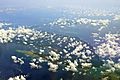
Polillo Island
- Area
- 657 km²
- High point
- 330 m
Guimaras
- Area
- 578 km²
- High point
- 266 m

Tawi-Tawi Island
- Area
- 565 km²
- High point
- 535 m
Biliran
- Area
- 498 km²
- High point
- 1,346 m

Sibuyan Island
- Area
- 452 km²
- High point
- 2,023 m
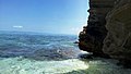
Burias
- Area
- 416 km²
- High point
- 333 m
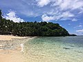
Siargao
- Area
- 365 km²
- High point
- 263 m
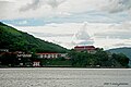
Culion Island
- Area
- 361 km²
- High point
- 468 m
Ticao Island
- Area
- 325 km²
- High point
- 393 m

Siquijor
- Area
- 319 km²
- High point
- 605 m
Dumaran Island
- Area
- 306 km²
- High point
- 201 m
Balabac Island
- Area
- 301 km²
- High point
- 569 m
Samal
- Area
- 251 km²
- High point
- 510 m
Camiguin
- Area
- 243 km²
- High point
- 1,630 m

Panaon Island
- Area
- 203 km²
- High point
- 687 m

Lubang Island
- Area
- 195 km²
- High point
- 618 m
Calayan Island
- Area
- 192 km²
- High point
- 543 m

Alabat Island
- Area
- 189 km²
- High point
- 412 m
Olutanga Island
- Area
- 169 km²
- High point
- 86 m
Camiguin Island
- Area
- 168 km²
- High point
- 800 m
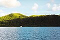
Bucas Grande
- Area
- 122 km²
- High point
- 287 m
Bugsuk
- Area
- 122 km²
- High point
- 42 m
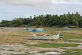
Bantayan Island
- Area
- 113 km²
- High point
- 91 m

Sibutu Island
- Area
- 104 km²
- High point
- 137 m
Homonhon Island
- Area
- 103 km²
- High point
- 379 m
Linapacan Island
- Area
- 97.5 km²
- High point
- 339 m
Pacijan Island
- Area
- 96.3 km²
- High point
- 205 m
Poro Island
- Area
- 96.1 km²
- High point
- 385 m

Fuga Island
- Area
- 95.6 km²
- High point
- 191 m
Daram Island
- Area
- 93.4 km²
- High point
- 371 m
Patnanongan Island
- Area
- 92.2 km²
- High point
- 102 m

Panglao Island
- Area
- 89.9 km²
- High point
- 190 m
Batan Island
- Area
- 89.1 km²
- High point
- 396 m

Itbayat Island
- Area
- 84.3 km²
- High point
- 277 m

Romblon Island
- Area
- 82.8 km²
- High point
- 444 m
Pangutaran Island
- Area
- 80.6 km²
- High point
- 25 m
Semirara Island
- Area
- 76.4 km²
- High point
- 150 m
Cabarruyan Island
- Area
- 74.5 km²
- High point
- 48 m
Ilin Island
- Area
- 73.7 km²
- High point
- 232 m

Babuyan Island
- Area
- 73.2 km²
- High point
- 1,070 m
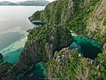
Coron Island
- Area
- 71.7 km²
- High point
- 595 m

Batan Island
- Area
- 70.9 km²
- High point
- 1,009 m
Siasi Island
- Area
- 69.1 km²
- High point
- 480 m
Cagraray Island
- Area
- 68.3 km²
- High point
- 370 m
Rapu Rapu Island
- Area
- 64.5 km²
- High point
- 521 m
Dalupiri Island
- Area
- 64.3 km²
- High point
- 275 m
Mapun Island
- Area
- 63.2 km²
- High point
- 337 m

Mactan
- Area
- 58.6 km²
- High point
- 38 m

Cuyo Island
- Area
- 57.1 km²
- High point
- 247 m
Balut Island
- Area
- 53.6 km²
- High point
- 840 m

Jomalig Island
- Area
- 51.5 km²
- High point
- 37 m
Nonoc Island
- Area
- 46.1 km²
- High point
- 300 m
Sacol Island
- Area
- 44.6 km²
- High point
- 212 m
Pata Island
- Area
- 44.5 km²
- High point
- 401 m
Sibay Island
- Area
- 42.2 km²
- High point
- 71 m
Maytiguid Island
- Area
- 41.5 km²
- High point
- 339 m
Sanga-Sanga Island
- Area
- 40.9 km²
- High point
- 97 m
Simunul Island
- Area
- 39.1 km²
- High point
- 29 m
Pandanan Island
- Area
- 39 km²
- High point
- 48 m
Lapinig Island
- Area
- 38.4 km²
- High point
- 126 m
Lugus Island
- Area
- 36.4 km²
- High point
- 297 m
Lapak Island
- Area
- 34.8 km²
- High point
- 360 m
Buad Island
- Area
- 34.7 km²
- High point
- 345 m
Sarangani Island
- Area
- 34.6 km²
- High point
- 160 m
Capul Island
- Area
- 34.1 km²
- High point
- 217 m

Sabtang Island
- Area
- 33.8 km²
- High point
- 347 m
Ponson Island
- Area
- 33.7 km²
- High point
- 217 m
Tongkil Island
- Area
- 32.4 km²
- High point
- 23 m
Maricaban Island
- Area
- 32 km²
- High point
- 447 m
Tapul Island
- Area
- 31.9 km²
- High point
- 474 m
Quinalasag Island
- Area
- 31.3 km²
- High point
- 235 m
Tandubatu Island
- Area
- 30.8 km²
- High point
- 143 m
Lintian Island
- Area
- 30.1 km²
- High point
- 198 m
Laoang Island
- Area
- 29.7 km²
- High point
- 69 m
Maripipi Island
- Area
- 29 km²
- High point
- 924 m
Ambil Island
- Area
- 28.8 km²
- High point
- 750 m
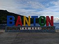
Banton Island
- Area
- 28.6 km²
- High point
- 596 m
Dalupiri Island
- Area
- 28.4 km²
- High point
- 127 m
Tagapul-an Island
- Area
- 28.1 km²
- High point
- 424 m
Carabao Island
- Area
- 28 km²
- High point
- 216 m
Talicud
- Area
- 27.7 km²
- High point
- 130 m
Batas Island
- Area
- 27.5 km²
- High point
- 440 m
Ramos
- Area
- 27.1 km²
- High point
- 90 m

Palaui Island
- Area
- 25.8 km²
- High point
- 261 m
Pilas Island
- Area
- 25 km²
- High point
- 149 m
Batag Island
- Area
- 24.8 km²
- High point
- 85 m
Caluya Island
- Area
- 24.3 km²
- High point
- 172 m
Almagro Island
- Area
- 22.4 km²
- High point
- 553 m
Pagbilao Grande Island
- Area
- 22.3 km²
- High point
- 144 m
Santiago Island
- Area
- 21.8 km²
- High point
- 47 m
San Miguel Island
- Area
- 21.5 km²
- High point
- 88 m
Mantangule Island
- Area
- 21.4 km²
- High point
- 29 m
Golo Island
- Area
- 21.4 km²
- High point
- 292 m
Bongo Island
- Area
- 21 km²
- High point
- 90 m
Tuluran Island
- Area
- 20.9 km²
- High point
- 279 m
Limbangcavayan Island
- Area
- 20.7 km²
- High point
- 468 m

Simara Island
- Area
- 20.6 km²
- High point
- 229 m
Capual Island
- Area
- 20.4 km²
- High point
- 312 m
Maestre de Campo Island
- Area
- 20.2 km²
- High point
- 340 m
Calagnaan Island
- Area
- 20.1 km²
- High point
- 329 m
Tumindao Island
- Area
- 18.9 km²
- High point
- 19 m
Lahuy Island
- Area
- 18.3 km²
- High point
- 177 m
Unnamed island
- Area
- 18.1 km²
- High point
- 64 m
Calicoan Island
- Area
- 17.4 km²
- High point
- 108 m
Malamawi Island
- Area
- 17.2 km²
- High point
- 122 m

Cagbalete
- Area
- 16.9 km²
- High point
- 52 m
Unnamed island
- Area
- 16.9 km²
- High point
- 364 m
Palasan Island
- Area
- 16.7 km²
- High point
- 63 m
Bancalan Island
- Area
- 16 km²
- High point
- 32 m
Manok Mangkaw Island
- Area
- 15.9 km²
- High point
- 23 m

Pan de Azucar Island
- Area
- 15.8 km²
- High point
- 550 m
Iloc Island
- Area
- 15.6 km²
- High point
- 263 m
Bilatan Island
- Area
- 15.5 km²
- High point
- 26 m
Kabingaan Island
- Area
- 15.1 km²
- High point
- 16 m
Agutaya Island
- Area
- 14.9 km²
- High point
- 271 m
East Bucas Island
- Area
- 14.8 km²
- High point
- 154 m
Simisa Island
- Area
- 14.6 km²
- High point
- 23 m
Sikubung Island
- Area
- 13.9 km²
- High point
- 24 m
Tagubanhan Island
- Area
- 13.8 km²
- High point
- 279 m
Boayan
- Area
- 13.5 km²
- High point
- 279 m
Gilbert island
- Area
- 13.4 km²
- High point
- 75 m
Cabaongon Island
- Area
- 13.3 km²
- High point
- 21 m
Masapelid Island
- Area
- 13.2 km²
- High point
- 195 m
Biri Island
- Area
- 12.9 km²
- High point
- 143 m
Hinatuan Island
- Area
- 12.4 km²
- High point
- 335 m
Poneas Island
- Area
- 12 km²
- High point
- 183 m
Panay Island
- Area
- 11.2 km²
- High point
- 133 m
Uson Island
- Area
- 11.1 km²
- High point
- 206 m
Manicani Island
- Area
- 10.9 km²
- High point
- 142 m
Mahanay Island
- Area
- 10.8 km²
- High point
- 15 m
Bucutua Island
- Area
- 10.7 km²
- High point
- 89 m

Sicogon
- Area
- 10.7 km²
- High point
- 214 m
Tandubas Island
- Area
- 10.6 km²
- High point
- 0 m

Tinaga Island
- Area
- 10.5 km²
- High point
- 115 m
Bangalao Island
- Area
- 10.3 km²
- High point
- 20 m
Pandukan Island
- Area
- 10.2 km²
- High point
- 19 m
Bongao Island
- Area
- 10.2 km²
- High point
- 342 m
Bulan Island
- Area
- 10 km²
- High point
- 329 m

Boracay
- Area
- 10 km²
- High point
- 96 m
Middle Bucas Island
- Area
- 9.9 km²
- High point
- 287 m
Bubuan Island
- Area
- 9.8 km²
- High point
- 200 m
Cabra Island
- Area
- 9.6 km²
- High point
- 53 m
Cadlao Island
- Area
- 9.6 km²
- High point
- 607 m
Inampulungan Island
- Area
- 9.6 km²
- High point
- 204 m
Ambulong Island
- Area
- 9.6 km²
- High point
- 160 m
Gibusong
- Area
- 9.5 km²
- High point
- 189 m
Tambon Island
- Area
- 9.3 km²
- High point
- 185 m

Olango Island
- Area
- 9.2 km²
- High point
- 16 m
Rasa Island
- Area
- 9.2 km²
- High point
- 29 m
Hikdop Island
- Area
- 9.2 km²
- High point
- 298 m
Camandag Island
- Area
- 9.2 km²
- High point
- 432 m
Kaulungan Island
- Area
- 9.1 km²
- High point
- 18 m
Hanigad Island
- Area
- 8.9 km²
- High point
- 173 m
Pandan Island
- Area
- 8.9 km²
- High point
- 74 m
Guintacan Island
- Area
- 8.8 km²
- High point
- 53 m
Mantabuan Island
- Area
- 8.7 km²
- High point
- 53 m
Apo Island
- Area
- 8.7 km²
- High point
- 170 m
Parasan Island
- Area
- 8.6 km²
- High point
- 139 m
Tapiantana Island
- Area
- 8 km²
- High point
- 249 m
Calabugdong Island
- Area
- 7.8 km²
- High point
- 216 m
Bulalacao Island
- Area
- 7.8 km²
- High point
- 210 m
Binuluangan Island
- Area
- 7.8 km²
- High point
- 79 m

Tumbagaan Island
- Area
- 7.5 km²
- High point
- 190 m
Awasan Island
- Area
- 7.3 km²
- High point
- 140 m

Igbon Island
- Area
- 7.2 km²
- High point
- 224 m

Cabilao Island
- Area
- 7.2 km²
- High point
- 36 m
Butauanan Island
- Area
- 7.1 km²
- High point
- 208 m

Cagayan Island
- Area
- 7.1 km²
- High point
- 62 m
San Juan Island
- Area
- 7 km²
- High point
- 103 m
Tigungun Island
- Area
- 7 km²
- High point
- 111 m
Limasawa Island
- Area
- 6.7 km²
- High point
- 226 m
Santa Cruz Island
- Area
- 6.7 km²
- High point
- 20 m
Marily Island
- Area
- 6.6 km²
- High point
- 199 m
Bani Island
- Area
- 6.5 km²
- High point
- 110 m
Guintinua
- Area
- 6.4 km²
- High point
- 152 m
Ivuhos
- Area
- 6.1 km²
- High point
- 107 m
Casian Island
- Area
- 6.1 km²
- High point
- 261 m
Diar-Diar
- Area
- 6.1 km²
- High point
- 68 m
Maobanen Island
- Area
- 6 km²
- High point
- 210 m
Tubabao Island
- Area
- 6 km²
- High point
- 41 m
Banaran Island
- Area
- 6 km²
- High point
- 16 m
Bacol Island
- Area
- 5.9 km²
- High point
- 57 m
Rocks & skerries
On the chart above, at its closest zooms.
Listing 200 of 7946; the rest are on the chart.
Figures
Comparative heights
To the same scale
Islands by area
Groups within
Overlapping groups
Photographs


South China Sea. Sabang, Palawan, Philippines.

View of City of Manila from Manila Bay

Northwest Panay Peninsula seen on Nagustan, Nabas, Aklan

a drone shot of a patch of farmland in Atok, Phillipines.

General Alejo Santos Highway Poblacion Bustos

The Asian glossy starling is a species of starling in the family Sturnidae. It is found in Bangladesh, Brunei, India, Indonesia, Malaysia, Myanmar, the Philippines, Singapore, Taiwan, Cambodia and Thailand.

The Asian glossy starling is a species of starling in the family Sturnidae. It is found in Bangladesh, Brunei, India, Indonesia, Malaysia, Myanmar, the Philippines, Singapore, Taiwan, Cambodia and Thailand.

The Asian glossy starling is a species of starling in the family Sturnidae. It is found in Bangladesh, Brunei, India, Indonesia, Malaysia, Myanmar, the Philippines, Singapore, Taiwan, Cambodia and Thailand.

Beach in Naga, Zamboanga Sibugay

Blue Banded Bee in the highlands of Leon, Iloilo

The brown shrike is a bird in the shrike family that is found mainly in Asia.
Sources
Facts
Photographs
- Marabut, Philippines, Limestone outcrops. Vyacheslav Argenberg / CC BY 4.0
- Sabang, South China Sea, Palawan, Philippines. Vyacheslav Argenberg / CC BY 4.0
- Manila Bay, Roxas Boulevard buildings with navy fleet (Ermita and Malate, Manila)(2017-12-31). Patrick Roque / CC BY-SA 4.0
- Northwest Panay Peninsula 3. EnzoBontia / CC BY-SA 4.0
- A farmland in Atok. Jp442 / CC BY-SA 3.0
- 9892General Alejo Santos Highway Poblacion Bustos 57. Judgefloro / CC0
- Asian glossy starling 23. Mhlayson / CC BY-SA 4.0
- Asian glossy starling 5. Mhlayson / CC BY-SA 4.0
- Asian glossy starlings. Mhlayson / CC BY-SA 4.0
- Beach in Naga. Tundan / CC BY-SA 4.0
- Blue Banded Bee 4. Parizfranz / CC BY-SA 4.0
- Brown Shrike 5. Mhlayson / CC BY-SA 4.0