Papua New Guinea, Japan, Philippines, Russia, Taiwan, Canada, Ecuador, United States, Kiribati, France, Niue, Chile, Pitcairn Islands, Tuvalu and Tokelau
14°47′N 12°22′E
Pacific Islands
The islands in the Pacific Ocean are categorized into three major island groups: Melanesia, Micronesia, and Polynesia.

Chart
Overview
The islands in the Pacific Ocean are categorized into three major island groups: Melanesia, Micronesia, and Polynesia. Depending on the context, the term Pacific Islands may refer to one of several concepts: (1) those Pacific islands whose people have Austronesian origins, (2) the Pacific islands once or currently colonized after 1500 CE, (3) the geographical region of Oceania, or (4) any island located in the Pacific Ocean. Inhabitants of the Pacific islands are known as Pacific Islanders. This list of islands in the Pacific Ocean is organized by archipelago or political boundary. In order to keep this list of moderate size, the more complete lists for countries with large numbers of small or uninhabited islands have been hyperlinked.
From Wikipedia, CC BY-SA 4.0
Census, cataloged
- Major islands6
- Minor islands2,825
- Islets8,894
- Rocks & skerries13,249
Major islands
New Guinea
- Area
- 774,566 km²
- High point
- 4,884 m
New Guinea (also known as Papua or historically Irian) is the world's second-largest island, with an area of 785,753 km2 (303,381 sq mi). It has the third-largest remaining rainforest globally, and the highest plant biodiversity of any island.
Honshu
- Area
- 227,970 km²
- High point
- 3,776 m
Honshu, historically known as Akitsushima (秋津島; lit. 'dragonfly island') or Hondo (本土; lit. 'mainland'), is the largest of Japan's four main islands. It lies between the Pacific Ocean (east) and the Sea of Japan (west).
Luzon
- Area
- 104,935 km²
- High point
- 2,928 m
Luzon ( loo-ZON, Tagalog: [luˈson]) is the largest and most populous island in the Philippines. Located in the northern portion of the Philippine archipelago, it is the economic and political center of the nation.
Mindanao
- Area
- 93,885 km²
- High point
- 2,954 m
Mindanao ( , MIN-də-NOW) is the second-largest island in the Philippines, after Luzon, and seventh-most populous island in the world. Located in the southern region of the archipelago, the island is part of an island group of the same name that also includes its adjacent islands, notably the Sulu Archipelago.


Japan
- Area
- 377,974 km²
Japan is an island country in East Asia. Located in the Pacific Ocean off the northeast coast of the Asian mainland, it is bordered to the west by the Sea of Japan, the Sea of Okhotsk in the north, and the East China Sea in the south.
New Zealand
- Area
- 268,021 km²
New Zealand is an island country in the southwestern Pacific Ocean. It comprises two main landmasses—the North Island (Te Ika-a-Māui) and the South Island (Te Waipounamu)—and over 700 smaller islands.
Minor islands

Hokkaido
- Area
- 77,983 km²
- High point
- 2,291 m

Sakhalin
- Area
- 74,571 km²
- High point
- 1,609 m

Kyushu
- Area
- 36,770 km²
- High point
- 1,791 m

Taiwan
- Area
- 36,035 km²
- High point
- 3,952 m

Vancouver Island
- Area
- 31,773 km²
- High point
- 2,195 m

Shikoku
- Area
- 18,284 km²
- High point
- 1,982 m

Negros
- Area
- 12,778 km²
- High point
- 2,465 m

Samar
- Area
- 12,435 km²
- High point
- 890 m

Panay
- Area
- 11,512 km²
- High point
- 2,102 m

Palawan
- Area
- 11,346 km²
- High point
- 2,963 m

Mindoro
- Area
- 9,824 km²
- High point
- 2,616 m

Leyte
- Area
- 6,997 km²
- High point
- 1,200 m

Isabela Island
- Area
- 4,702 km²
- High point
- 1,707 m

Cebu
- Area
- 4,406 km²
- High point
- 1,037 m

Unimak Island
- Area
- 4,078 km²
- High point
- 2,857 m
Bohol
- Area
- 3,767 km²
- High point
- 850 m

Masbate Island
- Area
- 3,209 km²
- High point
- 682 m

Iturup
- Area
- 3,163 km²
- High point
- 1,634 m
Samoa
- Area
- 2,842 km²

Unalaska Island
- Area
- 2,711 km²
- High point
- 1,811 m

Paramushir
- Area
- 2,031 km²
- High point
- 1,816 m

Umnak
- Area
- 1,775 km²
- High point
- 2,103 m

Kunashir
- Area
- 1,485 km²
- High point
- 1,819 m
Rangiroa
- Area
- 1,446 km²
- High point
- 12 m
Catanduanes
- Area
- 1,444 km²
- High point
- 734 m

Urup
- Area
- 1,419 km²
- High point
- 1,348 m

Basilan Island
- Area
- 1,218 km²
- High point
- 990 m

Okinawa Island
- Area
- 1,207 km²
- High point
- 503 m

Bering Island
- Area
- 1,172 km²
- High point
- 755 m
Fakarava
- Area
- 1,112 km²

Atka Island
- Area
- 1,046 km²
- High point
- 1,543 m

Santa Cruz Island
- Area
- 984 km²
- High point
- 864 m

Busuanga Island
- Area
- 932 km²
- High point
- 620 m
Marinduque Island
- Area
- 900 km²
- High point
- 1,174 m

Attu Island
- Area
- 886 km²
- High point
- 898 m
Jolo
- Area
- 807 km²
- High point
- 790 m

Dinagat Island
- Area
- 758 km²
- High point
- 939 m
Tonga
- Area
- 749 km²
Hao
- Area
- 720 km²
- High point
- 3 m

Adak Island
- Area
- 716 km²
- High point
- 1,196 m

Amami Ōshima
- Area
- 712 km²
- High point
- 694 m
Apataki
- Area
- 706 km²

Tablas Island
- Area
- 671 km²
- High point
- 665 m
Polillo Island
- Area
- 657 km²
- High point
- 330 m

Fernandina Island
- Area
- 643 km²
- High point
- 1,476 m
Makemo
- Area
- 603 km²
Tabukaokao
- Area
- 586 km²
- High point
- 10 m
Guimaras
- Area
- 578 km²
- High point
- 266 m

Santiago Island
- Area
- 576 km²
- High point
- 907 m
Shimoshima Island
- Area
- 575 km²
- High point
- 538 m

Tawi-Tawi Island
- Area
- 565 km²
- High point
- 535 m
Toau
- Area
- 561 km²

San Cristóbal Island
- Area
- 558 km²
- High point
- 724 m
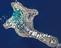
Kiritimati
- Area
- 546 km²
- High point
- 13 m
Tahanea
- Area
- 523 km²

Tanaga Island
- Area
- 508 km²
- High point
- 1,804 m

Yakushima
- Area
- 504 km²
- High point
- 1,936 m
Biliran
- Area
- 498 km²
- High point
- 1,346 m
Arutua
- Area
- 484 km²
Tikehau
- Area
- 461 km²
Marutea Nord
- Area
- 458 km²

Sibuyan Island
- Area
- 452 km²
- High point
- 2,023 m

Tanegashima
- Area
- 445 km²
- High point
- 238 m

Amlia
- Area
- 445 km²
- High point
- 636 m
Kaukura
- Area
- 434 km²
Onekotan
- Area
- 428 km²
- High point
- 1,325 m

Burias
- Area
- 416 km²
- High point
- 333 m

Shumshu
- Area
- 382 km²
- High point
- 189 m

Siargao
- Area
- 365 km²
- High point
- 263 m

Culion Island
- Area
- 361 km²
- High point
- 468 m

Kanaga Island
- Area
- 359 km²
- High point
- 1,307 m
Raroia
- Area
- 359 km²
Raraka
- Area
- 342 km²

Nuku Hiva
- Area
- 339 km²
- High point
- 1,224 m

Simushir
- Area
- 336 km²
- High point
- 1,540 m

Akutan Island
- Area
- 331 km²
- High point
- 1,303 m

Fukue Island
- Area
- 326 km²
- High point
- 460 m
Ticao Island
- Area
- 325 km²
- High point
- 393 m
Kauehi
- Area
- 320 km²

Siquijor
- Area
- 319 km²
- High point
- 605 m

Hiva Oa
- Area
- 308 km²
- High point
- 1,266 m
Dumaran Island
- Area
- 306 km²
- High point
- 201 m
Amchitka Island
- Area
- 302 km²
- High point
- 357 m
Balabac Island
- Area
- 301 km²
- High point
- 569 m

Iriomote Island
- Area
- 290 km²
- High point
- 470 m

Kiska
- Area
- 276 km²
- High point
- 1,220 m

Niue
- Area
- 261 km²
- High point
- 69 m
Samal
- Area
- 251 km²
- High point
- 510 m

Tokunoshima
- Area
- 248 km²
- High point
- 645 m

Shimono-shima
- Area
- 246 km²
- High point
- 649 m

Shikotan
- Area
- 246 km²
- High point
- 405 m
Camiguin
- Area
- 243 km²
- High point
- 1,630 m
Dōgojima
- Area
- 241 km²
- High point
- 608 m
Cook Islands
- Area
- 240 km²
Katiu
- Area
- 233 km²
Faaite
- Area
- 227 km²
Kamishima
- Area
- 226 km²
- High point
- 682 m
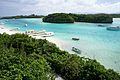
Ishigaki Island
- Area
- 223 km²
- High point
- 526 m

Semisopochnoi Island
- Area
- 222 km²
- High point
- 1,221 m

Agattu
- Area
- 221 km²
- High point
- 327 m

Medny Island
- Area
- 221 km²
- High point
- 647 m
Marokau
- Area
- 216 km²

Seguam Island
- Area
- 208 km²
- High point
- 859 m

Panaon Island
- Area
- 203 km²
- High point
- 687 m

Lubang Island
- Area
- 195 km²
- High point
- 618 m
Calayan Island
- Area
- 192 km²
- High point
- 543 m

Alabat Island
- Area
- 189 km²
- High point
- 412 m

Rishiri Island
- Area
- 182 km²
- High point
- 1,721 m

Floreana Island
- Area
- 172 km²
- High point
- 640 m

Yunaska Island
- Area
- 172 km²
- High point
- 950 m
Olutanga Island
- Area
- 169 km²
- High point
- 86 m

Nakadōri Island
- Area
- 168 km²
- High point
- 442 m
Camiguin Island
- Area
- 168 km²
- High point
- 800 m

Chuginadak Island
- Area
- 167 km²
- High point
- 1,730 m

Easter Island
- Area
- 164 km²
- High point
- 506 m

Akun Island
- Area
- 160 km²
- High point
- 818 m
Manihi
- Area
- 160 km²
- High point
- 9 m

Miyako Island
- Area
- 159 km²
- High point
- 109 m

Atlasov Island
- Area
- 153 km²
- High point
- 2,339 m

Great Sitkin Island
- Area
- 153 km²
- High point
- 1,740 m
Ahe
- Area
- 150 km²
Deer Island
- Area
- 148 km²
- High point
- 621 m
Aratika
- Area
- 145 km²

Okushiri Island
- Area
- 143 km²
- High point
- 584 m
Taenga
- Area
- 140 km²
Marchena Island
- Area
- 131 km²
- High point
- 337 m
Motutunga
- Area
- 126 km²

Bucas Grande
- Area
- 122 km²
- High point
- 287 m
Bugsuk
- Area
- 122 km²
- High point
- 42 m

Sanak Island
- Area
- 120 km²
- High point
- 532 m
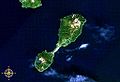
Shiashkotan
- Area
- 117 km²
- High point
- 925 m
Kagalaska Island
- Area
- 116 km²
- High point
- 472 m

Bantayan Island
- Area
- 113 km²
- High point
- 91 m
Marutea Sud
- Area
- 112 km²

Saint Paul Island
- Area
- 111 km²
- High point
- 198 m

Ua Pou
- Area
- 105 km²
- High point
- 1,230 m

Sibutu Island
- Area
- 104 km²
- High point
- 137 m
Homonhon Island
- Area
- 103 km²
- High point
- 379 m

Sedanka Island
- Area
- 100 km²
- High point
- 614 m
Abanekeneke
- Area
- 99.9 km²
- High point
- 21 m
Linapacan Island
- Area
- 97.5 km²
- High point
- 339 m
Pacijan Island
- Area
- 96.3 km²
- High point
- 205 m
Poro Island
- Area
- 96.1 km²
- High point
- 385 m

Fuga Island
- Area
- 95.6 km²
- High point
- 191 m

Okinoerabujima
- Area
- 93.5 km²
- High point
- 240 m
Daram Island
- Area
- 93.4 km²
- High point
- 371 m
Takaroa
- Area
- 93 km²
Patnanongan Island
- Area
- 92.2 km²
- High point
- 102 m
Tigalda Island
- Area
- 91.7 km²
- High point
- 496 m
Nagashima Island
- Area
- 90.7 km²
- High point
- 403 m

Panglao Island
- Area
- 89.9 km²
- High point
- 190 m
Batan Island
- Area
- 89.1 km²
- High point
- 396 m

St. George Island
- Area
- 88.8 km²
- High point
- 290 m

Ua Huka
- Area
- 85.7 km²
- High point
- 887 m
Takapoto
- Area
- 85 km²

Fatu-Hiva
- Area
- 84.3 km²
- High point
- 1,115 m

Itbayat Island
- Area
- 84.3 km²
- High point
- 277 m

Romblon Island
- Area
- 82.8 km²
- High point
- 444 m
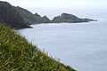
Rebun Island
- Area
- 81.2 km²
- High point
- 490 m
Pangutaran Island
- Area
- 80.6 km²
- High point
- 25 m
Hikueru
- Area
- 79 km²

Kakeromajima
- Area
- 77.2 km²
- High point
- 326 m
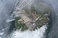
Kharimkotan
- Area
- 76.5 km²
- High point
- 1,145 m
Semirara Island
- Area
- 76.4 km²
- High point
- 150 m
Cabarruyan Island
- Area
- 74.5 km²
- High point
- 48 m
Ilin Island
- Area
- 73.7 km²
- High point
- 232 m

Babuyan Island
- Area
- 73.2 km²
- High point
- 1,070 m

Coron Island
- Area
- 71.7 km²
- High point
- 595 m

Ketoy
- Area
- 71.5 km²
- High point
- 1,172 m

Batan Island
- Area
- 70.9 km²
- High point
- 1,009 m

Tahuata
- Area
- 69.3 km²
- High point
- 966 m
Siasi Island
- Area
- 69.1 km²
- High point
- 480 m

Little Tanaga Island
- Area
- 68.4 km²
- High point
- 519 m
Cagraray Island
- Area
- 68.3 km²
- High point
- 370 m
Nengonengo
- Area
- 67 km²

Gareloi Island
- Area
- 66.8 km²
- High point
- 1,530 m
Rapu Rapu Island
- Area
- 64.5 km²
- High point
- 521 m
Dalupiri Island
- Area
- 64.3 km²
- High point
- 275 m
Mapun Island
- Area
- 63.2 km²
- High point
- 337 m

Rasshua
- Area
- 62.6 km²
- High point
- 956 m

Little Sitkin Island
- Area
- 62.4 km²
- High point
- 900 m
Tematangi
- Area
- 61 km²

Española Island
- Area
- 60.1 km²
- High point
- 215 m

Kume Island
- Area
- 59.6 km²
- High point
- 310 m
Pinta Island
- Area
- 59.4 km²
- High point
- 636 m

Mactan
- Area
- 58.6 km²
- High point
- 38 m

Zelyony Island
- Area
- 58.1 km²
- High point
- 27 m
Ravahere
- Area
- 57.5 km²

Cuyo Island
- Area
- 57.1 km²
- High point
- 247 m

Kikai Island
- Area
- 56.9 km²
- High point
- 63 m

Nishinoshima
- Area
- 55.8 km²
- High point
- 452 m
Niau
- Area
- 54.5 km²
- High point
- 20 m
Herbert Island
- Area
- 54 km²
- High point
- 1,300 m
Balut Island
- Area
- 53.6 km²
- High point
- 840 m
Rocks & skerries
On the chart above, at its closest zooms.
Listing 200 of 24974; the rest are on the chart.
Figures
Comparative heights
To the same scale
Islands by area
Groups within
Overlapping groups
Photographs

Satellite picture of New Guinea

Inside the crater of the Cagua Volcano with many slopes belching with sulfur dioxide and pools of boiling mud
Sources
Facts
Photographs
- PapuaNG. NASA, Cropped by User:Jklamo / Public domain
- Inside the Cagua Volcano crater. Warrendering / CC BY-SA 4.0