Philippines
7°30′N 125°00′E
Mindanao
Part of Philippines
Mindanao ( , MIN-də-NOW) is the second-largest island in the Philippines, after Luzon, and seventh-most populous island in the world. Located in the southern region of the archipelago, the island is part of an island group of the same name that also includes its adjacent islands, notably the Sulu Archipelago.

Chart
Overview
Mindanao ( , MIN-də-NOW) is the second-largest island in the Philippines, after Luzon, and seventh-most populous island in the world. Located in the southern region of the archipelago, the island is part of an island group of the same name that also includes its adjacent islands, notably the Sulu Archipelago. According to the 2020 census, Mindanao had a population of 26,252,442, while the entire island group had an estimated population of 27,384,138 as of 2024. Mindanao is divided into six administrative regions: the Zamboanga Peninsula, Northern Mindanao, the Caraga region, the Davao region, Soccsksargen, and the autonomous region of Bangsamoro. According to the 2020 census, Davao City is the most populous city on the island, with 1,776,949 people, followed by Zamboanga City (pop. 977,234), Cagayan De Oro (pop. 728,402), General Santos (pop. 722,059), Butuan (pop. 372,910), and Cotabato City (pop. 325,079). The vast majority of Mindanao's residents declare affiliation to various Christian groups, tantamounting roughly to two thirds of the population, while the Islamic religion sums up the island's (and the country's) largest minority, which has been reported or estimated to represent from 15 to 25%. Ethnic minority groups in Mindanao whose members are predominantly Islamic account for most of Muslims in Philippines. The Bangsamoro Autonomous Region in Muslim Mindanao (BARMM) stands out as the most predominantly Islamic region, where, according to the 2020 census, above 89% of the population identified as Muslims. Reports on religious demographics are often considered unreliable or inaccurate, though, as Mindanao is a deeply-divided society. Humanists, atheists, Muslims, and other religious minorities are concerned about discrimination, and human rights abuses have been denounced. Therefore, the appropriate methodology to access its ethno-religious diversity is disputed. The Philippine government's inherent failure to measure religious demographics is also argued by the National Commission on Muslim Filipinos (NCMF). Mindanao is considered the major breadbasket of the Philippines.
From Wikipedia, CC BY-SA 4.0
Census, cataloged
- Major islands1
- Minor islands431
- Islets1,706
- Rocks & skerries1,163
Major islands
Mindanao
- Area
- 93,885 km²
- High point
- 2,954 m
Mindanao ( , MIN-də-NOW) is the second-largest island in the Philippines, after Luzon, and seventh-most populous island in the world. Located in the southern region of the archipelago, the island is part of an island group of the same name that also includes its adjacent islands, notably the Sulu Archipelago.

Minor islands

Basilan Island
- Area
- 1,218 km²
- High point
- 990 m
Jolo
- Area
- 807 km²
- High point
- 790 m

Dinagat Island
- Area
- 758 km²
- High point
- 939 m

Tawi-Tawi Island
- Area
- 565 km²
- High point
- 535 m
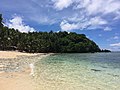
Siargao
- Area
- 365 km²
- High point
- 263 m
Samal
- Area
- 251 km²
- High point
- 510 m
Camiguin
- Area
- 243 km²
- High point
- 1,630 m
Olutanga Island
- Area
- 169 km²
- High point
- 86 m
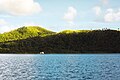
Bucas Grande
- Area
- 122 km²
- High point
- 287 m

Sibutu Island
- Area
- 104 km²
- High point
- 137 m
Pangutaran Island
- Area
- 80.6 km²
- High point
- 25 m
Siasi Island
- Area
- 69.1 km²
- High point
- 480 m
Mapun Island
- Area
- 63.2 km²
- High point
- 337 m
Balut Island
- Area
- 53.6 km²
- High point
- 840 m
Nonoc Island
- Area
- 46.1 km²
- High point
- 300 m
Sacol Island
- Area
- 44.6 km²
- High point
- 212 m
Pata Island
- Area
- 44.5 km²
- High point
- 401 m
Sanga-Sanga Island
- Area
- 40.9 km²
- High point
- 97 m
Simunul Island
- Area
- 39.1 km²
- High point
- 29 m
Lugus Island
- Area
- 36.4 km²
- High point
- 297 m
Lapak Island
- Area
- 34.8 km²
- High point
- 360 m
Sarangani Island
- Area
- 34.6 km²
- High point
- 160 m
Tongkil Island
- Area
- 32.4 km²
- High point
- 23 m
Tapul Island
- Area
- 31.9 km²
- High point
- 474 m
Tandubatu Island
- Area
- 30.8 km²
- High point
- 143 m
Lintian Island
- Area
- 30.1 km²
- High point
- 198 m
Talicud
- Area
- 27.7 km²
- High point
- 130 m
Pilas Island
- Area
- 25 km²
- High point
- 149 m
Bongo Island
- Area
- 21 km²
- High point
- 90 m
Capual Island
- Area
- 20.4 km²
- High point
- 312 m
Tumindao Island
- Area
- 18.9 km²
- High point
- 19 m
Malamawi Island
- Area
- 17.2 km²
- High point
- 122 m
Manok Mangkaw Island
- Area
- 15.9 km²
- High point
- 23 m
Bilatan Island
- Area
- 15.5 km²
- High point
- 26 m
Kabingaan Island
- Area
- 15.1 km²
- High point
- 16 m
East Bucas Island
- Area
- 14.8 km²
- High point
- 154 m
Simisa Island
- Area
- 14.6 km²
- High point
- 23 m
Sikubung Island
- Area
- 13.9 km²
- High point
- 24 m
Masapelid Island
- Area
- 13.2 km²
- High point
- 195 m
Hinatuan Island
- Area
- 12.4 km²
- High point
- 335 m
Poneas Island
- Area
- 12 km²
- High point
- 183 m
Bucutua Island
- Area
- 10.7 km²
- High point
- 89 m
Tandubas Island
- Area
- 10.6 km²
- High point
- 0 m
Bangalao Island
- Area
- 10.3 km²
- High point
- 20 m
Pandukan Island
- Area
- 10.2 km²
- High point
- 19 m
Bongao Island
- Area
- 10.2 km²
- High point
- 342 m
Bulan Island
- Area
- 10 km²
- High point
- 329 m
Middle Bucas Island
- Area
- 9.9 km²
- High point
- 287 m
Bubuan Island
- Area
- 9.8 km²
- High point
- 200 m
Gibusong
- Area
- 9.5 km²
- High point
- 189 m
Hikdop Island
- Area
- 9.2 km²
- High point
- 298 m
Kaulungan Island
- Area
- 9.1 km²
- High point
- 18 m
Hanigad Island
- Area
- 8.9 km²
- High point
- 173 m
Mantabuan Island
- Area
- 8.7 km²
- High point
- 53 m
Tapiantana Island
- Area
- 8 km²
- High point
- 249 m

Tumbagaan Island
- Area
- 7.5 km²
- High point
- 190 m
Awasan Island
- Area
- 7.3 km²
- High point
- 140 m
Tigungun Island
- Area
- 7 km²
- High point
- 111 m
Diar-Diar
- Area
- 6.1 km²
- High point
- 68 m
Banaran Island
- Area
- 6 km²
- High point
- 16 m
South Ubian Island
- Area
- 5.5 km²
- High point
- 20 m
Balukbaluk Island
- Area
- 5.5 km²
- High point
- 139 m

Basbas Island
- Area
- 5.3 km²
- High point
- 65 m
Bayagnan Island
- Area
- 5.2 km²
- High point
- 243 m
General Island
- Area
- 5.2 km²
- High point
- 239 m
Latuan Island
- Area
- 5.2 km²
- High point
- 17 m
North Ubian Island
- Area
- 5.1 km²
- High point
- 24 m
Taluk Island
- Area
- 5 km²
- High point
- 10 m
Igat Island
- Area
- 4.9 km²
- High point
- 167 m
Cap Island
- Area
- 4.9 km²
- High point
- 15 m
Tictauan Island
- Area
- 4.8 km²
- High point
- 9 m
Bitinan Island
- Area
- 4.6 km²
- High point
- 215 m
Naunghn Island
- Area
- 4.6 km²
- High point
- 148 m
Bubuan Island
- Area
- 4.5 km²
- High point
- 124 m
Tabulunga Island
- Area
- 4.2 km²
- High point
- 24 m
Tabawan Island
- Area
- 4.1 km²
- High point
- 17 m
Laparan Island
- Area
- 4.1 km²
- High point
- 14 m
Omapuy Island
- Area
- 4 km²
- High point
- 19 m
Unib Island
- Area
- 3.7 km²
- High point
- 198 m
Manalipa Island
- Area
- 3.5 km²
- High point
- 113 m
Tatalan Island
- Area
- 3.5 km²
- High point
- 102 m
Unnamed island
- Area
- 3.4 km²
- High point
- 49 m
Tamuk Island
- Area
- 3.3 km²
- High point
- 54 m
Taruk Island
- Area
- 3.3 km²
- High point
- 70 m
Pakiya Island
- Area
- 3.3 km²
- High point
- 10 m
Sugbay Island
- Area
- 3.1 km²
- High point
- 226 m
Maningkulat Island
- Area
- 3 km²
- High point
- 244 m
Sibale Island
- Area
- 2.9 km²
- High point
- 171 m
Pandalan Island
- Area
- 2.8 km²
- High point
- 14 m
Usada Island
- Area
- 2.6 km²
- High point
- 19 m
Kangbangyo Island
- Area
- 2.6 km²
- High point
- 130 m
Talavera Island
- Area
- 2.6 km²
- High point
- 182 m
Patian Island
- Area
- 2.5 km²
- High point
- 123 m

Great Santa Cruz Island
- Area
- 2.5 km²
- High point
- 10 m
Linawan Island
- Area
- 2.4 km²
- High point
- 112 m
Dongdong Island
- Area
- 2.4 km²
- High point
- 14 m
Bintoulan Island
- Area
- 2.4 km²
- High point
- 16 m
Condona Island
- Area
- 2.3 km²
- High point
- 84 m
Manangal Island
- Area
- 2.2 km²
- High point
- 102 m
Big Sangboy Island
- Area
- 2.2 km²
- High point
- 249 m

Pababag Island
- Area
- 2.2 km²
- High point
- 26 m
Sibanac Island
- Area
- 2.2 km²
- High point
- 142 m
Tona Island
- Area
- 2.1 km²
- High point
- 22 m
Sibago Island
- Area
- 2.1 km²
- High point
- 204 m
Bambannan Island
- Area
- 2.1 km²
- High point
- 8 m
Langil Island
- Area
- 2.1 km²
- High point
- 148 m
Tengolan Island
- Area
- 2.1 km²
- High point
- 7 m
Small Sangboy Island
- Area
- 2 km²
- High point
- 172 m
Ludguron Island
- Area
- 2 km²
- High point
- 94 m
Deatobato Island
- Area
- 2 km²
- High point
- 16 m
Unnamed island
- Area
- 1.9 km²
- High point
- 7 m
Kinapusan Island
- Area
- 1.8 km²
- High point
- 15 m
Parol Island
- Area
- 1.8 km²
- High point
- 19 m
Binoscogan Island
- Area
- 1.8 km²
- High point
- 36 m
Tolon Pisa Island
- Area
- 1.8 km²
- High point
- 9 m
Kakatan Island
- Area
- 1.7 km²
- High point
- 14 m
Saluping Island
- Area
- 1.7 km²
- High point
- 15 m
Tubigan Island
- Area
- 1.7 km²
- High point
- 12 m
Bubuan Island
- Area
- 1.6 km²
- High point
- 89 m
Teomabal Island
- Area
- 1.6 km²
- High point
- 9 m
Cabut Island
- Area
- 1.6 km²
- High point
- 20 m
Capaquian Island
- Area
- 1.6 km²
- High point
- 74 m
Unnamed island
- Area
- 1.6 km²
- High point
- 22 m
Dammi Island
- Area
- 1.6 km²
- High point
- 11 m
Unnamed island
- Area
- 1.6 km²
- High point
- 21 m
Balanguingui Island
- Area
- 1.5 km²
- High point
- 20 m
Unnamed island
- Area
- 1.5 km²
- High point
- 20 m
Tulayan Island
- Area
- 1.5 km²
- High point
- 161 m
Lajanosa Island
- Area
- 1.5 km²
- High point
- 50 m
Daco Island
- Area
- 1.5 km²
- High point
- 33 m
Kamawi Island
- Area
- 1.4 km²
- High point
- 71 m
Mamanog Island
- Area
- 1.4 km²
- High point
- 19 m
Pagaspas
- Area
- 1.4 km²
- High point
- 104 m
Mataja Island
- Area
- 1.4 km²
- High point
- 11 m
Kalupag Island
- Area
- 1.3 km²
- High point
- 81 m
Kulassian Island
- Area
- 1.3 km²
- High point
- 12 m
Minis Island
- Area
- 1.3 km²
- High point
- 7 m
Tara Island
- Area
- 1.3 km²
- High point
- 29 m
Lupa Island
- Area
- 1.3 km²
- High point
- 24 m
Unnamed island
- Area
- 1.3 km²
- High point
- 6 m
Timbungan Island
- Area
- 1.2 km²
- High point
- 6 m
Dassalan Island
- Area
- 1.2 km²
- High point
- 19 m
Doc Can Island
- Area
- 1.1 km²
- High point
- 13 m
Buan Island
- Area
- 1.1 km²
- High point
- 95 m
Pamisaan Island
- Area
- 1.1 km²
- High point
- 7 m
Mahaba Island
- Area
- 1 km²
- High point
- 18 m
Cujangan Island
- Area
- 1 km²
- High point
- 5 m
Bilabid Island
- Area
- 1 km²
- High point
- 69 m
Tagau Island
- Area
- 1 km²
- High point
- 70 m
Basbas Island
- Area
- 1 km²
- High point
- 7 m
Sipangkot Island
- Area
- 1 km²
- High point
- 18 m
Gujangan Island
- Area
- 1 km²
- High point
- 122 m
Doran Island
- Area
- 1 km²
- High point
- 44 m
Teinga Island
- Area
- 0.98 km²
- High point
- 17 m
Casulian Island
- Area
- 0.97 km²
- High point
- 61 m
Unnamed island
- Area
- 0.96 km²
- High point
- 20 m
Parangan Island
- Area
- 0.95 km²
- High point
- 55 m
Kopiat Island
- Area
- 0.92 km²
- High point
- 21 m
Mahaba Island
- Area
- 0.92 km²
- High point
- 73 m
Tikul Island
- Area
- 0.92 km²
- High point
- 13 m
Sulare Island
- Area
- 0.87 km²
- High point
- 14 m
Teomabal Island
- Area
- 0.86 km²
- High point
- 10 m
Buli Nusa Island
- Area
- 0.86 km²
- High point
- 11 m
Sagayaran Island
- Area
- 0.85 km²
- High point
- 83 m
Unnamed island
- Area
- 0.84 km²
- High point
- 9 m
Unnamed island
- Area
- 0.83 km²
- High point
- 26 m
Mawes Island
- Area
- 0.83 km²
- High point
- 20 m
Lutangan Island
- Area
- 0.81 km²
- High point
- 22 m
Coco
- Area
- 0.79 km²
- High point
- 143 m
Kaludlud Island
- Area
- 0.79 km²
- High point
- 13 m
Anajauan Island
- Area
- 0.78 km²
- High point
- 52 m
Silino Island
- Area
- 0.78 km²
- High point
- 16 m
Bagasin Island
- Area
- 0.77 km²
- High point
- 52 m
Lapinigan
- Area
- 0.75 km²
- High point
- 70 m
Tulnalutan Island
- Area
- 0.73 km²
- High point
- 75 m

Aliguay Island
- Area
- 0.72 km²
- High point
- 21 m
Gusi Island
- Area
- 0.71 km²
- High point
- 11 m
Unnamed island
- Area
- 0.71 km²
- High point
- 7 m
Minis Island
- Area
- 0.69 km²
- High point
- 10 m
Manungut Island
- Area
- 0.69 km²
- High point
- 80 m
Tamloylangan Island
- Area
- 0.68 km²
- High point
- 96 m
Nanacaan Island
- Area
- 0.68 km²
- High point
- 26 m
Kaluitan Island
- Area
- 0.66 km²
- High point
- 9 m
Paturuan Island
- Area
- 0.65 km²
- High point
- 7 m
Pintada Island
- Area
- 0.65 km²
- High point
- 84 m
Dalauan Island
- Area
- 0.64 km²
- High point
- 11 m
Puyo Island
- Area
- 0.63 km²
- High point
- 45 m
Mamannak Island
- Area
- 0.63 km²
- High point
- 7 m
Unnamed island
- Area
- 0.63 km²
- High point
- 8 m
Unnamed island
- Area
- 0.62 km²
- High point
- 13 m
Unnamed island
- Area
- 0.61 km²
- High point
- 54 m
Langas Island
- Area
- 0.6 km²
- High point
- 11 m
Muligi Mihi Island
- Area
- 0.6 km²
- High point
- 112 m
Palajangan Island
- Area
- 0.59 km²
- High point
- 14 m
Keenapusan Island
- Area
- 0.59 km²
- High point
- 69 m
Laonan Island
- Area
- 0.58 km²
- High point
- 122 m
Danawan
- Area
- 0.58 km²
- High point
- 39 m
Bakhan Dakula Island
- Area
- 0.58 km²
- High point
- 20 m
Unnamed island
- Area
- 0.56 km²
- High point
- 45 m
Rocks & skerries
On the chart above, at its closest zooms.
Listing 200 of 3301; the rest are on the chart.
Figures
Comparative heights
To the same scale
Islands by area
Groups within
- Arangasa Islands
- Bayasa Islands
- Binaliu Rocks
- Cabilan Islands
- Calaitan Islets
- Celandat Islets
- Dahikan Islets
- Haycock Islands
- Jolo Group
- Kanhatid Islets
- Kinapusan Islands
- Muligi Islands
- Nusanusa Batu Islands
- Once Islas
- Panolean Islands
- Pelotes Rocks
- Pilas Group
- Sarangani Islands
- Siargao Islands
- Sulu Archipelago
- Tabunan Islands
- Tata Islands
- Tauntong Islands
- Tigbauan Islands
Photographs

Philippines, Mindanao, March 2012: Even apparently solid structures made from concrete and bricks were simply lifted up from their foundations and carried along by the raging torrents, displacing some 400 000 people.

Mangima Canyon at the Sitio Angeles View Deck in Maluko, Manolo Fortich, Bukidnon

Mangima Canyon at the Sitio Angeles View Deck in Maluko, Manolo Fortich, Bukidnon

The slopes of Mt. Kitanglad and the Kitanglad Mountain Range as viewed from the slopes of Mt. Dulang-Dulang

Eagle Camp, Mount Katanglad, Mindanao, Philippines

Random photos at Bihing Tahik Resort in Bongao, Tawi-Tawi

Sceneries in Upi, Maguindanao

Sceneries in Upi, Maguindanao

Sceneries in Upi, Maguindanao

Sceneries in Upi, Maguindanao

Two limestone burial jars from Salansang, South Cotabato dated circa 8th-9th century. A 20th century scale model of a native Filipinon boat called a "virey" can be seen behind. Ayala Museum collection. Exhibited in the Ayala Museum, 2022.

Courtesy Visit to Strategic Partners in Bongao, Tawi-Tawi
Sources
Facts
Photographs
- Flash flood damage in Mindanao, Philippines, March 2012. Mathias Eick EU/ECHO / CC BY-SA 2.0
- Mangima Canyon at Maluko, Manolo Fortich, Bukidnon 01. Obsidian Soul / CC0
- Mangima Canyon at Maluko, Manolo Fortich, Bukidnon 02. Obsidian Soul / CC0
- Mount Kitanglad and the Kitanglad Mountain Range. Warrendering / CC BY-SA 4.0
- Eagle Camp, Mount Katanglad, Mindanao - 8605403789. sussexbirder / Public domain
- Bihing Tahik 7. LuzViMindaLife / CC BY-SA 4.0
- Nangi Upi 1. LuzViMindaLife / CC BY-SA 4.0
- Nangi Upi 11. LuzViMindaLife / CC BY-SA 4.0
- Nuro Upi 2. LuzViMindaLife / CC BY-SA 4.0
- Nuro Upi 5. LuzViMindaLife / CC BY-SA 4.0
- Two limestone burial jars from Salansang, South Cotabato. EyeTrick / CC BY 4.0
- Wiki Literacy Training and Meeting with Partners in Tawi-Tawi 1. LuzViMindaLife / CC BY-SA 4.0