Indian OceanPhilippines, Brunei, Malaysia, Papua New Guinea, Timor-Leste, Singapore and Indonesia
2°05′S 126°33′E
Malay Archipelago
The Malay Archipelago is the archipelago between Mainland Southeast Asia and Australia, and is also called Insulindia or the Indo-Australian Archipelago. The name was taken from the 19th-century European concept of a Malay race, later based on the distribution of Austronesian languages.

Chart
Overview
The Malay Archipelago is the archipelago between Mainland Southeast Asia and Australia, and is also called Insulindia or the Indo-Australian Archipelago. The name was taken from the 19th-century European concept of a Malay race, later based on the distribution of Austronesian languages. It has also been called the "Malay world", "Nusantara", and the "East Indies" over time. The name is controversial in Indonesia due to its ethnic connotations and colonial undertones, which can overshadow the country's diverse cultures. Situated between the Indian and Pacific oceans, the archipelago of over 25,000 islands and islets is the largest archipelago by area and fifth by number of islands in the world. It includes Brunei, East Timor, Indonesia, Malaysia (specifically East Malaysia), Papua New Guinea, the Philippines, and Singapore. The term is largely synonymous with Maritime Southeast Asia.
From Wikipedia, CC BY-SA 4.0
Census, cataloged
- Major islands6
- Minor islands5,225
- Islets12,026
- Rocks & skerries5,975
Major islands
Borneo
- Area
- 732,069 km²
- High point
- 4,095 m
Borneo is the third-largest island in the world, with an area of 748,168 km2 (288,869 sq mi), and population of 23,053,723 (2020 national censuses). Situated at the geographic centre of Maritime Southeast Asia, it is one of the Greater Sunda Islands, located north of Java, west of Sulawesi, and east of Sumatra.
Sumatra
- Area
- 429,717 km²
- High point
- 3,805 m
Sumatra is one of the Sunda Islands of western Indonesia. 2), including adjacent islands and archipelagos. The island is divided into ten Indonesian provinces. The most populous city is Medan.
Sulawesi
- Area
- 168,788 km²
- High point
- 3,478 m
Sulawesi ( SOO-lə-WAY-see, Indonesian: [ˌsulaˈwesi]; Lontara: ᨔᨘᨒᨓᨙᨔᨗ romanized: Sulawési), also known as Celebes, is an island in Indonesia.
Java
- Area
- 126,804 km²
- High point
- 3,676 m
Java is one of the Greater Sunda Islands in the South East Asian country of Indonesia. It is bordered by the Indian Ocean to the south and the Java Sea (a part of the Pacific Ocean) to the north. 2 million people; about 56% of the Indonesian population, while constituting only 7% of the country's land area.
Luzon
- Area
- 104,935 km²
- High point
- 2,928 m
Luzon ( loo-ZON, Tagalog: [luˈson]) is the largest and most populous island in the Philippines. Located in the northern portion of the Philippine archipelago, it is the economic and political center of the nation.
Mindanao
- Area
- 93,885 km²
- High point
- 2,954 m
Mindanao ( , MIN-də-NOW) is the second-largest island in the Philippines, after Luzon, and seventh-most populous island in the world. Located in the southern region of the archipelago, the island is part of an island group of the same name that also includes its adjacent islands, notably the Sulu Archipelago.


Minor islands

Timor
- Area
- 28,560 km²
- High point
- 2,963 m

Halmahera
- Area
- 17,956 km²
- High point
- 1,571 m

Seram Island
- Area
- 17,368 km²
- High point
- 3,027 m

Sumbawa
- Area
- 14,406 km²
- High point
- 2,690 m

Flores
- Area
- 13,993 km²
- High point
- 2,367 m

Negros
- Area
- 12,778 km²
- High point
- 2,465 m

Samar
- Area
- 12,435 km²
- High point
- 890 m
Pulau Dolok
- Area
- 11,646 km²
- High point
- 38 m
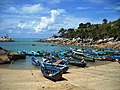
Bangka Island
- Area
- 11,548 km²
- High point
- 654 m

Panay
- Area
- 11,512 km²
- High point
- 2,102 m

Palawan
- Area
- 11,346 km²
- High point
- 2,963 m

Sumba
- Area
- 10,902 km²
- High point
- 1,225 m

Mindoro
- Area
- 9,824 km²
- High point
- 2,616 m

Buru
- Area
- 8,514 km²
- High point
- 2,700 m

Leyte
- Area
- 6,997 km²
- High point
- 1,200 m

Bali
- Area
- 5,370 km²
- High point
- 3,031 m

Belitung
- Area
- 4,611 km²
- High point
- 503 m

Lombok
- Area
- 4,535 km²
- High point
- 3,726 m

Madura
- Area
- 4,472 km²
- High point
- 466 m

Cebu
- Area
- 4,406 km²
- High point
- 1,037 m
Buton
- Area
- 4,389 km²
- High point
- 1,045 m

Nias
- Area
- 4,113 km²
- High point
- 856 m

Siberut
- Area
- 3,808 km²
- High point
- 390 m
Bohol
- Area
- 3,767 km²
- High point
- 850 m

Yamdena
- Area
- 3,255 km²
- High point
- 299 m

Masbate Island
- Area
- 3,209 km²
- High point
- 682 m

Waigeo
- Area
- 2,996 km²
- High point
- 990 m

Muna Island
- Area
- 2,926 km²
- High point
- 416 m
Taliabu Island
- Area
- 2,916 km²
- High point
- 1,403 m
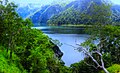
Wetar
- Area
- 2,611 km²
- High point
- 1,411 m
Obimayor Island
- Area
- 2,461 km²
- High point
- 1,611 m
Terangan Island
- Area
- 2,398 km²
- High point
- 110 m
Peling Island
- Area
- 2,319 km²
- High point
- 1,035 m

Morotai
- Area
- 2,269 km²
- High point
- 1,250 m

Yapen
- Area
- 2,260 km²
- High point
- 1,496 m

Alor Island
- Area
- 2,114 km²
- High point
- 1,821 m
Laut Island
- Area
- 2,088 km²
- High point
- 728 m

Misool
- Area
- 2,067 km²
- High point
- 523 m

Biak
- Area
- 1,895 km²
- High point
- 729 m
Kobroor
- Area
- 1,806 km²
- High point
- 92 m

Bacan
- Area
- 1,787 km²
- High point
- 2,111 m

Simeulue
- Area
- 1,733 km²
- High point
- 294 m
Salawati
- Area
- 1,655 km²
- High point
- 808 m

Bunguran Island
- Area
- 1,627 km²
- High point
- 1,035 m
Wokam Island
- Area
- 1,607 km²
- High point
- 97 m
Rupat
- Area
- 1,498 km²
- High point
- 42 m
Catanduanes
- Area
- 1,444 km²
- High point
- 734 m
Tebing Tinggi Island
- Area
- 1,362 km²
- High point
- 51 m

Lembata
- Area
- 1,248 km²
- High point
- 1,621 m

Basilan Island
- Area
- 1,218 km²
- High point
- 990 m

Rote Island
- Area
- 1,206 km²
- High point
- 452 m
Mangoli Island
- Area
- 1,204 km²
- High point
- 1,115 m

Bintan Island
- Area
- 1,169 km²
- High point
- 356 m
Padang Island
- Area
- 1,106 km²
- High point
- 52 m
Maya Island
- Area
- 1,004 km²
- High point
- 512 m

Busuanga Island
- Area
- 932 km²
- High point
- 620 m
Bengkalis Island
- Area
- 907 km²
- High point
- 35 m
Marinduque Island
- Area
- 900 km²
- High point
- 1,174 m
Rangsang
- Area
- 883 km²
- High point
- 36 m
Lingga Island
- Area
- 858 km²
- High point
- 1,113 m
Pagai Selatan Island
- Area
- 857 km²
- High point
- 321 m

Kabaena
- Area
- 854 km²
- High point
- 1,552 m
Jolo
- Area
- 807 km²
- High point
- 790 m

Karakelang
- Area
- 800 km²
- High point
- 680 m

Singkep
- Area
- 779 km²
- High point
- 493 m

Ambon Island
- Area
- 772 km²
- High point
- 1,023 m

Dinagat Island
- Area
- 758 km²
- High point
- 939 m
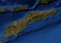
Pantar
- Area
- 730 km²
- High point
- 1,336 m
Wawonii Island
- Area
- 690 km²
- High point
- 894 m
Pulau Komoran
- Area
- 679 km²
- High point
- 33 m

Tablas Island
- Area
- 671 km²
- High point
- 665 m
Polillo Island
- Area
- 657 km²
- High point
- 330 m

Singapore
- Area
- 655 km²
- High point
- 164 m

Selayar Island
- Area
- 648 km²
- High point
- 397 m
Babar Island
- Area
- 623 km²
- High point
- 818 m
Supiori Island
- Area
- 612 km²
- High point
- 973 m
Pagai Utara Island
- Area
- 600 km²
- High point
- 346 m

Sipora
- Area
- 594 km²
- High point
- 287 m
Guimaras
- Area
- 578 km²
- High point
- 266 m

Tawi-Tawi Island
- Area
- 565 km²
- High point
- 535 m

Sangihe Island
- Area
- 550 km²
- High point
- 1,320 m

Nuhu Yuthu Island
- Area
- 544 km²
- High point
- 611 m

Sulabesi Island
- Area
- 531 km²
- High point
- 644 m
Adonara
- Area
- 506 km²
- High point
- 1,658 m
Biliran
- Area
- 498 km²
- High point
- 1,346 m

Sibuyan Island
- Area
- 452 km²
- High point
- 2,023 m
Batanta
- Area
- 447 km²
- High point
- 1,184 m
Tanabala Island
- Area
- 446 km²
- High point
- 268 m
Kasiruta
- Area
- 438 km²
- High point
- 798 m

Sebatik Island
- Area
- 436 km²
- High point
- 438 m
Bruit Island
- Area
- 436 km²
- High point
- 35 m

Batam Island
- Area
- 425 km²
- High point
- 171 m
Sawu
- Area
- 421 km²
- High point
- 350 m

Burias
- Area
- 416 km²
- High point
- 333 m
Kei Kecil Island
- Area
- 410 km²
- High point
- 112 m

Kangean Island
- Area
- 402 km²
- High point
- 346 m
Pulau Koba
- Area
- 400 km²
- High point
- 58 m
Maikoor
- Area
- 398 km²
- High point
- 84 m

Enggano Island
- Area
- 395 km²
- High point
- 261 m

Siargao
- Area
- 365 km²
- High point
- 263 m

Culion Island
- Area
- 361 km²
- High point
- 468 m
Moa
- Area
- 360 km²
- High point
- 255 m

Selaru
- Area
- 347 km²
- High point
- 79 m

Numfor
- Area
- 341 km²
- High point
- 200 m
Tanahmasa Island
- Area
- 332 km²
- High point
- 196 m

Moyo Island
- Area
- 330 km²
- High point
- 531 m
Ticao Island
- Area
- 325 km²
- High point
- 393 m
Unnamed island
- Area
- 324 km²
- High point
- 41 m

Pini Island
- Area
- 320 km²
- High point
- 96 m

Siquijor
- Area
- 319 km²
- High point
- 605 m

Komodo
- Area
- 318 km²
- High point
- 808 m

Kundur Island
- Area
- 313 km²
- High point
- 120 m
Mendol Island
- Area
- 308 km²
- High point
- 42 m
Komfane
- Area
- 307 km²
- High point
- 79 m
Dumaran Island
- Area
- 306 km²
- High point
- 201 m

Penang Island
- Area
- 301 km²
- High point
- 833 m
Balabac Island
- Area
- 301 km²
- High point
- 569 m
Pulau Kola
- Area
- 287 km²
- High point
- 85 m

Banggai Island
- Area
- 267 km²
- High point
- 362 m
Samal
- Area
- 251 km²
- High point
- 510 m
Tarakan Island
- Area
- 251 km²
- High point
- 121 m
Pulau Batudaka
- Area
- 245 km²
- High point
- 368 m
Camiguin
- Area
- 243 km²
- High point
- 1,630 m
Pulau Nunukan
- Area
- 236 km²
- High point
- 220 m
Unnamed island
- Area
- 225 km²
- High point
- 32 m
Semau Island
- Area
- 220 km²
- High point
- 40 m

Solor
- Area
- 217 km²
- High point
- 863 m
Pulau Sebuku
- Area
- 215 km²
- High point
- 193 m
Merbau Island
- Area
- 215 km²
- High point
- 34 m
Larat
- Area
- 214 km²
- High point
- 119 m
Pulau Lepar
- Area
- 213 km²
- High point
- 260 m
Mandioli Island
- Area
- 207 km²
- High point
- 322 m
Jemaja Island
- Area
- 207 km²
- High point
- 465 m
Unnamed island
- Area
- 205 km²
- High point
- 42 m

Rinca
- Area
- 205 km²
- High point
- 735 m

Panaon Island
- Area
- 203 km²
- High point
- 687 m
Tuangku
- Area
- 201 km²
- High point
- 270 m

Bawean
- Area
- 198 km²
- High point
- 655 m

Nusapenida Island
- Area
- 196 km²
- High point
- 528 m

Lubang Island
- Area
- 195 km²
- High point
- 618 m
Calayan Island
- Area
- 192 km²
- High point
- 543 m

Damar Island
- Area
- 192 km²
- High point
- 868 m
Unnamed island
- Area
- 190 km²
- High point
- 41 m

Alabat Island
- Area
- 189 km²
- High point
- 412 m

Gam Island
- Area
- 181 km²
- High point
- 405 m

Karimata Island
- Area
- 180 km²
- High point
- 998 m
Pulau Laag
- Area
- 176 km²
- High point
- 39 m

Romang
- Area
- 174 km²
- High point
- 743 m

Haruku Island
- Area
- 174 km²
- High point
- 582 m
Bisa Island
- Area
- 171 km²
- High point
- 423 m
Olutanga Island
- Area
- 169 km²
- High point
- 86 m
Camiguin Island
- Area
- 168 km²
- High point
- 800 m
Pulau Workai
- Area
- 163 km²
- High point
- 60 m
Alang Gantang River
- Area
- 160 km²
- High point
- 38 m

Saparua
- Area
- 159 km²
- High point
- 321 m
Pulau Tanahjampea
- Area
- 158 km²
- High point
- 512 m
Pulau Wuliaru
- Area
- 157 km²
- High point
- 175 m
Pulau Wangiwangi
- Area
- 156 km²
- High point
- 261 m

Rempang Island
- Area
- 156 km²
- High point
- 155 m
Togean Island
- Area
- 155 km²
- High point
- 518 m
Pulau Adi
- Area
- 155 km²
- High point
- 169 m

Sanghyang Island
- Area
- 154 km²
- High point
- 1,949 m
Pulau Kofiau
- Area
- 146 km²
- High point
- 269 m
Unnamed island
- Area
- 142 km²
- High point
- 39 m
Kelang
- Area
- 141 km²
- High point
- 777 m
Atauro
- Area
- 140 km²
- High point
- 984 m
Pulau Gebe
- Area
- 139 km²
- High point
- 383 m
Penambulai
- Area
- 137 km²
- High point
- 54 m
Sebangka Island
- Area
- 136 km²
- High point
- 137 m
Unnamed island
- Area
- 129 km²
- High point
- 39 m
Pulau Subi Besar
- Area
- 128 km²
- High point
- 51 m

Buano Island
- Area
- 126 km²
- High point
- 622 m
Sapudi Island
- Area
- 126 km²
- High point
- 128 m

Karimun Island
- Area
- 125 km²
- High point
- 438 m
Panaitan Island
- Area
- 122 km²
- High point
- 329 m

Bucas Grande
- Area
- 122 km²
- High point
- 287 m
Bugsuk
- Area
- 122 km²
- High point
- 42 m
Nusakambangan Island
- Area
- 121 km²
- High point
- 19 m

Weh Island
- Area
- 121 km²
- High point
- 617 m
Mendanau Island
- Area
- 118 km²
- High point
- 207 m

Tidore Island
- Area
- 118 km²
- High point
- 1,750 m
Siau Island
- Area
- 114 km²
- High point
- 1,827 m
Bunyu
- Area
- 113 km²
- High point
- 118 m

Bantayan Island
- Area
- 113 km²
- High point
- 91 m
Manipa
- Area
- 112 km²
- High point
- 622 m
Lakor Island
- Area
- 111 km²
- High point
- 35 m
Pulau Kalao
- Area
- 110 km²
- High point
- 340 m
Bangkurung island
- Area
- 109 km²
- High point
- 668 m
Pulau Mioswaar
- Area
- 109 km²
- High point
- 453 m
Sermata Island
- Area
- 108 km²
- High point
- 387 m
Pulau Baun
- Area
- 108 km²
- High point
- 52 m
Bulan Island
- Area
- 107 km²
- High point
- 209 m
Siantan Island
- Area
- 104 km²
- High point
- 561 m

Sibutu Island
- Area
- 104 km²
- High point
- 137 m
Rocks & skerries
On the chart above, at its closest zooms.
Listing 200 of 23232; the rest are on the chart.
Figures
Comparative heights
To the same scale
Islands by area
Groups within
Photographs

Inside the crater of the Cagua Volcano with many slopes belching with sulfur dioxide and pools of boiling mud

As File

Sources
Facts
Photographs
- Inside the Cagua Volcano crater. Warrendering / CC BY-SA 4.0
- Malay Archipelago Banner. engraved by Emery Walker / Public domain
- Narrative HMS.Samarang,1843-46. Unknown authorUnknown author / Public domain
- The polar and tropical worlds - a description of man and nature in the polar and equatorial regions of the globe (1874) (14775705174). Internet Archive Book Images / No restrictions