Pantar
Pulau Pantar, Pantar Island
8°22′S 124°11′E
Pantar (Indonesian: Pulau Pantar; Indonesian pronunciation: [ˌpulau̯ ˈpan̪t̪ar]) is the second largest island in the Indonesian Alor Archipelago, after Alor. To the east is the island of Alor and other small islands in the archipelago; to the west is the Alor Strait, which separates it from the Solor Archipelago.
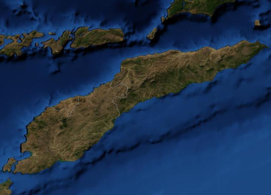
Terrain
8°22′S 124°11′E
Overview
Pantar (Indonesian: Pulau Pantar; Indonesian pronunciation: [ˌpulau̯ ˈpan̪t̪ar]) is the second largest island in the Indonesian Alor Archipelago, after Alor. To the east is the island of Alor and other small islands in the archipelago; to the west is the Alor Strait, which separates it from the Solor Archipelago. To the south is the Ombai Strait, and 72 kilometres (45 mi) away, the island of Timor. To the north is the Banda Sea. Pantar is about 50 kilometres (31 mi) north-to-south, and varies from 11 to 29 kilometres (6.8 to 18.0 mi) in east–west width. It has a land area of 771.98 square kilometres (298.06 sq mi). The main towns on the island are Baranusa (which sits on a small peninsula in the middle of the north coast, projecting into Blangmerang Bay) and Kabir (a small port on the east coast facing Alor Island). Administratively, the island is part of the Alor Regency within East Nusa Tenggara Province.
From Wikipedia, CC BY-SA 4.0
Chart
Nearest islands
- Treweng Island17 km
- Batang Island18 km
- Pura Island19 km
- Lapang Island22 km
- Ternate Island26 km
- Kangge Island28 km
Also in Alor Archipelago

Alor Island
2,114 km²▲ 1,821 m
Major islands
Pura Island
27.7 km²▲ 1,015 m
Minor islands

Kangge Island
13.8 km²▲ 187 m
Minor islands
Rusa Island
13.6 km²▲ 330 m
Minor islands
Ternate Island
3.8 km²▲ 432 m
Minor islands
Treweng Island
3.7 km²▲ 373 m
Minor islands
Batang Island
3.5 km²▲ 246 m
Minor islands
Lapang Island
2.4 km²▲ 15 m
Minor islands
Also in Lesser Sunda Islands

Timor
28,560 km²▲ 2,963 m
Major islands

Sumbawa
14,406 km²▲ 2,690 m
Major islands

Flores
13,993 km²▲ 2,367 m
Major islands

Sumba
10,902 km²▲ 1,225 m
Major islands

Lombok
4,535 km²▲ 3,726 m
Major islands

Bali
5,370 km²▲ 3,031 m
Minor islands
Alor Island
2,114 km²▲ 1,821 m
Minor islands

Lembata
1,248 km²▲ 1,621 m
Minor islands
Also in Malayo-Indonesian

Sumatra
429,717 km²▲ 3,805 m
Major islands

Sulawesi
168,788 km²▲ 3,478 m
Major islands

Java
126,804 km²▲ 3,676 m
Major islands
Timor
28,560 km²▲ 2,963 m
Minor islands
Sumbawa
14,406 km²▲ 2,690 m
Minor islands
Flores
13,993 km²▲ 2,367 m
Minor islands

Bangka Island
11,548 km²▲ 654 m
Minor islands
Sumba
10,902 km²▲ 1,225 m
Minor islands
Also in Sunda Islands
Sumatra
429,717 km²▲ 3,805 m
Major islands
Sulawesi
168,788 km²▲ 3,478 m
Major islands
Java
126,804 km²▲ 3,676 m
Major islands
Timor
28,560 km²▲ 2,963 m
Minor islands
Sumbawa
14,406 km²▲ 2,690 m
Minor islands
Flores
13,993 km²▲ 2,367 m
Minor islands
Bangka Island
11,548 km²▲ 654 m
Minor islands
Sumba
10,902 km²▲ 1,225 m
Minor islands
Also in Indonesia

Borneo
732,069 km²▲ 4,095 m
Major islands
Sumatra
429,717 km²▲ 3,805 m
Major islands
Sulawesi
168,788 km²▲ 3,478 m
Major islands
Java
126,804 km²▲ 3,676 m
Major islands
Timor
28,560 km²▲ 2,963 m
Minor islands

Halmahera
17,956 km²▲ 1,571 m
Minor islands

Seram Island
17,368 km²▲ 3,027 m
Minor islands
Sumbawa
14,406 km²▲ 2,690 m
Minor islands
Also in Malay Archipelago
Borneo
732,069 km²▲ 4,095 m
Major islands
Sumatra
429,717 km²▲ 3,805 m
Major islands
Sulawesi
168,788 km²▲ 3,478 m
Major islands
Java
126,804 km²▲ 3,676 m
Major islands

Luzon
104,935 km²▲ 2,928 m
Major islands

Mindanao
93,885 km²▲ 2,954 m
Major islands
Timor
28,560 km²▲ 2,963 m
Minor islands
Halmahera
17,956 km²▲ 1,571 m
Minor islands
Sources
Facts
Photographs
- East Timor Satellite. Unknown author / Public domain