Caribbean SeaAntigua & Barbuda, France, Dominica, Netherlands, United States, St. Kitts & Nevis, Montserrat, Anguilla and British Virgin Islands
17°05′N 61°48′W
Leeward Islands
Part of Windward Antilles
The Leeward Islands are a group of islands in the Lesser Antilles of the West Indies in the Caribbean region of the Americas, situated where the northeastern Caribbean Sea meets the western North Atlantic Ocean.

No machine-readable author provided. Juanpdp assumed (based on copyright claims). / CC BY-SA 2.5
Chart
Overview
The Leeward Islands are a group of islands in the Lesser Antilles of the West Indies in the Caribbean region of the Americas, situated where the northeastern Caribbean Sea meets the western North Atlantic Ocean. Starting with the Virgin Islands east of the Greater Antilles main island of Puerto Rico, they extend southeast to Guadeloupe and its dependencies. They lie north of the Windward Islands, southern islands from Dominica to Trinidad and Tobago, and northeast of the Leeward Antilles, southwestern islands from the Federal Dependencies of Venezuela to Aruba. In English, the term Leeward Islands refers to the northern islands of the Lesser Antilles chain. The more southerly part of this chain, from Dominica to Trinidad and Tobago, is known as the Windward Islands. Dominica was initially considered a part of the Leeward Islands, but was transferred from the British Leeward Islands to the British Windward Islands in 1940.
From Wikipedia, CC BY-SA 4.0
Census, cataloged
- Major islands12
- Minor islands97
- Islets301
- Rocks & skerries369
Major islands
Basse-Terre Island
- Area
- 847 km²
- High point
- 1,467 m
Guadeloupe is an overseas department and region of France in the Caribbean. It consists of six inhabited islands—Basse-Terre, Grande-Terre, Marie-Galante, La Désirade, and two Îles des Saintes—and 30 uninhabited islets and 3 inhabited islets. It is south of Antigua and Barbuda and Montserrat and north of Dominica.
Dominica
- Area
- 751 km²
- High point
- 1,447 m
Dominica officially the Commonwealth of Dominica, is an island country in the Caribbean. It is part of the Windward Islands chain in the Lesser Antilles archipelago in the Caribbean Sea. The capital, Roseau, is located on the western side of the island.
Grande-Terre
- Area
- 593 km²
- High point
- 136 m
Grande-Terre Island (French: île de Grande-Terre / île de la Grande-Terre [ɡʁɑ̃d tɛʁ]; Guadeloupean Creole: or Granntè) is the name of the eastern-half of Guadeloupe proper, in the Lesser Antilles.
Bonaire
- Area
- 272 km²
- High point
- 241 m
Antigua
- Area
- 271 km²
- High point
- 402 m
Antigua is an island in the Lesser Antilles. It is one of the Leeward Islands in the Caribbean region and the most populous island of the country of Antigua and Barbuda. Antigua and Barbuda became an independent state within the Commonwealth of Nations on 1 November 1981.
Saint Croix
- Area
- 217 km²
- High point
- 334 m
Saint Croix ( KROY; Spanish: Santa Cruz; Dutch: Sint-Kruis; French: Sainte-Croix; Danish and Norwegian: Sankt Croix; Taino: Ay Ay) is an island in the Caribbean, and a county and constituent district of the United States Virgin Islands (USVI), an unincorporated territory of the United States.
Aruba
- Area
- 179 km²
- High point
- 188 m
Barbuda
- Area
- 174 km²
- High point
- 43 m
Barbuda (; Barbudan Creole: Baabyuuda) is an island and dependency located in the eastern Caribbean forming part of the twin-island state of Antigua and Barbuda as an autonomous entity. Barbuda is located approximately 30 miles (48 km) north of Antigua.
Saint Kitts
- Area
- 168 km²
- High point
- 1,156 m
Saint Kitts, also known as Saint Christopher, is an island in the West Indies. The west side of the island borders the Caribbean Sea, and the eastern coast faces the Atlantic Ocean. Saint Kitts and the neighbouring island of Nevis constitute one country: the Federation of Saint Kitts and Nevis.
Marie-Galante
- Area
- 159 km²
- High point
- 204 m
Marie-Galante (French pronunciation: [maʁi ɡalɑ̃t], Guadeloupean Creole: Marigalant) is one of the dependencies of Guadeloupe, an overseas department of France. 0 square miles). 5/km2 (162/sq mi).
Vieques
- Area
- 133 km²
- High point
- 281 m
Vieques ( ; Spanish pronunciation: [ˈbjekes], locally [ˈbjekeʔ]), officially the Isla de Vieques, is an island and municipality of Puerto Rico, comprising the Spanish Virgin Islands together with Culebra. 5 miles (7 km) wide.


Curaçao
- Area
- 428 km²
- High point
- 372 m
Curaçao, officially the Country of Curaçao, is a constituent country within the Kingdom of the Netherlands. It is an island country located in the southern Caribbean Sea, specifically the Dutch Caribbean region, about 65 km (40 mi) north of Venezuela and 80 km (50 mi) southeast of Aruba.
Minor islands

Montserrat
- Area
- 103 km²
- High point
- 915 m

Nevis
- Area
- 93.8 km²
- High point
- 960 m

Saint Martin
- Area
- 72.7 km²
- High point
- 418 m

Anguilla
- Area
- 72.1 km²
- High point
- 73 m

Saint Thomas
- Area
- 71.3 km²
- High point
- 474 m
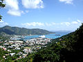
Tortola
- Area
- 56.5 km²
- High point
- 521 m

Saint John
- Area
- 49.7 km²
- High point
- 377 m

Anegada
- Area
- 39.9 km²
- High point
- 13 m

Culebra
- Area
- 26.8 km²
- High point
- 185 m

Virgin Gorda
- Area
- 21.9 km²
- High point
- 414 m

Sint Eustatius
- Area
- 20.9 km²
- High point
- 600 m

La Désirade
- Area
- 19.7 km²
- High point
- 279 m
Saint Barthelemy
- Area
- 19.2 km²
- High point
- 286 m

Saba
- Area
- 13.1 km²
- High point
- 870 m

Jost Van Dyke
- Area
- 8.5 km²
- High point
- 315 m
Lowlands island
- Area
- 8.4 km²
- High point
- 72 m
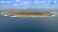
Klein Bonaire
- Area
- 6.9 km²
- High point
- 7 m

Terre-de-Bas Island
- Area
- 6.8 km²
- High point
- 293 m

Terre-de-Haut Island
- Area
- 4.5 km²
- High point
- 309 m
Peter Island
- Area
- 4.3 km²
- High point
- 160 m
Beef Island
- Area
- 4 km²
- High point
- 210 m

Scrub Island
- Area
- 3.5 km²
- High point
- 24 m
Great Camanoe
- Area
- 3.3 km²
- High point
- 169 m

Guana Island
- Area
- 3 km²
- High point
- 242 m

Norman Island
- Area
- 2.5 km²
- High point
- 129 m

Water Island
- Area
- 2 km²
- High point
- 74 m

Hans Lollik Island
- Area
- 2 km²
- High point
- 212 m
Dog Island
- Area
- 1.9 km²
- High point
- 28 m
Guiana Island
- Area
- 1.9 km²
- High point
- 16 m

Cooper Island
- Area
- 1.4 km²
- High point
- 157 m

Cayo Luis Peña
- Area
- 1.4 km²
- High point
- 135 m
Cayo Norte
- Area
- 1.3 km²
- High point
- 93 m

Terre de Bas
- Area
- 1.3 km²
- High point
- 9 m

Klein Curaçao
- Area
- 1.2 km²
- High point
- 5 m
Long Island
- Area
- 1.2 km²
- High point
- 16 m

Île Tintamarre
- Area
- 1.2 km²
- High point
- 36 m

Great Thatch
- Area
- 1.2 km²
- High point
- 196 m

îlet à Fajou
- Area
- 1.1 km²
- High point
- 9 m

Culebrita Island
- Area
- 1.1 km²
- High point
- 73 m
Ginger Island
- Area
- 1 km²
- High point
- 127 m
Great Tobago Island
- Area
- 0.99 km²
- High point
- 159 m

Scrub Island
- Area
- 0.97 km²
- High point
- 134 m
Thatch Cay
- Area
- 0.96 km²
- High point
- 143 m

Grand-Îlet
- Area
- 0.8 km²
- High point
- 165 m

Salt Island
- Area
- 0.79 km²
- High point
- 112 m
Prickly Pear
- Area
- 0.73 km²
- High point
- 59 m
Savana Island
- Area
- 0.73 km²
- High point
- 82 m

Buck Island
- Area
- 0.7 km²
- High point
- 101 m
Great Saint James Island
- Area
- 0.65 km²
- High point
- 59 m
Little Jost Van Dyke
- Area
- 0.64 km²
- High point
- 103 m

Redonda
- Area
- 0.6 km²
- High point
- 296 m
Frenchman's Cay
- Area
- 0.58 km²
- High point
- 117 m
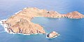
Île Fourchue
- Area
- 0.57 km²
- High point
- 89 m
Hassel Island
- Area
- 0.56 km²
- High point
- 61 m
Inner Brass Island
- Area
- 0.52 km²
- High point
- 72 m
Lovango Cay
- Area
- 0.5 km²
- High point
- 82 m

Moskito Island(BVI)
- Area
- 0.5 km²
- High point
- 77 m
Green Island
- Area
- 0.47 km²
- High point
- 50 m
Outer Brass Island
- Area
- 0.45 km²
- High point
- 125 m
Little Hans Lollik Island
- Area
- 0.43 km²
- High point
- 64 m

Île Chevreau
- Area
- 0.42 km²
- High point
- 105 m

Îlet à Cabrit
- Area
- 0.39 km²
- High point
- 85 m

Sombrero
- Area
- 0.38 km²
- High point
- 11 m
Great Dog
- Area
- 0.37 km²
- High point
- 51 m

Necker Island
- Area
- 0.32 km²
- High point
- 26 m
Terre de Haut
- Area
- 0.31 km²
- High point
- 8 m
Unnamed island
- Area
- 0.31 km²
- High point
- 17 m
Unnamed island
- Area
- 0.3 km²
- High point
- 12 m
Little Saint James Island
- Area
- 0.29 km²
- High point
- 43 m
Îlet Cochon
- Area
- 0.26 km²
- High point
- 15 m
Grass Cay
- Area
- 0.25 km²
- High point
- 66 m
Little Tobago Island
- Area
- 0.24 km²
- High point
- 81 m
Salt Cay
- Area
- 0.22 km²
- High point
- 68 m
Little Thatch Island
- Area
- 0.21 km²
- High point
- 88 m
Fallen Jerusalem Island
- Area
- 0.21 km²
- High point
- 31 m
Crump Island
- Area
- 0.21 km²
- High point
- 29 m
Bovoni Cay
- Area
- 0.21 km²
- High point
- 21 m
Mingo Cay
- Area
- 0.2 km²
- High point
- 55 m
Capella Islands
- Area
- 0.18 km²
- High point
- 26 m

Buck Island
- Area
- 0.18 km²
- High point
- 44 m
Îlet à Kahouanne
- Area
- 0.17 km²
- High point
- 69 m
George Dog
- Area
- 0.17 km²
- High point
- 59 m
Little Camanoe
- Area
- 0.17 km²
- High point
- 34 m
Île Frégate
- Area
- 0.16 km²
- High point
- 44 m
Cayo Lobo
- Area
- 0.16 km²
- High point
- 29 m

Pinel Island
- Area
- 0.16 km²
- High point
- 28 m
West Cay
- Area
- 0.15 km²
- High point
- 33 m
Dead Chest Island
- Area
- 0.15 km²
- High point
- 60 m
Pelican Island, Antigua and Barbuda
- Area
- 0.14 km²
- High point
- 27 m
Dutchcap Cay
- Area
- 0.14 km²
- High point
- 79 m
Patricia Cay
- Area
- 0.13 km²
- High point
- 18 m
Saba Island
- Area
- 0.13 km²
- High point
- 55 m
Eustatia Island
- Area
- 0.12 km²
- High point
- 33 m
Ruth Island
- Area
- 0.11 km²
- High point
- 6 m
West Dog
- Area
- 0.1 km²
- High point
- 27 m
Les Augustins
- Area
- —
size unknown
Nanny Cay
- Area
- —
- High point
- 7 m
size unknown
Rocks & skerries
On the chart above, at its closest zooms.
Listing 109 of 779; the rest are on the chart.
Figures
Comparative heights
- Basse-Terre: 1,467 m
- Dominica: 1,447 m
- Saint Kitts: 1,156 m
- Nevis: 960 m
- Montserrat: 915 m
- Saba: 870 m
- Sint Eustatius: 600 m
- Tortola: 521 m
- Saint Thomas: 474 m
- Saint Martin: 418 m
- Virgin Gorda: 414 m
- Antigua: 402 m
- Saint John: 377 m
- Curaçao: 372 m
To the same scale
Islands by area
Groups within
Overlapping groups
Photographs

w:Explorer of the Seas and w:Sea Princess at Charlotte Amalie, St. Thomas, US VI. Photography taken by JuanPDP on 07-Oct-2005
No machine-readable author provided. Juanpdp assumed (based on copyright claims). / CC BY-SA 2.5

St. Maarten: Philipsburg: Great Bay Beach

Anse à la Barque - Between Bouillante and Vieux-Habitants

Antigua: en:Nelson's Dockyard

St. Maarten: Philipsburg: Great Bay Boardwalk

Nevis: Pinney's Beach

Philipsburg, Sint Maarten Wathey Square: Courthouse

Côte sous le vent, au niveau de la Porte d'Enfer (Grande-Terre)

The plantation Slob on Saint Croix in the Danish West Indies.


Caribbean Netherlands

Parish burial ground next to the Church of Holy Mary, Santa Cruz, Aruba
Sources
Facts
Photographs
- Charlotte Amalie. No machine-readable author provided. Juanpdp assumed (based on copyright claims). / CC BY-SA 2.5
- St. Maarten Philipsburg Great Bay Beach. Dr. Thomas Liptak / CC BY-SA 4.0
- Anse à la Barque. Patrice78500 / CC BY-SA 3.0
- Antigua English Harbour Nelson's Dockyard 2. Dr. Thomas Liptak / CC BY 4.0
- St. Maarten Philipsburg Great Bay Boardwalk. Dr. Thomas Liptak / CC BY-SA 4.0
- Nevis Pinney's Beach. Dr. Thomas Liptak / CC BY-SA 4.0
- St Maarten Philipsburg Wathey Square Courthouse. Dr. Thomas Liptak / CC BY-SA 4.0
- Côte sous le vent, au niveau de la Porte d'Enfer. Antoine Cupial / CC BY-SA 4.0
- Slob (Danish West Indies). Unknown authorUnknown author / Public domain
- Funeral hatchment for Frances Hamilton in St Giles' church Stoke Poges Buckinghamshire UK. MaratOrbel / CC0
- Caribbean Netherlands (Unsplash zYjGtMpT fk). Austin Neill arstyy / CC0
- Church of Holy Mary (Aruba) 5. Caribiana / CC BY-SA 4.0