Caribbean SeaFrance
15°51′N 61°36′W
Îles des Saintes
Les Saintes
Part of Leeward Islands
The Îles des Saintes (pronounced [il de sɛ̃t]; lit. 'Islands of the (Female) Saints'), also known as Les Saintes, is a group of small islands in the archipelago of Guadeloupe, an overseas department of France. It is part of the Canton of Trois-Rivières and is divided into two communes: Terre-de-Haut and Terre-de-Bas.

Chart
Overview
The Îles des Saintes (pronounced [il de sɛ̃t]; lit. 'Islands of the (Female) Saints'), also known as Les Saintes, is a group of small islands in the archipelago of Guadeloupe, an overseas department of France. It is part of the Canton of Trois-Rivières and is divided into two communes: Terre-de-Haut and Terre-de-Bas. It is in the arrondissement of Basse-Terre and also in Guadeloupe's 4th constituency.
From Wikipedia, CC BY-SA 4.0
Census, cataloged
- Major islands2
- Minor islands3
- Islets6
- Rocks & skerries34
Major islands
Terre-de-Bas Island
- Area
- 6.8 km²
- High point
- 293 m
Terre-de-Bas Island (French pronunciation: [tɛʁ də ba]; officially in French: Terre-de-Bas des Saintes (literally: Lowland of les Saintes)) is an island in the Îles des Saintes archipelago, in the Lesser Antilles.
Terre-de-Haut Island
- Area
- 4.5 km²
- High point
- 309 m
Terre-de-Haut Island (French pronunciation: [tɛʁ də ʔo]; Guadeloupean Creole: Tèdého; also formerly known as Petite Martinique) is the easternmost island in the Îles des Saintes, part of the archipelago of Guadeloupe.


Minor islands
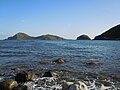
Grand-Îlet
- Area
- 0.8 km²
- High point
- 165 m
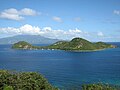
Îlet à Cabrit
- Area
- 0.39 km²
- High point
- 85 m
Les Augustins
- Area
- —
size unknown
Islets
- La Coche28 m · 0.08 km²
- Les Roches Percées27 m · 0.04 km²
- La Redonde10 m · 0.01 km²
- Le Pâté5 m · 0.01 km²
- Unnamed island4 m · 0.8 ha
- Unnamed island7 m · 0.2 ha
Rocks & skerries
- Unnamed island<0.1 ha
- Unnamed island<0.1 ha
- Unnamed island<0.1 ha
- Unnamed island<0.1 ha
- Unnamed island<0.1 ha
- Unnamed island<0.1 ha
- Unnamed island<0.1 ha
- Unnamed island<0.1 ha
- Unnamed island<0.1 ha
- Unnamed island<0.1 ha
- Unnamed island<0.1 ha
- Unnamed island<0.1 ha
Figures
Comparative heights
- Terre-de-Haut: 309 m
- Terre-de-Bas: 293 m
- Grand-Îlet: 165 m
- Îlet à Cabrit: 85 m
- La Coche: 28 m
- Les Roches Percées: 27 m
- La Redonde: 10 m
- Le Pâté: 5 m
To the same scale
Islands by area
| Terre-de-Bas Island | 6.8 km² |
| Terre-de-Haut Island | 4.5 km² |
| Grand-Îlet | 0.8 km² |
| Îlet à Cabrit | 0.39 km² |
| La Coche | 0.08 km² |
| Les Roches Percées | 0.04 km² |
| La Redonde | 0.01 km² |
| Le Pâté | 0.01 km² |
| Unnamed island | 0.8 ha |
| Unnamed island | 0.2 ha |
| Unnamed island | <0.1 ha |
| Unnamed island | <0.1 ha |
| Unnamed island | <0.1 ha |
| Unnamed island | <0.1 ha |
| Unnamed island | <0.1 ha |
| Unnamed island | <0.1 ha |
| Unnamed island | <0.1 ha |
| Unnamed island | <0.1 ha |
| Unnamed island | <0.1 ha |
| Unnamed island | <0.1 ha |
| Unnamed island | <0.1 ha |
| Unnamed island | <0.1 ha |
| les Quilles | <0.1 ha |
| Unnamed island | <0.1 ha |
| Unnamed island | <0.1 ha |
| Unnamed island | <0.1 ha |
| Unnamed island | <0.1 ha |
| Unnamed island | <0.1 ha |
| Unnamed island | <0.1 ha |
| Unnamed island | <0.1 ha |
| Unnamed island | <0.1 ha |
| Unnamed island | <0.1 ha |
| Unnamed island | <0.1 ha |
| Unnamed island | <0.1 ha |
| Unnamed island | <0.1 ha |
| Unnamed island | <0.1 ha |
| Unnamed island | <0.1 ha |
| Unnamed island | <0.1 ha |
| Unnamed island | <0.1 ha |
| Unnamed island | <0.1 ha |
| Unnamed island | <0.1 ha |
| Unnamed island | <0.1 ha |
| Unnamed island | <0.1 ha |
| Unnamed island | <0.1 ha |
Groups within
Photographs

Photo : Nicolas Vilars Les Saintes vues d'avion. Au premier plan, Terre-de-Haut, au deuxième plan, Terre-de-Bas. À droite, au milieu de l'image, l'Ilet Cabris.

Les Saintes - Terre de Haut

Baie du Marigot et morne Morel

Anse Mire

Fort Napoléon des Saintes

le Saintois s'endort

Pointe à l'Eau

Pointe à l'Eau

Pointe Coquelet

Pointe Morel (Les Saintes)

Townhall of Terre-de-Haut on Les Saintes, Guadeloupe, France

UCPA of Terre-de-Haut
Sources
Facts
Photographs
- Les Saintes - Archipel de Guadeloupe. Jonathan SALAÜN / CC BY-SA 4.0
- Les Saintes vues avion. Original uploader was Vilars at fr.wikipedia / CC BY-SA 1.0
- Baie du Marigot et morne Morel. Enrevseluj / CC BY-SA 4.0
- Anse Mire. Enrevseluj / CC BY-SA 4.0
- Fort-Napoléon-des-Saintes. Friman / CC BY-SA 3.0
- Le Saintois s'endort (51266828057). Bernard Fidel / CC BY 2.0
- Pointe à l'Eau 2. Enrevseluj / CC BY-SA 4.0
- Pointe à l'Eau. Enrevseluj / CC BY-SA 4.0
- Pointe Coquelet. Enrevseluj / CC BY-SA 4.0
- Pointe Morel (Les Saintes). Enrevseluj / CC BY-SA 4.0
- Townhall of Terre-de-Haut on Les Saintes. Tjeerd Wiersma / CC BY 2.0
- Union nationale des Centres sportifs et Plein Air 01. Filo gèn' / CC BY-SA 4.0