Caribbean SeaUnited Kingdom, United States and British Virgin Islands
18°12′N 64°48′W
Virgin Islands
Part of Leeward Islands
The Virgin Islands (Spanish: Islas Vírgenes) is an archipelago between the North Atlantic Ocean and northeastern Caribbean Sea, located to the immediate east of the main island of Puerto Rico. It generally forms part of the Leeward Islands of the Lesser Antilles in the West Indies of the Caribbean region.

Fred Hsu (Wikipedia:User:Fred Hsu on en.wikipedia) / CC BY-SA 3.0
Chart
Overview
The Virgin Islands (Spanish: Islas Vírgenes) is an archipelago between the North Atlantic Ocean and northeastern Caribbean Sea, located to the immediate east of the main island of Puerto Rico. It generally forms part of the Leeward Islands of the Lesser Antilles in the West Indies of the Caribbean region. Geologically separated from the Lesser Antilles by the Anegada Passage and from the Greater Antilles by the Mona passage, all the islands except for Saint Croix lie on the same carbonate platform and insular shelf, known as the Puerto Rico Bank, and same tectonic plate, known as the Puerto Rico–Virgin Islands microplate. Politically, the islands fall into three jurisdictions: the easternmost British overseas territory of the Virgin Islands, commonly referred to as the British Virgin Islands; the central unincorporated American territory of the Virgin Islands of the United States, commonly known as the U.S. Virgin Islands; and the westernmost island-municipalities of the unincorporated American territory of Puerto Rico, officially named Vieques and Culebra but generally called the Spanish Virgin Islands or Puerto Rican Virgin Islands.
From Wikipedia, CC BY-SA 4.0
Census, cataloged
- Major islands6
- Minor islands56
- Islets112
- Rocks & skerries138
Major islands
Saint Croix
- Area
- 217 km²
- High point
- 334 m
Saint Croix ( KROY; Spanish: Santa Cruz; Dutch: Sint-Kruis; French: Sainte-Croix; Danish and Norwegian: Sankt Croix; Taino: Ay Ay) is an island in the Caribbean, and a county and constituent district of the United States Virgin Islands (USVI), an unincorporated territory of the United States.
Vieques
- Area
- 133 km²
- High point
- 281 m
Vieques ( ; Spanish pronunciation: [ˈbjekes], locally [ˈbjekeʔ]), officially the Isla de Vieques, is an island and municipality of Puerto Rico, comprising the Spanish Virgin Islands together with Culebra. 5 miles (7 km) wide.
Saint Thomas
- Area
- 71.3 km²
- High point
- 474 m
S. Virgin Islands in the Caribbean Sea, and a constituent district of the United States Virgin Islands (USVI), an unincorporated territory of the United States. Along with surrounding minor islands, it is one of three county equivalents in the USVI. Together with Saint John, it forms one of the districts of the USVI.
Tortola
- Area
- 56.5 km²
- High point
- 521 m
Tortola is the largest and most populated island of the British Virgin Islands, a group of islands that form part of the archipelago of the Virgin Islands. 5 square miles) with a total population of 23,908, with 9,400 residents in Road Town. Mount Sage is its highest point at 530 metres (1,740 feet) above sea level.
Saint John
- Area
- 49.7 km²
- High point
- 377 m
Saint John (Danish: Sankt Jan; Spanish: San Juan) is one of the Virgin Islands in the Caribbean Sea and a constituent district of the United States Virgin Islands (USVI), an unincorporated territory of the United States.
Anegada
- Area
- 39.9 km²
- High point
- 13 m
Anegada is the northernmost of the British Virgin Islands (BVI), a group of islands that form part of the archipelago of the Virgin Islands. It lies about 15 miles (24 km) north of Virgin Gorda. Anegada is the only inhabited British Virgin Island formed from coral and limestone, rather than of volcanic origin.


Minor islands

Culebra
- Area
- 26.8 km²
- High point
- 185 m

Virgin Gorda
- Area
- 21.9 km²
- High point
- 414 m

Jost Van Dyke
- Area
- 8.5 km²
- High point
- 315 m
Peter Island
- Area
- 4.3 km²
- High point
- 160 m
Beef Island
- Area
- 4 km²
- High point
- 210 m
Great Camanoe
- Area
- 3.3 km²
- High point
- 169 m

Guana Island
- Area
- 3 km²
- High point
- 242 m

Norman Island
- Area
- 2.5 km²
- High point
- 129 m

Water Island
- Area
- 2 km²
- High point
- 74 m

Hans Lollik Island
- Area
- 2 km²
- High point
- 212 m

Cooper Island
- Area
- 1.4 km²
- High point
- 157 m

Cayo Luis Peña
- Area
- 1.4 km²
- High point
- 135 m
Cayo Norte
- Area
- 1.3 km²
- High point
- 93 m

Great Thatch
- Area
- 1.2 km²
- High point
- 196 m

Culebrita Island
- Area
- 1.1 km²
- High point
- 73 m
Ginger Island
- Area
- 1 km²
- High point
- 127 m
Great Tobago Island
- Area
- 0.99 km²
- High point
- 159 m

Scrub Island
- Area
- 0.97 km²
- High point
- 134 m
Thatch Cay
- Area
- 0.96 km²
- High point
- 143 m

Salt Island
- Area
- 0.79 km²
- High point
- 112 m
Prickly Pear
- Area
- 0.73 km²
- High point
- 59 m
Savana Island
- Area
- 0.73 km²
- High point
- 82 m

Buck Island
- Area
- 0.7 km²
- High point
- 101 m
Great Saint James Island
- Area
- 0.65 km²
- High point
- 59 m
Little Jost Van Dyke
- Area
- 0.64 km²
- High point
- 103 m
Frenchman's Cay
- Area
- 0.58 km²
- High point
- 117 m
Hassel Island
- Area
- 0.56 km²
- High point
- 61 m
Inner Brass Island
- Area
- 0.52 km²
- High point
- 72 m
Lovango Cay
- Area
- 0.5 km²
- High point
- 82 m

Moskito Island(BVI)
- Area
- 0.5 km²
- High point
- 77 m
Outer Brass Island
- Area
- 0.45 km²
- High point
- 125 m
Little Hans Lollik Island
- Area
- 0.43 km²
- High point
- 64 m
Great Dog
- Area
- 0.37 km²
- High point
- 51 m

Necker Island
- Area
- 0.32 km²
- High point
- 26 m
Little Saint James Island
- Area
- 0.29 km²
- High point
- 43 m
Grass Cay
- Area
- 0.25 km²
- High point
- 66 m
Little Tobago Island
- Area
- 0.24 km²
- High point
- 81 m
Salt Cay
- Area
- 0.22 km²
- High point
- 68 m
Little Thatch Island
- Area
- 0.21 km²
- High point
- 88 m
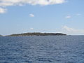
Fallen Jerusalem Island
- Area
- 0.21 km²
- High point
- 31 m
Bovoni Cay
- Area
- 0.21 km²
- High point
- 21 m
Mingo Cay
- Area
- 0.2 km²
- High point
- 55 m
Capella Islands
- Area
- 0.18 km²
- High point
- 26 m

Buck Island
- Area
- 0.18 km²
- High point
- 44 m
George Dog
- Area
- 0.17 km²
- High point
- 59 m
Little Camanoe
- Area
- 0.17 km²
- High point
- 34 m
Cayo Lobo
- Area
- 0.16 km²
- High point
- 29 m
West Cay
- Area
- 0.15 km²
- High point
- 33 m
Dead Chest Island
- Area
- 0.15 km²
- High point
- 60 m
Dutchcap Cay
- Area
- 0.14 km²
- High point
- 79 m
Patricia Cay
- Area
- 0.13 km²
- High point
- 18 m
Saba Island
- Area
- 0.13 km²
- High point
- 55 m
Eustatia Island
- Area
- 0.12 km²
- High point
- 33 m
Ruth Island
- Area
- 0.11 km²
- High point
- 6 m
West Dog
- Area
- 0.1 km²
- High point
- 27 m
Nanny Cay
- Area
- —
- High point
- 7 m
size unknown
Rocks & skerries
On the chart above, at its closest zooms.
Listing 62 of 312; the rest are on the chart.
Figures
Comparative heights
- Tortola: 521 m
- Saint Thomas: 474 m
- Virgin Gorda: 414 m
- Saint John: 377 m
- Saint Croix: 334 m
- Jost Van Dyke: 315 m
- Vieques: 281 m
- Guana: 242 m
- Hans Lollik: 212 m
- Beef: 210 m
- Great Thatch: 196 m
- Culebra: 185 m
- Great Camanoe: 169 m
- Peter: 160 m
To the same scale
Islands by area
Groups within
Overlapping groups
Photographs

Anegada
Walker Mangum. Original uploader was Nwmangum at en.wikipedia / Public domain

Wharf by Marriott−Pacquereau Bay — on St. Thomas island, United States Virgin Islands.
Fred Hsu (Wikipedia:User:Fred Hsu on en.wikipedia) / CC BY-SA 3.0

Vieques Island, Puerto Rico viewed from the air

Road Town, Tortola, British Virgin Islands
Photo: Henry A-W (Henry aw 23:34, 10 July 2006 (UTC)) / CC BY-SA 3.0

View from a sea cave towards Navio Beach and native palms, Vieques, Puerto Rico

The National Guard 1st Lt. Paul Stennett/179th Airlift Wing / Public domain

Air Force Gen. Joseph Lengyel, chief, National Guard Bureau, visits Soldiers and Airmen in St. Croix, Virgin Islands, assisting with hurricane relief efforts Sept. 25, 2017. (U.S. Army National Guard photo by Staff Sgt. Michelle Gonzalez)

Air Force Gen. Joseph Lengyel, chief, National Guard Bureau, visits Soldiers and Airmen in St. Croix, Virgin Islands, assisting with hurricane relief efforts Sept. 25, 2017. (U.S. Army National Guard photo by Staff Sgt. Michelle Gonzalez)

Tortola: Beef Island: Trellis Bay

White Road

Who Is Draws The Clouds Every Days

Sources
Facts
Photographs
- St Thomas Marriott Pacquereau Bay 1. Fred Hsu (Wikipedia:User:Fred Hsu on en.wikipedia) / CC BY-SA 3.0
- AnegadaWestEndAerial. Walker Mangum. Original uploader was Nwmangum at en.wikipedia / Public domain
- Vieques from air. U.S. Fish and Wildlife Service / Public domain
- Roadtown, Tortola. Photo: Henry A-W (Henry aw 23:34, 10 July 2006 (UTC)) / CC BY-SA 3.0
- Vieques jaskyna na PlayaNavio. Jaro Nemčok / CC BY-SA 3.0
- Ohio National Guard (36807107604). The National Guard 1st Lt. Paul Stennett/179th Airlift Wing / Public domain
- 170925-Z-CD688-047 (37303774902). Chief National Guard Bureau from USA / CC BY 2.0
- 170925-Z-CD688-051 (36624295444). Chief National Guard Bureau from USA / CC BY 2.0
- Tortola Beef Island Trellis Bay. Dr. Thomas Liptak / CC BY-SA 4.0
- White Road - panoramio. ---=XEON=--- / CC BY 3.0
- Who Is Draws The Clouds Every Days - panoramio. ---=XEON=--- / CC BY 3.0
- Alan Friedlander. NOAA photo library / Public domain