Atlantic OceanVenezuela and Netherlands
12°11′N 68°59′W
Leeward Antilles
Part of Lesser Antilles
The Leeward Antilles (Dutch: Benedenwindse Eilanden; Spanish: islas de Sotavento; Papiamento: Islanan Abou) are a chain of islands in the Caribbean, specifically part of the southerly islands of the Lesser Antilles (and, in turn, the Antilles and the West Indies) along the southeastern fringe of the Caribbean Sea, just north of the Venezuelan coast of the South American mainland.

Chart
Overview
The Leeward Antilles (Dutch: Benedenwindse Eilanden; Spanish: islas de Sotavento; Papiamento: Islanan Abou) are a chain of islands in the Caribbean, specifically part of the southerly islands of the Lesser Antilles (and, in turn, the Antilles and the West Indies) along the southeastern fringe of the Caribbean Sea, just north of the Venezuelan coast of the South American mainland. The Leeward Antilles, while among the Lesser Antilles, are not to be confused with the Leeward Islands (also of the Lesser Antilles) to the northeast. Largely lacking in volcanic activity, the Leeward Antilles island arc occurs along the deformed southern edge of the Caribbean Plate and was formed by the plate's subduction under the South American Plate. Recent studies indicate that the Leeward Antilles are accreting to South America.
From Wikipedia, CC BY-SA 4.0
Census, cataloged
- Major islands5
- Minor islands15
- Islets27
- Rocks & skerries44
Major islands
Margarita Island
- Area
- 952 km²
- High point
- 960 m
Margarita Island (Isla de Margarita, Spanish pronunciation: [maɾɣaˈɾita]) is the largest island in the Venezuelan state of Nueva Esparta, situated off the north west coast of the country, in the Caribbean Sea. The capital city of Nueva Esparta, La Asunción, is located on the island.
Bonaire
- Area
- 272 km²
- High point
- 241 m
Aruba
- Area
- 179 km²
- High point
- 188 m
La Tortuga Island
- Area
- 152 km²
- High point
- 48 m
La Tortuga Island (Spanish: Isla La Tortuga; "La Tortuga" means literally "the turtle") is an uninhabited island of Venezuela, the largest in the Federal Dependencies of Venezuela. It is part of a group of islands that include the Tortuguillos and Cayo Herradura. Isla La Tortuga has an area of 156 km2 (60 sq mi).

Curaçao
- Area
- 428 km²
- High point
- 372 m
Curaçao, officially the Country of Curaçao, is a constituent country within the Kingdom of the Netherlands. It is an island country located in the southern Caribbean Sea, specifically the Dutch Caribbean region, about 65 km (40 mi) north of Venezuela and 80 km (50 mi) southeast of Aruba.
Minor islands

La Blanquilla Island
- Area
- 64.4 km²
- High point
- 46 m

Coche Island
- Area
- 55.1 km²
- High point
- 67 m

La Orchila Island
- Area
- 42.8 km²
- High point
- 132 m

Cubagua Island
- Area
- 24.5 km²
- High point
- 56 m
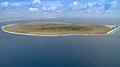
Klein Bonaire
- Area
- 6.9 km²
- High point
- 7 m
Unnamed island
- Area
- 1.5 km²
- High point
- 8 m
Unnamed island
- Area
- 1.5 km²
- High point
- 6 m

Klein Curaçao
- Area
- 1.2 km²
- High point
- 5 m
Unnamed island
- Area
- 0.79 km²
- High point
- 11 m
Cayo Herradura
- Area
- 0.3 km²
- High point
- 2 m
Maceta de Isla Fernando
- Area
- 0.24 km²
- High point
- 19 m
Unnamed island
- Area
- 0.2 km²
- High point
- 6 m
Unnamed island
- Area
- 0.15 km²
- High point
- 7 m
Unnamed island
- Area
- —
size unknown
Nordisquí
- Area
- —
size unknown
Islets
- Palm Island Key3 m · 0.1 km²
- Isla Fernando5 m · 0.08 km²
- Maceta de Nube Verde0.07 km²
- Isla de Plata34 m · 0.04 km²
- Isleta Varadero22 m · 0.02 km²
- Unnamed island11 m · 0.02 km²
- Unnamed island2 m · 0.02 km²
- Unnamed island4 m · 0.02 km²
- Unnamed island1 m · 0.01 km²
- Unnamed island0.01 km²
- Unnamed island2 m · 0.01 km²
- Unnamed island2 m · 1 ha
Rocks & skerries
- Farallón Centinela0.5 ha
- Unnamed island<0.1 ha
- Unnamed island<0.1 ha
- Unnamed island<0.1 ha
- Unnamed island<0.1 ha
- Unnamed island<0.1 ha
- Unnamed island<0.1 ha
- Unnamed island<0.1 ha
- Unnamed island<0.1 ha
- Fallaroncito<0.1 ha
- Unnamed island<0.1 ha
- La Sola Island<0.1 ha
Figures
Comparative heights
- Margarita: 960 m
- Curaçao: 372 m
- Bonaire: 241 m
- Aruba: 188 m
- La Orchila: 132 m
- Coche: 67 m
- Cubagua: 56 m
- La Tortuga: 48 m
- La Blanquilla: 46 m
- Isla de Plata: 34 m
- Isleta Varadero: 22 m
- Maceta de Isla Fernando: 19 m
- Klein Bonaire: 7 m
- Klein Curaçao: 5 m
To the same scale
Islands by area
| Margarita Island | 952 km² |
| Curaçao | 428 km² |
| Bonaire | 272 km² |
| Aruba | 179 km² |
| La Tortuga Island | 152 km² |
| La Blanquilla Island | 64.4 km² |
| Coche Island | 55.1 km² |
| La Orchila Island | 42.8 km² |
| Cubagua Island | 24.5 km² |
| Klein Bonaire | 6.9 km² |
| Unnamed island | 1.5 km² |
| Unnamed island | 1.5 km² |
| Klein Curaçao | 1.2 km² |
| Unnamed island | 0.79 km² |
| Cayo Herradura | 0.3 km² |
| Maceta de Isla Fernando | 0.24 km² |
| Unnamed island | 0.2 km² |
| Unnamed island | 0.15 km² |
| Palm Island Key | 0.1 km² |
| Isla Fernando | 0.08 km² |
| Maceta de Nube Verde | 0.07 km² |
| Isla de Plata | 0.04 km² |
| Isleta Varadero | 0.02 km² |
| Unnamed island | 0.02 km² |
| Unnamed island | 0.02 km² |
| Unnamed island | 0.02 km² |
| Unnamed island | 0.01 km² |
| Unnamed island | 0.01 km² |
| Unnamed island | 0.01 km² |
| Unnamed island | 1 ha |
| Unnamed island | 0.7 ha |
| Unnamed island | 0.5 ha |
| Unnamed island | 0.5 ha |
| Unnamed island | 0.5 ha |
| Unnamed island | 0.5 ha |
| Farallón Centinela | 0.5 ha |
| Unnamed island | 0.5 ha |
| Unnamed island | 0.3 ha |
| Isla Palomino | 0.3 ha |
| Unnamed island | 0.3 ha |
| Unnamed island | 0.3 ha |
| Unnamed island | 0.2 ha |
| Unnamed island | 0.2 ha |
| Unnamed island | 0.1 ha |
| Unnamed island | 0.1 ha |
| Unnamed island | 0.1 ha |
| Unnamed island | <0.1 ha |
| Unnamed island | <0.1 ha |
| Unnamed island | <0.1 ha |
| Unnamed island | <0.1 ha |
| Unnamed island | <0.1 ha |
| Unnamed island | <0.1 ha |
| Unnamed island | <0.1 ha |
| Unnamed island | <0.1 ha |
| Fallaroncito | <0.1 ha |
| Unnamed island | <0.1 ha |
| La Sola Island | <0.1 ha |
| Unnamed island | <0.1 ha |
| Piedra El Montadero | <0.1 ha |
| Unnamed island | <0.1 ha |
| Unnamed island | <0.1 ha |
| Unnamed island | <0.1 ha |
| Unnamed island | <0.1 ha |
| Unnamed island | <0.1 ha |
| Unnamed island | <0.1 ha |
| Unnamed island | <0.1 ha |
| Unnamed island | <0.1 ha |
| Unnamed island | <0.1 ha |
| Piedra Platini | <0.1 ha |
| Unnamed island | <0.1 ha |
| Unnamed island | <0.1 ha |
| Unnamed island | <0.1 ha |
| Unnamed island | <0.1 ha |
| Unnamed island | <0.1 ha |
| Unnamed island | <0.1 ha |
| Unnamed island | <0.1 ha |
| Unnamed island | <0.1 ha |
| Unnamed island | <0.1 ha |
| Unnamed island | <0.1 ha |
| Unnamed island | <0.1 ha |
| Unnamed island | <0.1 ha |
| Unnamed island | <0.1 ha |
| Unnamed island | <0.1 ha |
| Unnamed island | <0.1 ha |
| Unnamed island | <0.1 ha |
| Unnamed island | <0.1 ha |
| Unnamed island | <0.1 ha |
| Unnamed island | <0.1 ha |
| Unnamed island | <0.1 ha |
Groups within
Overlapping groups
Photographs

Panoramic view of Juan Griego bay from Fort La Galera. Juan Griego is a city on the northern side of Isla Margarita, and is the most northern port in Venezuela.

Caribbean Netherlands

Federal Dependencies of Venezuela, Venezuela

Parish burial ground next to the Church of Holy Mary, Santa Cruz, Aruba
Sources
Facts
Photographs
- Panoramic of Juan Griego 45. Wilfredor / CC0
- Caribbean Netherlands (Unsplash zYjGtMpT fk). Austin Neill arstyy / CC0
- Federal Dependencies of Venezuela, Venezuela - panoramio. sildibiasi / CC BY 3.0
- Church of Holy Mary (Aruba) 5. Caribiana / CC BY-SA 4.0
- Bonaire WV Banner. Crystal Clear waters of Bonaire (13256547653).jpg: Chris Favero from USA derivative work: ויקיג'אנקי / CC BY-SA 2.0