Atlantic OceanBritish Virgin Islands, Anguilla, Montserrat, U.S. Virgin Islands, Dominica, Antigua & Barbuda, Grenada, St. Kitts & Nevis, St. Lucia, St. Vincent & Grenadines, Trinidad & Tobago, Venezuela, Barbados, France, Netherlands and United States
14°00′N 61°00′W
Lesser Antilles
Antillas Menores
Part of Antilles
The Lesser Antilles is a group of islands at the edge of the Caribbean Sea, forming part of the West Indies in the Caribbean region of the Americas. They are distinguished from the larger islands of the Greater Antilles to the west.

Chart
Overview
The Lesser Antilles is a group of islands at the edge of the Caribbean Sea, forming part of the West Indies in the Caribbean region of the Americas. They are distinguished from the larger islands of the Greater Antilles to the west. They form an arc which begins east of Puerto Rico at the archipelago of the Virgin Islands, swings southeast through the Leeward and Windward Islands towards South America, and turns westward through the Leeward Antilles along the Venezuelan coast. Most of the islands are part of a long, partially volcanic island arc between the Greater Antilles and the continent of South America. The islands form the eastern boundary of the Caribbean Sea where it meets the Atlantic Ocean. Together, the Lesser Antilles and the Greater Antilles make up the Antilles. The Antilles together with the Lucayan Archipelago are collectively known as the West Indies. Compared to the Greater Antilles, which was settled by several peoples, including the Taíno, the islands' dominant Indigenous peoples were the Kalinago. The boundary set between them is known as the "poison arrow curtain," named after the Kalinago's favoured weapon for fending off Europeans that came to conquer the islands in the 16th century. The archipelago is politically divided into eight sovereign states—all of which were formerly part of the British Empire—and 17 non-sovereign, partly self-governing dependencies of France, the Netherlands, the United Kingdom, the United States, or Venezuela.
From Wikipedia, CC BY-SA 4.0
Census, cataloged
- Major islands13
- Minor islands234
- Islets659
- Rocks & skerries689
Major islands
Trinidad
- Area
- 4,823 km²
- High point
- 940 m
Trinidad is the largest and most populous island of the Republic of Trinidad and Tobago. The island lies 11 km (7 mi) off the northeastern coast of Venezuela and sits on the continental shelf of South America. It is the southernmost island in the Caribbean.
Martinique
- Area
- 1,089 km²
- High point
- 1,397 m
Martinique ( MAR-tin-EEK, French pronunciation: [maʁtinik] ; Martinican Creole: Matinik or Matnik; Kalinago: Madinina or Madiana) is an island in the Lesser Antilles of the West Indies, in the eastern Caribbean Sea.
Margarita Island
- Area
- 952 km²
- High point
- 960 m
Margarita Island (Isla de Margarita, Spanish pronunciation: [maɾɣaˈɾita]) is the largest island in the Venezuelan state of Nueva Esparta, situated off the north west coast of the country, in the Caribbean Sea. The capital city of Nueva Esparta, La Asunción, is located on the island.
Basse-Terre Island
- Area
- 847 km²
- High point
- 1,467 m
Guadeloupe is an overseas department and region of France in the Caribbean. It consists of six inhabited islands—Basse-Terre, Grande-Terre, Marie-Galante, La Désirade, and two Îles des Saintes—and 30 uninhabited islets and 3 inhabited islets. It is south of Antigua and Barbuda and Montserrat and north of Dominica.
Dominica
- Area
- 751 km²
- High point
- 1,447 m
Dominica officially the Commonwealth of Dominica, is an island country in the Caribbean. It is part of the Windward Islands chain in the Lesser Antilles archipelago in the Caribbean Sea. The capital, Roseau, is located on the western side of the island.
Saint Lucia
- Area
- 603 km²
- High point
- 950 m
Saint Lucia (also written as St. Lucia) is an island country in the eastern and southern Caribbean. Part of the Windward Islands of the Lesser Antilles, it is located north/northeast of the island of Saint Vincent, northwest of Barbados and south of Martinique.
Grande-Terre
- Area
- 593 km²
- High point
- 136 m
Grande-Terre Island (French: île de Grande-Terre / île de la Grande-Terre [ɡʁɑ̃d tɛʁ]; Guadeloupean Creole: or Granntè) is the name of the eastern-half of Guadeloupe proper, in the Lesser Antilles.
Barbados
- Area
- 433 km²
- High point
- 340 m
Barbados is an island nation in the Caribbean Sea. It is part of the Lesser Antilles of the West Indies and is the southernmost and easternmost island of the Caribbean region. It lies on the boundary of the South American and Caribbean tectonic plates. Its capital and largest city is Bridgetown.
Saint Vincent
- Area
- 344 km²
- High point
- 1,234 m
Saint Vincent is a volcanic island in the southern Caribbean. It is the largest island of the country Saint Vincent and the Grenadines and is located in the Caribbean Sea, between Saint Lucia and Grenada. It is composed of partially submerged volcanic mountains.
Grenada
- Area
- 313 km²
- High point
- 840 m
Grenada is an island country located between the Caribbean Sea and Atlantic Ocean, north of Trinidad and Tobago. It is located at 12°07′N 61°40′W. There are no large inland bodies of water on the island, which consists entirely of the state of Grenada. The coastline is 121 km long.
Tobago
- Area
- 300 km²
- High point
- 580 m
Tobago, officially the Ward of Tobago, is an island and ward in Trinidad and Tobago. It is 35 kilometres (20 nautical miles) northeast of the larger island of Trinidad and about 160 kilometres (85 nautical miles) off Venezuela's northeastern coast. It is southeast of Grenada and southwest of Barbados.
Bonaire
- Area
- 272 km²
- High point
- 241 m


Curaçao
- Area
- 428 km²
- High point
- 372 m
Curaçao, officially the Country of Curaçao, is a constituent country within the Kingdom of the Netherlands. It is an island country located in the southern Caribbean Sea, specifically the Dutch Caribbean region, about 65 km (40 mi) north of Venezuela and 80 km (50 mi) southeast of Aruba.
Minor islands

Antigua
- Area
- 271 km²
- High point
- 402 m
Saint Kitts and Nevis
- Area
- 269 km²

Saint Croix
- Area
- 217 km²
- High point
- 334 m

Aruba
- Area
- 179 km²
- High point
- 188 m

Barbuda
- Area
- 174 km²
- High point
- 43 m

Saint Kitts
- Area
- 168 km²
- High point
- 1,156 m

Marie-Galante
- Area
- 159 km²
- High point
- 204 m

La Tortuga Island
- Area
- 152 km²
- High point
- 48 m

Vieques
- Area
- 133 km²
- High point
- 281 m

Montserrat
- Area
- 103 km²
- High point
- 915 m

Nevis
- Area
- 93.8 km²
- High point
- 960 m

Saint Martin
- Area
- 72.7 km²
- High point
- 418 m
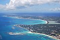
Anguilla
- Area
- 72.1 km²
- High point
- 73 m

Saint Thomas
- Area
- 71.3 km²
- High point
- 474 m

La Blanquilla Island
- Area
- 64.4 km²
- High point
- 46 m
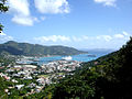
Tortola
- Area
- 56.5 km²
- High point
- 521 m

Coche Island
- Area
- 55.1 km²
- High point
- 67 m

Saint John
- Area
- 49.7 km²
- High point
- 377 m

La Orchila Island
- Area
- 42.8 km²
- High point
- 132 m

Anegada
- Area
- 39.9 km²
- High point
- 13 m

Carriacou
- Area
- 32.1 km²
- High point
- 291 m

Culebra
- Area
- 26.8 km²
- High point
- 185 m

Cubagua Island
- Area
- 24.5 km²
- High point
- 56 m

Virgin Gorda
- Area
- 21.9 km²
- High point
- 414 m

Sint Eustatius
- Area
- 20.9 km²
- High point
- 600 m
Gresquí
- Area
- 20.3 km²
- High point
- 20 m

La Désirade
- Area
- 19.7 km²
- High point
- 279 m
Saint Barthelemy
- Area
- 19.2 km²
- High point
- 286 m

Bequia
- Area
- 16.1 km²
- High point
- 265 m

Saba
- Area
- 13.1 km²
- High point
- 870 m

Union Island
- Area
- 8.7 km²
- High point
- 304 m

Jost Van Dyke
- Area
- 8.5 km²
- High point
- 315 m
Lowlands island
- Area
- 8.4 km²
- High point
- 72 m

Canouan
- Area
- 7.7 km²
- High point
- 232 m
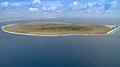
Klein Bonaire
- Area
- 6.9 km²
- High point
- 7 m

Terre-de-Bas Island
- Area
- 6.8 km²
- High point
- 293 m
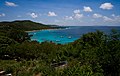
Mustique
- Area
- 5.6 km²
- High point
- 144 m

Terre-de-Haut Island
- Area
- 4.5 km²
- High point
- 309 m
Isla Testigo Grande
- Area
- 4.4 km²
- High point
- 243 m
Monos Island
- Area
- 4.4 km²
- High point
- 288 m
Peter Island
- Area
- 4.3 km²
- High point
- 160 m

Chacachacare
- Area
- 4 km²
- High point
- 239 m
Beef Island
- Area
- 4 km²
- High point
- 210 m

Scrub Island
- Area
- 3.5 km²
- High point
- 24 m
Great Camanoe
- Area
- 3.3 km²
- High point
- 169 m

Guana Island
- Area
- 3 km²
- High point
- 242 m
Isla Larga
- Area
- 2.6 km²
- High point
- 13 m
Ronde Island
- Area
- 2.5 km²
- High point
- 153 m

Norman Island
- Area
- 2.5 km²
- High point
- 129 m
Cayo Cuchillo
- Area
- 2.2 km²
- High point
- 25 m

Petite Martinique
- Area
- 2 km²
- High point
- 195 m
Islas Las Aves Sotavento
- Area
- 2 km²
- High point
- 13 m

Water Island
- Area
- 2 km²
- High point
- 74 m
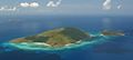
Hans Lollik Island
- Area
- 2 km²
- High point
- 212 m
Dog Island
- Area
- 1.9 km²
- High point
- 28 m
Guiana Island
- Area
- 1.9 km²
- High point
- 16 m
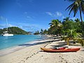
Mayreau
- Area
- 1.8 km²
- High point
- 98 m
El Gran Roque
- Area
- 1.7 km²
- High point
- 89 m
Unnamed island
- Area
- 1.5 km²
- High point
- 8 m

Quatre
- Area
- 1.5 km²
- High point
- 136 m
Unnamed island
- Area
- 1.5 km²
- High point
- 6 m

Cooper Island
- Area
- 1.4 km²
- High point
- 157 m
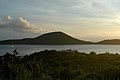
Cayo Luis Peña
- Area
- 1.4 km²
- High point
- 135 m
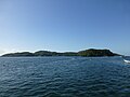
Gaspar Grande
- Area
- 1.3 km²
- High point
- 104 m

Baliceaux
- Area
- 1.3 km²
- High point
- 117 m
Cayo Norte
- Area
- 1.3 km²
- High point
- 93 m

Terre de Bas
- Area
- 1.3 km²
- High point
- 9 m
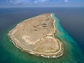
Klein Curaçao
- Area
- 1.2 km²
- High point
- 5 m
Cayo Esparquí
- Area
- 1.2 km²
- High point
- 16 m
Long Island
- Area
- 1.2 km²
- High point
- 16 m
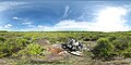
Île Tintamarre
- Area
- 1.2 km²
- High point
- 36 m
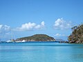
Great Thatch
- Area
- 1.2 km²
- High point
- 196 m

Little Tobago
- Area
- 1.2 km²
- High point
- 143 m
Espenqui
- Area
- 1.1 km²
- High point
- 14 m
Unnamed island
- Area
- 1.1 km²
- High point
- 12 m

îlet à Fajou
- Area
- 1.1 km²
- High point
- 9 m
Rabusquí
- Area
- 1.1 km²
- High point
- 11 m

Culebrita Island
- Area
- 1.1 km²
- High point
- 73 m
Huevos Island
- Area
- 1 km²
- High point
- 196 m
Ginger Island
- Area
- 1 km²
- High point
- 127 m
Great Tobago Island
- Area
- 0.99 km²
- High point
- 159 m

Scrub Island
- Area
- 0.97 km²
- High point
- 134 m
Isla Fraile Grande
- Area
- 0.96 km²
- High point
- 137 m
Thatch Cay
- Area
- 0.96 km²
- High point
- 143 m
Unnamed island
- Area
- 0.95 km²
- High point
- 7 m
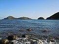
Grand-Îlet
- Area
- 0.8 km²
- High point
- 165 m
Unnamed island
- Area
- 0.79 km²
- High point
- 11 m

Salt Island
- Area
- 0.79 km²
- High point
- 112 m
Isla Conejo
- Area
- 0.73 km²
- High point
- 129 m
Prickly Pear
- Area
- 0.73 km²
- High point
- 59 m
Savana Island
- Area
- 0.73 km²
- High point
- 82 m
Ilet Chancel
- Area
- 0.73 km²
- High point
- 67 m
Isla de Patos
- Area
- 0.71 km²
- High point
- 93 m

Buck Island
- Area
- 0.7 km²
- High point
- 101 m
Unnamed island
- Area
- 0.68 km²
- High point
- 13 m
Crasquí
- Area
- 0.68 km²
- High point
- 9 m
Isla La Iguana
- Area
- 0.66 km²
- High point
- 112 m
Unnamed island
- Area
- 0.66 km²
- High point
- 198 m
Great Saint James Island
- Area
- 0.65 km²
- High point
- 59 m
Little Jost Van Dyke
- Area
- 0.64 km²
- High point
- 103 m
Caille Island
- Area
- 0.63 km²
- High point
- 69 m
Battowia
- Area
- 0.63 km²
- High point
- 194 m

Redonda
- Area
- 0.6 km²
- High point
- 296 m
Large Island
- Area
- 0.59 km²
- High point
- 57 m
Frenchman's Cay
- Area
- 0.58 km²
- High point
- 117 m
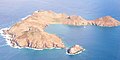
Île Fourchue
- Area
- 0.57 km²
- High point
- 89 m
Hassel Island
- Area
- 0.56 km²
- High point
- 61 m
Unnamed island
- Area
- 0.55 km²
Cayo Carenero
- Area
- 0.52 km²
- High point
- 8 m
Inner Brass Island
- Area
- 0.52 km²
- High point
- 72 m
Lovango Cay
- Area
- 0.5 km²
- High point
- 82 m

Moskito Island(BVI)
- Area
- 0.5 km²
- High point
- 77 m
Petit Mustique
- Area
- 0.5 km²
- High point
- 99 m
Green Island
- Area
- 0.47 km²
- High point
- 50 m
Outer Brass Island
- Area
- 0.45 km²
- High point
- 125 m
Cayo de Agua
- Area
- 0.45 km²
- High point
- 8 m
Tortuguillo del Este
- Area
- 0.44 km²
- High point
- 5 m
Francisqui Arriba
- Area
- 0.43 km²
- High point
- 7 m
Unnamed island
- Area
- 0.43 km²
- High point
- 97 m

Palm Island
- Area
- 0.43 km²
- High point
- 28 m
Little Hans Lollik Island
- Area
- 0.43 km²
- High point
- 64 m

Île Chevreau
- Area
- 0.42 km²
- High point
- 105 m
Bubies Arriva
- Area
- 0.42 km²
- High point
- 11 m
Unnamed island
- Area
- 0.41 km²
- High point
- 129 m

Petit Saint Vincent
- Area
- 0.41 km²
- High point
- 75 m
Tortuguillo del Oeste
- Area
- 0.4 km²
- High point
- 6 m
Frigate Island
- Area
- 0.39 km²
- High point
- 51 m
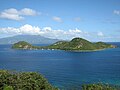
Îlet à Cabrit
- Area
- 0.39 km²
- High point
- 85 m
Unnamed island
- Area
- 0.38 km²
- High point
- 169 m
Unnamed island
- Area
- 0.38 km²
- High point
- 9 m
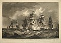
Sombrero
- Area
- 0.38 km²
- High point
- 11 m
Unnamed island
- Area
- 0.37 km²
- High point
- 135 m
Great Dog
- Area
- 0.37 km²
- High point
- 51 m
Bubies Medio
- Area
- 0.35 km²
- High point
- 10 m
Hog Island
- Area
- 0.35 km²
- High point
- 47 m
Isla Agustín
- Area
- 0.35 km²
- High point
- 8 m
Cayo Bequevé Norte
- Area
- 0.32 km²
- High point
- 6 m

Necker Island
- Area
- 0.32 km²
- High point
- 26 m
Terre de Haut
- Area
- 0.31 km²
- High point
- 8 m
Unnamed island
- Area
- 0.31 km²
- High point
- 17 m
Cayo Herradura
- Area
- 0.3 km²
- High point
- 2 m
Unnamed island
- Area
- 0.3 km²
- High point
- 12 m
Cayo Pirata
- Area
- 0.29 km²
- High point
- 4 m

Petite Nevis
- Area
- 0.29 km²
- High point
- 83 m
Little Saint James Island
- Area
- 0.29 km²
- High point
- 43 m
Giles Island
- Area
- 0.28 km²
- High point
- 87 m
Calivigny Island
- Area
- 0.28 km²
- High point
- 30 m
Saline Island
- Area
- 0.27 km²
- High point
- 61 m
Îlet Cochon
- Area
- 0.26 km²
- High point
- 15 m
Unnamed island
- Area
- 0.26 km²
- High point
- 31 m
Noronquises Medio
- Area
- 0.25 km²
- High point
- 4 m
Unnamed island
- Area
- 0.25 km²
- High point
- 7 m
Îlet Long
- Area
- 0.25 km²
- High point
- 23 m
Grass Cay
- Area
- 0.25 km²
- High point
- 66 m
Little Tobago Island
- Area
- 0.24 km²
- High point
- 81 m
Maceta de Isla Fernando
- Area
- 0.24 km²
- High point
- 19 m
Unnamed island
- Area
- 0.23 km²
- High point
- 130 m
Grand Tantes
- Area
- 0.23 km²
- High point
- 84 m
Diamond Island
- Area
- 0.22 km²
- High point
- 170 m
Isla Testigo Pequeño
- Area
- 0.22 km²
- High point
- 44 m
Salt Cay
- Area
- 0.22 km²
- High point
- 68 m
Little Thatch Island
- Area
- 0.21 km²
- High point
- 88 m
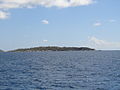
Fallen Jerusalem Island
- Area
- 0.21 km²
- High point
- 31 m
Crump Island
- Area
- 0.21 km²
- High point
- 29 m
Unnamed island
- Area
- 0.21 km²
- High point
- 8 m
Bovoni Cay
- Area
- 0.21 km²
- High point
- 21 m
Unnamed island
- Area
- 0.2 km²
- High point
- 6 m
Mingo Cay
- Area
- 0.2 km²
- High point
- 55 m
Sarquí
- Area
- 0.2 km²
- High point
- 4 m
Unnamed island
- Area
- 0.19 km²
- High point
- 3 m
Madrisquí
- Area
- 0.19 km²
- High point
- 9 m
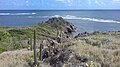
Îlet à Chevalier
- Area
- 0.18 km²
- High point
- 22 m
Bubies Bajo
- Area
- 0.18 km²
- High point
- 11 m
Capella Islands
- Area
- 0.18 km²
- High point
- 26 m

Buck Island
- Area
- 0.18 km²
- High point
- 44 m
Gros Îlet
- Area
- 0.17 km²
- High point
- 70 m
Îlet à Kahouanne
- Area
- 0.17 km²
- High point
- 69 m
Unnamed island
- Area
- 0.17 km²
- High point
- 7 m
Petite Canouan
- Area
- 0.17 km²
- High point
- 50 m
George Dog
- Area
- 0.17 km²
- High point
- 59 m
Little Camanoe
- Area
- 0.17 km²
- High point
- 34 m
Isla Mosquises Sur
- Area
- 0.16 km²
- High point
- 4 m
Île Frégate
- Area
- 0.16 km²
- High point
- 44 m
Unnamed island
- Area
- 0.16 km²
- High point
- 66 m
Francisqui Abajo
- Area
- 0.16 km²
- High point
- 7 m
Cayo Lobo
- Area
- 0.16 km²
- High point
- 29 m

Pinel Island
- Area
- 0.16 km²
- High point
- 28 m
Rocks & skerries
On the chart above, at its closest zooms.
Listing 200 of 1595; the rest are on the chart.
Figures
Comparative heights
- Basse-Terre: 1,467 m
- Dominica: 1,447 m
- Martinique: 1,397 m
- Saint Vincent: 1,234 m
- Saint Kitts: 1,156 m
- Margarita: 960 m
- Nevis: 960 m
- Saint Lucia: 950 m
- Trinidad: 940 m
- Montserrat: 915 m
- Saba: 870 m
- Grenada: 840 m
- Sint Eustatius: 600 m
- Tobago: 580 m
To the same scale
Islands by area
Groups within
Overlapping groups
Photographs

St. Kitts Frigate Bay from Timothy Hill Overlook

Panoramic view of Juan Griego bay from Fort La Galera. Juan Griego is a city on the northern side of Isla Margarita, and is the most northern port in Venezuela.

St. Kitts: Basseterre: Port Zante Cruise Terminal

Anse à la Barque - Between Bouillante and Vieux-Habitants

Quinam Bay, Columbus Channel, South Coast, Trinidad

Nevis: Pinney's Beach

U.S. Air Force 12AF-AFSOUTH by Andrea Jenkins / Public domain

U.S. Air Force 12AF-AFSOUTH by Andrea Jenkins / Public domain

Siwik at Emerald Pool, Dominica, W.I.

Côte sous le vent, au niveau de la Porte d'Enfer (Grande-Terre)

U.S. Air force photo by Tech. Sgt. Rachel Maxwell / Public domain

U.S. Navy photo by Petty Officer 2nd Class Marianne Guemo / Public domain
Sources
Facts
Photographs
- St. Kitts Basseterre Frigate Bay. Dr. Thomas Liptak / CC BY-SA 4.0
- Panoramic of Juan Griego 45. Wilfredor / CC0
- St. Kitts Basseterre Port Zante. Dr. Thomas Liptak / CC BY-SA 4.0
- Anse à la Barque. Patrice78500 / CC BY-SA 3.0
- Quinam bay, Columbus Channel, South Coast, Trinidad & Tobago. Kalamazadkhan / CC BY-SA 3.0
- Nevis Pinney's Beach. Dr. Thomas Liptak / CC BY-SA 4.0
- AFSOUTH leadership visits LAMAT team in Lesser Antilles (8922802). U.S. Air Force 12AF-AFSOUTH by Andrea Jenkins / Public domain
- AFSOUTH leadership visits LAMAT team in Lesser Antilles (8922803). U.S. Air Force 12AF-AFSOUTH by Andrea Jenkins / Public domain
- Guinotia dentata. Hans Hillewaert / CC BY-SA 4.0
- Côte sous le vent, au niveau de la Porte d'Enfer. Antoine Cupial / CC BY-SA 4.0
- Readiness through partnership- LAMAT 2026 returns to Saint Lucia (9647026). U.S. Air force photo by Tech. Sgt. Rachel Maxwell / Public domain
- USS Sioux City Conducts Bilateral Maritime Exercise with FS Germinal (6707361). U.S. Navy photo by Petty Officer 2nd Class Marianne Guemo / Public domain