Caribbean SeaUnited Kingdom, France, United States, Trinidad & Tobago, Dominica, St. Lucia, Barbados, Netherlands, St. Vincent & Grenadines, Grenada, Antigua & Barbuda, St. Kitts & Nevis, Montserrat, Anguilla and British Virgin Islands
15°15′N 61°41′W
Windward Antilles
Part of Lesser Antilles
The Windward Antilles are a group of islands part of the Lesser Antilles, forming a volcanic arc to the East of the Caribbean Sea, preferably subdivided in English into:

Chart
Overview
The Windward Antilles are a group of islands part of the Lesser Antilles, forming a volcanic arc to the East of the Caribbean Sea, preferably subdivided in English into:
The "Leeward Islands" (the northeastern subgroup), between the Virgin Islands and Dominica. The "Windward Islands" (the southeastern subgroup), between Martinique and Grenada, generally extended to Trinidad and Tobago.
From Wikipedia, CC BY-SA 4.0
Census, cataloged
- Major islands11
- Minor islands142
- Islets421
- Rocks & skerries444
Major islands
Trinidad
- Area
- 4,823 km²
- High point
- 940 m
Trinidad is the largest and most populous island of the Republic of Trinidad and Tobago. The island lies 11 km (7 mi) off the northeastern coast of Venezuela and sits on the continental shelf of South America. It is the southernmost island in the Caribbean.
Basse-Terre Island
- Area
- 847 km²
- High point
- 1,467 m
Guadeloupe is an overseas department and region of France in the Caribbean. It consists of six inhabited islands—Basse-Terre, Grande-Terre, Marie-Galante, La Désirade, and two Îles des Saintes—and 30 uninhabited islets and 3 inhabited islets. It is south of Antigua and Barbuda and Montserrat and north of Dominica.
Dominica
- Area
- 751 km²
- High point
- 1,447 m
Dominica officially the Commonwealth of Dominica, is an island country in the Caribbean. It is part of the Windward Islands chain in the Lesser Antilles archipelago in the Caribbean Sea. The capital, Roseau, is located on the western side of the island.
Saint Lucia
- Area
- 603 km²
- High point
- 950 m
Saint Lucia (also written as St. Lucia) is an island country in the eastern and southern Caribbean. Part of the Windward Islands of the Lesser Antilles, it is located north/northeast of the island of Saint Vincent, northwest of Barbados and south of Martinique.
Grande-Terre
- Area
- 593 km²
- High point
- 136 m
Grande-Terre Island (French: île de Grande-Terre / île de la Grande-Terre [ɡʁɑ̃d tɛʁ]; Guadeloupean Creole: or Granntè) is the name of the eastern-half of Guadeloupe proper, in the Lesser Antilles.
Barbados
- Area
- 433 km²
- High point
- 340 m
Barbados is an island nation in the Caribbean Sea. It is part of the Lesser Antilles of the West Indies and is the southernmost and easternmost island of the Caribbean region. It lies on the boundary of the South American and Caribbean tectonic plates. Its capital and largest city is Bridgetown.
Saint Vincent
- Area
- 344 km²
- High point
- 1,234 m
Saint Vincent is a volcanic island in the southern Caribbean. It is the largest island of the country Saint Vincent and the Grenadines and is located in the Caribbean Sea, between Saint Lucia and Grenada. It is composed of partially submerged volcanic mountains.
Grenada
- Area
- 313 km²
- High point
- 840 m
Grenada is an island country located between the Caribbean Sea and Atlantic Ocean, north of Trinidad and Tobago. It is located at 12°07′N 61°40′W. There are no large inland bodies of water on the island, which consists entirely of the state of Grenada. The coastline is 121 km long.
Tobago
- Area
- 300 km²
- High point
- 580 m
Tobago, officially the Ward of Tobago, is an island and ward in Trinidad and Tobago. It is 35 kilometres (20 nautical miles) northeast of the larger island of Trinidad and about 160 kilometres (85 nautical miles) off Venezuela's northeastern coast. It is southeast of Grenada and southwest of Barbados.
Bonaire
- Area
- 272 km²
- High point
- 241 m


Curaçao
- Area
- 428 km²
- High point
- 372 m
Curaçao, officially the Country of Curaçao, is a constituent country within the Kingdom of the Netherlands. It is an island country located in the southern Caribbean Sea, specifically the Dutch Caribbean region, about 65 km (40 mi) north of Venezuela and 80 km (50 mi) southeast of Aruba.
Minor islands

Antigua
- Area
- 271 km²
- High point
- 402 m

Saint Croix
- Area
- 217 km²
- High point
- 334 m

Aruba
- Area
- 179 km²
- High point
- 188 m

Barbuda
- Area
- 174 km²
- High point
- 43 m

Saint Kitts
- Area
- 168 km²
- High point
- 1,156 m

Marie-Galante
- Area
- 159 km²
- High point
- 204 m

Vieques
- Area
- 133 km²
- High point
- 281 m

Montserrat
- Area
- 103 km²
- High point
- 915 m

Nevis
- Area
- 93.8 km²
- High point
- 960 m

Saint Martin
- Area
- 72.7 km²
- High point
- 418 m

Anguilla
- Area
- 72.1 km²
- High point
- 73 m

Saint Thomas
- Area
- 71.3 km²
- High point
- 474 m
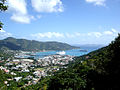
Tortola
- Area
- 56.5 km²
- High point
- 521 m

Saint John
- Area
- 49.7 km²
- High point
- 377 m

Anegada
- Area
- 39.9 km²
- High point
- 13 m

Carriacou
- Area
- 32.1 km²
- High point
- 291 m

Culebra
- Area
- 26.8 km²
- High point
- 185 m

Virgin Gorda
- Area
- 21.9 km²
- High point
- 414 m

Sint Eustatius
- Area
- 20.9 km²
- High point
- 600 m

La Désirade
- Area
- 19.7 km²
- High point
- 279 m
Saint Barthelemy
- Area
- 19.2 km²
- High point
- 286 m

Bequia
- Area
- 16.1 km²
- High point
- 265 m

Saba
- Area
- 13.1 km²
- High point
- 870 m

Union Island
- Area
- 8.7 km²
- High point
- 304 m

Jost Van Dyke
- Area
- 8.5 km²
- High point
- 315 m
Lowlands island
- Area
- 8.4 km²
- High point
- 72 m

Canouan
- Area
- 7.7 km²
- High point
- 232 m
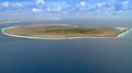
Klein Bonaire
- Area
- 6.9 km²
- High point
- 7 m

Terre-de-Bas Island
- Area
- 6.8 km²
- High point
- 293 m

Mustique
- Area
- 5.6 km²
- High point
- 144 m

Terre-de-Haut Island
- Area
- 4.5 km²
- High point
- 309 m
Peter Island
- Area
- 4.3 km²
- High point
- 160 m
Beef Island
- Area
- 4 km²
- High point
- 210 m

Scrub Island
- Area
- 3.5 km²
- High point
- 24 m
Great Camanoe
- Area
- 3.3 km²
- High point
- 169 m

Guana Island
- Area
- 3 km²
- High point
- 242 m

Ronde Island
- Area
- 2.5 km²
- High point
- 153 m

Norman Island
- Area
- 2.5 km²
- High point
- 129 m

Petite Martinique
- Area
- 2 km²
- High point
- 195 m

Water Island
- Area
- 2 km²
- High point
- 74 m

Hans Lollik Island
- Area
- 2 km²
- High point
- 212 m
Dog Island
- Area
- 1.9 km²
- High point
- 28 m
Guiana Island
- Area
- 1.9 km²
- High point
- 16 m

Mayreau
- Area
- 1.8 km²
- High point
- 98 m

Quatre
- Area
- 1.5 km²
- High point
- 136 m

Cooper Island
- Area
- 1.4 km²
- High point
- 157 m

Cayo Luis Peña
- Area
- 1.4 km²
- High point
- 135 m

Baliceaux
- Area
- 1.3 km²
- High point
- 117 m
Cayo Norte
- Area
- 1.3 km²
- High point
- 93 m

Terre de Bas
- Area
- 1.3 km²
- High point
- 9 m

Klein Curaçao
- Area
- 1.2 km²
- High point
- 5 m
Long Island
- Area
- 1.2 km²
- High point
- 16 m

Île Tintamarre
- Area
- 1.2 km²
- High point
- 36 m

Great Thatch
- Area
- 1.2 km²
- High point
- 196 m

îlet à Fajou
- Area
- 1.1 km²
- High point
- 9 m

Culebrita Island
- Area
- 1.1 km²
- High point
- 73 m
Ginger Island
- Area
- 1 km²
- High point
- 127 m
Great Tobago Island
- Area
- 0.99 km²
- High point
- 159 m

Scrub Island
- Area
- 0.97 km²
- High point
- 134 m
Thatch Cay
- Area
- 0.96 km²
- High point
- 143 m

Grand-Îlet
- Area
- 0.8 km²
- High point
- 165 m

Salt Island
- Area
- 0.79 km²
- High point
- 112 m
Prickly Pear
- Area
- 0.73 km²
- High point
- 59 m
Savana Island
- Area
- 0.73 km²
- High point
- 82 m

Buck Island
- Area
- 0.7 km²
- High point
- 101 m
Great Saint James Island
- Area
- 0.65 km²
- High point
- 59 m
Little Jost Van Dyke
- Area
- 0.64 km²
- High point
- 103 m
Caille Island
- Area
- 0.63 km²
- High point
- 69 m
Battowia
- Area
- 0.63 km²
- High point
- 194 m

Redonda
- Area
- 0.6 km²
- High point
- 296 m
Large Island
- Area
- 0.59 km²
- High point
- 57 m
Frenchman's Cay
- Area
- 0.58 km²
- High point
- 117 m
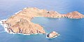
Île Fourchue
- Area
- 0.57 km²
- High point
- 89 m
Hassel Island
- Area
- 0.56 km²
- High point
- 61 m
Inner Brass Island
- Area
- 0.52 km²
- High point
- 72 m
Lovango Cay
- Area
- 0.5 km²
- High point
- 82 m

Moskito Island(BVI)
- Area
- 0.5 km²
- High point
- 77 m
Petit Mustique
- Area
- 0.5 km²
- High point
- 99 m
Green Island
- Area
- 0.47 km²
- High point
- 50 m
Outer Brass Island
- Area
- 0.45 km²
- High point
- 125 m

Palm Island
- Area
- 0.43 km²
- High point
- 28 m
Little Hans Lollik Island
- Area
- 0.43 km²
- High point
- 64 m

Île Chevreau
- Area
- 0.42 km²
- High point
- 105 m

Petit Saint Vincent
- Area
- 0.41 km²
- High point
- 75 m
Frigate Island
- Area
- 0.39 km²
- High point
- 51 m

Îlet à Cabrit
- Area
- 0.39 km²
- High point
- 85 m

Sombrero
- Area
- 0.38 km²
- High point
- 11 m
Great Dog
- Area
- 0.37 km²
- High point
- 51 m
Hog Island
- Area
- 0.35 km²
- High point
- 47 m

Necker Island
- Area
- 0.32 km²
- High point
- 26 m
Terre de Haut
- Area
- 0.31 km²
- High point
- 8 m
Unnamed island
- Area
- 0.31 km²
- High point
- 17 m
Unnamed island
- Area
- 0.3 km²
- High point
- 12 m

Petite Nevis
- Area
- 0.29 km²
- High point
- 83 m
Little Saint James Island
- Area
- 0.29 km²
- High point
- 43 m
Calivigny Island
- Area
- 0.28 km²
- High point
- 30 m
Saline Island
- Area
- 0.27 km²
- High point
- 61 m
Îlet Cochon
- Area
- 0.26 km²
- High point
- 15 m
Grass Cay
- Area
- 0.25 km²
- High point
- 66 m
Little Tobago Island
- Area
- 0.24 km²
- High point
- 81 m
Grand Tantes
- Area
- 0.23 km²
- High point
- 84 m
Diamond Island
- Area
- 0.22 km²
- High point
- 170 m
Salt Cay
- Area
- 0.22 km²
- High point
- 68 m
Little Thatch Island
- Area
- 0.21 km²
- High point
- 88 m
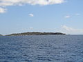
Fallen Jerusalem Island
- Area
- 0.21 km²
- High point
- 31 m
Crump Island
- Area
- 0.21 km²
- High point
- 29 m
Bovoni Cay
- Area
- 0.21 km²
- High point
- 21 m
Mingo Cay
- Area
- 0.2 km²
- High point
- 55 m

Îlet à Chevalier
- Area
- 0.18 km²
- High point
- 22 m
Capella Islands
- Area
- 0.18 km²
- High point
- 26 m

Buck Island
- Area
- 0.18 km²
- High point
- 44 m
Gros Îlet
- Area
- 0.17 km²
- High point
- 70 m
Îlet à Kahouanne
- Area
- 0.17 km²
- High point
- 69 m
Petite Canouan
- Area
- 0.17 km²
- High point
- 50 m
George Dog
- Area
- 0.17 km²
- High point
- 59 m
Little Camanoe
- Area
- 0.17 km²
- High point
- 34 m
Île Frégate
- Area
- 0.16 km²
- High point
- 44 m
Cayo Lobo
- Area
- 0.16 km²
- High point
- 29 m

Pinel Island
- Area
- 0.16 km²
- High point
- 28 m
West Cay
- Area
- 0.15 km²
- High point
- 33 m
Dead Chest Island
- Area
- 0.15 km²
- High point
- 60 m
Pelican Island, Antigua and Barbuda
- Area
- 0.14 km²
- High point
- 27 m
Dutchcap Cay
- Area
- 0.14 km²
- High point
- 79 m
Green Island
- Area
- 0.13 km²
- High point
- 61 m
Patricia Cay
- Area
- 0.13 km²
- High point
- 18 m
Saba Island
- Area
- 0.13 km²
- High point
- 55 m
Eustatia Island
- Area
- 0.12 km²
- High point
- 33 m
Îlet Petite Grenade
- Area
- 0.11 km²
- High point
- 38 m
Ruth Island
- Area
- 0.11 km²
- High point
- 6 m
Savan
- Area
- 0.1 km²
- High point
- 39 m
West Dog
- Area
- 0.1 km²
- High point
- 27 m
Unnamed island
- Area
- —
size unknown
Unnamed island
- Area
- —
size unknown
Unnamed island
- Area
- —
size unknown
Unnamed island
- Area
- —
size unknown
îlet Caret
- Area
- —
size unknown
Les Augustins
- Area
- —
size unknown
Martinique
- Area
- —
size unknown
Nanny Cay
- Area
- —
- High point
- 7 m
size unknown
Petite Mustique
- Area
- —
- High point
- 2 m
size unknown
Saint Elairs Cay
- Area
- —
size unknown
Samples Cay
- Area
- —
- High point
- 1 m
size unknown
Rocks & skerries
On the chart above, at its closest zooms.
Listing 153 of 1018; the rest are on the chart.
Figures
Comparative heights
- Basse-Terre: 1,467 m
- Dominica: 1,447 m
- Saint Vincent: 1,234 m
- Saint Kitts: 1,156 m
- Nevis: 960 m
- Saint Lucia: 950 m
- Trinidad: 940 m
- Montserrat: 915 m
- Saba: 870 m
- Grenada: 840 m
- Sint Eustatius: 600 m
- Tobago: 580 m
- Tortola: 521 m
- Saint Thomas: 474 m
To the same scale
Islands by area
Groups within
Photographs

Salt Whistle Bay (also known as Carnash Bay) at the north end of Mayreau Island, St. Vincent and the Grenadines, Eastern Caribbean, is famous for its beaches and bars.

Anse à la Barque - Between Bouillante and Vieux-Habitants

Côte sous le vent, au niveau de la Porte d'Enfer (Grande-Terre)

Quinam Bay, Columbus Channel, South Coast, Trinidad

Barbados, Karibik - View from Gun Hill Signal Station

Sources
Facts
Photographs
- Salt Whistle Bay (49996126521). David Stanley from Nanaimo, Canada / CC BY 2.0
- Anse à la Barque. Patrice78500 / CC BY-SA 3.0
- Côte sous le vent, au niveau de la Porte d'Enfer. Antoine Cupial / CC BY-SA 4.0
- Quinam bay, Columbus Channel, South Coast, Trinidad & Tobago. Kalamazadkhan / CC BY-SA 3.0
- Barbados, Karibik - View from Gun Hill Signal Station - panoramio. giggel / CC BY 3.0
- Maria 2017-09-19 0615Z. NOAA/NASA / Public domain