Curaçao, Aruba, Grenada, St. Lucia, St. Vincent & Grenadines, Trinidad & Tobago and Netherlands
14°00′N 67°00′W
Southern Caribbean
Part of Lesser Antilles
The Southern Caribbean is a group of islands that neighbor mainland South America in the West Indies. Saint Lucia lies to the north of the region, Barbados in the east, Trinidad and Tobago at its southernmost point, and Aruba at the most westerly section.

Chart
Overview
The Southern Caribbean is a group of islands that neighbor mainland South America in the West Indies. Saint Lucia lies to the north of the region, Barbados in the east, Trinidad and Tobago at its southernmost point, and Aruba at the most westerly section.
From Wikipedia, CC BY-SA 4.0
Census, cataloged
- Major islands3
- Minor islands37
- Islets153
- Rocks & skerries231
Major islands
Trinidad
- Area
- 4,823 km²
- High point
- 940 m
Trinidad is the largest and most populous island of the Republic of Trinidad and Tobago. The island lies 11 km (7 mi) off the northeastern coast of Venezuela and sits on the continental shelf of South America. It is the southernmost island in the Caribbean.
Saint Lucia
- Area
- 603 km²
- High point
- 950 m
Saint Lucia (also written as St. Lucia) is an island country in the eastern and southern Caribbean. Part of the Windward Islands of the Lesser Antilles, it is located north/northeast of the island of Saint Vincent, northwest of Barbados and south of Martinique.


Curaçao
- Area
- 428 km²
- High point
- 372 m
Curaçao, officially the Country of Curaçao, is a constituent country within the Kingdom of the Netherlands. It is an island country located in the southern Caribbean Sea, specifically the Dutch Caribbean region, about 65 km (40 mi) north of Venezuela and 80 km (50 mi) southeast of Aruba.
Minor islands

Saint Vincent
- Area
- 344 km²
- High point
- 1,234 m

Grenada
- Area
- 313 km²
- High point
- 840 m

Tobago
- Area
- 300 km²
- High point
- 580 m

Aruba
- Area
- 179 km²
- High point
- 188 m

Carriacou
- Area
- 32.1 km²
- High point
- 291 m

Bequia
- Area
- 16.1 km²
- High point
- 265 m

Union Island
- Area
- 8.7 km²
- High point
- 304 m

Canouan
- Area
- 7.7 km²
- High point
- 232 m
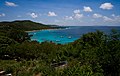
Mustique
- Area
- 5.6 km²
- High point
- 144 m
Monos Island
- Area
- 4.4 km²
- High point
- 288 m

Chacachacare
- Area
- 4 km²
- High point
- 239 m
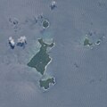
Ronde Island
- Area
- 2.5 km²
- High point
- 153 m

Petite Martinique
- Area
- 2 km²
- High point
- 195 m
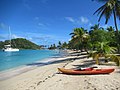
Mayreau
- Area
- 1.8 km²
- High point
- 98 m

Quatre
- Area
- 1.5 km²
- High point
- 136 m
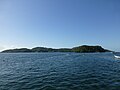
Gaspar Grande
- Area
- 1.3 km²
- High point
- 104 m

Baliceaux
- Area
- 1.3 km²
- High point
- 117 m

Little Tobago
- Area
- 1.2 km²
- High point
- 143 m
Huevos Island
- Area
- 1 km²
- High point
- 196 m
Caille Island
- Area
- 0.63 km²
- High point
- 69 m
Battowia
- Area
- 0.63 km²
- High point
- 194 m
Large Island
- Area
- 0.59 km²
- High point
- 57 m
Petit Mustique
- Area
- 0.5 km²
- High point
- 99 m

Palm Island
- Area
- 0.43 km²
- High point
- 28 m

Petit Saint Vincent
- Area
- 0.41 km²
- High point
- 75 m
Frigate Island
- Area
- 0.39 km²
- High point
- 51 m
Hog Island
- Area
- 0.35 km²
- High point
- 47 m

Petite Nevis
- Area
- 0.29 km²
- High point
- 83 m
Giles Island
- Area
- 0.28 km²
- High point
- 87 m
Calivigny Island
- Area
- 0.28 km²
- High point
- 30 m
Saline Island
- Area
- 0.27 km²
- High point
- 61 m
Grand Tantes
- Area
- 0.23 km²
- High point
- 84 m
Diamond Island
- Area
- 0.22 km²
- High point
- 170 m
Petite Canouan
- Area
- 0.17 km²
- High point
- 50 m
Saut d'Eau
- Area
- 0.13 km²
- High point
- 57 m
Green Island
- Area
- 0.13 km²
- High point
- 61 m
Savan
- Area
- 0.1 km²
- High point
- 39 m
Rocks & skerries
On the chart above, at its closest zooms.
Listing 40 of 424; the rest are on the chart.
Figures
Comparative heights
- Saint Vincent: 1,234 m
- Saint Lucia: 950 m
- Trinidad: 940 m
- Grenada: 840 m
- Tobago: 580 m
- Curaçao: 372 m
- Union: 304 m
- Carriacou: 291 m
- Monos: 288 m
- Bequia: 265 m
- Chacachacare: 239 m
- Canouan: 232 m
- Huevos: 196 m
- Petite Martinique: 195 m
To the same scale
Islands by area
| Trinidad | 4,823 km² |
| Saint Lucia | 603 km² |
| Curaçao | 428 km² |
| Saint Vincent | 344 km² |
| Grenada | 313 km² |
| Tobago | 300 km² |
| Aruba | 179 km² |
| Carriacou | 32.1 km² |
| Bequia | 16.1 km² |
| Union Island | 8.7 km² |
| Canouan | 7.7 km² |
| Mustique | 5.6 km² |
| Monos Island | 4.4 km² |
| Chacachacare | 4 km² |
| Ronde Island | 2.5 km² |
| Petite Martinique | 2 km² |
| Mayreau | 1.8 km² |
| Quatre | 1.5 km² |
| Gaspar Grande | 1.3 km² |
| Baliceaux | 1.3 km² |
| Little Tobago | 1.2 km² |
| Huevos Island | 1 km² |
| Caille Island | 0.63 km² |
| Battowia | 0.63 km² |
| Large Island | 0.59 km² |
| Petit Mustique | 0.5 km² |
| Palm Island | 0.43 km² |
| Petit Saint Vincent | 0.41 km² |
| Frigate Island | 0.39 km² |
| Hog Island | 0.35 km² |
| Petite Nevis | 0.29 km² |
| Giles Island | 0.28 km² |
| Calivigny Island | 0.28 km² |
| Saline Island | 0.27 km² |
| Grand Tantes | 0.23 km² |
| Diamond Island | 0.22 km² |
| Petite Canouan | 0.17 km² |
| Saut d'Eau | 0.13 km² |
| Green Island | 0.13 km² |
| Savan | 0.1 km² |
Groups within
Overlapping groups
Sources
Facts
Photographs
- Quinam bay, Columbus Channel, South Coast, Trinidad & Tobago. Kalamazadkhan / CC BY-SA 3.0