Trinidad & Tobago
10°40′N 61°31′W
Trinidad and Tobago
Part of Southern Caribbean
Trinidad and Tobago, officially the Republic of Trinidad and Tobago, is the southernmost archipelagic country in the Caribbean, comprising the main islands of Trinidad and Tobago, along with several smaller islets. The capital city is Port of Spain, while its largest and most populous municipality is Chaguanas.

Chart
Overview
Trinidad and Tobago, officially the Republic of Trinidad and Tobago, is the southernmost archipelagic country in the Caribbean, comprising the main islands of Trinidad and Tobago, along with several smaller islets. The capital city is Port of Spain, while its largest and most populous municipality is Chaguanas. Trinidad and Tobago comprises the southernmost islands of the Caribbean eastern islands chain, and it is close to the continent of South America, being north to northeast of Venezuela and northwest of Guyana. Trinidad and Tobago is located six nautical miles (11 km; 6.9 mi) north to northeast off the coast of Venezuela, 70 nautical miles (130 km; 81 mi) south of Grenada, and 155 nautical miles (287 km; 178 mi) southwest of Barbados. Indigenous peoples inhabited Trinidad for centuries prior to Spanish colonisation, following the arrival of Christopher Columbus in 1498. Spanish governor José María Chacón surrendered the island to a British fleet under Sir Ralph Abercromby's command in 1797. Trinidad and Tobago were ceded to Britain in 1802 under the Treaty of Amiens as separate states and unified in 1889. Trinidad and Tobago obtained independence in 1962, and became a republic in 1976. Unlike most Caribbean countries and territories, which rely heavily on tourism, the economy is primarily industrial, based on large reserves of oil and gas. The country sees fewer hurricanes than most of the Caribbean because it is farther south. Trinidad and Tobago is well known for its African and Indian cultures, reflected in its large and famous Carnival, Diwali, and Hosay celebrations, as well as being the birthplace of the steelpan, the limbo, and musical styles such as calypso, soca, rapso, chutney, and chutney soca.
From Wikipedia, CC BY-SA 4.0
Census, cataloged
- Major islands1
- Minor islands8
- Islets72
- Rocks & skerries160
Major islands
Trinidad
- Area
- 4,823 km²
- High point
- 940 m
Trinidad is the largest and most populous island of the Republic of Trinidad and Tobago. The island lies 11 km (7 mi) off the northeastern coast of Venezuela and sits on the continental shelf of South America. It is the southernmost island in the Caribbean.
Minor islands

Tobago
- Area
- 300 km²
- High point
- 580 m
Monos Island
- Area
- 4.4 km²
- High point
- 288 m

Chacachacare
- Area
- 4 km²
- High point
- 239 m
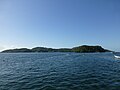
Gaspar Grande
- Area
- 1.3 km²
- High point
- 104 m

Little Tobago
- Area
- 1.2 km²
- High point
- 143 m
Huevos Island
- Area
- 1 km²
- High point
- 196 m
Giles Island
- Area
- 0.28 km²
- High point
- 87 m
Saut d'Eau
- Area
- 0.13 km²
- High point
- 57 m
Rocks & skerries
On the chart above, at its closest zooms.
Listing 9 of 241; the rest are on the chart.
Figures
Comparative heights
- Trinidad: 940 m
- Tobago: 580 m
- Monos: 288 m
- Chacachacare: 239 m
- Huevos: 196 m
- Little Tobago: 143 m
- Gaspar Grande: 104 m
- Giles: 87 m
- Saut d'Eau: 57 m
To the same scale
Islands by area
| Trinidad | 4,823 km² |
| Tobago | 300 km² |
| Monos Island | 4.4 km² |
| Chacachacare | 4 km² |
| Gaspar Grande | 1.3 km² |
| Little Tobago | 1.2 km² |
| Huevos Island | 1 km² |
| Giles Island | 0.28 km² |
| Saut d'Eau | 0.13 km² |
Groups within
Overlapping groups
Photographs

Pigeon Point beach, Tobago, Trinidad and Tobago, west Indies.

Quinam Bay, Columbus Channel, South Coast, Trinidad

This black&white photo shows some buildings for drying cocoa beans; in Vale State, Trinidad. [Very similar to page 11.]

This black&white photo shows some buildings for drying cocoa beans; in Vale State, Trinidad.

B&W headshot of Navid Lancaster.
Sources
Facts
Photographs
- Pigeon Point beach. Kp93 / CC BY-SA 3.0
- Quinam bay, Columbus Channel, South Coast, Trinidad & Tobago. Kalamazadkhan / CC BY-SA 3.0
- Cacao och choklad - Fig 13. Unknown authorUnknown author / Public domain
- Cacao och choklad - Fig 11. Unknown authorUnknown author / Public domain
- NAVID LANCASTER. Navidhendrix / CC BY-SA 4.0
- Pigeon Point (Tobago) banner Beach. Wikifurn / CC0