Caribbean SeaSt. Vincent & Grenadines
13°15′N 61°12′W
Saint Vincent and the Grenadines
Part of Southern Caribbean and French West Indies
Saint Vincent and the Grenadines, sometimes known simply as Saint Vincent, is an archipelagic country in the eastern Caribbean.

Chart
Overview
Saint Vincent and the Grenadines, sometimes known simply as Saint Vincent, is an archipelagic country in the eastern Caribbean. It is located in the southeast Windward Islands of the Lesser Antilles, which lie in the West Indies, at the southern end of the eastern border between the Caribbean Sea and the Atlantic Ocean. To the north lies Saint Lucia, to the east is Barbados and Grenada lies to the south. Spanning a land area of 389 km2 (150 sq mi), most of its territory consists of the northernmost island of Saint Vincent, which includes the capital and largest city, Kingstown. To the south lie the northern two-thirds of the Grenadines, a chain of 32 smaller islands; the remaining southern third make up Grenada. Seven of the islands are inhabited, of which the largest and most populous are Bequia, Mustique, Canouan and Union Island. With a population of around 109,296, Saint Vincent and the Grenadines has a population density of 281 inhabitants/km2 (730 per sq mi). The majority of its people are descendants of enslaved Africans brought by France and then later Great Britain, which contested the islands during the 18th century. SVG remained a colony of the British Empire from 1783 until 1979, when it peacefully achieved independence; the country's culture, language, government and legal system reflect the long legacy of British rule. It is part of the Commonwealth of Nations and is a Commonwealth realm, with King Charles III as its official head of state. Saint Vincent is a member of the Organisation of Eastern Caribbean States, CARICOM, the Bolivarian Alliance for the Americas, and the Community of Latin American and Caribbean States (CELAC). In April 2021, the La Soufrière volcano erupted several times with "explosive events" continuing for two weeks, resulting in the evacuation of 16,000 residents. Assistance and emergency financial support was provided by several nearby islands, the United Kingdom, and agencies such as the United Nations. The first significant offer of long-term funding of US$20 million was announced on 13 April 2021 by the World Bank.
From Wikipedia, CC BY-SA 4.0
Census, cataloged
- Major islands1
- Minor islands14
- Islets45
- Rocks & skerries22
Major islands
Saint Vincent
- Area
- 344 km²
- High point
- 1,234 m
Saint Vincent is a volcanic island in the southern Caribbean. It is the largest island of the country Saint Vincent and the Grenadines and is located in the Caribbean Sea, between Saint Lucia and Grenada. It is composed of partially submerged volcanic mountains.

Minor islands

Bequia
- Area
- 16.1 km²
- High point
- 265 m

Union Island
- Area
- 8.7 km²
- High point
- 304 m

Canouan
- Area
- 7.7 km²
- High point
- 232 m
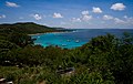
Mustique
- Area
- 5.6 km²
- High point
- 144 m
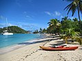
Mayreau
- Area
- 1.8 km²
- High point
- 98 m

Quatre
- Area
- 1.5 km²
- High point
- 136 m

Baliceaux
- Area
- 1.3 km²
- High point
- 117 m
Battowia
- Area
- 0.63 km²
- High point
- 194 m
Petit Mustique
- Area
- 0.5 km²
- High point
- 99 m

Palm Island
- Area
- 0.43 km²
- High point
- 28 m

Petit Saint Vincent
- Area
- 0.41 km²
- High point
- 75 m

Petite Nevis
- Area
- 0.29 km²
- High point
- 83 m
Petite Canouan
- Area
- 0.17 km²
- High point
- 50 m
Savan
- Area
- 0.1 km²
- High point
- 39 m
Islets
- Big Pillory52 m · 0.09 km²
- Petit Rameau35 m · 0.08 km²
- Petit Bateau41 m · 0.08 km²
- Pigeon Island42 m · 0.08 km²
- Unnamed island50 m · 0.06 km²
- Young Island33 m · 0.05 km²
- Rabbit Island15 m · 0.04 km²
- All Awash Island23 m · 0.04 km²
- Catholic Island37 m · 0.04 km²
- Middle Pillory13 m · 0.04 km²
- L'Islot26 m · 0.03 km²
- Baradal17 m · 0.03 km²
Rocks & skerries
- Savan Rock0.03 km²
- Sail Rock0.01 km²
- Brooks Rock0.8 ha
- Wilcks Rock0.6 ha
- Black Rock0.4 ha
- Unnamed island<0.1 ha
- Unnamed island<0.1 ha
- Petit Prune<0.1 ha
- The Pillories<0.1 ha
- Thompson Island<0.1 ha
- Black Rock<0.1 ha
- Unnamed island<0.1 ha
Figures
Comparative heights
- Saint Vincent: 1,234 m
- Union: 304 m
- Bequia: 265 m
- Canouan: 232 m
- Battowia: 194 m
- Mustique: 144 m
- Quatre: 136 m
- Baliceaux: 117 m
- Petit Mustique: 99 m
- Mayreau: 98 m
- Petite Nevis: 83 m
- Petit Saint Vincent: 75 m
- Big Pillory: 52 m
- Petite Canouan: 50 m
To the same scale
Islands by area
| Saint Vincent | 344 km² |
| Bequia | 16.1 km² |
| Union Island | 8.7 km² |
| Canouan | 7.7 km² |
| Mustique | 5.6 km² |
| Mayreau | 1.8 km² |
| Quatre | 1.5 km² |
| Baliceaux | 1.3 km² |
| Battowia | 0.63 km² |
| Petit Mustique | 0.5 km² |
| Palm Island | 0.43 km² |
| Petit Saint Vincent | 0.41 km² |
| Petite Nevis | 0.29 km² |
| Petite Canouan | 0.17 km² |
| Savan | 0.1 km² |
| Big Pillory | 0.09 km² |
| Petit Rameau | 0.08 km² |
| Petit Bateau | 0.08 km² |
| Pigeon Island | 0.08 km² |
| Unnamed island | 0.06 km² |
| Young Island | 0.05 km² |
| Rabbit Island | 0.04 km² |
| All Awash Island | 0.04 km² |
| Catholic Island | 0.04 km² |
| Middle Pillory | 0.04 km² |
| L'Islot | 0.03 km² |
| Baradal | 0.03 km² |
| Savan Rock | 0.03 km² |
| Little Pillory | 0.03 km² |
| Petit Tabac | 0.03 km² |
| Unnamed island | 0.02 km² |
| Little Savan | 0.02 km² |
| Jamesby | 0.01 km² |
| Sail Rock | 0.01 km² |
| Church Cay | 0.01 km² |
| The Pillories | 0.9 ha |
| Middle Cay | 0.8 ha |
| Duvernette Island | 0.8 ha |
| Big Cay | 0.8 ha |
| Brooks Rock | 0.8 ha |
| Petit Cay | 0.8 ha |
| Semples Cay | 0.7 ha |
| West Cay | 0.6 ha |
| Wilcks Rock | 0.6 ha |
| Unnamed island | 0.6 ha |
| Canouan Baleine | 0.6 ha |
| Unnamed island | 0.5 ha |
| Unnamed island | 0.4 ha |
| Syrup Cay | 0.4 ha |
| Black Rock | 0.4 ha |
| Unnamed island | 0.4 ha |
| Unnamed island | 0.4 ha |
| Unnamed island | 0.3 ha |
| Bullet Cay | 0.3 ha |
| Unnamed island | 0.3 ha |
| The Pillories | 0.2 ha |
| Unnamed island | 0.2 ha |
| Mopion | 0.2 ha |
| The Pillories | 0.2 ha |
| Unnamed island | 0.1 ha |
| Unnamed island | 0.1 ha |
| Unnamed island | 0.1 ha |
| Unnamed island | 0.1 ha |
| Unnamed island | 0.1 ha |
| Dike Island | 0.1 ha |
| Unnamed island | <0.1 ha |
| Unnamed island | <0.1 ha |
| Petit Prune | <0.1 ha |
| The Pillories | <0.1 ha |
| Thompson Island | <0.1 ha |
| Black Rock | <0.1 ha |
| Unnamed island | <0.1 ha |
| Unnamed island | <0.1 ha |
| Dove Island | <0.1 ha |
| Unnamed island | <0.1 ha |
| Unnamed island | <0.1 ha |
| Happy Island | <0.1 ha |
| Unnamed island | <0.1 ha |
| Unnamed island | <0.1 ha |
| Unnamed island | <0.1 ha |
| Unnamed island | <0.1 ha |
| Bellins Rock | <0.1 ha |
Overlapping groups
Photographs

Salt Whistle Bay ground view

Salt Whistle Bay (also known as Carnash Bay) at the north end of Mayreau Island, St. Vincent and the Grenadines, Eastern Caribbean, is famous for its beaches and bars.

Saint Vincent and the Grenadines, Saint-Vincent island, Wallilabou

st-vincenz-grenad

Kingstown, St. Vincent

View of the Lesser Antilles taken during ISS Expedition 6.
Earth Science and Remote Sensing Unit, Lyndon B. Johnson Space Center / Public domain

Honorary Consulate of St. Vicent & the Grenadines in Luxembourg.


Petit Nevis

Private Island NOTICE on Petit Nevis
Sources
Facts
Photographs
- Salt Whistle. Ashbox451 / CC BY-SA 4.0
- Salt Whistle Bay (49996126521). David Stanley from Nanaimo, Canada / CC BY 2.0
- Saint-Vincent Wallilabou Bay. Waielbi / CC BY-SA 3.0
- St-vincenz-grenad. Balou46 / CC BY-SA 4.0
- Saint Vincent Island, kingstown. Luisrpaz / CC BY-SA 4.0
- ISS006-E-38029 - View of the Lesser Antilles. Earth Science and Remote Sensing Unit, Lyndon B. Johnson Space Center / Public domain
- Honorary Consulate of Saint Vincent and the Grenadines in Luxembourg-CIty (Luxembourg). Gregori-luxair / CC BY-SA 4.0
- Show Your Stripes change in temperature graphic for All of Saint Vincent and the Grenadines with bars with labels. Professor Ed Hawkins / CC BY 4.0
- Show Your Stripes change in temperature graphic for All of Saint Vincent and the Grenadines with bars. Professor Ed Hawkins / CC BY 4.0
- La Soufrière Volcano ash plume, Saint Vincent and the Grenadines - April 9th, 2021 (51111518991). Pierre Markuse from Hamm, Germany / CC BY 2.0
- Noritsu Koki EZ Controller 19980806 00006 x r20abbjmf6b0006. Khurt / CC BY 4.0
- Noritsu Koki EZ Controller 19980806 00011 x r20abbjmf6b0011. Khurt / CC BY 4.0