Caribbean SeaCuba, Dominican Republic, Jamaica, United States, Trinidad & Tobago, France, Venezuela, Dominica, Haiti, St. Lucia, Barbados, Netherlands, St. Vincent & Grenadines, Grenada, Antigua & Barbuda, Cayman Islands, St. Kitts & Nevis, Montserrat, Anguilla and British Virgin Islands
18°13′N 67°52′W
Antilles
Part of Caribbean
The Antilles is an archipelago within the West Indies in the Caribbean region of the Americas. It is bordered by the Caribbean Sea to the south and west, the Gulf of Mexico to the northwest, and the North Atlantic Ocean to the north and east.

Chart
Overview
The Antilles is an archipelago within the West Indies in the Caribbean region of the Americas. It is bordered by the Caribbean Sea to the south and west, the Gulf of Mexico to the northwest, and the North Atlantic Ocean to the north and east. The Antillean islands are divided into two smaller archipelagos: the Greater Antilles and the Lesser Antilles. The Greater Antilles include the Cayman Islands and larger islands of Cuba, Hispaniola (subdivided into the nations of the Dominican Republic and Haiti), Navassa Island, Jamaica, and Puerto Rico. The Lesser Antilles contains the northerly Leeward Islands and the southeasterly Windward Islands, as well as the Leeward Antilles immediately north of Venezuela. The Lucayan Archipelago, consisting of The Bahamas and the Turks and Caicos Islands, though a part of the West Indies, is generally not included among the Antillean islands. Geographically, the Antillean islands are generally considered a subregion of North America. Culturally speaking, Cuba, the Dominican Republic, and Puerto Rico – and sometimes the whole of the Antilles – are included in Latin America, although some sources use the phrase "Latin America and the Caribbean" instead. In terms of geology, the Greater Antilles are mostly made up of continental rock accreted on the North American Plate from relative movement of the Caribbean Plate. The Lesser Antilles are mostly young volcanic islands created by the Lesser Antilles subduction zone.
From Wikipedia, CC BY-SA 4.0
Census, cataloged
- Major islands2
- Minor islands1,130
- Islets3,462
- Rocks & skerries2,525
Major islands
Hispaniola
- Area
- 73,990 km²
- High point
- 3,098 m
Hispaniola is an island in the Greater Antilles of the Caribbean, located between Cuba and Puerto Rico. It is the most populous island in the West Indies and the second-largest by land area, after Cuba.

Cuba
- Area
- 105,261 km²
- High point
- 1,974 m
Cuba is an island nation in the Caribbean Sea. It comprises an archipelago of islands centred upon the geographic coordinates 21°3N, 80°00W. Cuba is the principal island, surrounded by four main archipelagos: the Colorados, the Sabana-Camagüey, the Jardines de la Reina and the Canarreos.
Minor islands

Jamaica
- Area
- 10,962 km²
- High point
- 2,256 m

Island of Puerto Rico
- Area
- 8,703 km²
- High point
- 1,328 m
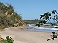
Trinidad
- Area
- 4,823 km²
- High point
- 940 m

Isla de la Juventud
- Area
- 2,198 km²
- High point
- 303 m

Martinique
- Area
- 1,089 km²
- High point
- 1,397 m

Margarita Island
- Area
- 952 km²
- High point
- 960 m

Basse-Terre Island
- Area
- 847 km²
- High point
- 1,467 m

Dominica
- Area
- 751 km²
- High point
- 1,447 m

Cayo Romano
- Area
- 750 km²
- High point
- 62 m

Gonâve Island
- Area
- 682 km²
- High point
- 361 m

Saint Lucia
- Area
- 603 km²
- High point
- 950 m

Grande-Terre
- Area
- 593 km²
- High point
- 136 m

Barbados
- Area
- 433 km²
- High point
- 340 m
Curaçao
- Area
- 428 km²
- High point
- 372 m

Cayo Coco
- Area
- 401 km²
- High point
- 16 m

Saint Vincent
- Area
- 344 km²
- High point
- 1,234 m

Grenada
- Area
- 313 km²
- High point
- 840 m

Tobago
- Area
- 300 km²
- High point
- 580 m
Cayo Romano Occidental
- Area
- 294 km²
- High point
- 44 m

Bonaire
- Area
- 272 km²
- High point
- 241 m

Antigua
- Area
- 271 km²
- High point
- 402 m
Saint Kitts and Nevis
- Area
- 269 km²

Saint Croix
- Area
- 217 km²
- High point
- 334 m

Grand Cayman
- Area
- 195 km²
- High point
- 28 m

Aruba
- Area
- 179 km²
- High point
- 188 m

Tortuga
- Area
- 179 km²
- High point
- 459 m

Barbuda
- Area
- 174 km²
- High point
- 43 m

Saint Kitts
- Area
- 168 km²
- High point
- 1,156 m

Marie-Galante
- Area
- 159 km²
- High point
- 204 m

La Tortuga Island
- Area
- 152 km²
- High point
- 48 m

Vieques
- Area
- 133 km²
- High point
- 281 m
Cayo Guajaba
- Area
- 119 km²
- High point
- 50 m

Saona Island
- Area
- 108 km²
- High point
- 38 m
Unnamed island
- Area
- 106 km²
- High point
- 10 m

Montserrat
- Area
- 103 km²
- High point
- 915 m

Nevis
- Area
- 93.8 km²
- High point
- 960 m
Cayo Fragoso
- Area
- 89 km²
- High point
- 11 m
Cayo Grande
- Area
- 83.3 km²
- High point
- 15 m
Cayo Piedra del Obispo
- Area
- 80.2 km²
- High point
- 12 m

Saint Martin
- Area
- 72.7 km²
- High point
- 418 m

Anguilla
- Area
- 72.1 km²
- High point
- 73 m

Saint Thomas
- Area
- 71.3 km²
- High point
- 474 m

La Blanquilla Island
- Area
- 64.4 km²
- High point
- 46 m
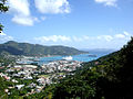
Tortola
- Area
- 56.5 km²
- High point
- 521 m

Isla de Mona
- Area
- 55.3 km²
- High point
- 92 m

Coche Island
- Area
- 55.1 km²
- High point
- 67 m

Saint John
- Area
- 49.7 km²
- High point
- 377 m
Grande Cayemite
- Area
- 48.9 km²
- High point
- 239 m
Cayos de la Virazón
- Area
- 48.6 km²
- High point
- 15 m

Île-à-Vache
- Area
- 45.7 km²
- High point
- 74 m

La Orchila Island
- Area
- 42.8 km²
- High point
- 132 m
Cayos de las Cinco Leguas
- Area
- 42.1 km²
- High point
- 11 m

Beata Island
- Area
- 41.3 km²
- High point
- 84 m
Cayo Cruz del Padre
- Area
- 40.1 km²
- High point
- 12 m

Anegada
- Area
- 39.9 km²
- High point
- 13 m

Cayman Brac
- Area
- 38.6 km²
- High point
- 43 m

Cayo Largo del Sur
- Area
- 37 km²
- High point
- 14 m

Carriacou
- Area
- 32.1 km²
- High point
- 291 m

Little Cayman
- Area
- 28.6 km²
- High point
- 18 m

Culebra
- Area
- 26.8 km²
- High point
- 185 m
Cayos Dromedarios
- Area
- 25.9 km²
- High point
- 11 m
Cayo Cruz
- Area
- 25 km²
- High point
- 9 m

Cubagua Island
- Area
- 24.5 km²
- High point
- 56 m

Virgin Gorda
- Area
- 21.9 km²
- High point
- 414 m
Cayo Santa María
- Area
- 21.5 km²
- High point
- 20 m
Unnamed island
- Area
- 21.1 km²
- High point
- 12 m

Sint Eustatius
- Area
- 20.9 km²
- High point
- 600 m
Gresquí
- Area
- 20.3 km²
- High point
- 20 m

La Désirade
- Area
- 19.7 km²
- High point
- 279 m
Saint Barthelemy
- Area
- 19.2 km²
- High point
- 286 m
Cayo del Rosario
- Area
- 18.2 km²
- High point
- 12 m
Cayo Cantiles
- Area
- 17.1 km²
- High point
- 10 m

Cayo Guillermo
- Area
- 16.4 km²
- High point
- 15 m
Cayo Blanquizal
- Area
- 16.2 km²
- High point
- 10 m

Bequia
- Area
- 16.1 km²
- High point
- 265 m
Ernst Thälmann Island
- Area
- 14.9 km²
- High point
- 10 m

Saba
- Area
- 13.1 km²
- High point
- 870 m
Cayo Las Picúas
- Area
- 12 km²
- High point
- 9 m
Cayo Cantiles
- Area
- 11.9 km²
- High point
- 10 m
Cayo Esquivel
- Area
- 10.9 km²
- High point
- 13 m
Cayo Paredón Grande
- Area
- 10.5 km²
- High point
- 8 m
Cayo Judas
- Area
- 10.4 km²
- High point
- 10 m
Cayo Diego Pérez
- Area
- 10.1 km²
- High point
- 6 m
Cayo del Macío
- Area
- 9.9 km²
- High point
- 8 m
Cayo Culebra
- Area
- 9.7 km²
- High point
- 11 m
Cayo Las Brujas
- Area
- 9.4 km²
- High point
- 18 m

Catalina Island
- Area
- 9 km²
- High point
- 25 m

Union Island
- Area
- 8.7 km²
- High point
- 304 m
Cayo Campos
- Area
- 8.5 km²
- High point
- 11 m

Jost Van Dyke
- Area
- 8.5 km²
- High point
- 315 m
Lowlands island
- Area
- 8.4 km²
- High point
- 72 m
Cayo Marcos
- Area
- 8.4 km²
- High point
- 10 m
Cayo Mégano Grande
- Area
- 8.4 km²
- High point
- 8 m

Canouan
- Area
- 7.7 km²
- High point
- 232 m
Unnamed island
- Area
- 7.5 km²
- High point
- 7 m
Cayo Matías
- Area
- 7.4 km²
- High point
- 6 m
Cayo Siju
- Area
- 7 km²
- High point
- 11 m
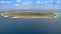
Klein Bonaire
- Area
- 6.9 km²
- High point
- 7 m
Cayo de Buenavista
- Area
- 6.8 km²
- High point
- 11 m

Terre-de-Bas Island
- Area
- 6.8 km²
- High point
- 293 m
Unnamed island
- Area
- 6.7 km²
Unnamed island
- Area
- 6.5 km²
- High point
- 7 m
Cayo San Juan
- Area
- 6.4 km²
- High point
- 4 m
Cayo Francés
- Area
- 6.2 km²
- High point
- 25 m
Cayo La Potala
- Area
- 6.1 km²
- High point
- 14 m
Unnamed island
- Area
- 6 km²
- High point
- 12 m
Cayo El Sapo
- Area
- 5.7 km²
- High point
- 8 m
Cayo Versagua
- Area
- 5.6 km²
- High point
- 13 m

Mustique
- Area
- 5.6 km²
- High point
- 144 m
Cayo Lucas
- Area
- 5.4 km²
- High point
- 28 m
Unnamed island
- Area
- 5.1 km²
- High point
- 6 m
Cayo Las Loras
- Area
- 4.8 km²
- High point
- 10 m
Cayos Pajonal
- Area
- 4.7 km²
- High point
- 8 m
Cayo Rancho de Cándido
- Area
- 4.7 km²
- High point
- 7 m

Navassa Island
- Area
- 4.7 km²
- High point
- 76 m
Cayo Coco
- Area
- 4.6 km²
- High point
- 11 m

Terre-de-Haut Island
- Area
- 4.5 km²
- High point
- 309 m
Isla Testigo Grande
- Area
- 4.4 km²
- High point
- 243 m
Monos Island
- Area
- 4.4 km²
- High point
- 288 m
Unnamed island
- Area
- 4.3 km²
- High point
- 12 m
Cayo Blanco
- Area
- 4.3 km²
- High point
- 11 m
Peter Island
- Area
- 4.3 km²
- High point
- 160 m
Unnamed island
- Area
- 4.3 km²
- High point
- 11 m
Cayo Ines de Soto
- Area
- 4.1 km²
- High point
- 11 m
Cayos Bocas de Alonso
- Area
- 4.1 km²
- High point
- 6 m
Cayo Iguana
- Area
- 4.1 km²
- High point
- 12 m

Chacachacare
- Area
- 4 km²
- High point
- 239 m
Beef Island
- Area
- 4 km²
- High point
- 210 m
Cayo Grande
- Area
- 4 km²
- High point
- 5 m
Unnamed island
- Area
- 3.8 km²
- High point
- 8 m
Unnamed island
- Area
- 3.7 km²
- High point
- 6 m
Unnamed island
- Area
- 3.6 km²
- High point
- 7 m
Unnamed island
- Area
- 3.5 km²
- High point
- 8 m
Cayo Alacrán Grande
- Area
- 3.5 km²
- High point
- 9 m

Scrub Island
- Area
- 3.5 km²
- High point
- 24 m
Grosse Caye
- Area
- 3.5 km²
- High point
- 135 m
Unnamed island
- Area
- 3.4 km²
- High point
- 15 m
Unnamed island
- Area
- 3.4 km²
- High point
- 2 m
Cayo Guzmán
- Area
- 3.4 km²
- High point
- 11 m
Cayo Boca Ciega
- Area
- 3.4 km²
- High point
- 8 m
Great Camanoe
- Area
- 3.3 km²
- High point
- 169 m
Unnamed island
- Area
- 3.3 km²
- High point
- 2 m
Cayo Flamenco
- Area
- 3.3 km²
- High point
- 8 m
Cayo Punta Iguana
- Area
- 3.2 km²
- High point
- 7 m
Cayo Mariposa
- Area
- 3.2 km²
- High point
- 10 m
Cayo Las Pasas
- Area
- 3.2 km²
- High point
- 7 m
Unnamed island
- Area
- 3.2 km²
- High point
- 2 m
Cayos Los Indios
- Area
- 3.2 km²
- High point
- 8 m
Cayo Hachuela
- Area
- 3 km²
- High point
- 9 m
Cayo Redondo
- Area
- 3 km²
- High point
- 6 m
Cayo del Navio
- Area
- 3 km²
- High point
- 4 m
Cayo Rapado Grande
- Area
- 3 km²
- High point
- 12 m
Cayo Palma
- Area
- 3 km²
- High point
- 7 m
Cayo Hicacos
- Area
- 3 km²
- High point
- 7 m
Cayo Pueblo Viejo
- Area
- 3 km²
- High point
- 13 m

Guana Island
- Area
- 3 km²
- High point
- 242 m
Cayeria Las Cayamas
- Area
- 2.9 km²
- High point
- 8 m
Cayo Jutías
- Area
- 2.7 km²
- High point
- 9 m
Cayo Conuco
- Area
- 2.7 km²
- High point
- 24 m

San Juan Islet
- Area
- 2.6 km²
- High point
- 44 m
Isla Larga
- Area
- 2.6 km²
- High point
- 13 m
Cayo Nuevitas
- Area
- 2.6 km²
- High point
- 6 m
Unnamed island
- Area
- 2.5 km²
- High point
- 5 m

Ronde Island
- Area
- 2.5 km²
- High point
- 153 m

Norman Island
- Area
- 2.5 km²
- High point
- 129 m
Cayo La Aguada
- Area
- 2.5 km²
- High point
- 16 m
Unnamed island
- Area
- 2.4 km²
- High point
- 5 m
Cayo Coco
- Area
- 2.4 km²
- High point
- 8 m
Unnamed island
- Area
- 2.4 km²
- High point
- 11 m
Unnamed island
- Area
- 2.3 km²
- High point
- 10 m
Islas de Mangles
- Area
- 2.3 km²
- High point
- 7 m
Unnamed island
- Area
- 2.3 km²
- High point
- 7 m
Cayo del Pasaje
- Area
- 2.3 km²
- High point
- 5 m
Cayo Punta Tierra del Guzmán
- Area
- 2.3 km²
- High point
- 7 m
Cayos de la Manteca
- Area
- 2.3 km²
- High point
- 5 m
Unnamed island
- Area
- 2.2 km²
- High point
- 8 m
Cayo Moa Grande
- Area
- 2.2 km²
- High point
- 10 m
Cayo Matahambre
- Area
- 2.2 km²
- High point
- 6 m
Cayo Cuchillo
- Area
- 2.2 km²
- High point
- 25 m
Cayo del Cristo
- Area
- 2.2 km²
- High point
- 10 m
Cayos de la Enfermería
- Area
- 2.2 km²
- High point
- 12 m
Unnamed island
- Area
- 2.1 km²
- High point
- 5 m
Unnamed island
- Area
- 2.1 km²
- High point
- 10 m
Cayo Mal País
- Area
- 2.1 km²
- High point
- 9 m
Unnamed island
- Area
- 2.1 km²
- High point
- 5 m
Cayo Cuarto
- Area
- 2.1 km²
- High point
- 9 m
Cayo Juan Ruíz
- Area
- 2.1 km²
- High point
- 9 m

Petite Martinique
- Area
- 2 km²
- High point
- 195 m
Cayo Tio Joaquin
- Area
- 2 km²
- High point
- 5 m
Islas Las Aves Sotavento
- Area
- 2 km²
- High point
- 13 m

Water Island
- Area
- 2 km²
- High point
- 74 m

Hans Lollik Island
- Area
- 2 km²
- High point
- 212 m
Dog Island
- Area
- 1.9 km²
- High point
- 28 m
Guiana Island
- Area
- 1.9 km²
- High point
- 16 m
Cayos Aguardiente
- Area
- 1.9 km²
- High point
- 8 m
Cayo Tablones
- Area
- 1.9 km²
- High point
- 6 m
Unnamed island
- Area
- 1.9 km²
- High point
- 10 m
Cayo Guao
- Area
- 1.9 km²
- High point
- 5 m
Rocks & skerries
On the chart above, at its closest zooms.
Listing 200 of 7119; the rest are on the chart.
Figures
Comparative heights
- Hispaniola: 3,098 m
- Jamaica: 2,256 m
- Cuba: 1,974 m
- Basse-Terre: 1,467 m
- Dominica: 1,447 m
- Martinique: 1,397 m
- Island of Puerto Rico: 1,328 m
- Saint Vincent: 1,234 m
- Saint Kitts: 1,156 m
- Margarita: 960 m
- Nevis: 960 m
- Saint Lucia: 950 m
- Trinidad: 940 m
- Montserrat: 915 m
To the same scale
Islands by area
Groups within
Photographs

From Basil's Bar - Moustique - Grenadines

Petit Nevis

Petit Nevis

Остров Антигуа в группе Малых Антильских островов.

Frontispice "Orage aux Antilles" et page de titre du volume septième de Histoire des deux Indes, J.-L. Pellet, Genève, 1780.

Maria l'Antillaise ("Maria the West Indian", believed to likely be Maria Martínez[1]) holding a fan. Albumen print from a glass negative, 23.8 x 19.4 cm

Maria l'Antillaise ("Maria the West Indian", believed to likely be Maria Martínez[1]) holding a fan. Albumen print from a glass negative, 23.8 x 19.4 cm

Chantal Loïal, donnant des cours de danse aux Antilles-Guyane

Ordonnance du roi du 17 avril 1825 qui concède aux Habitans actuels de la partie française de Saint Domingue l'indépendance pleine et entière de leur Gouvernement aux conditions exprimées dans ladite Ordonnance

Schwarze Putti mit Kolonialwaren, Ausschnitt aus Seite I von Nikolaus Joseph Jacquin: Selectarum stirpium Americanarum historia, Wien 1763

Indigene als Edle Wilde, Ausschnitt aus dem Titelbild von Nikolaus Joseph von Jacquin: Selectarum stirpium Americanarum historia, Wien 1763
Sources
Facts
Photographs
- From Basil's Bar - Moustique - Grenadines - panoramio. cazah / CC BY 3.0
- Petit Nevis - panoramio. cazah / CC BY 3.0
- Petit Nevis - panoramio (1). cazah / CC BY 3.0
- Остров Антигуа в группе Малых Антильских островов.. Erudit22 / CC BY-SA 4.0
- Saint-Barths-Bucket-Regatta-typo. Rundvald / CC BY-SA 4.0
- Raynal histoire des deux Indes Frontispice t7. Guillaume Thomas François Raynal / Public domain
- Maria l'Antillaise, tenant un éventail - Nadar - Original. Nadar / Public domain
- Maria l'Antillaise, tenant un éventail - Nadar. Nadar / Adam Cuerden / Public domain
- Chantal Loïal 1 ©Peggy Fargues. Difé Kako / CC BY-SA 4.0
- Ordonnance du 17 avril 1825 qui concède l'indépendance aux Habitans actuels de la partie française de Saint-Domingue. Ambre Troizat / CC BY-SA 4.0
- Nicolai Josephi Jacquin Selectarum stirpium Americanarum historia Seite I Ausschnitt. Nikolaus Ludwig Jacquin / Public domain
- Nicolai Josephi Jacquin Selectarum stirpium Americanarum historia Titelbild Ausschnitt. Nicolás Joseph Jacquin / Public domain