Caribbean SeaCuba, Dominican Republic, Jamaica, United States, Trinidad & Tobago, Bahamas, France, Venezuela, Dominica, Haiti, St. Lucia, Barbados, Netherlands, St. Vincent & Grenadines, Grenada, Turks & Caicos Islands, Antigua & Barbuda, Cayman Islands, St. Kitts & Nevis, Montserrat, Anguilla, British Virgin Islands and Nicaragua
15°00′N 73°00′W
Caribbean
The Caribbean is a geo-political region in the middle of the Americas centered around the Caribbean Sea in the North Atlantic Ocean, mostly overlapping with the West Indies.

Chart
Overview
The Caribbean is a geo-political region in the middle of the Americas centered around the Caribbean Sea in the North Atlantic Ocean, mostly overlapping with the West Indies. Bordered by North America to the north and also the west through Central America, and South America to the south, it comprises numerous islands, cays, islets, reefs, and banks. It includes the Lucayan Archipelago and Antilles of the west Indies; the Quintana Roo islands and Belizean islands of the Yucatán Peninsula; and the Bay Islands, Miskito Cays, Archipelago of San Andrés, Providencia and Santa Catalina, Corn Islands, and San Blas Islands of Central America. It also includes the coastal areas on the continental mainland of the Americas bordering the region from the Yucatán Peninsula in North America through Central America to the Guianas in South America.
From Wikipedia, CC BY-SA 4.0
Census, cataloged
- Major islands4
- Minor islands2,145
- Islets7,946
- Rocks & skerries4,774
Major islands
Hispaniola
- Area
- 73,990 km²
- High point
- 3,098 m
Hispaniola is an island in the Greater Antilles of the Caribbean, located between Cuba and Puerto Rico. It is the most populous island in the West Indies and the second-largest by land area, after Cuba.

Cuba
- Area
- 109,884 km²
Cuba, officially the Republic of Cuba, is an island country in the Caribbean. It comprises the eponymous main island as well as 4,195 islands, islets, and cays.
Cuba
- Area
- 105,261 km²
- High point
- 1,974 m
Cuba is an island nation in the Caribbean Sea. It comprises an archipelago of islands centred upon the geographic coordinates 21°3N, 80°00W. Cuba is the principal island, surrounded by four main archipelagos: the Colorados, the Sabana-Camagüey, the Jardines de la Reina and the Canarreos.
Haiti
- Area
- 27,750 km²
Haiti, officially the Republic of Haiti, is a country in the Caribbean on the island of Hispaniola in the Caribbean Sea, east of Cuba and Jamaica and south of The Bahamas. It occupies the western side of the island, which it shares with the Dominican Republic. 4 million, it is the most populous Caribbean country.
Minor islands

Jamaica
- Area
- 10,962 km²
- High point
- 2,256 m

Island of Puerto Rico
- Area
- 8,703 km²
- High point
- 1,328 m
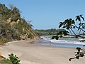
Trinidad
- Area
- 4,823 km²
- High point
- 940 m
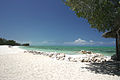
North Andros Island
- Area
- 3,323 km²
- High point
- 24 m

Isla de la Juventud
- Area
- 2,198 km²
- High point
- 303 m

Great Inagua
- Area
- 1,541 km²
- High point
- 33 m

Martinique
- Area
- 1,089 km²
- High point
- 1,397 m

Great Abaco
- Area
- 1,074 km²
- High point
- 40 m

Margarita Island
- Area
- 952 km²
- High point
- 960 m

Basse-Terre Island
- Area
- 847 km²
- High point
- 1,467 m

Dominica
- Area
- 751 km²
- High point
- 1,447 m

Cayo Romano
- Area
- 750 km²
- High point
- 62 m

Gonâve Island
- Area
- 682 km²
- High point
- 361 m

Grand Bahama
- Area
- 671 km²
- High point
- 18 m

Saint Lucia
- Area
- 603 km²
- High point
- 950 m

Grande-Terre
- Area
- 593 km²
- High point
- 136 m
Mangrove Cay
- Area
- 568 km²
- High point
- 35 m

Acklins
- Area
- 434 km²
- High point
- 41 m

Barbados
- Area
- 433 km²
- High point
- 340 m
Curaçao
- Area
- 428 km²
- High point
- 372 m

Eleuthera
- Area
- 416 km²
- High point
- 58 m
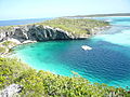
Long Island
- Area
- 405 km²
- High point
- 31 m

Cayo Coco
- Area
- 401 km²
- High point
- 16 m

Saint Vincent
- Area
- 344 km²
- High point
- 1,234 m

Cat Island
- Area
- 338 km²
- High point
- 63 m

Grenada
- Area
- 313 km²
- High point
- 840 m

Tobago
- Area
- 300 km²
- High point
- 580 m
Cayo Romano Occidental
- Area
- 294 km²
- High point
- 44 m

Middle Caicos
- Area
- 284 km²
- High point
- 43 m

Mayaguana
- Area
- 283 km²
- High point
- 39 m

Bonaire
- Area
- 272 km²
- High point
- 241 m

Antigua
- Area
- 271 km²
- High point
- 402 m
Saint Kitts and Nevis
- Area
- 269 km²

Crooked Island
- Area
- 263 km²
- High point
- 48 m

Saint Croix
- Area
- 217 km²
- High point
- 334 m

New Providence
- Area
- 213 km²
- High point
- 39 m
North Caicos
- Area
- 205 km²
- High point
- 31 m
Middle Bight Cay
- Area
- 198 km²
- High point
- 34 m

Grand Cayman
- Area
- 195 km²
- High point
- 28 m
East Caicos
- Area
- 194 km²
- High point
- 45 m
West Grand Bahama
- Area
- 189 km²
- High point
- 32 m

Aruba
- Area
- 179 km²
- High point
- 188 m

Tortuga
- Area
- 179 km²
- High point
- 459 m

Barbuda
- Area
- 174 km²
- High point
- 43 m

Saint Kitts
- Area
- 168 km²
- High point
- 1,156 m

Marie-Galante
- Area
- 159 km²
- High point
- 204 m

San Salvador Island
- Area
- 155 km²
- High point
- 40 m

La Tortuga Island
- Area
- 152 km²
- High point
- 48 m

Great Exuma
- Area
- 143 km²
- High point
- 38 m

Vieques
- Area
- 133 km²
- High point
- 281 m
Little Inagua
- Area
- 130 km²
- High point
- 29 m
Unnamed island
- Area
- 125 km²
- High point
- 21 m
Cayo Guajaba
- Area
- 119 km²
- High point
- 50 m

Providenciales
- Area
- 116 km²
- High point
- 48 m

Saona Island
- Area
- 108 km²
- High point
- 38 m
Unnamed island
- Area
- 106 km²
- High point
- 10 m

Montserrat
- Area
- 103 km²
- High point
- 915 m
Unnamed island
- Area
- 101 km²
- High point
- 13 m

Nevis
- Area
- 93.8 km²
- High point
- 960 m
Cayo Fragoso
- Area
- 89 km²
- High point
- 11 m
Cayo Grande
- Area
- 83.3 km²
- High point
- 15 m
Cayo Piedra del Obispo
- Area
- 80.2 km²
- High point
- 12 m
Rum Cay
- Area
- 76.7 km²
- High point
- 40 m

Saint Martin
- Area
- 72.7 km²
- High point
- 418 m

Anguilla
- Area
- 72.1 km²
- High point
- 73 m

Saint Thomas
- Area
- 71.3 km²
- High point
- 474 m
Unnamed island
- Area
- 71 km²
- High point
- 7 m

La Blanquilla Island
- Area
- 64.4 km²
- High point
- 46 m
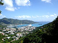
Tortola
- Area
- 56.5 km²
- High point
- 521 m

Isla de Mona
- Area
- 55.3 km²
- High point
- 92 m

Coche Island
- Area
- 55.1 km²
- High point
- 67 m
Little Abaco
- Area
- 54.9 km²
- High point
- 22 m

Saint John
- Area
- 49.7 km²
- High point
- 377 m
Grande Cayemite
- Area
- 48.9 km²
- High point
- 239 m
Cayos de la Virazón
- Area
- 48.6 km²
- High point
- 15 m
Big Wood Cay
- Area
- 47.8 km²
- High point
- 19 m

Île-à-Vache
- Area
- 45.7 km²
- High point
- 74 m

La Orchila Island
- Area
- 42.8 km²
- High point
- 132 m
Cayos de las Cinco Leguas
- Area
- 42.1 km²
- High point
- 11 m
Unnamed island
- Area
- 41.8 km²
- High point
- 7 m

Beata Island
- Area
- 41.3 km²
- High point
- 84 m
Cayo Cruz del Padre
- Area
- 40.1 km²
- High point
- 12 m

Anegada
- Area
- 39.9 km²
- High point
- 13 m

Cayman Brac
- Area
- 38.6 km²
- High point
- 43 m

Cayo Largo del Sur
- Area
- 37 km²
- High point
- 14 m
Unnamed island
- Area
- 33.3 km²
- High point
- 7 m

Samana Cay
- Area
- 33.2 km²
- High point
- 26 m

Carriacou
- Area
- 32.1 km²
- High point
- 291 m
Unnamed island
- Area
- 31.2 km²
- High point
- 28 m

Little Cayman
- Area
- 28.6 km²
- High point
- 18 m

Culebra
- Area
- 26.8 km²
- High point
- 185 m
Cayos Dromedarios
- Area
- 25.9 km²
- High point
- 11 m
Yellow Cay
- Area
- 25.4 km²
- High point
- 10 m
Cayo Cruz
- Area
- 25 km²
- High point
- 9 m

Cubagua Island
- Area
- 24.5 km²
- High point
- 56 m
Unnamed island
- Area
- 24.3 km²
- High point
- 8 m
Little Exuma Island
- Area
- 23.8 km²
- High point
- 27 m
West Caicos
- Area
- 22.9 km²
- High point
- 19 m
Long Cay
- Area
- 22.8 km²
- High point
- 31 m

Virgin Gorda
- Area
- 21.9 km²
- High point
- 414 m
Cayo Santa María
- Area
- 21.5 km²
- High point
- 20 m
Unnamed island
- Area
- 21.1 km²
- High point
- 12 m

South Caicos
- Area
- 21.1 km²
- High point
- 47 m

Sint Eustatius
- Area
- 20.9 km²
- High point
- 600 m
Great Harbour Cay
- Area
- 20.8 km²
- High point
- 26 m
Gresquí
- Area
- 20.3 km²
- High point
- 20 m

La Désirade
- Area
- 19.7 km²
- High point
- 279 m
Saint Barthelemy
- Area
- 19.2 km²
- High point
- 286 m
Cayo del Rosario
- Area
- 18.2 km²
- High point
- 12 m

Grand Turk Island
- Area
- 18.2 km²
- High point
- 30 m
Unnamed island
- Area
- 18.1 km²
- High point
- 5 m
Unnamed island
- Area
- 18 km²
- High point
- 13 m
Unnamed island
- Area
- 17.4 km²
- High point
- 3 m
Cayo Cantiles
- Area
- 17.1 km²
- High point
- 10 m
Unnamed island
- Area
- 16.7 km²
- High point
- 19 m
Moore's Island
- Area
- 16.5 km²
- High point
- 27 m

Cayo Guillermo
- Area
- 16.4 km²
- High point
- 15 m
Cayo Blanquizal
- Area
- 16.2 km²
- High point
- 10 m

Bequia
- Area
- 16.1 km²
- High point
- 265 m
Ernst Thälmann Island
- Area
- 14.9 km²
- High point
- 10 m
Linder Cay
- Area
- 14.5 km²
- High point
- 9 m
Pine Cay
- Area
- 14.4 km²
- High point
- 10 m
Williams Island
- Area
- 13.8 km²
- High point
- 5 m

Saba
- Area
- 13.1 km²
- High point
- 870 m
Unnamed island
- Area
- 12.8 km²
- High point
- 9 m
Lightbourn's Cay
- Area
- 12.1 km²
- High point
- 6 m
Cayo Las Picúas
- Area
- 12 km²
- High point
- 9 m
Cayo Cantiles
- Area
- 11.9 km²
- High point
- 10 m
Great Guana Cay
- Area
- 11.9 km²
- High point
- 35 m
Barraterre Island
- Area
- 11 km²
- High point
- 22 m
Cayo Esquivel
- Area
- 10.9 km²
- High point
- 13 m
Cayo Paredón Grande
- Area
- 10.5 km²
- High point
- 8 m
North Bimini
- Area
- 10.4 km²
- High point
- 21 m
Cayo Judas
- Area
- 10.4 km²
- High point
- 10 m
Cayo Diego Pérez
- Area
- 10.1 km²
- High point
- 6 m
Cayo del Macío
- Area
- 9.9 km²
- High point
- 8 m
Cayo Culebra
- Area
- 9.7 km²
- High point
- 11 m
Unnamed island
- Area
- 9.5 km²
- High point
- 10 m
Unnamed island
- Area
- 9.4 km²
- High point
- 7 m
Cayo Las Brujas
- Area
- 9.4 km²
- High point
- 18 m

Catalina Island
- Area
- 9 km²
- High point
- 25 m
Current Island
- Area
- 9 km²
- High point
- 20 m
Unnamed island
- Area
- 8.7 km²
- High point
- 3 m

Union Island
- Area
- 8.7 km²
- High point
- 304 m
Plana Cays
- Area
- 8.6 km²
- High point
- 18 m
Big Harbour Cay
- Area
- 8.6 km²
- High point
- 10 m
Cayo Campos
- Area
- 8.5 km²
- High point
- 11 m

Jost Van Dyke
- Area
- 8.5 km²
- High point
- 315 m
Lowlands island
- Area
- 8.4 km²
- High point
- 72 m
Cayo Marcos
- Area
- 8.4 km²
- High point
- 10 m

Ragged Island
- Area
- 8.4 km²
- High point
- 32 m
Cayo Mégano Grande
- Area
- 8.4 km²
- High point
- 8 m
Conception Island
- Area
- 8.4 km²
- High point
- 20 m
August Cay
- Area
- 8.2 km²
- High point
- 8 m
Unnamed island
- Area
- 8.2 km²
- High point
- 4 m
Sweetings Cay
- Area
- 8 km²
- High point
- 8 m
South Bimini
- Area
- 7.9 km²
- High point
- 21 m

Canouan
- Area
- 7.7 km²
- High point
- 232 m
Unnamed island
- Area
- 7.5 km²
- High point
- 7 m
Cayo Matías
- Area
- 7.4 km²
- High point
- 6 m
Cayo Siju
- Area
- 7 km²
- High point
- 11 m
Plana Cays
- Area
- 7 km²
- High point
- 20 m
Unnamed island
- Area
- 7 km²
- High point
- 4 m

Little San Salvador Island
- Area
- 7 km²
- High point
- 27 m
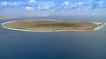
Klein Bonaire
- Area
- 6.9 km²
- High point
- 7 m
Cayo de Buenavista
- Area
- 6.8 km²
- High point
- 11 m

Terre-de-Bas Island
- Area
- 6.8 km²
- High point
- 293 m
Unnamed island
- Area
- 6.7 km²

Salt Cay
- Area
- 6.7 km²
- High point
- 19 m
Little Ambergris Cay
- Area
- 6.6 km²
- High point
- 5 m
Unnamed island
- Area
- 6.5 km²
- High point
- 7 m
Cayo San Juan
- Area
- 6.4 km²
- High point
- 4 m
Great Sale Cay
- Area
- 6.4 km²
- High point
- 8 m
Unnamed island
- Area
- 6.4 km²
- High point
- 14 m
Unnamed island
- Area
- 6.3 km²
- High point
- 2 m
Cayo Francés
- Area
- 6.2 km²
- High point
- 25 m
Cayo La Potala
- Area
- 6.1 km²
- High point
- 14 m
Unnamed island
- Area
- 6 km²
- High point
- 9 m
Unnamed island
- Area
- 6 km²
- High point
- 12 m
Unnamed island
- Area
- 5.9 km²
- High point
- 5 m
Little Harbour Cay
- Area
- 5.8 km²
- High point
- 9 m
Cayo El Sapo
- Area
- 5.7 km²
- High point
- 8 m
Parrot Cay
- Area
- 5.7 km²
- High point
- 19 m
McLean's Town Cay
- Area
- 5.6 km²
- High point
- 8 m
Unnamed island
- Area
- 5.6 km²
- High point
- 3 m
Cayo Versagua
- Area
- 5.6 km²
- High point
- 13 m

Mustique
- Area
- 5.6 km²
- High point
- 144 m
Cayo Lucas
- Area
- 5.4 km²
- High point
- 28 m
High Ridge Cay
- Area
- 5.3 km²
- High point
- 9 m
Unnamed island
- Area
- 5.3 km²
- High point
- 4 m
Unnamed island
- Area
- 5.2 km²
- High point
- 100 m
Unnamed island
- Area
- 5.1 km²
- High point
- 5 m
Unnamed island
- Area
- 5.1 km²
- High point
- 6 m
Unnamed island
- Area
- 5 km²
- High point
- 9 m
Chub Cay & Fraziers Hog Cay
- Area
- 4.8 km²
- High point
- 14 m
Cayo Las Loras
- Area
- 4.8 km²
- High point
- 10 m
Rocks & skerries
On the chart above, at its closest zooms.
Listing 200 of 14869; the rest are on the chart.
Figures
Comparative heights
- Hispaniola: 3,098 m
- Jamaica: 2,256 m
- Cuba: 1,974 m
- Basse-Terre: 1,467 m
- Dominica: 1,447 m
- Martinique: 1,397 m
- Island of Puerto Rico: 1,328 m
- Saint Vincent: 1,234 m
- Saint Kitts: 1,156 m
- Margarita: 960 m
- Nevis: 960 m
- Saint Lucia: 950 m
- Trinidad: 940 m
- Montserrat: 915 m
To the same scale
Islands by area
Groups within
Photographs

The lookout beside the Castillo de San Felipe del Morro, Old San Juan, PR

Rainforest on Island of St. Lucia in Caribbean

Groove Masters, Jouve Morning, San Nicolas 2025

Groove Masters, Jouve Morning, San Nicolas 2025

Rainforest on Island of St. Lucia in Caribbean; closeup of palm tree root cluster

Taken during a Cruise excursion

Grab hopper dredger (owned / operated by?) Santaella Estructuras Submarinas

Taken somewhere in the Caribbean

Tropical miniature landscape.

Rare view of the Cacique range - Tradewinds Trail - El Toro Wilderness - before Hurricane Maria - Nikon Image

In the Tradewinds Trail - the cloud forest, before Hurricane Maria. Nikon image.

Taken at Granpa's House in Mamiku Gardens
Sources
Facts
Photographs
- Lookout near el Morro, Old San Juan, PR. Ktorrespr / CC BY-SA 4.0
- Rainforest ST Lucia 2012 01 0760. Paul Harrison / CC BY-SA 4.0
- Groove Masters, Jouve Morning, San Nicolas 2025 - 2. Ginelly.Q / CC0
- Jouve Morning, San Nicolas 2025. Ginelly.Q / CC0
- Rainforest St. Lucia Palm Tree Roots 0869. Paul Harrison / CC BY-SA 4.0
- RANFOREST DOMINICA 6435. Paul Harrison / CC BY-SA 4.0
- Santamar 222 Aruba 0579. ImagePerson / CC0
- Tropical Beach Shells 0136. ImagePerson / CC BY-SA 4.0
- West Indian cherry Malpighia emarginata aloe st maarten. Paul Harrison / CC BY-SA 4.0
- YUNQUE PR 2013 RAIN FOREST 1483. RaulGarcia271828 / CC BY-SA 4.0
- YUNQUE PR 2013 RAIN FOREST. RaulGarcia271828 / CC BY-SA 4.0
- Kalanchoe pinnata St Lucia 0459. ImagePerson / CC0