North East Island
Severovýchodní ostrov
48°01′S 166°36′E
North East Island is the main island of the Snares Islands / Tini Heke, located approximately 100 kilometres (62 mi) southwest of Stewart Island / Rakiura, the southernmost of New Zealand's main islands. 6 mi) long by wide. Off the South Promontory lies Broughton Island, the second largest island in the group.

Terrain
48°01′S 166°36′E
Overview
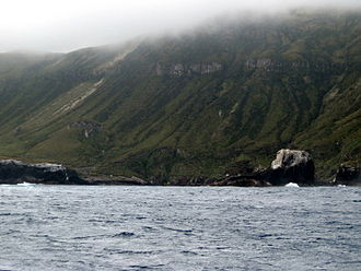
North East Island is the main island of the Snares Islands / Tini Heke, located approximately 100 kilometres (62 mi) southwest of Stewart Island / Rakiura, the southernmost of New Zealand's main islands. The island forms a central triangle with peninsulas to the north, south and west and is some 3 by 2.5 km (1.9 by 1.6 mi) long by wide. Off the South Promontory lies Broughton Island, the second largest island in the group. Just off the southern coast of the western peninsula lies the islet Alert Stack, while off the North Promontory are the North and South Daption Rocks.
From Wikipedia, CC BY-SA 4.0
Chart
Nearest islands
- Broughton Island2.4 km
- Enderby Island276 km
- Rose Island277 km
- Ewing Island279 km
- Disappointment Island291 km
- Auckland Island298 km
Also in Snares Islands/Tini Heke

Broughton Island
0.39 km²▲ 117 m
Major islands
Also in New Zealand Subantarctic Islands

Auckland Island
459 km²▲ 630 m
Major islands

Campbell Island / Motu Ihupuku
109 km²▲ 569 m
Major islands

Adams Island
96.9 km²▲ 705 m
Major islands
Antipodes Island
20.1 km²▲ 360 m
Minor islands

Enderby Island
7 km²▲ 52 m
Minor islands

Disappointment Island
2.8 km²▲ 442 m
Minor islands
Rose Island
0.8 km²▲ 38 m
Minor islands

Ewing Island
0.58 km²▲ 23 m
Minor islands
Sources
Facts
Photographs
- Snares North East Island. Lawrie Mead at en.wikipedia / Public domain