Rose Island
50°31′S 166°15′E
Rose Island is an uninhabited island and, with an area of 121 hectares, the fifth largest of the Auckland Islands group, a subantarctic chain that forms part of the New Zealand Outlying Islands.
50°31′S 166°15′E
Overview
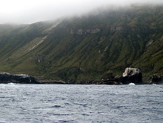
Rose Island is an uninhabited island and, with an area of 121 hectares, the fifth largest of the Auckland Islands group, a subantarctic chain that forms part of the New Zealand Outlying Islands. It is located in the northeast of the group, in the mouth of Port Ross, Auckland Island and south west of the larger Enderby Island. It was stocked with rabbits and provided with a boatshed for the relief of castaways during the nineteenth century. The rabbits have since been eradicated by the Department of Conservation, and provides a secure home for a population of Auckland Islands teal. The vegetation on Rose Island contains southern rātā, and while much original vegetation has been destroyed, it is less modified than much of the Auckland Islands.
From Wikipedia, CC BY-SA 4.0
Chart
Nearest islands
- Ocean Island2.3 km
- Ewing Island4.1 km
- Enderby Island4.2 km
- Auckland Island22 km
- Disappointment Island22 km
- Adams Island44 km
Also in Auckland Islands

Auckland Island
459 km²▲ 630 m
Major islands

Adams Island
96.9 km²▲ 705 m
Major islands

Enderby Island
7 km²▲ 52 m
Minor islands

Disappointment Island
2.8 km²▲ 442 m
Minor islands

Ewing Island
0.58 km²▲ 23 m
Minor islands
Ocean Island
0.12 km²▲ 21 m
Minor islands
Also in New Zealand Subantarctic Islands
Auckland Island
459 km²▲ 630 m
Major islands

Campbell Island / Motu Ihupuku
109 km²▲ 569 m
Major islands
Adams Island
96.9 km²▲ 705 m
Major islands
Antipodes Island
20.1 km²▲ 360 m
Minor islands
Enderby Island
7 km²▲ 52 m
Minor islands
Disappointment Island
2.8 km²▲ 442 m
Minor islands

North East Island
2.8 km²▲ 146 m
Minor islands
Ewing Island
0.58 km²▲ 23 m
Minor islands