New Zealand
50°45′S 166°06′E
New Zealand Subantarctic Islands
The New Zealand Subantarctic Islands comprise the five southernmost groups of the New Zealand outlying islands. They are collectively designated as a UNESCO World Heritage Site.

Chart
Overview
The New Zealand Subantarctic Islands comprise the five southernmost groups of the New Zealand outlying islands. They are collectively designated as a UNESCO World Heritage Site. Most of the islands lie near the southeast edge of the largely submerged continent centred on New Zealand called Zealandia, which was riven from Australia 60–85 million years ago, and from Antarctica 85–130 million years ago. They share some features with Australia's Macquarie Island to the west.
From Wikipedia, CC BY-SA 4.0
Census, cataloged
- Major islands3
- Minor islands13
- Islets218
- Rocks & skerries311
Major islands
Auckland Island
- Area
- 459 km²
- High point
- 630 m
Auckland Island (Māori: Mauka Huka) is the main island of the eponymous uninhabited archipelago in the South Pacific Ocean. It is part of the New Zealand subantarctic area. It is inscribed in the UNESCO World Heritage list together with the other New Zealand Subantarctic Islands in the region.
Campbell Island / Motu Ihupuku
- Area
- 109 km²
- High point
- 569 m
Campbell Island / Motu Ihupuku is an uninhabited subantarctic island of New Zealand, and the main island of the Campbell Island group. The island lies around 660 km (410 mi) south of New Zealand's South Island.
Adams Island
- Area
- 96.9 km²
- High point
- 705 m
Adams Island is the second largest island of New Zealand's Auckland Islands archipelago.

Minor islands

Antipodes Island
- Area
- 20.1 km²
- High point
- 360 m

Enderby Island
- Area
- 7 km²
- High point
- 52 m

Disappointment Island
- Area
- 2.8 km²
- High point
- 442 m
North East Island
- Area
- 2.8 km²
- High point
- 146 m
Rose Island
- Area
- 0.8 km²
- High point
- 38 m

Ewing Island
- Area
- 0.58 km²
- High point
- 23 m

Bollons Island
- Area
- 0.53 km²
- High point
- 195 m

Broughton Island
- Area
- 0.39 km²
- High point
- 117 m

Jacquemart Island
- Area
- 0.23 km²
- High point
- 127 m

Dent Island
- Area
- 0.2 km²
- High point
- 135 m
Depot Island
- Area
- 0.13 km²
- High point
- 39 m
Leeward Island
- Area
- 0.13 km²
Ocean Island
- Area
- 0.12 km²
- High point
- 21 m
Rocks & skerries
On the chart above, at its closest zooms.
Listing 16 of 545; the rest are on the chart.
Figures
Comparative heights
- Adams: 705 m
- Auckland: 630 m
- Campbell Island / Motu Ihupuku: 569 m
- Disappointment: 442 m
- Antipodes: 360 m
- Bollons: 195 m
- North East: 146 m
- Dent: 135 m
- Jacquemart: 127 m
- Broughton: 117 m
- Enderby: 52 m
- Depot: 39 m
- Rose: 38 m
- Ewing: 23 m
To the same scale
Islands by area
| Auckland Island | 459 km² |
| Campbell Island / Motu Ihupuku | 109 km² |
| Adams Island | 96.9 km² |
| Antipodes Island | 20.1 km² |
| Enderby Island | 7 km² |
| Disappointment Island | 2.8 km² |
| North East Island | 2.8 km² |
| Rose Island | 0.8 km² |
| Ewing Island | 0.58 km² |
| Bollons Island | 0.53 km² |
| Broughton Island | 0.39 km² |
| Jacquemart Island | 0.23 km² |
| Dent Island | 0.2 km² |
| Depot Island | 0.13 km² |
| Leeward Island | 0.13 km² |
| Ocean Island | 0.12 km² |
Groups within
Photographs

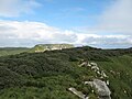
Adams Island - to the right of Carnley Harbour.

Scanned photo of Campbell Island landscape.

Auckland Island Western side - Looking East. Auckland Islands, New Zealand
Sources
Facts
Photographs
- Adams Island, NZ (to the right of Carnley Harbour, 2007). L. Mead & T. Nicklin / Public domain
- Campbell Island Landscape. Albatross2147 at English Wikipedia / Public domain
- Auckland3. L. Mead & T. Nicklin / Public domain
- Campbell Island banner. twiddleblat / CC BY-SA 2.0