Broughton Island
48°03′S 166°37′E
Broughton Island is the second largest island of The Snares, at 48°02′35″S 166°37′15″E. It sits just off the South Promontory of the main island, North East Island, which itself lies approximately 200 kilometres (120 mi) south of New Zealand's South Island.

Terrain
48°03′S 166°37′E
Overview
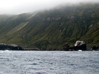
Broughton Island is the second largest island of The Snares, at 48°02′35″S 166°37′15″E. It sits just off the South Promontory of the main island, North East Island, which itself lies approximately 200 kilometres (120 mi) south of New Zealand's South Island. The island is some 1 by 0.5 km (0.62 by 0.31 mi) in size, with the main axis running northeast to southwest, and the highest elevation is 86 m (282 ft). The island is named after William Robert Broughton.
From Wikipedia, CC BY-SA 4.0
Chart
Nearest islands
- North East Island2.4 km
- Enderby Island274 km
- Rose Island276 km
- Disappointment Island289 km
- Auckland Island296 km
- Adams Island319 km
Also in Snares Islands/Tini Heke

North East Island
2.8 km²▲ 146 m
Major islands
Also in New Zealand Subantarctic Islands

Auckland Island
459 km²▲ 630 m
Major islands

Campbell Island / Motu Ihupuku
109 km²▲ 569 m
Major islands

Adams Island
96.9 km²▲ 705 m
Major islands
Antipodes Island
20.1 km²▲ 360 m
Minor islands

Enderby Island
7 km²▲ 52 m
Minor islands

Disappointment Island
2.8 km²▲ 442 m
Minor islands
North East Island
2.8 km²▲ 146 m
Minor islands
Rose Island
0.8 km²▲ 38 m
Minor islands
Sources
Facts
Photographs
- Broughton Island 1. L. Mead / CC BY-SA 3.0