Koniuji Island
Tanĝimax
52°13′N 175°08′W
Koniuji Island is one of the Andreanof Islands subgroup of the Aleutian Islands of southwestern Alaska, United States. It lies northwest of Atka Island and east of Kasatochi Island. 37 sq mi (237 acres) and is uninhabited.

Terrain
52°13′N 175°08′W
Overview
Koniuji Island is one of the Andreanof Islands subgroup of the Aleutian Islands of southwestern Alaska, United States. It lies northwest of Atka Island and east of Kasatochi Island. Koniuji Island has a land area of 0.37 sq mi (237 acres) and is uninhabited. The name "Koniuji" is derived from Russian: конюга, romanized: konyuga "auklet", bestowed by Russian sailors in reference to the endemic seabirds. The Aleut name is Tanax̂silĝux̂ "the big made island", in reference to putative recent volcanic activity. Koniuji Island is the emergent top of a mostly submarine stratovolcano. Little is known of the geologic history of this volcano. Reports of recent eruptive activity may be erroneous and are considered to refer to eruptions of Kasatochi volcano to the west. The last eruption of Koniuji Island was around 3,000 years ago, in approximately 1150 BC. On all sides of Koniuji Island except the south and southeast, the shoreline is sheer and precipitous, rising to two sharp summits of 896 feet (273 m) and 790 feet (240 m). The south side of the island, above lower bluffs at the shore, slopes gradually to a ridge about 0.2 miles (0.3 km) north, and drops off again into a ravine that passes through the island at some elevation. The slope up from the south side is grass covered. The northwest end of the island is a low, flat, rocky point about 200 yards (180 m) long. An extensive kelp patch extends from the south of the island. Also, in the summer, heavy kelp is found along and well off the western shore. Compass reading differences of as much as 10° from the normal variation have been observed on Koniuji Island and as much as 7° at a distance of 2 miles (3 km) in all directions around the island. Koniuji Island provides nesting habitat for close to 300,000 seabirds. Around 70% are Fork-tailed Storm-petrels and 17% are Leach's Storm-petrel. There are also large numbers of the Ancient Murrelet and the Whiskered Auklet that nest on Koniuji. These four species breed on Koniuji Island in numbers that exceed 1% of their total global populations. A 1998 survey found these birds on Koniuji during the breeding season:
From Wikipedia, CC BY-SA 4.0
Chart
Nearest islands
- Atka Island49 km
- Great Sitkin Island70 km
- Kagalaska Island97 km
- Amlia103 km
- Adak Island109 km
- Kanaga Island148 km
Also in Shumagin Islands

Unga Island
444 km²▲ 497 m
Major islands
Nagai Island
293 km²▲ 514 m
Major islands

Popof Island
92.2 km²▲ 459 m
Major islands
Big Koniuji Island
89.8 km²▲ 555 m
Major islands
Korovin Island
66.7 km²▲ 552 m
Major islands
Little Koniuji Island
58.2 km²▲ 481 m
Minor islands

Simeonof Island
43.3 km²▲ 427 m
Minor islands
Chernabura Island
30.7 km²▲ 481 m
Minor islands
Also in Andreanof Islands

Atka Island
1,046 km²▲ 1,543 m
Major islands

Adak Island
716 km²▲ 1,196 m
Major islands

Tanaga Island
508 km²▲ 1,804 m
Major islands

Amlia
445 km²▲ 636 m
Major islands

Kanaga Island
359 km²▲ 1,307 m
Major islands

Seguam Island
208 km²▲ 859 m
Major islands

Great Sitkin Island
153 km²▲ 1,740 m
Minor islands
Kagalaska Island
116 km²▲ 472 m
Minor islands
Also in Aleutian Islands

Unimak Island
4,078 km²▲ 2,857 m
Major islands

Unalaska Island
2,711 km²▲ 1,811 m
Major islands

Umnak
1,775 km²▲ 2,103 m
Major islands

Bering Island
1,172 km²▲ 755 m
Major islands
Atka Island
1,046 km²▲ 1,543 m
Major islands

Attu Island
886 km²▲ 898 m
Major islands
Adak Island
716 km²▲ 1,196 m
Major islands
Tanaga Island
508 km²▲ 1,804 m
Major islands
Also in Pacific Islands

New Guinea
774,566 km²▲ 4,884 m
Major islands
Japan
377,974 km²
Major islands
New Zealand
268,021 km²
Major islands

Honshu
227,970 km²▲ 3,776 m
Major islands

Luzon
104,935 km²▲ 2,928 m
Major islands

Mindanao
93,885 km²▲ 2,954 m
Major islands

Hokkaido
77,983 km²▲ 2,291 m
Minor islands

Sakhalin
74,571 km²▲ 1,609 m
Minor islands
Photographs

The view from the top of Little Koniuji Island looking across the Shumagins towards the snow-covered peaks of the Alaska Peninsula. Alaska, Shumagin Islands.

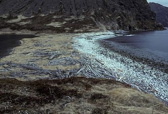
Koniuji Island, Aleutians, Alaska

Hillebrand Steve, U.S. Fish and Wildlife Service / Public domain
Sources
Facts
Photographs
- Line4638 - Flickr - NOAA Photo Library. Ensign Patricia Raymond, NOAA Corps. / Public domain
- KoniujiIsland. Edibobb / CC BY 3.0
- Boat on Shumagins big Koniuji island. Hillebrand Steve, U.S. Fish and Wildlife Service / Public domain