Simeonof Island
54°54′N 159°15′W

Terrain
54°54′N 159°15′W
Chart
Nearest islands
- Little Koniuji Island13 km
- Chernabura Island23 km
- Big Koniuji Island28 km
- Bird Island35 km
- Nagai Island53 km
- Popof Island83 km
Also in Shumagin Islands

Unga Island
444 km²▲ 497 m
Major islands
Nagai Island
293 km²▲ 514 m
Major islands

Popof Island
92.2 km²▲ 459 m
Major islands
Big Koniuji Island
89.8 km²▲ 555 m
Major islands
Korovin Island
66.7 km²▲ 552 m
Major islands
Little Koniuji Island
58.2 km²▲ 481 m
Minor islands
Chernabura Island
30.7 km²▲ 481 m
Minor islands
Bird Island
17.4 km²▲ 406 m
Minor islands
Sources
Facts
- Geometry, areas and high points: OpenStreetMap contributors (ODbL), Copernicus GLO-30, via Talus.
- Talus
- Wikidata
Photographs
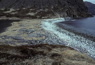
- Simeonof island white bog orchid platanthera dilatata. Hillebrand Steve, U.S. Fish and Wildlife Service / Public domain