Caballo Island
Fort Hughes
14°22′N 120°37′E
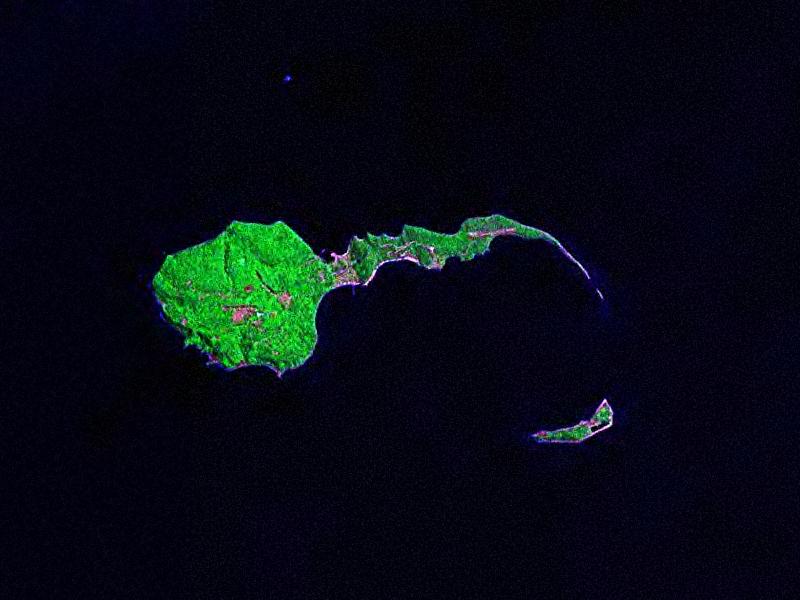
Caballo Island (which means "Horse Island" in Spanish) is a bluff, rocky island located at the entrance to Manila Bay in the Philippines. 75 mi) long with the highest elevation at 381 feet high.
Terrain
14°22′N 120°37′E
Overview
Caballo Island (which means "Horse Island" in Spanish) is a bluff, rocky island located at the entrance to Manila Bay in the Philippines. It is about 1.2 km (0.75 mi) long with the highest elevation at 381 feet high. Caballo, along with the larger Corregidor (2 km to the north), divides the entrance to the bay into two broad and deep channels, known as the North and South Channel. The whole island was formerly occupied by Fort Hughes, a U.S. defense fortification before World War II. It was heavily bombed during the war.
From Wikipedia, CC BY-SA 4.0
Chart
Nearest islands
- Luzon137 km
- Mindoro176 km
- Marinduque Island180 km
- Busuanga Island254 km
- Tablas Island267 km
- Catanduanes399 km
Also in Luzon

Luzon
104,935 km²▲ 2,928 m
Major islands

Palawan
11,346 km²▲ 2,963 m
Major islands

Mindoro
9,824 km²▲ 2,616 m
Minor islands

Masbate Island
3,209 km²▲ 682 m
Minor islands
Catanduanes
1,444 km²▲ 734 m
Minor islands

Busuanga Island
932 km²▲ 620 m
Minor islands
Marinduque Island
900 km²▲ 1,174 m
Minor islands

Tablas Island
671 km²▲ 665 m
Minor islands
Also in Philippines
Luzon
104,935 km²▲ 2,928 m
Major islands

Mindanao
93,885 km²▲ 2,954 m
Major islands

Negros
12,778 km²▲ 2,465 m
Major islands

Samar
12,435 km²▲ 890 m
Major islands

Panay
11,512 km²▲ 2,102 m
Major islands
Palawan
11,346 km²▲ 2,963 m
Major islands
Mindoro
9,824 km²▲ 2,616 m
Minor islands

Leyte
6,997 km²▲ 1,200 m
Minor islands
Also in Malay Archipelago

Borneo
732,069 km²▲ 4,095 m
Major islands

Sumatra
429,717 km²▲ 3,805 m
Major islands

Sulawesi
168,788 km²▲ 3,478 m
Major islands

Java
126,804 km²▲ 3,676 m
Major islands
Luzon
104,935 km²▲ 2,928 m
Major islands
Mindanao
93,885 km²▲ 2,954 m
Major islands

Timor
28,560 km²▲ 2,963 m
Minor islands

Halmahera
17,956 km²▲ 1,571 m
Minor islands
Also in Pacific Islands

New Guinea
774,566 km²▲ 4,884 m
Major islands
Japan
377,974 km²
Major islands
New Zealand
268,021 km²
Major islands

Honshu
227,970 km²▲ 3,776 m
Major islands
Luzon
104,935 km²▲ 2,928 m
Major islands
Mindanao
93,885 km²▲ 2,954 m
Major islands

Hokkaido
77,983 km²▲ 2,291 m
Minor islands

Sakhalin
74,571 km²▲ 1,609 m
Minor islands
Sources
Facts
Photographs
- Corregidor landsat2000. Unknown author / Public domain