Japan
29°00′N 130°00′E
Satsunan Islands
Part of Ryukyu Islands
The Satsunan Islands (薩南諸島, Satsunan-shotō) is a geopolitical name for a group of islands that forms the northern part of the Ryukyu Islands. The whole island group belongs to Kagoshima Prefecture, Japan and has a total population of about 150,000 people.

Chart
Overview
The Satsunan Islands (薩南諸島, Satsunan-shotō) is a geopolitical name for a group of islands that forms the northern part of the Ryukyu Islands. The whole island group belongs to Kagoshima Prefecture, Japan and has a total population of about 150,000 people.
From Wikipedia, CC BY-SA 4.0
Census, cataloged
- Major islands4
- Minor islands30
- Islets359
- Rocks & skerries2,683
Major islands
Amami Ōshima
- Area
- 712 km²
- High point
- 694 m
Amami Ōshima (奄美大島; Japanese pronunciation: [ä̀.mä́.mʲí ó̞ò̞.ɕì.mä̀] Okinawan: Uushima; Amami Ōshima: Ushima), also known as Amami ([ä́.mä̀.mʲì]), is the largest island in the Amami archipelago between Kyūshū and Okinawa. It is one of the Satsunan Islands, all of which belong to Kagoshima Prefecture, Japan.
Yakushima
- Area
- 504 km²
- High point
- 1,936 m
Yakushima (屋久島) is one of the Ōsumi Islands in Kagoshima Prefecture, Japan. The island, 504.88 km2 (194.94 sq mi) in area, has a population of 11,858. It is accessible by hydrofoil ferry, car ferry, or by air to Yakushima Airport.
Tanegashima
- Area
- 445 km²
- High point
- 238 m
ŋä̀-]) is one of the Ōsumi Islands belonging to Kagoshima Prefecture, Japan. 81 sq mi) in area, is the second largest of the Ōsumi Islands, and has a population of 33,000 people. Access to the island is by ferry, or by air to New Tanegashima Airport.
Tokunoshima
- Area
- 248 km²
- High point
- 645 m
Tokunoshima (Japanese: 徳之島; Tokunoshima: Tukunushima), or Tokuno Island, is an island in the Amami archipelago of the southern Satsunan Islands of Kagoshima Prefecture, Japan.


Minor islands

Okinoerabujima
- Area
- 93.5 km²
- High point
- 240 m

Kakeromajima
- Area
- 77.2 km²
- High point
- 326 m

Kikai Island
- Area
- 56.9 km²
- High point
- 63 m

Kuchinoerabu Island
- Area
- 35.8 km²
- High point
- 649 m

Nakanoshima
- Area
- 34.4 km²
- High point
- 979 m

Suwanosejima
- Area
- 27.6 km²
- High point
- 796 m

Yoronjima
- Area
- 20.6 km²
- High point
- 99 m

Kuroshima
- Area
- 15.4 km²
- High point
- 620 m

Uke Island
- Area
- 13.3 km²
- High point
- 398 m

Kuchinoshima
- Area
- 13.3 km²
- High point
- 628 m

Iōjima
- Area
- 11.6 km²
- High point
- 704 m
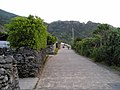
Yoroshima
- Area
- 9.4 km²
- High point
- 230 m

Mageshima
- Area
- 8.2 km²
- High point
- 69 m

Akusekijima
- Area
- 7.5 km²
- High point
- 584 m

Takarajima
- Area
- 7.1 km²
- High point
- 292 m
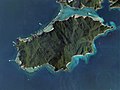
Edateku Island
- Area
- 5.8 km²
- High point
- 322 m

Takeshima
- Area
- 4.2 km²
- High point
- 220 m

Gajajima
- Area
- 4 km²
- High point
- 497 m

Yokoate-jima
- Area
- 2.7 km²
- High point
- 495 m

Tairajima
- Area
- 2.1 km²
- High point
- 243 m

Kodakara Island
- Area
- 0.97 km²
- High point
- 103 m

Sukomobanare Island
- Area
- 0.93 km²
- High point
- 152 m

Kaminonejima
- Area
- 0.45 km²
- High point
- 248 m
Kogajajima
- Area
- 0.37 km²
- High point
- 267 m

Kiyama Island
- Area
- 0.36 km²
- High point
- 85 m

Eniyabanare Island
- Area
- 0.35 km²
- High point
- 69 m
Kojima
- Area
- 0.3 km²
- High point
- 32 m
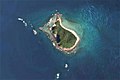
Yubanare Island
- Area
- 0.17 km²
- High point
- 90 m
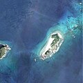
Hamiyajima Island
- Area
- 0.13 km²
- High point
- 77 m
Kikaigashima
- Area
- —
size unknown
Rocks & skerries
On the chart above, at its closest zooms.
Listing 34 of 3076; the rest are on the chart.
Figures
Comparative heights
- Yakushima: 1,936 m
- Nakanoshima: 979 m
- Suwanosejima: 796 m
- Iōjima: 704 m
- Amami Ōshima: 694 m
- Kuchinoerabu: 649 m
- Tokunoshima: 645 m
- Kuchinoshima: 628 m
- Kuroshima: 620 m
- Akusekijima: 584 m
- Gajajima: 497 m
- Yokoate-jima: 495 m
- Uke: 398 m
- Kakeromajima: 326 m
To the same scale
Islands by area
| Amami Ōshima | 712 km² |
| Yakushima | 504 km² |
| Tanegashima | 445 km² |
| Tokunoshima | 248 km² |
| Okinoerabujima | 93.5 km² |
| Kakeromajima | 77.2 km² |
| Kikai Island | 56.9 km² |
| Kuchinoerabu Island | 35.8 km² |
| Nakanoshima | 34.4 km² |
| Suwanosejima | 27.6 km² |
| Yoronjima | 20.6 km² |
| Kuroshima | 15.4 km² |
| Uke Island | 13.3 km² |
| Kuchinoshima | 13.3 km² |
| Iōjima | 11.6 km² |
| Yoroshima | 9.4 km² |
| Mageshima | 8.2 km² |
| Akusekijima | 7.5 km² |
| Takarajima | 7.1 km² |
| Edateku Island | 5.8 km² |
| Takeshima | 4.2 km² |
| Gajajima | 4 km² |
| Yokoate-jima | 2.7 km² |
| Tairajima | 2.1 km² |
| Kodakara Island | 0.97 km² |
| Sukomobanare Island | 0.93 km² |
| Kaminonejima | 0.45 km² |
| Kogajajima | 0.37 km² |
| Kiyama Island | 0.36 km² |
| Eniyabanare Island | 0.35 km² |
| Kojima | 0.3 km² |
| Yubanare Island | 0.17 km² |
| Hamiyajima Island | 0.13 km² |
Groups within
Photographs

A waterfall and red bridge at Yakushima Botanical Research Park.

Satellite pictures of Ryukyu Islands at 04:30 UTC February 19, 2017

Night in Okinawa Island and Kyushu, Japan.

珊瑚礁由来の石灰岩層を通して内陸の洞窟に海水が浸透し、潮の干満による潮位変化もみられる

Eye-Fiからアップロードされました
Sources
Facts
Photographs
- Yakushima Botanical Research Park - Yakushima839. lumoplank / CC0
- Ryukyu Islands on February 19, 2017. NASA, MODIS / LANCE / Public domain
- Night in Okinawa ISS040. Image Science and Analysis Laboratory, NASA-Johnson Space Center. "The Gateway to Astronaut Photography of Earth." / Public domain
- ウンブキ 02. Indiana jo / CC BY-SA 4.0
- エブリワン 2011 コンビニ (6093945040). くーさん / CC BY 2.0