Pacific OceanJapan
29°22′N 129°45′E
Tokara Islands
吐噶喇列島
Part of Satsunan Islands
The Tokara Islands (吐噶喇列島, Tokara-rettō) are an archipelago in the Nansei Islands, and are part of the Satsunan Islands, which are, in turn, part of the Ryukyu Archipelago.

Chart
Overview
The Tokara Islands (吐噶喇列島, Tokara-rettō) are an archipelago in the Nansei Islands, and are part of the Satsunan Islands, which are, in turn, part of the Ryukyu Archipelago. The 150-kilometre (93 mi)-long chain consists of twelve small islands located between Yakushima and Amami-Oshima. The islands have a total area of 101.35 square kilometres (39.13 sq mi). Administratively, the whole group belongs to Toshima Village, Kagoshima Prefecture, Japan. Only seven of the islands are permanently inhabited. The islands, especially Takarajima, are home to the Tokara horse.
From Wikipedia, CC BY-SA 4.0
Census, cataloged
- Major islands9
- Minor islands3
- Islets37
- Rocks & skerries169
Major islands
Nakanoshima
- Area
- 34.4 km²
- High point
- 979 m
Nakanoshima (Japanese: 中之島), is a volcanic island located in the Tokara Islands, part of the Kagoshima Prefecture, Japan. It is the largest and most populous island of the islands in Toshima village. The island, 34.47 km2 in area, had 167 inhabitants as of 2005.
Suwanosejima
- Area
- 27.6 km²
- High point
- 796 m
Suwanose Jima (諏訪之瀬島) is one of the Tokara Islands, belonging to Kagoshima Prefecture. 66 km² in area and has a population of 84 people. Although the island has an airport, there are no regularly scheduled services, and access is normally by ferry to the city of Kagoshima on the mainland.
Kuchinoshima
- Area
- 13.3 km²
- High point
- 628 m
Kuchinoshima (口之島), literally "mouth island", is one of the Tokara Islands, belonging to Kagoshima Prefecture. 15 sq mi) in area, and has a population of 140 persons. The island can only be reached by boat as it has no airport; there is regular ferry service to the city of Kagoshima on the mainland.
Akusekijima
- Area
- 7.5 km²
- High point
- 584 m
Akusekijima (Japanese: 悪石島) is one of the Tokara Islands, a subgroup of the Satsunan Islands belonging to Kagoshima Prefecture, Japan. 42 km² in area, has a population of 59 persons.
Takarajima
- Area
- 7.1 km²
- High point
- 292 m
Takarajima (宝島), literally "treasure island", is one of the Tokara Islands, belonging to Kagoshima Prefecture. 14 km² in area, had a population of 147 persons as of 2020 census data. The island can be reached only by boat as it has no airport, though there is a helipad that may be used in emergencies.
Gajajima
- Area
- 4 km²
- High point
- 497 m
Gajajima (臥蛇島), is an abandoned island in the Tokara Islands, a sub-group of the Satsunan Islands belonging to Kagoshima Prefecture, Japan. The island has an area of 4.07 km2 in area and was inhabited to 1970.
Yokoate-jima
- Area
- 2.7 km²
- High point
- 495 m
Yokoate-jima (横当島) is an uninhabited volcanic island located in the Tokara Islands, part of the Kagoshima Prefecture, Japan.
Tairajima
- Area
- 2.1 km²
- High point
- 243 m
Tairajima (平島), is one of the Tokara Islands, a sub-group of the Satsunan Islands belonging to Kagoshima Prefecture, Japan. 08 km² in area, has a population of 89 persons.
Kodakara Island
- Area
- 0.97 km²
- High point
- 103 m
Kodakarajima (小宝島), literally "small treasure island", is one of the Tokara Islands, belonging to Kagoshima Prefecture. 0 km² in area, is the smallest inhabited island in the archipelago, and has a population of 49 people.


Minor islands

Kaminonejima
- Area
- 0.45 km²
- High point
- 248 m
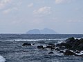
Kogajajima
- Area
- 0.37 km²
- High point
- 267 m
Kojima
- Area
- 0.3 km²
- High point
- 32 m
Rocks & skerries
On the chart above, at its closest zooms.
Listing 12 of 218; the rest are on the chart.
Figures
Comparative heights
- Nakanoshima: 979 m
- Suwanosejima: 796 m
- Kuchinoshima: 628 m
- Akusekijima: 584 m
- Gajajima: 497 m
- Yokoate-jima: 495 m
- Takarajima: 292 m
- Kogajajima: 267 m
- Kaminonejima: 248 m
- Tairajima: 243 m
- Kodakara: 103 m
- Kojima: 32 m
To the same scale
Islands by area
| Nakanoshima | 34.4 km² |
| Suwanosejima | 27.6 km² |
| Kuchinoshima | 13.3 km² |
| Akusekijima | 7.5 km² |
| Takarajima | 7.1 km² |
| Gajajima | 4 km² |
| Yokoate-jima | 2.7 km² |
| Tairajima | 2.1 km² |
| Kodakara Island | 0.97 km² |
| Kaminonejima | 0.45 km² |
| Kogajajima | 0.37 km² |
| Kojima | 0.3 km² |
Photographs

Yokoate-jima, Kagoshima prefecture, Japan.

鹿児島県諏訪之瀬島全景。フェリーとしまより見る

Island and volcano Akusekijima, Ryukyu Islands, Japan

トカラ列島中之島の西海岸(寄木地区)から御岳を見る

臥蛇島と小臥蛇島(十島村中之島から撮影) 撮影者:20nana75の親族(本人の了解済) 撮影日:2007年3月8日
Original uploader was 20nana75 at ja.wikipedia / CC BY-SA 3.0

鹿児島県平島全景。フェリーとしまより見る

Yakushima & Kuchinoshima

トカラ列島宝島港の壁画と女神山
Sources
Facts
Photographs
- Yokoate-jima20140128. Japan Coast Guard / Attribution
- 070503 Overall view of Suwanosejima. 名古屋太郎 / CC BY-SA 4.0
- Akusekijima. 名古屋太郎 / CC BY-SA 3.0
- Nakanoshima nishikaigan. 名古屋太郎 / Public domain
- Gaja island and Kogaja island 20070308. Original uploader was 20nana75 at ja.wikipedia / CC BY-SA 3.0
- 070503 Overall view of Tairajima. 名古屋太郎 / CC BY-SA 4.0
- Yakushima & Kuchinoshima - panoramio. Eichi Yoshida / CC BY-SA 3.0
- Port takarajima. 名古屋太郎 / Public domain
- Yokoate(Tokara Islands) banner. Inkey / CC BY-SA 3.0