Pacific OceanJapan
27°50′N 129°00′E
Amami Islands
奄美群島
Part of Satsunan Islands
tò̞ò̞]) are a Japanese archipelago in the Satsunan Islands, which is part of the Ryukyu Islands, and is southwest of Kyushu. Administratively, the group belongs to Kagoshima Prefecture, Japan.

Chart
Overview
The Amami Islands (奄美群島, Amami Guntō; Japanese pronunciation: [ä́.mä̀.mʲì, ä̀.mä́.mʲí ɡɯ̈́ǹ.tò̞ò̞]) are a Japanese archipelago in the Satsunan Islands, which is part of the Ryukyu Islands, and is southwest of Kyushu. Administratively, the group belongs to Kagoshima Prefecture, Japan. The Geospatial Information Authority of Japan and the Japan Coast Guard agreed on February 15, 2010, to use the name of Amami-guntō (奄美群島) for the Amami Islands. Prior to that, Amami-shotō (奄美諸島) was also used. The name of Amami is probably cognate with Amamikyu (阿摩美久), the goddess of creation in the Ryukyuan creation myth.
From Wikipedia, CC BY-SA 4.0
Census, cataloged
- Major islands3
- Minor islands11
- Islets150
- Rocks & skerries1,170
Major islands
Amami Ōshima
- Area
- 712 km²
- High point
- 694 m
Amami Ōshima (奄美大島; Japanese pronunciation: [ä̀.mä́.mʲí ó̞ò̞.ɕì.mä̀] Okinawan: Uushima; Amami Ōshima: Ushima), also known as Amami ([ä́.mä̀.mʲì]), is the largest island in the Amami archipelago between Kyūshū and Okinawa. It is one of the Satsunan Islands, all of which belong to Kagoshima Prefecture, Japan.
Tokunoshima
- Area
- 248 km²
- High point
- 645 m
Tokunoshima (Japanese: 徳之島; Tokunoshima: Tukunushima), or Tokuno Island, is an island in the Amami archipelago of the southern Satsunan Islands of Kagoshima Prefecture, Japan.
Okinoerabujima
- Area
- 93.5 km²
- High point
- 240 m
Okinoerabujima (Japanese: 沖永良部島; Okinoerabu: いぃらぶ, Yirabu; archaic Northern Ryukyuan: せりよさ, Seriyosa), also known as Okinoerabu, is one of the Satsunan Islands, classed with the Amami archipelago between Kyūshū and Okinawa.


Minor islands

Kakeromajima
- Area
- 77.2 km²
- High point
- 326 m

Kikai Island
- Area
- 56.9 km²
- High point
- 63 m

Yoronjima
- Area
- 20.6 km²
- High point
- 99 m

Uke Island
- Area
- 13.3 km²
- High point
- 398 m
Yoroshima
- Area
- 9.4 km²
- High point
- 230 m
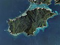
Edateku Island
- Area
- 5.8 km²
- High point
- 322 m

Sukomobanare Island
- Area
- 0.93 km²
- High point
- 152 m

Kiyama Island
- Area
- 0.36 km²
- High point
- 85 m

Eniyabanare Island
- Area
- 0.35 km²
- High point
- 69 m
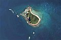
Yubanare Island
- Area
- 0.17 km²
- High point
- 90 m
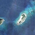
Hamiyajima Island
- Area
- 0.13 km²
- High point
- 77 m
Rocks & skerries
On the chart above, at its closest zooms.
Listing 14 of 1334; the rest are on the chart.
Figures
Comparative heights
- Amami Ōshima: 694 m
- Tokunoshima: 645 m
- Uke: 398 m
- Kakeromajima: 326 m
- Edateku: 322 m
- Okinoerabujima: 240 m
- Yoroshima: 230 m
- Sukomobanare: 152 m
- Yoronjima: 99 m
- Yubanare: 90 m
- Kiyama: 85 m
- Hamiyajima: 77 m
- Eniyabanare: 69 m
- Kikai: 63 m
To the same scale
Islands by area
| Amami Ōshima | 712 km² |
| Tokunoshima | 248 km² |
| Okinoerabujima | 93.5 km² |
| Kakeromajima | 77.2 km² |
| Kikai Island | 56.9 km² |
| Yoronjima | 20.6 km² |
| Uke Island | 13.3 km² |
| Yoroshima | 9.4 km² |
| Edateku Island | 5.8 km² |
| Sukomobanare Island | 0.93 km² |
| Kiyama Island | 0.36 km² |
| Eniyabanare Island | 0.35 km² |
| Yubanare Island | 0.17 km² |
| Hamiyajima Island | 0.13 km² |
Photographs

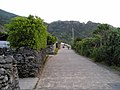
A beach in Amami City, Kagoshima.

須子茂離(鹿児島県瀬戸内町)の空中写真。CKU20085X-C10-49、CKU20085X-C10-50、CKU20085X-C9-57、CKU20085X-C9-58の4枚を合成作成。

Kiyama Island Aerial photograph.2008

江仁屋離島(鹿児島県瀬戸内町)の空中写真。CKU20085X-C12-29を利用作成。

枝手久島(鹿児島県宇検村)の空中写真。CKU20085X-C14-4、CKU20085X-C14-5、CKU20085X-C14-6、CKU20085X-C13-10、CKU20085X-C13-11、CKU20085X-C13-12の6枚を合成作成。

Okinoerabu Island Aerial photograph.2008

珊瑚礁由来の石灰岩層を通して内陸の洞窟に海水が浸透し、潮の干満による潮位変化もみられる

夕離(鹿児島県瀬戸内町)の空中写真。CKU20085X-C10-49を利用作成。

Figure 2; A panorama of the sand flat of Edateku Island at spring low tide (A) and the sand-dwelling organisms therein (B–F): B Bohadschia bivittata C Pharaonella amanyu D Tonganaella tongana E Branchiostoma belcheri F Trichonotus elegans.

サンドン岩(鹿児島県奄美市)。国土交通省ウェブマッピングシステム。CKU20002X-C2-2 を利用作成。

Pseudoscorpion. A female carrying the fertilized eggs in a brood pouch attached to her abdomen. Amami Is., Japan

Yoroshima Island Aerial photograph.2008
Sources
Facts
Photographs
- Amami beach. TANAKA Juuyoh (田中十洋) / CC BY 2.0
- Sukomo-Banare Island Aerial photograph.2008. 国土地理院 / Attribution
- Kiyama Island Aerial photograph.2008. 国土地理院 / Attribution
- Eniya-Banare-jima Island Aerial photograph.2008. 国土地理院 / Attribution
- Edateku-jima Island Aerial photograph.2008. 国土地理院 / Attribution
- Okinoerabu Island Aerial photograph.2008. 国土地理院 / Attribution
- ウンブキ 02. Indiana jo / CC BY-SA 4.0
- Yu-Banare Island Aerial photograph.2008. 国土地理院 / Attribution
- Sand-dwelling organisms (10.3897-zookeys.705.12888) Figure 2. Kato M, Yamamori L, Goto R, Tsubaki R, Ohsuga K (2017) A new large tellinid species of the genus Pharaonella from the Ry / CC BY 4.0
- Sandon rock reef Aerial photograph.2001. 国土地理院 / Attribution
- カニムシ抱卵. Mmsmr / CC0
- Hanmyajima east of Yoroshima Island Aerial photograph.2008 (cropped). 国土地理院 / Attribution