Pacific OceanJapan
34°22′N 139°16′E
Tokyo Islands
Part of Izu–Bonin–Mariana arc
The Islands of Tokyo (東京諸島, Tokyo-shotō), also known as the Insular Area of Tokyo Metropolis (東京都島嶼部, Tōkyō-to-tōshobu) or Izu-Ogasawara islands (伊豆・小笠原諸島, Izu-Ogasawara-shotō), consist of the Izu and Ogasawara (also known as Bonin) island chains to the south of the Izu Peninsula.

Chart
Overview
The Islands of Tokyo (東京諸島, Tokyo-shotō), also known as the Insular Area of Tokyo Metropolis (東京都島嶼部, Tōkyō-to-tōshobu) or Izu-Ogasawara islands (伊豆・小笠原諸島, Izu-Ogasawara-shotō), consist of the Izu and Ogasawara (also known as Bonin) island chains to the south of the Izu Peninsula.
From Wikipedia, CC BY-SA 4.0
Census, cataloged
- Major islands9
- Minor islands29
- Islets366
- Rocks & skerries2,816
Major islands
Izu Ōshima
- Area
- 90.8 km²
- High point
- 758 m
Izu Ōshima (伊豆大島, Izu-ōshima) is an inhabited volcanic island in the Izu archipelago and borders Sagami Bay and the Pacific Ocean, off the coast of Honshu, Japan, 22 km (14 mi) east of the Izu Peninsula and 36 km (22 mi) southwest of Bōsō Peninsula.
Hachijō-jima
- Area
- 69.4 km²
- High point
- 854 m
Hachijō-jima (Japanese: 八丈島) is a volcanic island of Japan in the Pacific Ocean. It is about 287 km (178 mi) south of the special wards of Tokyo. It is part of the Izu archipelago and within the Fuji-Hakone-Izu National Park. Its only municipality is Hachijō.
Miyakejima
- Area
- 55.4 km²
- High point
- 775 m
Miyake-jima (三宅島; "Miyake Island") is a volcanic island in the Izu archipelago in the Philippine Sea approximately 180 kilometers (110 mi) southeast of Tokyo, Japan. As with the other islands in the Izu Island group, Miyake-jima forms part of the Fuji-Hakone-Izu National Park.
Iwo Jima
- Area
- 30 km²
- High point
- 170 m
mä́], lit. tó̞ó̞]), is one of the Japanese Volcano Islands, which lie south of the Bonin Islands and together with them make up the Ogasawara Archipelago. Together with the Izu Islands, they make up Japan's Nanpō Islands.
Chichijima
- Area
- 23.8 km²
- High point
- 320 m
Chichijima (Japanese: 父島) is the largest and most populous of the Bonin Islands. Chichijima is about 240 km (150 mi) north of Iwo Jima. 1 sq mi) in size, the island is home to about 2,120 people (2021).
Nii-jima
- Area
- 23.2 km²
- High point
- 432 m
Nii-jima (新島) is a volcanic Japanese island administered by the Tokyo Metropolitan Government.
Mikura-jima
- Area
- 20.5 km²
- High point
- 851 m
Mikura-jima (御蔵島) is an inhabited volcanic Japanese island in the Pacific Ocean. The island is administered by Tōkyō Metropolis and is located approximately 200 kilometres (120 mi) south of Tokyo and 19 kilometres (12 mi) south-southeast of Miyakejima.
Hahajima
- Area
- 20.2 km²
- High point
- 462 m
Hahajima, Haha Jima, or Haha-jima (母島; meaning Mother Island) is the second-largest island within the Bonin or Ogasawara Islands south southeast of the Japanese Home Islands. The steeply-sloped island, which is about 21 km2 (8 sq mi) in area, has a population of 440.
Kōzu-shima
- Area
- 18.5 km²
- High point
- 572 m
Kōzu-shima (神津島) is a volcanic Japanese island in the Philippine Sea. 7 mi) southwest of the Nii-jima. It is one of the Izu Seven Islands, a group of the seven northern islands of the Izu archipelago.


Minor islands

Anijima
- Area
- 7.9 km²
- High point
- 254 m
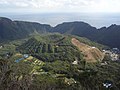
Aogashima
- Area
- 6 km²
- High point
- 423 m

North Iwo Jima
- Area
- 5.6 km²
- High point
- 792 m

Otōtojima
- Area
- 5.2 km²
- High point
- 299 m

Tori-shima
- Area
- 4.8 km²
- High point
- 394 m
Toshima
- Area
- 4.1 km²
- High point
- 508 m

Nishinoshima
- Area
- 3.8 km²
- High point
- 135 m

Shikine-jima
- Area
- 3.7 km²
- High point
- 97 m

South Iwo Jima
- Area
- 3.5 km²
- High point
- 916 m

Hachijō-kojima
- Area
- 3.1 km²
- High point
- 617 m

Mukojima
- Area
- 2.5 km²
- High point
- 88 m

Minamitorishima
- Area
- 1.5 km²
- High point
- 13 m

Anejima
- Area
- 1.4 km²
- High point
- 113 m

Mukōjima
- Area
- 1.4 km²
- High point
- 137 m

Nakōdo Island
- Area
- 1.3 km²
- High point
- 155 m

Imōtojima
- Area
- 1.2 km²
- High point
- 216 m

Meijima
- Area
- 0.87 km²
- High point
- 113 m

Yomejima
- Area
- 0.61 km²
- High point
- 105 m

Nishijima
- Area
- 0.49 km²
- High point
- 100 m

Hirajima
- Area
- 0.48 km²
- High point
- 57 m

Udone-shima
- Area
- 0.41 km²
- High point
- 209 m

Minamijima
- Area
- 0.29 km²
- High point
- 57 m

Higashijima
- Area
- 0.25 km²
- High point
- 92 m
Jinai-tō
- Area
- 0.19 km²
- High point
- 77 m
Kangoku Rock
- Area
- 0.18 km²
- High point
- 11 m

Kitanoshima
- Area
- 0.14 km²
- High point
- 40 m

Magojima
- Area
- 0.12 km²
- High point
- 91 m
Hanshima
- Area
- 0.11 km²
- High point
- 66 m
Zenisu
- Area
- —
size unknown
Rocks & skerries
On the chart above, at its closest zooms.
Listing 38 of 3220; the rest are on the chart.
Figures
Comparative heights
- South Iwo Jima: 916 m
- Hachijō-jima: 854 m
- Mikura-jima: 851 m
- North Iwo Jima: 792 m
- Miyakejima: 775 m
- Izu Ōshima: 758 m
- Hachijō-kojima: 617 m
- Kōzu-shima: 572 m
- Toshima: 508 m
- Hahajima: 462 m
- Nii-jima: 432 m
- Aogashima: 423 m
- Tori-shima: 394 m
- Chichijima: 320 m
To the same scale
Islands by area
| Izu Ōshima | 90.8 km² |
| Hachijō-jima | 69.4 km² |
| Miyakejima | 55.4 km² |
| Iwo Jima | 30 km² |
| Chichijima | 23.8 km² |
| Nii-jima | 23.2 km² |
| Mikura-jima | 20.5 km² |
| Hahajima | 20.2 km² |
| Kōzu-shima | 18.5 km² |
| Anijima | 7.9 km² |
| Aogashima | 6 km² |
| North Iwo Jima | 5.6 km² |
| Otōtojima | 5.2 km² |
| Tori-shima | 4.8 km² |
| Toshima | 4.1 km² |
| Nishinoshima | 3.8 km² |
| Shikine-jima | 3.7 km² |
| South Iwo Jima | 3.5 km² |
| Hachijō-kojima | 3.1 km² |
| Mukojima | 2.5 km² |
| Minamitorishima | 1.5 km² |
| Anejima | 1.4 km² |
| Mukōjima | 1.4 km² |
| Nakōdo Island | 1.3 km² |
| Imōtojima | 1.2 km² |
| Meijima | 0.87 km² |
| Yomejima | 0.61 km² |
| Nishijima | 0.49 km² |
| Hirajima | 0.48 km² |
| Udone-shima | 0.41 km² |
| Minamijima | 0.29 km² |
| Higashijima | 0.25 km² |
| Jinai-tō | 0.19 km² |
| Kangoku Rock | 0.18 km² |
| Kitanoshima | 0.14 km² |
| Magojima | 0.12 km² |
| Hanshima | 0.11 km² |
Groups within
Photographs

利島 全景

剣先山(東京都小笠原村 母島)より沖港を望む, Oki on Hahajima Island

A view of Mijura-jima taken from the west.

The white cliffs "Shiro-mama" near the southern end of the beach on the east side of Nii-jima, a volcanic island in Tokyo.

Crater of Oyama volcano on Miyakejima as seen from aircraft

Ministry of Land, Infrastructure, Transport and Tourism Ogasawara General Office in Chichijima, Ogasawara Village, Tokyo, Japan

U.S. Marine Corps photo by Lance Cpl. Emily Bos / Public domain
Sources
Facts
Photographs
- To-shima zenkei. Saigen Jiro / CC0
- Hahajima-oki. しんかわな / CC BY-SA 3.0
- Mikura-jima. Izawa Ryu / CC BY-SA 4.0
- Niijima 20221203 122020. Ka23 13 / CC BY-SA 4.0
- Miyakejima O-Yama Volcano crater. さかおり / CC BY-SA 4.0
- Ogasawara General Office. Yasu (talk) / CC BY-SA 3.0
- U S Marines with 3rd Marine Division visit Iwo Jima (9972514). U.S. Marine Corps photo by Lance Cpl. Emily Bos / Public domain
- Hachijojima from Noboryu peak Wikivoyage banner. hirohiro akabane / CC BY-SA 2.0