Micronesia, United States and Japan
22°07′N 145°02′E
Izu–Bonin–Mariana arc
The Izu–Bonin–Mariana (IBM) arc system is a tectonic plate convergent boundary in Micronesia.

Chart
Overview
The Izu–Bonin–Mariana (IBM) arc system is a tectonic plate convergent boundary in Micronesia. The IBM arc system extends over 2,800 km (1,700 mi) south from Tokyo, Japan, to beyond Guam, and includes the Izu Islands, the Bonin Islands, and the Mariana Islands; much more of the IBM arc system is submerged below sea level. The IBM arc system lies along the eastern margin of the Philippine Sea plate in the Western Pacific Ocean. It is the site of the deepest gash in Earth's solid surface, the Challenger Deep in the Mariana Trench. The IBM arc system formed as a result of subduction of the western Pacific plate. The IBM arc system now subducts mid-Jurassic to Early Cretaceous lithosphere, with younger lithosphere in the north and older lithosphere in the south, including the oldest (~170 million years old, or Ma) oceanic crust. Subduction rates vary from ~2 cm (1 inch) per year in the south to 6 cm (~2.5 inches) in the north. The volcanic islands that comprise these island arcs are thought to have been formed from the release of volatiles (steam from trapped water, and other gases) being released from the subducted plate, as it reached sufficient depth for the temperature to cause release of these materials. The associated trenches are formed as the oldest (most western) part of the Pacific plate crust increases in density with age, and because of this process finally reaches its lowest point just as it subducts under the crust to the west of it. The IBM arc system is an excellent example of an intra-oceanic convergent margin (IOCM). IOCMs are built on oceanic crust and contrast fundamentally with island arcs built on continental crust, such as Japan or the Andes. Because IOCM crust is thinner, denser, and more refractory than that beneath Andean-type margins, study of IOCM melts and fluids allows more confident assessment of mantle-to-crust fluxes and processes than is possible for Andean-type convergent margins. Because IOCMs are far removed from continents they are not affected by the large volume of alluvial and glacial sediments. The consequent thin sedimentary cover makes it much easier to study arc infrastructure and determine the mass and composition of subducted sediments. Active hydrothermal systems found on the submarine parts of IOCMs give us a chance to study how many of Earth's important ore deposits formed.
From Wikipedia, CC BY-SA 4.0
Census, cataloged
- Major islands11
- Minor islands50
- Islets408
- Rocks & skerries2,913
Major islands
Guam
- Area
- 543 km²
- High point
- 406 m
Saipan
- Area
- 119 km²
- High point
- 474 m
Saipan is the largest island and capital of the Northern Mariana Islands, an unincorporated territory of the United States in the western Pacific Ocean. According to 2020 estimates by the United States Census Bureau, the population of Saipan was 43,385. Its people have been United States citizens since the 1980s.
Tinian
- Area
- 101 km²
- High point
- 181 m
Tinian (; Chamorro: Tini'an) is one of the three principal islands of the Commonwealth of the Northern Mariana Islands (CNMI). Together with uninhabited neighboring Aguijan, it forms Tinian Municipality, one of the four constituent municipalities of the Northern Marianas. Tinian's largest village is San Jose.
Izu Ōshima
- Area
- 90.8 km²
- High point
- 758 m
Izu Ōshima (伊豆大島, Izu-ōshima) is an inhabited volcanic island in the Izu archipelago and borders Sagami Bay and the Pacific Ocean, off the coast of Honshu, Japan, 22 km (14 mi) east of the Izu Peninsula and 36 km (22 mi) southwest of Bōsō Peninsula.
Rota
- Area
- 85.1 km²
- High point
- 476 m
Rota (Chamorro: Luta), also known as the "Friendly Island", is the southernmost island of the United States Commonwealth of the Northern Mariana Islands (CNMI) and the third southernmost of the Marianas Archipelago (the first being Cocos Island).
Hachijō-jima
- Area
- 69.4 km²
- High point
- 854 m
Hachijō-jima (Japanese: 八丈島) is a volcanic island of Japan in the Pacific Ocean. It is about 287 km (178 mi) south of the special wards of Tokyo. It is part of the Izu archipelago and within the Fuji-Hakone-Izu National Park. Its only municipality is Hachijō.
Miyakejima
- Area
- 55.4 km²
- High point
- 775 m
Miyake-jima (三宅島; "Miyake Island") is a volcanic island in the Izu archipelago in the Philippine Sea approximately 180 kilometers (110 mi) southeast of Tokyo, Japan. As with the other islands in the Izu Island group, Miyake-jima forms part of the Fuji-Hakone-Izu National Park.
Yap Island
- Area
- 54.4 km²
- High point
- 170 m
Pagan
- Area
- 47.8 km²
- High point
- 206 m
Pagan is a volcanic island in the Marianas archipelago in the northwest Pacific Ocean, under the jurisdiction of the Commonwealth of the Northern Mariana Islands. It lies midway between Alamagan to the south and Agrihan to the north.
Agrihan
- Area
- 43.6 km²
- High point
- 965 m
Agrihan (also spelled Agrigan) is an island in the Northern Mariana Islands in the Pacific Ocean. The island has mostly been uninhabited, but had 4 permanent residents in the 2020 U.S. census. Agrihan is located 62 kilometers (39 mi) to the north of Pagan.
Anatahan
- Area
- 34 km²
- High point
- 790 m
Anatahan is a volcanic island in the Northern Mariana Islands in the Pacific Ocean, and has one of the most active volcanoes of the archipelago. Formerly inhabited, the island is currently uninhabited due to the constant danger of volcanic eruptions.


Minor islands

Iwo Jima
- Area
- 30 km²
- High point
- 170 m
Gagil-Tamil
- Area
- 27.2 km²
- High point
- 82 m

Chichijima
- Area
- 23.8 km²
- High point
- 320 m

Nii-jima
- Area
- 23.2 km²
- High point
- 432 m

Mikura-jima
- Area
- 20.5 km²
- High point
- 851 m

Hahajima
- Area
- 20.2 km²
- High point
- 462 m

Kōzu-shima
- Area
- 18.5 km²
- High point
- 572 m

Alamagan
- Area
- 12.9 km²
- High point
- 723 m
Maap
- Area
- 10.5 km²
- High point
- 75 m

Asuncion Island
- Area
- 7.9 km²
- High point
- 840 m

Anijima
- Area
- 7.9 km²
- High point
- 254 m

Aguijan
- Area
- 7 km²
- High point
- 165 m
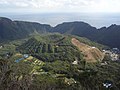
Aogashima
- Area
- 6 km²
- High point
- 423 m

North Iwo Jima
- Area
- 5.6 km²
- High point
- 792 m

Otōtojima
- Area
- 5.2 km²
- High point
- 299 m

Tori-shima
- Area
- 4.8 km²
- High point
- 394 m

Sarigan
- Area
- 4.5 km²
- High point
- 538 m

Guguan
- Area
- 4.3 km²
- High point
- 289 m
Toshima
- Area
- 4.1 km²
- High point
- 508 m
Rumung
- Area
- 4 km²
- High point
- 86 m

Nishinoshima
- Area
- 3.8 km²
- High point
- 135 m

Shikine-jima
- Area
- 3.7 km²
- High point
- 97 m

South Iwo Jima
- Area
- 3.5 km²
- High point
- 916 m

Hachijō-kojima
- Area
- 3.1 km²
- High point
- 617 m

Mukojima
- Area
- 2.5 km²
- High point
- 88 m

Farallón de Pájaros
- Area
- 2.3 km²
- High point
- 330 m

Minamitorishima
- Area
- 1.5 km²
- High point
- 13 m

Anejima
- Area
- 1.4 km²
- High point
- 113 m

Mukōjima
- Area
- 1.4 km²
- High point
- 137 m

Nakōdo Island
- Area
- 1.3 km²
- High point
- 155 m

Imōtojima
- Area
- 1.2 km²
- High point
- 216 m
Maug East Island
- Area
- 0.92 km²
- High point
- 190 m

Meijima
- Area
- 0.87 km²
- High point
- 113 m
Farallon de Medinilla
- Area
- 0.78 km²
- High point
- 66 m

Yomejima
- Area
- 0.61 km²
- High point
- 105 m
Maug West Island
- Area
- 0.59 km²
- High point
- 140 m

Nishijima
- Area
- 0.49 km²
- High point
- 100 m

Hirajima
- Area
- 0.48 km²
- High point
- 57 m
Maug North Island
- Area
- 0.44 km²
- High point
- 180 m

Udone-shima
- Area
- 0.41 km²
- High point
- 209 m
Cocos Island
- Area
- 0.31 km²
- High point
- 17 m

Minamijima
- Area
- 0.29 km²
- High point
- 57 m

Higashijima
- Area
- 0.25 km²
- High point
- 92 m
Jinai-tō
- Area
- 0.19 km²
- High point
- 77 m
Kangoku Rock
- Area
- 0.18 km²
- High point
- 11 m

Kitanoshima
- Area
- 0.14 km²
- High point
- 40 m

Magojima
- Area
- 0.12 km²
- High point
- 91 m
Fanqamat
- Area
- 0.12 km²
- High point
- 5 m
Hanshima
- Area
- 0.11 km²
- High point
- 66 m
Zenisu
- Area
- —
size unknown
Rocks & skerries
On the chart above, at its closest zooms.
Listing 61 of 3382; the rest are on the chart.
Figures
Comparative heights
- Agrihan: 965 m
- South Iwo Jima: 916 m
- Hachijō-jima: 854 m
- Mikura-jima: 851 m
- Asuncion: 840 m
- North Iwo Jima: 792 m
- Anatahan: 790 m
- Miyakejima: 775 m
- Izu Ōshima: 758 m
- Alamagan: 723 m
- Hachijō-kojima: 617 m
- Kōzu-shima: 572 m
- Sarigan: 538 m
- Toshima: 508 m
To the same scale
Islands by area
Groups within
Photographs

Aerial view of Saipan, Northern Mariana Islands

Coast of Rota Island.

Crater of Oyama volcano on Miyakejima as seen from aircraft

Sunrise over Tomil Harbor in Colonia, with Tamil Municipality in the horizon

ハガニア大聖堂
Sources
Facts
Photographs
- Saipan. P. Miller, (Pdmiller) / Public domain
- Rota Island in the Commonwealth of Northern Mariana Islands. CT Snow from Hsinchu, Taiwan / CC BY 2.0
- Miyakejima O-Yama Volcano crater. さかおり / CC BY-SA 4.0
- Sunrise Over Tomil Harbor, Colonia. W1K1L1By4N / CC BY-SA 4.0
- ハガニア大聖堂 - panoramio. Junpei Abe / CC BY 3.0