North Pacific OceanUnited States
16°42′N 145°47′E
Mariana Islands
Part of Izu–Bonin–Mariana arc and Micronesia
The Mariana Islands ( MARR-ee-AH-nə; Chamorro: Manislan Mariånas), also simply the Marianas, are a crescent-shaped archipelago comprising the summits of fifteen longitudinally oriented, mostly dormant volcanic mountains in the north-western Pacific Ocean, between the 12th and 21st parallels north and along the 145th meridian east.

Chart
Overview
The Mariana Islands ( MARR-ee-AH-nə; Chamorro: Manislan Mariånas), also simply the Marianas, are a crescent-shaped archipelago comprising the summits of fifteen longitudinally oriented, mostly dormant volcanic mountains in the north-western Pacific Ocean, between the 12th and 21st parallels north and along the 145th meridian east. They lie south-southeast of Japan, west-southwest of Hawaii, north of New Guinea, and east of the Philippines, demarcating the Philippine Sea's eastern limit. They are found in the northern part of the western Oceanic sub-region of Micronesia, and are politically divided into two jurisdictions of the United States: the Commonwealth of the Northern Mariana Islands and, at the southern end of the chain, the territory of Guam. The islands were named after the influential Spanish queen Mariana of Austria following their colonization in the 17th century. The indigenous inhabitants are the Chamorro people. Archaeologists in 2013 reported findings which indicated that the people who first settled the Marianas arrived there after making what may have been at the time the longest uninterrupted ocean voyage in human history. They further reported findings which suggested that Tinian is likely to have been the first island in Oceania to have been settled by humans. Spanish expeditions, beginning with one by Portuguese explorer Ferdinand Magellan in the early 16th century, were the first Europeans to arrive; eventually, Spain annexed and colonized the archipelago, establishing their capital on the largest island, Guam. The Marianas were the first islands Magellan encountered after traversing the Pacific from the southern tip of South America. The fruits found there saved the survivors from scurvy, which had already killed dozens of crewmembers.
From Wikipedia, CC BY-SA 4.0
Census, cataloged
- Major islands4
- Minor islands14
- Islets32
- Rocks & skerries90
Major islands
Guam
- Area
- 543 km²
- High point
- 406 m
Saipan
- Area
- 119 km²
- High point
- 474 m
Saipan is the largest island and capital of the Northern Mariana Islands, an unincorporated territory of the United States in the western Pacific Ocean. According to 2020 estimates by the United States Census Bureau, the population of Saipan was 43,385. Its people have been United States citizens since the 1980s.
Tinian
- Area
- 101 km²
- High point
- 181 m
Tinian (; Chamorro: Tini'an) is one of the three principal islands of the Commonwealth of the Northern Mariana Islands (CNMI). Together with uninhabited neighboring Aguijan, it forms Tinian Municipality, one of the four constituent municipalities of the Northern Marianas. Tinian's largest village is San Jose.
Rota
- Area
- 85.1 km²
- High point
- 476 m
Rota (Chamorro: Luta), also known as the "Friendly Island", is the southernmost island of the United States Commonwealth of the Northern Mariana Islands (CNMI) and the third southernmost of the Marianas Archipelago (the first being Cocos Island).

Minor islands

Pagan
- Area
- 47.8 km²
- High point
- 206 m

Agrihan
- Area
- 43.6 km²
- High point
- 965 m

Anatahan
- Area
- 34 km²
- High point
- 790 m

Alamagan
- Area
- 12.9 km²
- High point
- 723 m

Asuncion Island
- Area
- 7.9 km²
- High point
- 840 m

Aguijan
- Area
- 7 km²
- High point
- 165 m

Sarigan
- Area
- 4.5 km²
- High point
- 538 m
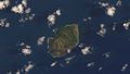
Guguan
- Area
- 4.3 km²
- High point
- 289 m

Farallón de Pájaros
- Area
- 2.3 km²
- High point
- 330 m
Maug East Island
- Area
- 0.92 km²
- High point
- 190 m
Farallon de Medinilla
- Area
- 0.78 km²
- High point
- 66 m
Maug West Island
- Area
- 0.59 km²
- High point
- 140 m
Maug North Island
- Area
- 0.44 km²
- High point
- 180 m
Cocos Island
- Area
- 0.31 km²
- High point
- 17 m
Islets
- Mañagaha13 m · 0.06 km²
- Unnamed island2 m · 0.06 km²
- Unnamed island8 m · 0.03 km²
- Unnamed island21 m · 0.03 km²
- Orote Island45 m · 0.03 km²
- Forbidden Island17 m · 0.03 km²
- Anae17 m · 0.03 km²
- Agrigan Island9 m · 0.02 km²
- Fofos Island6 m · 0.01 km²
- Unnamed island6 m · 0.01 km²
- Alutom Island10 m · 0.01 km²
- Bird Island8 m · 0.01 km²
Rocks & skerries
- Naftan Rock19 m · 0.8 ha
- Guijen Rock8 m · 0.5 ha
- Togari Rock1 m · 0.4 ha
- Hira Rock2 m · 0.2 ha
- Unnamed island<0.1 ha
- Unnamed island<0.1 ha
- Unnamed island<0.1 ha
- Unnamed island<0.1 ha
- Unnamed island<0.1 ha
- Unnamed island<0.1 ha
- Unnamed island<0.1 ha
- Yona Island<0.1 ha
Figures
Comparative heights
To the same scale
Islands by area
| Guam | 543 km² |
| Saipan | 119 km² |
| Tinian | 101 km² |
| Rota | 85.1 km² |
| Pagan | 47.8 km² |
| Agrihan | 43.6 km² |
| Anatahan | 34 km² |
| Alamagan | 12.9 km² |
| Asuncion Island | 7.9 km² |
| Aguijan | 7 km² |
| Sarigan | 4.5 km² |
| Guguan | 4.3 km² |
| Farallón de Pájaros | 2.3 km² |
| Maug East Island | 0.92 km² |
| Farallon de Medinilla | 0.78 km² |
| Maug West Island | 0.59 km² |
| Maug North Island | 0.44 km² |
| Cocos Island | 0.31 km² |
| Mañagaha | 0.06 km² |
| Unnamed island | 0.06 km² |
| Unnamed island | 0.03 km² |
| Unnamed island | 0.03 km² |
| Orote Island | 0.03 km² |
| Forbidden Island | 0.03 km² |
| Anae | 0.03 km² |
| Agrigan Island | 0.02 km² |
| Fofos Island | 0.01 km² |
| Unnamed island | 0.01 km² |
| Alutom Island | 0.01 km² |
| Bird Island | 0.01 km² |
| Alupat Island | 0.9 ha |
| Unnamed island | 0.9 ha |
| Naftan Rock | 0.8 ha |
| Bangi Island | 0.7 ha |
| Facpi Island | 0.7 ha |
| Unnamed island | 0.6 ha |
| Guijen Rock | 0.5 ha |
| Asgadao Island | 0.5 ha |
| Togari Rock | 0.4 ha |
| Unnamed island | 0.3 ha |
| Asgon Point | 0.2 ha |
| Unnamed island | 0.2 ha |
| Unnamed island | 0.2 ha |
| Unnamed island | 0.2 ha |
| Unnamed island | 0.2 ha |
| Hira Rock | 0.2 ha |
| Unnamed island | 0.2 ha |
| Babe Island | 0.1 ha |
| Unnamed island | 0.1 ha |
| Unnamed island | 0.1 ha |
| Unnamed island | 0.1 ha |
| Unnamed island | 0.1 ha |
| Unnamed island | 0.1 ha |
| Unnamed island | 0.1 ha |
| Unnamed island | <0.1 ha |
| Unnamed island | <0.1 ha |
| Unnamed island | <0.1 ha |
| Unnamed island | <0.1 ha |
| Unnamed island | <0.1 ha |
| Unnamed island | <0.1 ha |
| Unnamed island | <0.1 ha |
| Yona Island | <0.1 ha |
| Pelagi Islets | <0.1 ha |
| Unnamed island | <0.1 ha |
| Unnamed island | <0.1 ha |
| Camel Rock | <0.1 ha |
| Unnamed island | <0.1 ha |
| Unnamed island | <0.1 ha |
| Babe Island | <0.1 ha |
| Unnamed island | <0.1 ha |
| Unnamed island | <0.1 ha |
| Unnamed island | <0.1 ha |
| Unnamed island | <0.1 ha |
| Unnamed island | <0.1 ha |
| Unnamed island | <0.1 ha |
| Unnamed island | <0.1 ha |
| Unnamed island | <0.1 ha |
| Lalas Rock | <0.1 ha |
| Unnamed island | <0.1 ha |
| Unnamed island | <0.1 ha |
| Unnamed island | <0.1 ha |
| Unnamed island | <0.1 ha |
| Unnamed island | <0.1 ha |
| Unnamed island | <0.1 ha |
| Unnamed island | <0.1 ha |
| Unnamed island | <0.1 ha |
| Unnamed island | <0.1 ha |
| Unnamed island | <0.1 ha |
| Unnamed island | <0.1 ha |
| Unnamed island | <0.1 ha |
| Unnamed island | <0.1 ha |
| Unnamed island | <0.1 ha |
| Unnamed island | <0.1 ha |
| Unnamed island | <0.1 ha |
| Unnamed island | <0.1 ha |
| Unnamed island | <0.1 ha |
| Unnamed island | <0.1 ha |
| Unnamed island | <0.1 ha |
| Unnamed island | <0.1 ha |
| Unnamed island | <0.1 ha |
| Unnamed island | <0.1 ha |
| Unnamed island | <0.1 ha |
| Unnamed island | <0.1 ha |
| Babe Island | <0.1 ha |
| Unnamed island | <0.1 ha |
| Unnamed island | <0.1 ha |
| Unnamed island | <0.1 ha |
| Unnamed island | <0.1 ha |
| Unnamed island | <0.1 ha |
| Unnamed island | <0.1 ha |
| Unnamed island | <0.1 ha |
| Unnamed island | <0.1 ha |
| Unnamed island | <0.1 ha |
| Unnamed island | <0.1 ha |
| Unnamed island | <0.1 ha |
| Unnamed island | <0.1 ha |
| Unnamed island | <0.1 ha |
| Unnamed island | <0.1 ha |
| Unnamed island | <0.1 ha |
| Unnamed island | <0.1 ha |
| Unnamed island | <0.1 ha |
| Unnamed island | <0.1 ha |
| Unnamed island | <0.1 ha |
| Unnamed island | <0.1 ha |
| Unnamed island | <0.1 ha |
| Unnamed island | <0.1 ha |
| Unnamed island | <0.1 ha |
| Unnamed island | <0.1 ha |
| Unnamed island | <0.1 ha |
| Unnamed island | <0.1 ha |
| Unnamed island | <0.1 ha |
| Unnamed island | <0.1 ha |
| Unnamed island | <0.1 ha |
| Unnamed island | <0.1 ha |
| Unnamed island | <0.1 ha |
| Unnamed island | <0.1 ha |
| Unnamed island | <0.1 ha |
| Unnamed island | <0.1 ha |
| Unnamed island | <0.1 ha |
| Unnamed island | <0.1 ha |
Groups within
Photographs

Aerial view of Saipan, Northern Mariana Islands

Saipan beach

Coast of Rota Island.

A Lockheed C-130 Hercules flying near Tinian.

ハガニア大聖堂

Super Typhoon Keith radar image at its closet approach to the Mariana Islands.

illustration du roman

A powerful Super Typhoon Sinlaku approaches the Mariana Islands and Guam.

Typhoon Sinlaku churns near the Mariana Islands.

Piper guahamense fruit - Lost Pond, Dededo, Guam

Dischidia puberula in Guam, Mariana Islands.
Sources
Facts
Photographs
- Saipan. P. Miller, (Pdmiller) / Public domain
- Saipan beach (23745790). Matt Watts / CC BY-SA 2.0
- Rota Island in the Commonwealth of Northern Mariana Islands. CT Snow from Hsinchu, Taiwan / CC BY 2.0
- C-130 Hercules in Tinian. Editor abcdef / CC0
- ハガニア大聖堂 - panoramio. Junpei Abe / CC BY 3.0
- Keith 3. Adrian Garcia / Public domain
- Arago - Souvenirs d’un aveugle, nouv. éd.1840, t.1 (page 487 crop). anonymous / Public domain
- Mariana Islands banner Underwater life in Guam. David Burdick. / Public domain
- Powerful Sinlaku Nears Guam and the Mariana Islands (CIRA 2026-04-13). Himawari imagery: CSU/CIRA & JMA/JAXA / Public domain
- Sinlaku Churns Near the Mariana Islands (CIRA 2026-04-15). Himawari imagery: CSU/CIRA & JMA/JAXA / Public domain
- Piper guahamense fruit - Lost Pond, Dededo, Guam. Halenhardy / CC BY-SA 4.0
- Dischidia puberula 01. Shiokemuri / CC0