Japan
30°00′N 140°00′E
Nanpō Islands
Part of Tokyo Islands
The Nanpō Islands (南方諸島, Nanpō Shotō) is a collective term for the groups of islands that are located to the south of the Japanese archipelago. They extend from the Izu Peninsula west of Tokyo Bay southward for about 1,200 km (750 mi), to within 500 km (310 mi) of the Mariana Islands.

Chart
Overview
The Nanpō Islands (南方諸島, Nanpō Shotō) is a collective term for the groups of islands that are located to the south of the Japanese archipelago. They extend from the Izu Peninsula west of Tokyo Bay southward for about 1,200 km (750 mi), to within 500 km (310 mi) of the Mariana Islands. The Nanpō Islands are all administered by Tokyo Metropolis. The Hydrographic and Oceanographic Department of the Japan Coast Guard defines the Nanpō Shotō as follows:
Nanpō Shotō (Nanpō Islands) Izu Shotō (Izu Islands) Ogasawara Guntō (Bonin Islands) Mukojima Rettō Chichijima Rettō Hahajima Rettō Kazan Rettō (Volcano Islands) Kita Iwo Jima (North Iwo Jima) Iwo Jima Minami Iwo Jima (South Iwo Jima) Nishinoshima Okinotorishima Minamitorishima The Geospatial Information Authority of Japan, a government agency that is responsible for standardization of place names, does not use the term Nanpō Shotō, although it has agreed with the Japan Coast Guard over the names and extents of the subgroups of the Nanpō Shotō. Archeological evidence has since revealed that some of the islands were prehistorically inhabited by members of an unknown Micronesian ethnicity. The Japanese claim to have discovered the islands in 1593; however, many of the islands were known by the Spanish sailors that went from Philippines to New Spain since Bernardo de la Torre's voyage in 1543, while the British claimed the islands in 1827. However, neither Japan nor Britain developed the Nanpō Islands, although a small colony of Bonin Islanders was established at Chichi-jima. Some Japanese began migrating to the islands in 1853, and the Shogunate government attempted to claim the islands in 1861. In 1876, the Meji government of Japan formally incorporated Ogasawara islands into the territory with the consent of the Western powers, placing them under the administration of the Tokyo Prefecture. And in 1891 Japan incorporated the more southerly and then-uninhabited Volcano Islands as part of Ogasawara Subprefecture. By the mid-1930s the islands were closed to foreigners and a small Imperial Japanese Navy base was established at Chichi-jima. As the war intensified and U.S. forces approached in 1944, most of the civilians living on the islands were forced to evacuate. After World War II, the islands were administered by the United States under Article III of the Treaty of San Francisco until they were returned to Japan in 1968. In 2011, the Ogasawara Islands were included on UNESCO’s World Heritage list.
From Wikipedia, CC BY-SA 4.0
Census, cataloged
- Major islands6
- Minor islands17
- Islets271
- Rocks & skerries1,974
Major islands
Iwo Jima
- Area
- 30 km²
- High point
- 170 m
mä́], lit. tó̞ó̞]), is one of the Japanese Volcano Islands, which lie south of the Bonin Islands and together with them make up the Ogasawara Archipelago. Together with the Izu Islands, they make up Japan's Nanpō Islands.
Chichijima
- Area
- 23.8 km²
- High point
- 320 m
Chichijima (Japanese: 父島) is the largest and most populous of the Bonin Islands. Chichijima is about 240 km (150 mi) north of Iwo Jima. 1 sq mi) in size, the island is home to about 2,120 people (2021).
Hahajima
- Area
- 20.2 km²
- High point
- 462 m
Hahajima, Haha Jima, or Haha-jima (母島; meaning Mother Island) is the second-largest island within the Bonin or Ogasawara Islands south southeast of the Japanese Home Islands. The steeply-sloped island, which is about 21 km2 (8 sq mi) in area, has a population of 440.
Anijima
- Area
- 7.9 km²
- High point
- 254 m
North Iwo Jima
- Area
- 5.6 km²
- High point
- 792 m
North Iwo Jima (Japanese: 北硫黄島, Kita Iwōjima, "North Sulfur Island"), officially North or Kita Iōtō (written with the same characters) and previously known as Santo or San Alessandro, Hooge Meeuwen Island (Dutch: t'Hooge Meuwen Eylandt, "High Seagull Island"), and North Sulfur Island, is the northernmost member of Japan's Volcano Islands.
Otōtojima
- Area
- 5.2 km²
- High point
- 299 m
Otōtojima, Otōto-jima, or Otōto Jima (弟島, meaning Younger Brother Island), is an uninhabited island in the Chichijima archipelago of Japan's Ogasawara Islands. During the Meiji and Taishō eras between 50 and 100 people lived on the island, but it was deserted in 1944. The island is off-limits for tourists.


Minor islands

Nishinoshima
- Area
- 3.8 km²
- High point
- 135 m

South Iwo Jima
- Area
- 3.5 km²
- High point
- 916 m
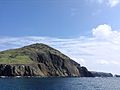
Mukojima
- Area
- 2.5 km²
- High point
- 88 m

Minamitorishima
- Area
- 1.5 km²
- High point
- 13 m

Anejima
- Area
- 1.4 km²
- High point
- 113 m

Mukōjima
- Area
- 1.4 km²
- High point
- 137 m

Nakōdo Island
- Area
- 1.3 km²
- High point
- 155 m

Imōtojima
- Area
- 1.2 km²
- High point
- 216 m
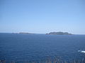
Meijima
- Area
- 0.87 km²
- High point
- 113 m

Yomejima
- Area
- 0.61 km²
- High point
- 105 m
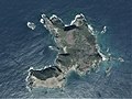
Nishijima
- Area
- 0.49 km²
- High point
- 100 m

Hirajima
- Area
- 0.48 km²
- High point
- 57 m

Minamijima
- Area
- 0.29 km²
- High point
- 57 m

Higashijima
- Area
- 0.25 km²
- High point
- 92 m
Kangoku Rock
- Area
- 0.18 km²
- High point
- 11 m
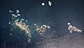
Kitanoshima
- Area
- 0.14 km²
- High point
- 40 m

Magojima
- Area
- 0.12 km²
- High point
- 91 m
Rocks & skerries
On the chart above, at its closest zooms.
Listing 23 of 2268; the rest are on the chart.
Figures
Comparative heights
- South Iwo Jima: 916 m
- North Iwo Jima: 792 m
- Hahajima: 462 m
- Chichijima: 320 m
- Otōtojima: 299 m
- Anijima: 254 m
- Imōtojima: 216 m
- Iwo Jima: 170 m
- Nakōdo: 155 m
- Mukōjima: 137 m
- Nishinoshima: 135 m
- Anejima: 113 m
- Meijima: 113 m
- Yomejima: 105 m
To the same scale
Islands by area
| Iwo Jima | 30 km² |
| Chichijima | 23.8 km² |
| Hahajima | 20.2 km² |
| Anijima | 7.9 km² |
| North Iwo Jima | 5.6 km² |
| Otōtojima | 5.2 km² |
| Nishinoshima | 3.8 km² |
| South Iwo Jima | 3.5 km² |
| Mukojima | 2.5 km² |
| Minamitorishima | 1.5 km² |
| Anejima | 1.4 km² |
| Mukōjima | 1.4 km² |
| Nakōdo Island | 1.3 km² |
| Imōtojima | 1.2 km² |
| Meijima | 0.87 km² |
| Yomejima | 0.61 km² |
| Nishijima | 0.49 km² |
| Hirajima | 0.48 km² |
| Minamijima | 0.29 km² |
| Higashijima | 0.25 km² |
| Kangoku Rock | 0.18 km² |
| Kitanoshima | 0.14 km² |
| Magojima | 0.12 km² |
Groups within
Photographs

Anijima as seen from the Nagasaki Observation Deck in Chichijima, Ogasawara Village, Tokyo, Japan

剣先山(東京都小笠原村 母島)より沖港を望む, Oki on Hahajima Island

Otouto-Jima Island Aerial photograph.2013

U.S. Marine Corps photo by Lance Cpl. Emily Bos / Public domain

Ministry of Land, Infrastructure, Transport and Tourism Ogasawara General Office in Chichijima, Ogasawara Village, Tokyo, Japan
Sources
Facts
Photographs
- Anisima. タクナワン / CC0
- Hahajima-oki. しんかわな / CC BY-SA 3.0
- Otouto-Jima Island Aerial photograph.2014. 国土地理院 / Attribution
- U S Marines with 3rd Marine Division visit Iwo Jima (9972514). U.S. Marine Corps photo by Lance Cpl. Emily Bos / Public domain
- Ogasawara General Office. Yasu (talk) / CC BY-SA 3.0