Philippine SeaJapan
27°00′N 142°10′E
Ogasawara Islands
Part of Nanpō Islands
The Bonin Islands, also known as the Ogasawara Islands (Japanese: 小笠原諸島), are a Japanese archipelago of over 30 subtropical and tropical islands located around 1,000 kilometers (620 mi) SSE of Tokyo and 1,600 kilometers (1,000 mi) northwest of Guam.

Chart
Overview
The Bonin Islands, also known as the Ogasawara Islands (Japanese: 小笠原諸島), are a Japanese archipelago of over 30 subtropical and tropical islands located around 1,000 kilometers (620 mi) SSE of Tokyo and 1,600 kilometers (1,000 mi) northwest of Guam. The group as a whole has a total area of 84 square kilometers (32 sq mi) but only two of the islands are permanently inhabited, Chichijima and Hahajima. Together, their population was 2,560 as of 2021. Administratively, Tokyo's Ogasawara Subprefecture also includes the settlements on the Volcano Islands and the Self-Defense Force post on Iwo Jima. The seat of government is Chichijima. Because of the Bonins' isolation, many of their animals and plants have undergone unique evolutionary processes. They have been referred to as the "Galápagos of the Orient" and were named a Natural World Heritage Site in 2011. When first reached during the early modern period, the islands were entirely uninhabited, although subsequent research has found evidence of some prehistoric habitation by Micronesians. Upon their repeated rediscoveries, the islands were largely ignored by the Spanish, Dutch, and isolationist Japanese until finally being claimed by a passing British captain in 1827. American, European, and Hawaiian colonists arrived from the Kingdom of Hawaii in 1830. Subsequently, Meiji Japan successfully colonized and reclaimed the islands in 1875, but Bonin Islanders' community continued up to World War II, when most islanders were forcibly relocated to Honshu. Following Japan's defeat, the US Navy occupied the island, bulldozing existing Japanese homes and restricting resettlement until full control of the Bonins was returned to Japan in 1968. Ethnically, the island is now majority Japanese but remains unusually diverse, which is reflected in the local Creole language known as Bonin English. Improved transportation has made agriculture more profitable and encouraged tourism, but the development required for an airport remains a contentious local issue.
From Wikipedia, CC BY-SA 4.0
Census, cataloged
- Major islands6
- Minor islands17
- Islets271
- Rocks & skerries1,974
Major islands
Iwo Jima
- Area
- 30 km²
- High point
- 170 m
mä́], lit. tó̞ó̞]), is one of the Japanese Volcano Islands, which lie south of the Bonin Islands and together with them make up the Ogasawara Archipelago. Together with the Izu Islands, they make up Japan's Nanpō Islands.
Chichijima
- Area
- 23.8 km²
- High point
- 320 m
Chichijima (Japanese: 父島) is the largest and most populous of the Bonin Islands. Chichijima is about 240 km (150 mi) north of Iwo Jima. 1 sq mi) in size, the island is home to about 2,120 people (2021).
Hahajima
- Area
- 20.2 km²
- High point
- 462 m
Hahajima, Haha Jima, or Haha-jima (母島; meaning Mother Island) is the second-largest island within the Bonin or Ogasawara Islands south southeast of the Japanese Home Islands. The steeply-sloped island, which is about 21 km2 (8 sq mi) in area, has a population of 440.
Anijima
- Area
- 7.9 km²
- High point
- 254 m
North Iwo Jima
- Area
- 5.6 km²
- High point
- 792 m
North Iwo Jima (Japanese: 北硫黄島, Kita Iwōjima, "North Sulfur Island"), officially North or Kita Iōtō (written with the same characters) and previously known as Santo or San Alessandro, Hooge Meeuwen Island (Dutch: t'Hooge Meuwen Eylandt, "High Seagull Island"), and North Sulfur Island, is the northernmost member of Japan's Volcano Islands.
Otōtojima
- Area
- 5.2 km²
- High point
- 299 m
Otōtojima, Otōto-jima, or Otōto Jima (弟島, meaning Younger Brother Island), is an uninhabited island in the Chichijima archipelago of Japan's Ogasawara Islands. During the Meiji and Taishō eras between 50 and 100 people lived on the island, but it was deserted in 1944. The island is off-limits for tourists.


Minor islands

Nishinoshima
- Area
- 3.8 km²
- High point
- 135 m

South Iwo Jima
- Area
- 3.5 km²
- High point
- 916 m
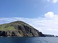
Mukojima
- Area
- 2.5 km²
- High point
- 88 m

Minamitorishima
- Area
- 1.5 km²
- High point
- 13 m

Anejima
- Area
- 1.4 km²
- High point
- 113 m

Mukōjima
- Area
- 1.4 km²
- High point
- 137 m

Nakōdo Island
- Area
- 1.3 km²
- High point
- 155 m

Imōtojima
- Area
- 1.2 km²
- High point
- 216 m
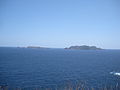
Meijima
- Area
- 0.87 km²
- High point
- 113 m

Yomejima
- Area
- 0.61 km²
- High point
- 105 m
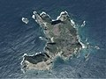
Nishijima
- Area
- 0.49 km²
- High point
- 100 m

Hirajima
- Area
- 0.48 km²
- High point
- 57 m

Minamijima
- Area
- 0.29 km²
- High point
- 57 m

Higashijima
- Area
- 0.25 km²
- High point
- 92 m
Kangoku Rock
- Area
- 0.18 km²
- High point
- 11 m
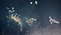
Kitanoshima
- Area
- 0.14 km²
- High point
- 40 m

Magojima
- Area
- 0.12 km²
- High point
- 91 m
Rocks & skerries
On the chart above, at its closest zooms.
Listing 23 of 2268; the rest are on the chart.
Figures
Comparative heights
- South Iwo Jima: 916 m
- North Iwo Jima: 792 m
- Hahajima: 462 m
- Chichijima: 320 m
- Otōtojima: 299 m
- Anijima: 254 m
- Imōtojima: 216 m
- Iwo Jima: 170 m
- Nakōdo: 155 m
- Mukōjima: 137 m
- Nishinoshima: 135 m
- Anejima: 113 m
- Meijima: 113 m
- Yomejima: 105 m
To the same scale
Islands by area
| Iwo Jima | 30 km² |
| Chichijima | 23.8 km² |
| Hahajima | 20.2 km² |
| Anijima | 7.9 km² |
| North Iwo Jima | 5.6 km² |
| Otōtojima | 5.2 km² |
| Nishinoshima | 3.8 km² |
| South Iwo Jima | 3.5 km² |
| Mukojima | 2.5 km² |
| Minamitorishima | 1.5 km² |
| Anejima | 1.4 km² |
| Mukōjima | 1.4 km² |
| Nakōdo Island | 1.3 km² |
| Imōtojima | 1.2 km² |
| Meijima | 0.87 km² |
| Yomejima | 0.61 km² |
| Nishijima | 0.49 km² |
| Hirajima | 0.48 km² |
| Minamijima | 0.29 km² |
| Higashijima | 0.25 km² |
| Kangoku Rock | 0.18 km² |
| Kitanoshima | 0.14 km² |
| Magojima | 0.12 km² |
Groups within
Photographs

剣先山(東京都小笠原村 母島)より沖港を望む, Oki on Hahajima Island

Otouto-Jima Island Aerial photograph.2013

Wai-Beach in Japan Bonin Islands Hahajima Island

Anijima as seen from the Nagasaki Observation Deck in Chichijima, Ogasawara Village, Tokyo, Japan

イルカたち

Ministry of Land, Infrastructure, Transport and Tourism Ogasawara General Office in Chichijima, Ogasawara Village, Tokyo, Japan

小笠原アイランズ農業協同組合

U.S. Marine Corps photo by Lance Cpl. Emily Bos / Public domain

Swimming with dolphins in Ogasawara, Japan

Typhoon Dolphin crosses the remote Ogasawara Islands of Japan.

Certificate of UNESCO World Heritage Site for Ogasawara Islands.
Sources
Facts
Photographs
- Hahajima-oki. しんかわな / CC BY-SA 3.0
- Otouto-Jima Island Aerial photograph.2014. 国土地理院 / Attribution
- Wai-Beach. タクナワン / CC0
- Anisima. タクナワン / CC0
- イルカたち - panoramio. takeakisky homma / CC BY-SA 3.0
- Ogasawara General Office. Yasu (talk) / CC BY-SA 3.0
- Ogasawara-islands-building. YusukeSaito / CC BY-SA 4.0
- U S Marines with 3rd Marine Division visit Iwo Jima (9972514). U.S. Marine Corps photo by Lance Cpl. Emily Bos / Public domain
- Swimming with dolphins Ogasawara. fo.ol / CC BY-SA 2.0
- Typhoon Dolphin Crosses the Ogasawara Islands (CIRA 2026-08-04). Himawari imagery: CSU/CIRA & JMA/JAXA / Public domain
- World Heritage certificate, Ogasawara Islands 20111216. Kirara3500 / CC BY-SA 3.0
- Ogasawara Islands Tokyo Metropolis Wikivoyage banner. Anagounagi / CC BY-SA 4.0