Aegean SeaGreece and Türkiye
39°07′N 23°43′E
Sporades
Σποράδες
Part of Aegean Islands
The (Northern) Sporades are an archipelago along the east coast of Greece, northeast of the island of Euboea, in the Aegean Sea. They consist of 24 islands, four of which are permanently inhabited: Alonnisos, Skiathos, Skopelos and Skyros. They may also be referred to as the Thessalian Sporades (Θεσσαλικές Σποράδες).

Chart
Overview
The (Northern) Sporades are an archipelago along the east coast of Greece, northeast of the island of Euboea, in the Aegean Sea. They consist of 24 islands, four of which are permanently inhabited: Alonnisos, Skiathos, Skopelos and Skyros. They may also be referred to as the Thessalian Sporades (Θεσσαλικές Σποράδες).
From Wikipedia, CC BY-SA 4.0
Census, cataloged
- Major islands11
- Minor islands200
- Islets419
- Rocks & skerries2,859
Major islands
Lesbos
- Area
- 1,632 km²
- High point
- 967 m
Lesbos or Lesvos (Greek: Λέσβος, romanized: Lésvos [ˈlezvos]) is a Greek island located in the northeastern Aegean Sea. It has an area of 1,633 km2 (631 sq mi), with approximately 400 km (249 mi) of coastline, making it the third largest island in Greece and the eighth largest in the Mediterranean.
Rhodes
- Area
- 1,400 km²
- High point
- 1,213 m
Rhodes ( ; Greek: Ρόδος, romanized: Ródos [ˈroðos]) is the largest of Greece's Dodecanese islands and their historical capital, as well as the ninth largest island in the Mediterranean Sea.
Chios
- Area
- 843 km²
- High point
- 1,297 m
os] ), also known as Scio in English, is the fifth largest Greek island, situated in the northern Aegean Sea, and the tenth largest island in the Mediterranean Sea. The island is separated from the Anatolian mainland by the Chios Strait.
Samos
- Area
- 476 km²
- High point
- 1,443 m
0 mi) Mycale Strait. It is also a separate regional unit of the North Aegean region.
Lemnos
- Area
- 476 km²
- High point
- 426 m
Lemnos (Ancient Greek: Λῆμνος [ˈlɛ̂ːmnos]) or Limnos (Modern Greek: Λήμνος [ˈlimnos]) is a Greek island in the northern Aegean Sea. Administratively the island forms a separate municipality within the Lemnos regional unit, which is part of the North Aegean region.
Thasos
- Area
- 383 km²
- High point
- 1,204 m
Thasos (Greek: Θάσος [ˈθasos]) is a Greek island in the northern Aegean Sea. It is the northernmost major Greek island, and 12th largest by area.
Karpathos
- Area
- 300 km²
- High point
- 1,215 m
Karpathos, also Carpathos, is the second largest of the Greek Dodecanese islands, in the southeastern Aegean Sea. Together with the neighboring smaller Saria Island it forms the municipality of Karpathos, which is part of the regional unit Karpathos-Kasos.
Kos
- Area
- 287 km²
- High point
- 846 m
Kos or Cos (; Greek: Κως [kos]) is a Greek island, part of the Dodecanese island chain in the southeastern Aegean Sea. Kos is the third largest island of the Dodecanese, after Rhodes and Karpathos; it has a population of 37,089 (2021 census), making it the second most populous of the Dodecanese after Rhodes.
Imbros
- Area
- 283 km²
- High point
- 673 m
Imbros (Greek: Ίμβρος, romanized: Ímvros; Turkish: İmroz; Ottoman Turkish: ايمروز), officially Gökçeada (lit. 'heavenly island') since 29 July 1970, is the largest island of Turkey, located in Çanakkale Province.
Icaria
- Area
- 254 km²
- High point
- 1,037 m
Ikaria, also spelled Icaria (; Greek: Ικαρία [ikaˈri.a]), is a Greek island in the Aegean Sea, 10 nautical miles (19 km) southwest of Samos. Administratively, Ikaria forms a separate municipality within the Ikaria regional unit, which is part of the North Aegean administrative region.
Scyros
- Area
- 209 km²
- High point
- 788 m
Skyros, in some historical contexts Latinized Scyros (Ancient Greek: Σκῦρος, Attic Greek pronunciation: [skŷːros]), is an island in Greece. It is the southernmost inhabited island of the Sporades, an archipelago in the Aegean Sea.


Minor islands

Samothrace
- Area
- 180 km²
- High point
- 1,611 m

Kalymnos
- Area
- 110 km²
- High point
- 676 m

Astypalaia
- Area
- 96.5 km²
- High point
- 482 m
Salamis
- Area
- 95.4 km²
- High point
- 376 m

Skopelos
- Area
- 95.2 km²
- High point
- 681 m

Kasos
- Area
- 65.8 km²
- High point
- 597 m

Alonnisos
- Area
- 64.3 km²
- High point
- 467 m

Tilos
- Area
- 61.5 km²
- High point
- 654 m

Symi
- Area
- 57.5 km²
- High point
- 617 m

Leros
- Area
- 53.9 km²
- High point
- 331 m

Skiathos
- Area
- 47.2 km²
- High point
- 433 m

Agios Efstratios
- Area
- 41.7 km²
- High point
- 297 m

Nisyros
- Area
- 41.1 km²
- High point
- 698 m

Psara
- Area
- 38.6 km²
- High point
- 64 m

Bozcaada
- Area
- 37.5 km²
- High point
- 192 m

Patmos
- Area
- 33.9 km²
- High point
- 264 m

Fourni Island
- Area
- 30.1 km²
- High point
- 509 m

Halki
- Area
- 27.4 km²
- High point
- 593 m

Uzunada
- Area
- 25.5 km²
- High point
- 187 m

Kyra Panagia
- Area
- 24.9 km²
- High point
- 303 m

Cunda Island
- Area
- 23.7 km²
- High point
- 81 m

Poros
- Area
- 22.5 km²
- High point
- 358 m

Saria Island
- Area
- 20.5 km²
- High point
- 620 m

Spetses
- Area
- 20 km²
- High point
- 244 m

Leipsoi
- Area
- 15.8 km²
- High point
- 277 m

Pserimos
- Area
- 14.5 km²
- High point
- 268 m

Peristera
- Area
- 14.3 km²
- High point
- 258 m

Oinousses
- Area
- 14.2 km²
- High point
- 173 m

Dokos
- Area
- 13.4 km²
- High point
- 297 m

Agathonisi
- Area
- 13.4 km²
- High point
- 208 m
Gioura
- Area
- 11.1 km²
- High point
- 567 m

Thymaina
- Area
- 10.1 km²
- High point
- 463 m

Levitha
- Area
- 9.1 km²
- High point
- 141 m
Syrna
- Area
- 8.3 km²
- High point
- 321 m

Alimia
- Area
- 7.4 km²
- High point
- 268 m
Ammouliani
- Area
- 7 km²
- High point
- 80 m

Arkoi
- Area
- 6.7 km²
- High point
- 112 m

Skantzoura
- Area
- 6.3 km²
- High point
- 104 m

Telendos
- Area
- 4.6 km²
- High point
- 457 m

Nimos
- Area
- 4.6 km²
- High point
- 363 m

Gyali
- Area
- 4.6 km²
- High point
- 179 m
Kinaros
- Area
- 4.5 km²
- High point
- 287 m

Valaxa
- Area
- 4.4 km²
- High point
- 213 m

Antipsara
- Area
- 4.3 km²
- High point
- 143 m

Agios Georgios
- Area
- 4.2 km²
- High point
- 297 m

Piperi
- Area
- 4.1 km²
- High point
- 352 m

Farmakonisi
- Area
- 3.9 km²
- High point
- 108 m

Skyropoula
- Area
- 3.7 km²
- High point
- 176 m
Sarakino
- Area
- 3.3 km²
- High point
- 132 m
Büyük Maden Island
- Area
- 3 km²
- High point
- 105 m

Armathia
- Area
- 2.5 km²
- High point
- 109 m
Pasas
- Area
- 2.4 km²
- High point
- 109 m

Çıplak Island
- Area
- 2.3 km²
- High point
- 50 m

Agios Minas Island
- Area
- 2.2 km²
- High point
- 205 m
Spetsopoula
- Area
- 1.9 km²
- High point
- 108 m

Kalolimnos
- Area
- 1.9 km²
- High point
- 106 m

Seskli
- Area
- 1.8 km²
- High point
- 122 m
Ofidoussa
- Area
- 1.8 km²
- High point
- 133 m

Prasonisi
- Area
- 1.5 km²
- High point
- 80 m
Archangelos
- Area
- 1.5 km²
- High point
- 132 m
Kandelioussa
- Area
- 1.4 km²
- High point
- 104 m
Kounoupi
- Area
- 1.4 km²
- High point
- 90 m

Fleves
- Area
- 1.3 km²
- High point
- 74 m
Agreloussa
- Area
- 1.3 km²
- High point
- 118 m

Zaforas
- Area
- 1.3 km²
- High point
- 220 m

Pergousa
- Area
- 1.2 km²
- High point
- 75 m
Pachia
- Area
- 1.2 km²
- High point
- 138 m

Tsougria
- Area
- 1.2 km²
- High point
- 90 m

Falkonera
- Area
- 1.1 km²
- High point
- 194 m
Pınar Adası
- Area
- 1 km²
- High point
- 86 m
Adelfi Alonnisou
- Area
- 1 km²
- High point
- 174 m

Astakida
- Area
- 0.98 km²
- High point
- 139 m
Pontikoussa
- Area
- 0.98 km²
- High point
- 227 m

Samiopoula
- Area
- 0.96 km²
- High point
- 153 m

Sergitsi
- Area
- 0.94 km²
- High point
- 139 m
Rabbit Island (Çanakkale)
- Area
- 0.92 km²
- High point
- 42 m
Orak Island
- Area
- 0.87 km²
- High point
- 67 m
Prasso
- Area
- 0.85 km²
- High point
- 156 m

Psathoura
- Area
- 0.82 km²
- High point
- 23 m
Nisiopi
- Area
- 0.79 km²
- High point
- 59 m

Gaidouronisi
- Area
- 0.75 km²
- High point
- 155 m
Plati Pserimou
- Area
- 0.68 km²
- High point
- 42 m
Agios Theodoros
- Area
- 0.66 km²
- High point
- 96 m

Büyük Ilyosta Island
- Area
- 0.64 km²
- High point
- 57 m
Yellice Adası
- Area
- 0.64 km²
- High point
- 55 m
Kisiria
- Area
- 0.63 km²
- High point
- 68 m
Platia
- Area
- 0.62 km²
- High point
- 39 m
Megalo Fokionisi
- Area
- 0.61 km²
- High point
- 53 m
Makry
- Area
- 0.61 km²
- High point
- 96 m
Mustafa Çelebi Adası
- Area
- 0.59 km²
- High point
- 27 m
Plakida
- Area
- 0.57 km²
- High point
- 76 m

Psyttaleia
- Area
- 0.57 km²
- High point
- 38 m
Erinia
- Area
- 0.56 km²
- High point
- 27 m

Barmbalias
- Area
- 0.55 km²
- High point
- 56 m

Kalem Island
- Area
- 0.51 km²
- High point
- 50 m

Antitilos
- Area
- 0.5 km²
- High point
- 119 m
Lale Island
- Area
- 0.5 km²
- High point
- 36 m
Mesonisi
- Area
- 0.49 km²
- High point
- 42 m
Lechousa
- Area
- 0.49 km²
- High point
- 122 m
Karabağ Island
- Area
- 0.49 km²
- High point
- 43 m
Koutsomytis
- Area
- 0.48 km²
- High point
- 66 m
Nera
- Area
- 0.48 km²
- High point
- 50 m
Gez Island
- Area
- 0.45 km²
- High point
- 74 m
Nero
- Area
- 0.44 km²
- High point
- 63 m

Chamili
- Area
- 0.44 km²
- High point
- 36 m
Thymenaki
- Area
- 0.42 km²
- High point
- 127 m

Garip Island
- Area
- 0.41 km²
- High point
- 29 m
Arkos
- Area
- 0.41 km²
- High point
- 85 m
Chondro
- Area
- 0.38 km²
- High point
- 90 m
Adelfopoulo
- Area
- 0.37 km²
- High point
- 146 m
Agios Georgios
- Area
- 0.37 km²
- High point
- 224 m
Vatos
- Area
- 0.37 km²
- High point
- 45 m
Tragonisi
- Area
- 0.36 km²
- High point
- 102 m
Kinira
- Area
- 0.35 km²
- High point
- 143 m
Piganousa
- Area
- 0.35 km²
- High point
- 139 m

Karantina Island
- Area
- 0.35 km²
- High point
- 27 m

Marathos Island
- Area
- 0.34 km²
- High point
- 50 m
Dasia
- Area
- 0.34 km²
- High point
- 126 m
Nisos
- Area
- 0.33 km²
- High point
- 48 m
Kaşık Adası
- Area
- 0.32 km²
- High point
- 67 m
Megalo Liadi
- Area
- 0.32 km²
- High point
- 50 m
Anydros
- Area
- 0.31 km²
- High point
- 100 m

Büyük Ada
- Area
- 0.31 km²
- High point
- 53 m
Makronisi
- Area
- 0.3 km²
- High point
- 20 m
Tragousa
- Area
- 0.3 km²
- High point
- 58 m
Çiçek Island
- Area
- 0.3 km²
- High point
- 22 m
Gaidouronissos
- Area
- 0.3 km²
- High point
- 46 m
Kalovolos
- Area
- 0.29 km²
- High point
- 60 m
Kalavros
- Area
- 0.29 km²
- High point
- 99 m
Koulouri
- Area
- 0.29 km²
- High point
- 76 m
Agia Kyriaki islets
- Area
- 0.28 km²
- High point
- 23 m
Unnamed island
- Area
- 0.28 km²
- High point
- 23 m
Chiliomódi
- Area
- 0.27 km²
- High point
- 107 m
Divounia 1
- Area
- 0.26 km²
- High point
- 95 m
Makronisi
- Area
- 0.26 km²
- High point
- 41 m
Kara Ada
- Area
- 0.25 km²
- High point
- 57 m
Makronisos
- Area
- 0.25 km²
- High point
- 37 m
Frangkos
- Area
- 0.24 km²
- High point
- 72 m
Praso Skantzouras
- Area
- 0.24 km²
- High point
- 44 m
Glyno
- Area
- 0.24 km²
- High point
- 39 m
Kouneli
- Area
- 0.22 km²
- High point
- 51 m
Megalos Adelfos islet
- Area
- 0.22 km²
- High point
- 129 m
Küçük Maden Adası
- Area
- 0.22 km²
- High point
- 63 m
Strogyli
- Area
- 0.21 km²
- High point
- 71 m
Revythoussa
- Area
- 0.21 km²
- High point
- 47 m

Strongylí
- Area
- 0.21 km²
- High point
- 120 m
Makronisi
- Area
- 0.21 km²
- High point
- 34 m
Strongyli
- Area
- 0.21 km²
- High point
- 88 m
Divounia 2
- Area
- 0.21 km²
- High point
- 95 m
Faradonisia
- Area
- 0.2 km²
- High point
- 60 m
Skantili
- Area
- 0.2 km²
- High point
- 34 m
Gaidaros
- Area
- 0.19 km²
- High point
- 72 m
Glaros
- Area
- 0.19 km²
- High point
- 33 m
Chondrós
- Area
- 0.18 km²
- High point
- 98 m
Aspronisi
- Area
- 0.18 km²
- High point
- 70 m
Panagia
- Area
- 0.18 km²
- High point
- 37 m
Unnamed island
- Area
- 0.18 km²
- High point
- 28 m
Agios Stefanos Elatas
- Area
- 0.18 km²
- High point
- 21 m
Margariti
- Area
- 0.17 km²
- High point
- 23 m
Pelerissa
- Area
- 0.17 km²
- High point
- 50 m
Incir Ada
- Area
- 0.17 km²
- High point
- 41 m
Yassıada
- Area
- 0.16 km²
- High point
- 9 m
Strongyli
- Area
- 0.16 km²
- High point
- 84 m
Arefousa
- Area
- 0.16 km²
- High point
- 46 m
Stefania
- Area
- 0.15 km²
- High point
- 25 m
Koukonesi
- Area
- 0.15 km²
- High point
- 9 m
Boğaz Adası
- Area
- 0.15 km²
- High point
- 18 m
Artemis
- Area
- 0.15 km²
- High point
- 29 m
Katonisi
- Area
- 0.15 km²
- High point
- 46 m
Safonidi
- Area
- 0.15 km²
- High point
- 44 m
Unnamed island
- Area
- 0.14 km²
- High point
- 84 m
Pelagonissos
- Area
- 0.14 km²
- High point
- 28 m
Agia Kyriaki
- Area
- 0.14 km²
- High point
- 56 m
Pitta
- Area
- 0.13 km²
- High point
- 15 m
Fener Ada
- Area
- 0.13 km²
- High point
- 31 m
Kara Ada
- Area
- 0.13 km²
- High point
- 43 m
Aspronisi
- Area
- 0.13 km²
- High point
- 27 m
Modi
- Area
- 0.13 km²
- High point
- 80 m
Mesos Adelfos islet
- Area
- 0.13 km²
- High point
- 67 m
Panagia
- Area
- 0.13 km²
- High point
- 24 m
Astakidopoulo
- Area
- 0.12 km²
- High point
- 42 m
Agios Nikolaos
- Area
- 0.12 km²
- High point
- 78 m
Megalo Glaronisi
- Area
- 0.12 km²
- High point
- 32 m
Korakas
- Area
- 0.12 km²
- High point
- 21 m
Notio Podi
- Area
- 0.11 km²
- High point
- 75 m
Gialesino
- Area
- 0.11 km²
- High point
- 43 m
Polemika
- Area
- 0.11 km²
- High point
- 42 m
Penna
- Area
- 0.11 km²
- High point
- 28 m
Agia Kyriaki
- Area
- 0.11 km²
- High point
- 67 m
Rocks & skerries
On the chart above, at its closest zooms.
Listing 200 of 3489; the rest are on the chart.
Figures
Comparative heights
To the same scale
Islands by area
Groups within
Photographs
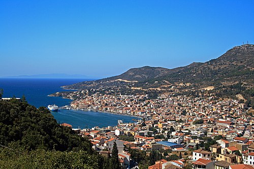
View of Samos town, capital of Samos island, Greece.

Berth of fishing boats in Lefkos. Karpathos, Greece

This is a photograph of a Natura 2000 protected area with ID

View on Mirina, main town Limnos isl, Greece.

The coastal relief of Rhodes. Greece

Burned forest near Kastro / Thasos Island

Alonnisos island in Greece

Chios, Greece, August 2023

Achladies Apartments, Skiathos, Greece

Greek Island Skantzoura from space

Touranes islets, south of Skiathos, Thessaly, Greece
Sources
Facts
Photographs
- Samos 049 2009. Pe-sa / CC BY-SA 3.0
- Berth of fishing boats in Lefkos. Karpathos, Greece. Ввласенко / CC BY-SA 3.0
- Papadimitriou anna psathoura. Annapapth / CC BY-SA 4.0
- MirinaLimnosGreece. User:Digr / Public domain
- The coastal relief of Rhodes. Greece. Ввласенко / CC BY-SA 3.0
- Verbrannter Wald, Thasos. Neptuul / CC BY-SA 4.0
- Alonnisos IMG 3703. Deyan Vasilev ( Dido3 ) / CC BY-SA 3.0
- Chios Aug 2023 12 53 52 808000. Robot8A / CC BY-SA 4.0
- Achladies Apartments, Skiathos, Greece (Unsplash). Nick Karvounis nickkarvounis / CC0
- Skantzoura from space. NASA / Public domain
- Alonisos banner. Adamantios,Inkey / CC BY-SA 4.0
- Touranes. Dan Taylor / CC BY 2.0