Aegean SeaTürkiye and Greece
38°00′N 25°00′E
Aegean Islands
The Aegean Islands are the group of islands in the Aegean Sea, with mainland Greece to the west and north and Turkey to the east; the island of Crete delimits the sea to the south, those of Rhodes, Karpathos and Kasos to the southeast.

Chart
Overview
The Aegean Islands are the group of islands in the Aegean Sea, with mainland Greece to the west and north and Turkey to the east; the island of Crete delimits the sea to the south, those of Rhodes, Karpathos and Kasos to the southeast. The ancient Greek name of the Aegean Sea, Archipelago (ἀρχιπέλαγος, archipelagos), was later applied to the islands it contains and is now used more generally, to refer to any island group. The vast majority of the Aegean Islands belong to Greece, being split among nine administrative regions. The only sizable possessions of Turkey in the Aegean Sea are Imbros (Gökçeada) and Tenedos (Bozcaada), in the northeastern part of the sea. Various smaller islets off Turkey's western coast are also under Turkish sovereignty. The islands have hot summers and mild winters, a hot-summer Mediterranean climate (Csa in the Köppen climate classification).
From Wikipedia, CC BY-SA 4.0
Census, cataloged
- Major islands2
- Minor islands282
- Islets619
- Rocks & skerries6,263
Major islands
Crete
- Area
- 8,256 km²
- High point
- 2,456 m
Crete ( KREET) is the largest and most populous island of Greece, the 89th largest island in the world, and the fifth largest island in the Mediterranean Sea, after Sicily, Sardinia, Cyprus, and Corsica.
Euboea
- Area
- 3,655 km²
- High point
- 1,743 m
Euboea, also known as Evia, is the second-largest Greek island in area and population, after Crete, and the sixth largest island in the Mediterranean Sea.


Minor islands
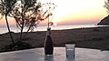
Lesbos
- Area
- 1,632 km²
- High point
- 967 m

Rhodes
- Area
- 1,400 km²
- High point
- 1,213 m

Chios
- Area
- 843 km²
- High point
- 1,297 m

Samos
- Area
- 476 km²
- High point
- 1,443 m
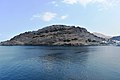
Lemnos
- Area
- 476 km²
- High point
- 426 m

Naxos
- Area
- 429 km²
- High point
- 1,001 m

Thasos
- Area
- 383 km²
- High point
- 1,204 m

Andros
- Area
- 379 km²
- High point
- 994 m

Karpathos
- Area
- 300 km²
- High point
- 1,215 m

Kos
- Area
- 287 km²
- High point
- 846 m
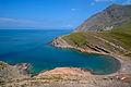
Imbros
- Area
- 283 km²
- High point
- 673 m

Icaria
- Area
- 254 km²
- High point
- 1,037 m

Scyros
- Area
- 209 km²
- High point
- 788 m
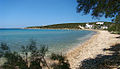
Paros
- Area
- 195 km²
- High point
- 776 m

Tinos
- Area
- 195 km²
- High point
- 727 m
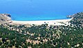
Samothrace
- Area
- 180 km²
- High point
- 1,611 m

Milos
- Area
- 158 km²
- High point
- 748 m

Kea
- Area
- 132 km²
- High point
- 559 m

Amorgos
- Area
- 120 km²
- High point
- 823 m

Kalymnos
- Area
- 110 km²
- High point
- 676 m

Ios
- Area
- 109 km²
- High point
- 713 m

Kythnos
- Area
- 99 km²
- High point
- 352 m
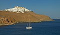
Astypalaia
- Area
- 96.5 km²
- High point
- 482 m
Salamis
- Area
- 95.4 km²
- High point
- 376 m
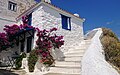
Skopelos
- Area
- 95.2 km²
- High point
- 681 m

Mykonos
- Area
- 86.4 km²
- High point
- 341 m

Syros
- Area
- 84.3 km²
- High point
- 442 m
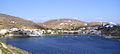
Sifnos
- Area
- 76.3 km²
- High point
- 682 m

Santorini
- Area
- 76 km²
- High point
- 567 m

Serifos
- Area
- 72.5 km²
- High point
- 585 m

Kasos
- Area
- 65.8 km²
- High point
- 597 m

Alonnisos
- Area
- 64.3 km²
- High point
- 467 m

Tilos
- Area
- 61.5 km²
- High point
- 654 m

Symi
- Area
- 57.5 km²
- High point
- 617 m

Leros
- Area
- 53.9 km²
- High point
- 331 m

Skiathos
- Area
- 47.2 km²
- High point
- 433 m

Agios Efstratios
- Area
- 41.7 km²
- High point
- 297 m

Sikinos
- Area
- 41.4 km²
- High point
- 545 m

Nisyros
- Area
- 41.1 km²
- High point
- 698 m

Psara
- Area
- 38.6 km²
- High point
- 64 m

Anafi
- Area
- 38.3 km²
- High point
- 581 m

Kimolos
- Area
- 37.5 km²
- High point
- 345 m

Bozcaada
- Area
- 37.5 km²
- High point
- 192 m

Antiparos
- Area
- 34.6 km²
- High point
- 300 m

Patmos
- Area
- 33.9 km²
- High point
- 264 m

Folegandros
- Area
- 32.2 km²
- High point
- 416 m

Fourni Island
- Area
- 30.1 km²
- High point
- 509 m

Halki
- Area
- 27.4 km²
- High point
- 593 m

Uzunada
- Area
- 25.5 km²
- High point
- 187 m

Kyra Panagia
- Area
- 24.9 km²
- High point
- 303 m

Cunda Island
- Area
- 23.7 km²
- High point
- 81 m

Poros
- Area
- 22.5 km²
- High point
- 358 m

Saria Island
- Area
- 20.5 km²
- High point
- 620 m

Spetses
- Area
- 20 km²
- High point
- 244 m
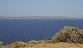
Makronisos
- Area
- 18.5 km²
- High point
- 149 m

Irakleia
- Area
- 18.1 km²
- High point
- 418 m
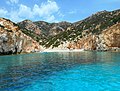
Polyaigos
- Area
- 17.8 km²
- High point
- 345 m
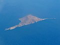
Gyaros
- Area
- 17.5 km²
- High point
- 490 m
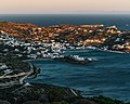
Leipsoi
- Area
- 15.8 km²
- High point
- 277 m
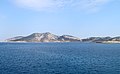
Keros
- Area
- 15.1 km²
- High point
- 429 m

Pserimos
- Area
- 14.5 km²
- High point
- 268 m

Peristera
- Area
- 14.3 km²
- High point
- 258 m

Oinousses
- Area
- 14.2 km²
- High point
- 173 m

Rineia
- Area
- 14 km²
- High point
- 136 m

Dokos
- Area
- 13.4 km²
- High point
- 297 m
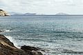
Donoussa
- Area
- 13.4 km²
- High point
- 386 m

Agathonisi
- Area
- 13.4 km²
- High point
- 208 m
Gioura
- Area
- 11.1 km²
- High point
- 567 m

Thymaina
- Area
- 10.1 km²
- High point
- 463 m

Therasia
- Area
- 9.2 km²
- High point
- 294 m

Levitha
- Area
- 9.1 km²
- High point
- 141 m

Antimilos
- Area
- 8.7 km²
- High point
- 684 m
Syrna
- Area
- 8.3 km²
- High point
- 321 m

Schoinoussa
- Area
- 8.1 km²
- High point
- 134 m

Despotiko
- Area
- 7.7 km²
- High point
- 186 m

Alimia
- Area
- 7.4 km²
- High point
- 268 m
Ammouliani
- Area
- 7 km²
- High point
- 80 m

Arkoi
- Area
- 6.7 km²
- High point
- 112 m
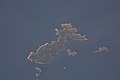
Skantzoura
- Area
- 6.3 km²
- High point
- 104 m

Ano Koufonisi
- Area
- 5.7 km²
- High point
- 101 m

Telendos
- Area
- 4.6 km²
- High point
- 457 m

Nimos
- Area
- 4.6 km²
- High point
- 363 m

Gyali
- Area
- 4.6 km²
- High point
- 179 m
Kinaros
- Area
- 4.5 km²
- High point
- 287 m

Valaxa
- Area
- 4.4 km²
- High point
- 213 m

Antipsara
- Area
- 4.3 km²
- High point
- 143 m

Agios Georgios
- Area
- 4.2 km²
- High point
- 297 m

Piperi
- Area
- 4.1 km²
- High point
- 352 m

Farmakonisi
- Area
- 3.9 km²
- High point
- 108 m

Kato Koufonisi
- Area
- 3.9 km²
- High point
- 121 m

Skyropoula
- Area
- 3.7 km²
- High point
- 176 m

Delos
- Area
- 3.6 km²
- High point
- 112 m

Nea Kameni
- Area
- 3.4 km²
- High point
- 134 m
Sarakino
- Area
- 3.3 km²
- High point
- 132 m
Büyük Maden Island
- Area
- 3 km²
- High point
- 105 m
Nikouria
- Area
- 2.7 km²
- High point
- 326 m

Armathia
- Area
- 2.5 km²
- High point
- 109 m
Pasas
- Area
- 2.4 km²
- High point
- 109 m

Çıplak Island
- Area
- 2.3 km²
- High point
- 50 m

Agios Minas Island
- Area
- 2.2 km²
- High point
- 205 m
Spetsopoula
- Area
- 1.9 km²
- High point
- 108 m
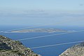
Kalolimnos
- Area
- 1.9 km²
- High point
- 106 m

Seskli
- Area
- 1.8 km²
- High point
- 122 m
Ofidoussa
- Area
- 1.8 km²
- High point
- 133 m
Strongyli
- Area
- 1.6 km²
- High point
- 179 m
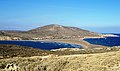
Prasonisi
- Area
- 1.5 km²
- High point
- 80 m
Archangelos
- Area
- 1.5 km²
- High point
- 132 m
Tragonisi
- Area
- 1.4 km²
- High point
- 152 m
Kandelioussa
- Area
- 1.4 km²
- High point
- 104 m
Kounoupi
- Area
- 1.4 km²
- High point
- 90 m

Serifopoula
- Area
- 1.4 km²
- High point
- 189 m

Fleves
- Area
- 1.3 km²
- High point
- 74 m
Kardiotissa
- Area
- 1.3 km²
- High point
- 133 m
Agreloussa
- Area
- 1.3 km²
- High point
- 118 m

Zaforas
- Area
- 1.3 km²
- High point
- 220 m

Pergousa
- Area
- 1.2 km²
- High point
- 75 m
Pachia
- Area
- 1.2 km²
- High point
- 138 m

Tsougria
- Area
- 1.2 km²
- High point
- 90 m
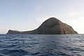
Christiani island
- Area
- 1.1 km²
- High point
- 258 m

Falkonera
- Area
- 1.1 km²
- High point
- 194 m
Antíkeri
- Area
- 1.1 km²
- High point
- 88 m
Drima
- Area
- 1.1 km²
- High point
- 86 m
Pınar Adası
- Area
- 1 km²
- High point
- 86 m
Adelfi Alonnisou
- Area
- 1 km²
- High point
- 174 m

Astakida
- Area
- 0.98 km²
- High point
- 139 m
Pontikoussa
- Area
- 0.98 km²
- High point
- 227 m

Samiopoula
- Area
- 0.96 km²
- High point
- 153 m

Sergitsi
- Area
- 0.94 km²
- High point
- 139 m
Rabbit Island (Çanakkale)
- Area
- 0.92 km²
- High point
- 42 m
Orak Island
- Area
- 0.87 km²
- High point
- 67 m
Prasso
- Area
- 0.85 km²
- High point
- 156 m
Kitriani
- Area
- 0.84 km²
- High point
- 100 m
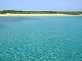
Psathoura
- Area
- 0.82 km²
- High point
- 23 m
Nisiopi
- Area
- 0.79 km²
- High point
- 59 m

Gaidouronisi
- Area
- 0.75 km²
- High point
- 155 m
Plati Pserimou
- Area
- 0.68 km²
- High point
- 42 m
Agios Theodoros
- Area
- 0.66 km²
- High point
- 96 m

Büyük Ilyosta Island
- Area
- 0.64 km²
- High point
- 57 m
Unnamed island
- Area
- 0.64 km²
- High point
- 77 m
Yellice Adası
- Area
- 0.64 km²
- High point
- 55 m
Kisiria
- Area
- 0.63 km²
- High point
- 68 m
Platia
- Area
- 0.62 km²
- High point
- 39 m
Megalo Fokionisi
- Area
- 0.61 km²
- High point
- 53 m
Makry
- Area
- 0.61 km²
- High point
- 96 m
Mustafa Çelebi Adası
- Area
- 0.59 km²
- High point
- 27 m
Plakida
- Area
- 0.57 km²
- High point
- 76 m

Psyttaleia
- Area
- 0.57 km²
- High point
- 38 m
Erinia
- Area
- 0.56 km²
- High point
- 27 m

Barmbalias
- Area
- 0.55 km²
- High point
- 56 m

Palea Kameni
- Area
- 0.52 km²
- High point
- 90 m

Kalem Island
- Area
- 0.51 km²
- High point
- 50 m
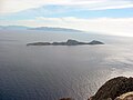
Antitilos
- Area
- 0.5 km²
- High point
- 119 m
Lale Island
- Area
- 0.5 km²
- High point
- 36 m
Mesonisi
- Area
- 0.49 km²
- High point
- 42 m
Lechousa
- Area
- 0.49 km²
- High point
- 122 m
Panteronisi
- Area
- 0.49 km²
- High point
- 51 m
Karabağ Island
- Area
- 0.49 km²
- High point
- 43 m
Koutsomytis
- Area
- 0.48 km²
- High point
- 66 m
Nisos Gaidaros-Didymi
- Area
- 0.48 km²
- High point
- 37 m
Nera
- Area
- 0.48 km²
- High point
- 50 m
Diplo
- Area
- 0.46 km²
- High point
- 17 m
Gez Island
- Area
- 0.45 km²
- High point
- 74 m
Nero
- Area
- 0.44 km²
- High point
- 63 m

Chamili
- Area
- 0.44 km²
- High point
- 36 m
Thymenaki
- Area
- 0.42 km²
- High point
- 127 m

Garip Island
- Area
- 0.41 km²
- High point
- 29 m
Arkos
- Area
- 0.41 km²
- High point
- 85 m
Drionisi
- Area
- 0.38 km²
- High point
- 36 m
Chondro
- Area
- 0.38 km²
- High point
- 90 m
Adelfopoulo
- Area
- 0.37 km²
- High point
- 146 m
Agios Georgios
- Area
- 0.37 km²
- High point
- 224 m
Vatos
- Area
- 0.37 km²
- High point
- 45 m
Tragonisi
- Area
- 0.36 km²
- High point
- 102 m
Kinira
- Area
- 0.35 km²
- High point
- 143 m
Piganousa
- Area
- 0.35 km²
- High point
- 139 m

Karantina Island
- Area
- 0.35 km²
- High point
- 27 m
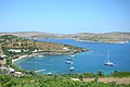
Marathos Island
- Area
- 0.34 km²
- High point
- 50 m
Dasia
- Area
- 0.34 km²
- High point
- 126 m
Nisos
- Area
- 0.33 km²
- High point
- 48 m
Kaşık Adası
- Area
- 0.32 km²
- High point
- 67 m
Megalo Liadi
- Area
- 0.32 km²
- High point
- 50 m
Anydros
- Area
- 0.31 km²
- High point
- 100 m

Büyük Ada
- Area
- 0.31 km²
- High point
- 53 m
Makronisi
- Area
- 0.3 km²
- High point
- 20 m
Tragousa
- Area
- 0.3 km²
- High point
- 58 m
Çiçek Island
- Area
- 0.3 km²
- High point
- 22 m
Gaidouronissos
- Area
- 0.3 km²
- High point
- 46 m
Kalovolos
- Area
- 0.29 km²
- High point
- 60 m
Kalavros
- Area
- 0.29 km²
- High point
- 99 m
Koulouri
- Area
- 0.29 km²
- High point
- 76 m
Agia Kyriaki islets
- Area
- 0.28 km²
- High point
- 23 m
Kavouras
- Area
- 0.28 km²
- High point
- 27 m
Unnamed island
- Area
- 0.28 km²
- High point
- 23 m
Chiliomódi
- Area
- 0.27 km²
- High point
- 107 m
Divounia 1
- Area
- 0.26 km²
- High point
- 95 m
Makronisi
- Area
- 0.26 km²
- High point
- 41 m
Kara Ada
- Area
- 0.25 km²
- High point
- 57 m
Makronisos
- Area
- 0.25 km²
- High point
- 37 m
Rocks & skerries
On the chart above, at its closest zooms.
Listing 200 of 7166; the rest are on the chart.
Figures
Comparative heights
To the same scale
Islands by area
Groups within
Photographs

Tsoukalas islet, Tomaronisia, Lesvos

Insel Thymena mit Kisira (Fourni), im Vordergrund der Ort Fourni, im Hintergrund die Insel Ikaria

Schiffahrtsroute mit der Fähre von Rhodos in der Südost-Ägäis zur Insel Symi

The island of Velopoula for the West.

Panagia islet, Tomaronisia Lesvos

Schiffahrtsroute mit der Fähre von Rhodos in der Südost-Ägäis zur Insel Symi

The island of Velopoula for the NW

Ägäis (o. J.) - Aquarell Gerhard Ausborn

Insel Agios Minas (Fourni), im Hintergrund die Insel Samos

Small Island (Koyun adasi / Koyun Island/ Koyun Insel)

besser is das.....

The Kelifos Island, also known as the Turtle Island, seen from the town of Neos Marmaras in Sithonia, Halkidiki
Sources
Facts
Photographs
- Tsoukalas islet. C messier / CC BY-SA 3.0
- Insel Thymena (Fourni). Waldviertler / CC BY-SA 3.0 de
- 2023-09-19 Von Rhodos zur Insel Symi 01. Burkhard Mücke / CC BY-SA 4.0
- Velopoula West. C messier / CC BY 3.0
- Panagia, Tomaronisia. C messier / CC BY-SA 3.0
- 2023-09-19 Von Rhodos zur Insel Symi 02. Burkhard Mücke / CC BY-SA 4.0
- Velopoula, NW. C messier / CC BY 3.0
- Aegaeis AquarellGerhardAusborn. Gisela Krause-Ausborn / CC BY-SA 4.0
- Insel Agios Minas (Fourni). Waldviertler / CC BY-SA 3.0 de
- Small Island (Koyun adasi - Koyun Island- Koyun Insel) - panoramio. Bir_Ege_Hikayesi © / CC BY 3.0
- Besser is das..... (47067559804). Rolf Dietrich Brecher from Germany / CC BY 2.0
- Kelifos Island viewed from Neos Marmaras. Pelajanela / CC BY-SA 4.0