Aegean SeaGreece
37°00′N 25°10′E
Cyclades
Κυκλάδες
Part of Aegean Islands
The Cyclades is an archipelago in the Aegean Sea, southeast of the Greek mainland and a former administrative prefecture of Greece. The archipelago is one of Greece's island groups which constitute the Aegean archipelago.

Chart
Overview
The Cyclades is an archipelago in the Aegean Sea, southeast of the Greek mainland and a former administrative prefecture of Greece. The archipelago is one of Greece's island groups which constitute the Aegean archipelago. One of the group's constituent islands Delos is significant and was sacred to Ancient Greek religion, thus the islands surrounding (κyκλόω, kyklóō cognate to cycle) it take after it (Κυκλάδες νήσοι, Kykládes nísoi, 'surrounding islands'). The largest island of the Cyclades is Naxos; the most populated, however, is Syros.
From Wikipedia, CC BY-SA 4.0
Census, cataloged
- Major islands14
- Minor islands56
- Islets176
- Rocks & skerries3,029
Major islands
Naxos
- Area
- 429 km²
- High point
- 1,001 m
Naxos is a Greek island belonging to the Cyclades island group. It is the largest island in the group. The largest town and capital of the island is Chora or Naxos City, with 8,897 inhabitants out of the total 20,578 in the island (2021 census).
Andros
- Area
- 379 km²
- High point
- 994 m
Andros is the northernmost island of the Cyclades archipelago in Greece, about 10 km (6 mi) southeast of Euboea, and about 3 km (2 mi) north of Tinos. It is nearly 40 km (25 mi) long, and its greatest breadth is 16 km (10 mi). It is for the most part mountainous, with many fruitful and well-watered valleys.
Paros
- Area
- 195 km²
- High point
- 776 m
Paros (; Greek: Πάρος [ˈparos]; Venetian: Paro) is a Greek island in the central Aegean Sea and part of the Cyclades island group. It lies 8 kilometers (5 miles) west of Naxos, separated by a narrow channel and about 150 km (93 miles) south-east of Piraeus. 795 sq mi), including numerous uninhabited offshore islets.
Tinos
- Area
- 195 km²
- High point
- 727 m
Tinos (Greek: Τήνος [ˈtinos]) is a Greek island situated in the Aegean Sea. It forms part of the Cyclades archipelago. The closest islands are Andros, Delos, and Mykonos. It has a land area of 194.464 square kilometres (75.083 sq mi) and a 2021 census population of 8,934 inhabitants.
Milos
- Area
- 158 km²
- High point
- 748 m
Milos or Melos is a volcanic Greek island in the Aegean Sea, just north of the Sea of Crete. It is the southwestern-most of the Cyclades islands.
Kea
- Area
- 132 km²
- High point
- 559 m
Kea (Greek: Κέα), also known as Tzia (Greek: Τζιά) and in antiquity Keos (Greek: Κέως, Latin: Ceos), is a Greek island in the Cyclades archipelago in the Aegean Sea. Kea is part of the Kea-Kythnos regional unit.
Amorgos
- Area
- 120 km²
- High point
- 823 m
Amorgos is the easternmost island of the Cyclades island group and the nearest island to the neighboring Dodecanese island group in Greece. 782 square miles) and at the 2021 census had a population of 1,961.
Ios
- Area
- 109 km²
- High point
- 713 m
os]; locally Nios, Νιός) is a Greek island in the Cyclades group in the Aegean Sea. The island is largely hilly, with cliffs descending steeply to the sea on most sides. It is situated halfway between Naxos and Santorini. 094 sq mi). Its population was 2,299 in the 2021 census (down from 3,500 in the 20th century).
Kythnos
- Area
- 99 km²
- High point
- 352 m
Kythnos, commonly called Thermia (Θερμιά), is a Greek island and municipality in the Western Cyclades between Kea and Serifos. It is 56 nautical miles (104 km) from the Athenian harbor of Piraeus. 68 sq mi) in area and has a coastline of about 100 km (62 mi). Mount Kakovolo is island's highest peak (365m).
Mykonos
- Area
- 86.4 km²
- High point
- 341 m
Mykonos (, UK also ; Greek: Μύκονος [ˈmikonos]) is a Greek island, part of the Cyclades, lying between Tinos, Syros, Paros and Naxos. 0 sq mi) and rises to an elevation of 341 metres (1,119 feet) at its highest point.
Syros
- Area
- 84.3 km²
- High point
- 442 m
Syros (Greek: Σύρος, romanized: Sýros, [ˈsiros]), also known as Siros or Syra, is a Greek island in the Cyclades, in the Aegean Sea. It is 78 nautical miles (144 km) south-east of Athens. The area of the island is 83.6 km2 (32 sq mi) and at the 2021 census it had 21,124 inhabitants.
Sifnos
- Area
- 76.3 km²
- High point
- 682 m
Sifnos (Greek: Σίφνος) is an island municipality in the Cyclades island group in Greece. The main town, near the center, known as Apollonia (pop. 918 as of 2021), is home of the island's folklore museum and library.
Santorini
- Area
- 76 km²
- High point
- 567 m
Santorini, officially Thira or Thera, is a Greek island in the southern Aegean Sea, about 200 km (120 mi) southeast from the mainland. It is the largest island of a small, circular archipelago formed by the Santorini caldera.
Serifos
- Area
- 72.5 km²
- High point
- 585 m
Serifos (Greek: Σέριφος) is a Greek island in the Aegean Sea, located in the western Cyclades, south of Kythnos and northwest of Sifnos. It is part of the Milos regional unit. 038 sq mi) and the population was 1,241 at the 2021 census.


Minor islands

Sikinos
- Area
- 41.4 km²
- High point
- 545 m

Anafi
- Area
- 38.3 km²
- High point
- 581 m

Kimolos
- Area
- 37.5 km²
- High point
- 345 m

Antiparos
- Area
- 34.6 km²
- High point
- 300 m

Folegandros
- Area
- 32.2 km²
- High point
- 416 m

Makronisos
- Area
- 18.5 km²
- High point
- 149 m

Irakleia
- Area
- 18.1 km²
- High point
- 418 m

Polyaigos
- Area
- 17.8 km²
- High point
- 345 m

Gyaros
- Area
- 17.5 km²
- High point
- 490 m
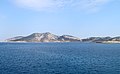
Keros
- Area
- 15.1 km²
- High point
- 429 m

Rineia
- Area
- 14 km²
- High point
- 136 m

Donoussa
- Area
- 13.4 km²
- High point
- 386 m

Therasia
- Area
- 9.2 km²
- High point
- 294 m

Antimilos
- Area
- 8.7 km²
- High point
- 684 m

Schoinoussa
- Area
- 8.1 km²
- High point
- 134 m

Despotiko
- Area
- 7.7 km²
- High point
- 186 m

Ano Koufonisi
- Area
- 5.7 km²
- High point
- 101 m

Kato Koufonisi
- Area
- 3.9 km²
- High point
- 121 m

Delos
- Area
- 3.6 km²
- High point
- 112 m

Nea Kameni
- Area
- 3.4 km²
- High point
- 134 m
Nikouria
- Area
- 2.7 km²
- High point
- 326 m
Strongyli
- Area
- 1.6 km²
- High point
- 179 m

Serifopoula
- Area
- 1.4 km²
- High point
- 189 m
Kardiotissa
- Area
- 1.3 km²
- High point
- 133 m

Christiani island
- Area
- 1.1 km²
- High point
- 258 m

Antíkeri
- Area
- 1.1 km²
- High point
- 88 m
Drima
- Area
- 1.1 km²
- High point
- 86 m
Kitriani
- Area
- 0.84 km²
- High point
- 100 m
Unnamed island
- Area
- 0.64 km²
- High point
- 77 m

Palea Kameni
- Area
- 0.52 km²
- High point
- 90 m
Panteronisi
- Area
- 0.49 km²
- High point
- 51 m
Nisos Gaidaros-Didymi
- Area
- 0.48 km²
- High point
- 37 m
Diplo
- Area
- 0.46 km²
- High point
- 17 m
Drionisi
- Area
- 0.38 km²
- High point
- 36 m
Kavouras
- Area
- 0.28 km²
- High point
- 27 m
Unnamed island
- Area
- 0.24 km²

Askania
- Area
- 0.24 km²
- High point
- 157 m
Oikonomou
- Area
- 0.21 km²
- High point
- 17 m
Glarompi
- Area
- 0.21 km²
- High point
- 13 m
Megalo
- Area
- 0.21 km²
- High point
- 57 m
Unnamed island
- Area
- 0.18 km²
- High point
- 49 m

Akrathi islet
- Area
- 0.18 km²
- High point
- 106 m
Filitzi
- Area
- 0.17 km²
- High point
- 21 m

Vous Island
- Area
- 0.16 km²
- High point
- 94 m
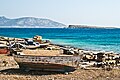
Glaros
- Area
- 0.15 km²
- High point
- 17 m
Grambonissi
- Area
- 0.14 km²
- High point
- 72 m
Unnamed island
- Area
- 0.14 km²
- High point
- 37 m
Gaidouronisi
- Area
- 0.14 km²
- High point
- 34 m

Aspronisi
- Area
- 0.13 km²
- High point
- 72 m
Planitis
- Area
- 0.12 km²
- High point
- 73 m
Venetiko
- Area
- 0.12 km²
- High point
- 36 m
Ovriokastro
- Area
- 0.12 km²
- High point
- 44 m
Voulgaris
- Area
- 0.12 km²
- High point
- 67 m
Unnamed island
- Area
- 0.11 km²
- High point
- 29 m
Agios Georgios
- Area
- 0.11 km²
- High point
- 32 m
Strongyli (prehistoric Thera)
- Area
- —
size unknown
Rocks & skerries
On the chart above, at its closest zooms.
Listing 70 of 3275; the rest are on the chart.
Figures
Comparative heights
To the same scale
Islands by area
| Naxos | 429 km² |
| Andros | 379 km² |
| Paros | 195 km² |
| Tinos | 195 km² |
| Milos | 158 km² |
| Kea | 132 km² |
| Amorgos | 120 km² |
| Ios | 109 km² |
| Kythnos | 99 km² |
| Mykonos | 86.4 km² |
| Syros | 84.3 km² |
| Sifnos | 76.3 km² |
| Santorini | 76 km² |
| Serifos | 72.5 km² |
| Sikinos | 41.4 km² |
| Anafi | 38.3 km² |
| Kimolos | 37.5 km² |
| Antiparos | 34.6 km² |
| Folegandros | 32.2 km² |
| Makronisos | 18.5 km² |
| Irakleia | 18.1 km² |
| Polyaigos | 17.8 km² |
| Gyaros | 17.5 km² |
| Keros | 15.1 km² |
| Rineia | 14 km² |
| Donoussa | 13.4 km² |
| Therasia | 9.2 km² |
| Antimilos | 8.7 km² |
| Schoinoussa | 8.1 km² |
| Despotiko | 7.7 km² |
| Ano Koufonisi | 5.7 km² |
| Kato Koufonisi | 3.9 km² |
| Delos | 3.6 km² |
| Nea Kameni | 3.4 km² |
| Nikouria | 2.7 km² |
| Strongyli | 1.6 km² |
| Serifopoula | 1.4 km² |
| Kardiotissa | 1.3 km² |
| Christiani island | 1.1 km² |
| Antíkeri | 1.1 km² |
| Drima | 1.1 km² |
| Kitriani | 0.84 km² |
| Unnamed island | 0.64 km² |
| Palea Kameni | 0.52 km² |
| Panteronisi | 0.49 km² |
| Nisos Gaidaros-Didymi | 0.48 km² |
| Diplo | 0.46 km² |
| Drionisi | 0.38 km² |
| Kavouras | 0.28 km² |
| Unnamed island | 0.24 km² |
| Askania | 0.24 km² |
| Oikonomou | 0.21 km² |
| Glarompi | 0.21 km² |
| Megalo | 0.21 km² |
| Unnamed island | 0.18 km² |
| Akrathi islet | 0.18 km² |
| Filitzi | 0.17 km² |
| Vous Island | 0.16 km² |
| Glaros | 0.15 km² |
| Grambonissi | 0.14 km² |
| Unnamed island | 0.14 km² |
| Gaidouronisi | 0.14 km² |
| Aspronisi | 0.13 km² |
| Planitis | 0.12 km² |
| Venetiko | 0.12 km² |
| Ovriokastro | 0.12 km² |
| Voulgaris | 0.12 km² |
| Unnamed island | 0.11 km² |
| Agios Georgios | 0.11 km² |
Groups within
Overlapping groups
Photographs

Aerial view of Ios during sunset

Aerial view of Despotiko, Antiparos, Paros and Naxos islands during sunset

Alyki, Paros, Greece.

Katapola and Moundoulia hill, Amorgos Island, Greece

Naxos port

Milos Island, Greece

Sunset from Andros, Greece setting behind Kithnos and Giaros in August overlooking the Aegean Sea

Ioulis at Kea (Tzia) Island

This is a photograph of a Natura 2000 protected area with ID

Anydros

Cyclades

Cyclades
Sources
Facts
Photographs
- Íos aerial. kallerna / CC BY-SA 4.0
- Despotikó Antíparos Páros Náxos aerial. kallerna / CC BY-SA 4.0
- Paros Alyki2 tango7174. Tango7174 / CC BY-SA 4.0
- Amorgos-1. Oliwan / CC BY-SA 3.0
- Naxos-port. Rol1000 / CC BY-SA 3.0
- Milos-4. Oliwan / CC BY-SA 3.0
- Sunset from Andros, Greece. Demetri Andriani / CC BY 4.0
- Ioulis at Kea (Tzia) Island - panoramio (1). Michael Paraskevas / CC BY-SA 3.0
- Ano Koufonisi. G-Lignum / CC BY-SA 4.0
- Anydros. C messier / CC BY-SA 3.0
- Cyclades (29858787506). madras91 / CC BY 2.0
- Cyclades (29936628006). madras91 / CC BY 2.0