Japan
26°20′N 128°40′E
Ryukyu Arc
Part of Japanese archipelago
The Ryukyu Arc is an island arc which extends from the south of Kyushu along the Ryukyu Islands to the northeast of Taiwan, spanning about 1,200 kilometres (750 mi).

Chart
Overview
The Ryukyu Arc is an island arc which extends from the south of Kyushu along the Ryukyu Islands to the northeast of Taiwan, spanning about 1,200 kilometres (750 mi). It is located along a section of the convergent plate boundary where the Philippine Sea Plate is subducting northwestward beneath the Eurasian Plate along the Ryukyu Trench. The arc has an overall northeast to southwest trend and is located northwest of the Pacific Ocean and southeast of the East China Sea. It runs parallel to the Okinawa Trough, an active volcanic arc, and the Ryukyu Trench. The Ryukyu Arc, based on its geomorphology, can be segmented from north to south into Northern Ryukyu, Central Ryukyu, and Southern Ryukyu; the Tokara Strait separates Northern Ryukyu and Central Ryukyu at about 130˚E while the Kerama Gap separates Central Ryukyu and Southern Ryukyu at about 127 ˚E. The geological units of the arc include igneous, sedimentary, and metamorphic rocks, ranging from the Paleozoic to Cenozoic in age.
From Wikipedia, CC BY-SA 4.0
Census, cataloged
- Major islands8
- Minor islands128
- Islets725
- Rocks & skerries4,633
Major islands
Okinawa Island
- Area
- 1,207 km²
- High point
- 503 m
Okinawa Island (Japanese: 沖縄島, Hepburn: Okinawa-jima; Okinawan: 沖縄 / うちなー, romanized: Uchinā; Kunigami: ふちなー, romanized: Fuchináa), also known as Okinawa Main Island (沖縄本島, Okinawa-hontō), is the largest of the Okinawa Islands and the Ryukyu (Nansei) Islands of Japan in the Kyushu region. 02 sq mi).
Amami Ōshima
- Area
- 712 km²
- High point
- 694 m
Amami Ōshima (奄美大島; Japanese pronunciation: [ä̀.mä́.mʲí ó̞ò̞.ɕì.mä̀] Okinawan: Uushima; Amami Ōshima: Ushima), also known as Amami ([ä́.mä̀.mʲì]), is the largest island in the Amami archipelago between Kyūshū and Okinawa. It is one of the Satsunan Islands, all of which belong to Kagoshima Prefecture, Japan.
Yakushima
- Area
- 504 km²
- High point
- 1,936 m
Yakushima (屋久島) is one of the Ōsumi Islands in Kagoshima Prefecture, Japan. The island, 504.88 km2 (194.94 sq mi) in area, has a population of 11,858. It is accessible by hydrofoil ferry, car ferry, or by air to Yakushima Airport.
Tanegashima
- Area
- 445 km²
- High point
- 238 m
ŋä̀-]) is one of the Ōsumi Islands belonging to Kagoshima Prefecture, Japan. 81 sq mi) in area, is the second largest of the Ōsumi Islands, and has a population of 33,000 people. Access to the island is by ferry, or by air to New Tanegashima Airport.
Iriomote Island
- Area
- 290 km²
- High point
- 470 m
Iriomote Island (西表島, Iriomote-jima; Yaeyama: Irïmutii; Iriomote: Irimutii; Okinawan: Iriumuti) is the largest of the Yaeyama Islands of Japan, and the second largest in Okinawa Prefecture after Okinawa Island itself.
Tokunoshima
- Area
- 248 km²
- High point
- 645 m
Tokunoshima (Japanese: 徳之島; Tokunoshima: Tukunushima), or Tokuno Island, is an island in the Amami archipelago of the southern Satsunan Islands of Kagoshima Prefecture, Japan.
Ishigaki Island
- Area
- 223 km²
- High point
- 526 m
mä́), -ŋä́-]; Yaeyama: Ishanagï; Okinawan: Ishigachi) is a Japanese island south-west of Okinawa Hontō and the second-largest island of the Yaeyama Island group, behind Iriomote Island. It is located approximately 411 km (255 mi) south-west of Okinawa Hontō. It is within the City of Ishigaki in Okinawa Prefecture.
Miyako Island
- Area
- 159 km²
- High point
- 109 m
Miyako Island (Japanese: 宮古島, Hepburn: Miyako-jima; Miyako: Myaaku (ミャーク); Okinawan: Naaku (ナーク)) is the largest and the most populous island among the Miyako Islands of Okinawa Prefecture, Japan.


Minor islands

Okinoerabujima
- Area
- 93.5 km²
- High point
- 240 m

Kakeromajima
- Area
- 77.2 km²
- High point
- 326 m

Kume Island
- Area
- 59.6 km²
- High point
- 310 m

Kikai Island
- Area
- 56.9 km²
- High point
- 63 m

Kuchinoerabu Island
- Area
- 35.8 km²
- High point
- 649 m

Nakanoshima
- Area
- 34.4 km²
- High point
- 979 m

Minamidaitō Island
- Area
- 30.5 km²
- High point
- 68 m

Irabu Island
- Area
- 29.2 km²
- High point
- 89 m

Yonaguni
- Area
- 28.9 km²
- High point
- 231 m

Suwanosejima
- Area
- 27.6 km²
- High point
- 796 m

Iejima
- Area
- 22.8 km²
- High point
- 172 m

Iheya Island
- Area
- 20.7 km²
- High point
- 294 m

Yoronjima
- Area
- 20.6 km²
- High point
- 99 m

Tarama Island
- Area
- 19.8 km²
- High point
- 35 m

Kuroshima
- Area
- 15.4 km²
- High point
- 620 m

Tokashiki Island
- Area
- 15.3 km²
- High point
- 226 m

Izena Island
- Area
- 14.2 km²
- High point
- 121 m

Uke Island
- Area
- 13.3 km²
- High point
- 398 m

Kuchinoshima
- Area
- 13.3 km²
- High point
- 628 m

Hateruma
- Area
- 12.7 km²
- High point
- 59 m

Kitadaitō Island
- Area
- 11.9 km²
- High point
- 74 m

Iōjima
- Area
- 11.6 km²
- High point
- 704 m

Kuroshima
- Area
- 10 km²
- High point
- 17 m
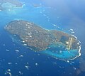
Shimoji Island
- Area
- 9.6 km²
- High point
- 26 m
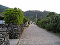
Yoroshima
- Area
- 9.4 km²
- High point
- 230 m

Mageshima
- Area
- 8.2 km²
- High point
- 69 m
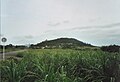
Kohama Island
- Area
- 7.9 km²
- High point
- 99 m

Yagaji Island
- Area
- 7.8 km²
- High point
- 58 m
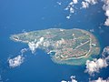
Aguni Island
- Area
- 7.6 km²
- High point
- 96 m

Akusekijima
- Area
- 7.5 km²
- High point
- 584 m

Takarajima
- Area
- 7.1 km²
- High point
- 292 m

Zamami Island
- Area
- 6.7 km²
- High point
- 161 m
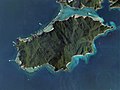
Edateku Island
- Area
- 5.8 km²
- High point
- 322 m

Miyagi Island
- Area
- 5.6 km²
- High point
- 124 m

Taketomi Island
- Area
- 5.4 km²
- High point
- 24 m

Henza Island
- Area
- 5.2 km²
- High point
- 112 m

Takeshima
- Area
- 4.2 km²
- High point
- 220 m

Gajajima
- Area
- 4 km²
- High point
- 497 m

Aka Island
- Area
- 3.8 km²
- High point
- 187 m

Uotsuri Island
- Area
- 3.8 km²
- High point
- 362 m

Tonaki Island
- Area
- 3.6 km²
- High point
- 179 m

Kouri Island
- Area
- 3.2 km²
- High point
- 107 m

Sesoko Island
- Area
- 3 km²
- High point
- 78 m

Kurima Island
- Area
- 2.8 km²
- High point
- 48 m

Ikema Island
- Area
- 2.8 km²
- High point
- 31 m

Yokoate-jima
- Area
- 2.7 km²
- High point
- 495 m

Iōtorishima
- Area
- 2.5 km²
- High point
- 212 m

Minna Island
- Area
- 2.2 km²
- High point
- 15 m

Hamahiga Island
- Area
- 2.1 km²
- High point
- 79 m

Uchibanari island
- Area
- 2.1 km²
- High point
- 192 m

Tairajima
- Area
- 2.1 km²
- High point
- 243 m

Tsuken Island
- Area
- 1.9 km²
- High point
- 39 m

Aragusuku Islands
- Area
- 1.8 km²
- High point
- 15 m
Ikei Island
- Area
- 1.7 km²
- High point
- 42 m

Mae Island
- Area
- 1.6 km²
- High point
- 133 m
Shimoji Island
- Area
- 1.6 km²
- High point
- 21 m
Kamiji Island
- Area
- 1.6 km²
- High point
- 12 m
Kuba Island
- Area
- 1.5 km²
- High point
- 270 m

Kudaka Island
- Area
- 1.4 km²
- High point
- 23 m

Sotobanari
- Area
- 1.3 km²
- High point
- 143 m
Yakabi Island
- Area
- 1.3 km²
- High point
- 214 m

Geruma Island
- Area
- 1.2 km²
- High point
- 157 m

Oki Daitō Island
- Area
- 1.1 km²
- High point
- 30 m

Noho Island
- Area
- 1.1 km²
- High point
- 43 m

Hatoma
- Area
- 0.97 km²
- High point
- 34 m

Kodakara Island
- Area
- 0.97 km²
- High point
- 103 m

Sukomobanare Island
- Area
- 0.93 km²
- High point
- 152 m

Kuba Island
- Area
- 0.9 km²
- High point
- 177 m
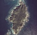
Fukaji Island
- Area
- 0.83 km²
- High point
- 78 m
Yanaha Island
- Area
- 0.8 km²
- High point
- 16 m
Amuro Island
- Area
- 0.71 km²
- High point
- 98 m

Ōjima
- Area
- 0.65 km²
- High point
- 20 m
Yabuchi Island
- Area
- 0.61 km²
- High point
- 39 m

Kerama Islands
- Area
- 0.49 km²
- High point
- 106 m

Minnajima
- Area
- 0.47 km²
- High point
- 17 m
Gushikawa Island
- Area
- 0.47 km²
- High point
- 23 m

Kaminonejima
- Area
- 0.45 km²
- High point
- 248 m
Minamikojima
- Area
- 0.4 km²
- High point
- 139 m

Kayama Island
- Area
- 0.39 km²
- High point
- 18 m
Unnamed island
- Area
- 0.38 km²
- High point
- 10 m
Kogajajima
- Area
- 0.37 km²
- High point
- 267 m
Small Island
- Area
- 0.37 km²
- High point
- 17 m
Ōha Island
- Area
- 0.37 km²
- High point
- 13 m

Kiyama Island
- Area
- 0.36 km²
- High point
- 85 m

Eniyabanare Island
- Area
- 0.35 km²
- High point
- 69 m
Nakanshi
- Area
- 0.33 km²

Kitakojima
- Area
- 0.31 km²
- High point
- 125 m
Kojima
- Area
- 0.3 km²
- High point
- 32 m
Ukibaru Island
- Area
- 0.3 km²
- High point
- 11 m

Ou Island
- Area
- 0.3 km²
- High point
- 22 m

Ogami Island
- Area
- 0.28 km²
- High point
- 72 m
Kuroshima
- Area
- 0.27 km²
- High point
- 126 m
Ōjima
- Area
- 0.27 km²
- High point
- 35 m
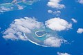
Irisuna-jima
- Area
- 0.26 km²
- High point
- 29 m
Unjima Island
- Area
- 0.26 km²
- High point
- 81 m
Miyagi Island
- Area
- 0.24 km²
- High point
- 70 m

Nakanokamishima
- Area
- 0.23 km²
- High point
- 102 m
Yanoshita Island
- Area
- 0.23 km²
- High point
- 8 m
Unnamed island
- Area
- 0.2 km²
- High point
- 4 m
Kamiyama Island
- Area
- 0.19 km²
- High point
- 10 m
Unnamed island
- Area
- 0.19 km²
- High point
- 10 m
Nagannu Island
- Area
- 0.18 km²
- High point
- 8 m
Nakashima Island
- Area
- 0.18 km²
- High point
- 94 m
Senaga Island
- Area
- 0.18 km²
- High point
- 33 m
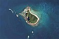
Yubanare Island
- Area
- 0.17 km²
- High point
- 90 m

Yubu Island
- Area
- 0.16 km²
- High point
- 8 m
Hatejima Island
- Area
- 0.14 km²
- High point
- 55 m
Hamiyajima Island
- Area
- 0.13 km²
- High point
- 77 m
Gahi Island
- Area
- 0.13 km²
- High point
- 52 m
Gushikujima Island
- Area
- 0.11 km²
- High point
- 80 m
Unnamed island
- Area
- 0.11 km²
- High point
- 12 m

Hanarijima
- Area
- 0.1 km²
- High point
- 55 m
Unnamed island
- Area
- —
size unknown
Chibei East Islet
- Area
- —
size unknown
Chibei South Islet
- Area
- —
size unknown
Chibei West Islet
- Area
- —
size unknown
Chitou Islet
- Area
- —
size unknown
Dajinguizi Islet
- Area
- —
size unknown
Dongniujiao Islet
- Area
- —
size unknown
Feilong Islet
- Area
- —
size unknown
Kikaigashima
- Area
- —
size unknown
Longzhu Islet
- Area
- —
size unknown
Niaocao Islet
- Area
- —
size unknown
Niaoluan Islet
- Area
- —
size unknown
Saipanari
- Area
- —
size unknown
Wangchi Islet
- Area
- —
size unknown
Xiaochiwei Islet
- Area
- —
size unknown
Xiniujiao Islet
- Area
- —
size unknown
Rocks & skerries
On the chart above, at its closest zooms.
Listing 136 of 5494; the rest are on the chart.
Figures
Comparative heights
- Yakushima: 1,936 m
- Nakanoshima: 979 m
- Suwanosejima: 796 m
- Iōjima: 704 m
- Amami Ōshima: 694 m
- Kuchinoerabu: 649 m
- Tokunoshima: 645 m
- Kuchinoshima: 628 m
- Kuroshima: 620 m
- Akusekijima: 584 m
- Ishigaki: 526 m
- Okinawa: 503 m
- Gajajima: 497 m
- Yokoate-jima: 495 m
To the same scale
Islands by area
Groups within
Photographs

Kabira Bay of Ishigaki Island in Ishigaki City, Okinawa Prefecture, Japan. It is one of the Japan's Places of Scenic Beauty.

Yonahamaehama Beach view from Kurima Island in Miyakojima, Okinawa Prefecture, Japan.

Large mangrove forest along Urauchi River in Iriomote Island of the Yaeyama Islands, Okinawa, Japan

A waterfall and red bridge at Yakushima Botanical Research Park.


珊瑚礁由来の石灰岩層を通して内陸の洞窟に海水が浸透し、潮の干満による潮位変化もみられる
Sources
Facts
Photographs
- Kabira Bay Ishigaki Island41s3s4500. 663highland / CC BY 2.5
- Yonahamaehama Miyakojima Okinawa Japan06s3s4592. 663highland / CC BY 2.5
- Mangrove swamp, Iriomote Island, Okinawa, Japan. Anagounagi / CC BY-SA 4.0
- Yakushima Botanical Research Park - Yakushima839. lumoplank / CC0
- MC-130J Commando IIs from the 1st Special Operations Squadron off the coast of Okinawa. Airman 1st Class Stephen Pulter / Public domain
- ウンブキ 02. Indiana jo / CC BY-SA 4.0