France
8°42′S 140°08′W
Northern Marquesas group
Part of Marquesas Islands

Chart
Major islands
Nuku Hiva
- Area
- 339 km²
- High point
- 1,224 m
Nuku Hiva (sometimes spelled Nukahiva or Nukuhiva) is the largest of the Marquesas Islands in French Polynesia, an overseas country of France in the Pacific Ocean. It was formerly also known as Île Marchand and Madison Island.
Ua Pou
- Area
- 105 km²
- High point
- 1,230 m
Ua Pou (French: Ua Pou, North Marquesan: ’uapou) is the third-largest of the Marquesas Islands, in French Polynesia, an overseas territory of France in the Pacific Ocean.
Ua Huka
- Area
- 85.7 km²
- High point
- 887 m
Ua Huka is one of the Marquesas Islands, in French Polynesia, an overseas territory of France in the Pacific Ocean. It is situated in the northern group of the archipelago, approximately 40 km (25 mi) to the east of Nuku Hiva, at 8°54′S 139°33′W.


Minor islands

Eiao
- Area
- 37 km²
- High point
- 574 m
Hatutu
- Area
- 6 km²
- High point
- 408 m
Motu Oa
- Area
- 0.37 km²
- High point
- 103 m
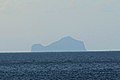
Motu Iti
- Area
- 0.24 km²
- High point
- 144 m
Motu Mokohe
- Area
- 0.11 km²
- High point
- 50 m
Rocks & skerries
On the chart above, at its closest zooms.
Listing 8 of 261; the rest are on the chart.
Figures
Comparative heights
To the same scale
Groups within
Photographs

The Matau point, with semi-arid climate, on the south-western coast of the island of Ua Huka, Marquesas Islands, French Polynesia.

KONICA MINOLTA DIGITAL CAMERA

Vue panoramique de Nuku Hiva
Sources
Facts
- Geometry, areas and high points: OpenStreetMap contributors (ODbL), Copernicus GLO-30, via Talus.
- Wikidata
Photographs
- UaHuka Pointe Matau. Sémhur / CC BY-SA 3.0
- Ua Pou dikes, Marquesas, French Polynesia. Jeanmi8413 / CC BY-SA 4.0
- Nuku Hiva - Laurent Seignobos. Laurent Seignobos / CC BY-SA 4.0