Pacific OceanFrance
8°54′S 139°36′W
Marquesas Islands
Îles Marquises
Part of Polynesia
The Marquesas Islands ( mar-KAY-səss; French: Îles Marquises or Archipel des Marquises or Marquises [maʁkiz]; Marquesan: Te Henua ʻEnana (North Marquesan) and Te Fenua ʻEnata (South Marquesan), both meaning "the land of men") are a group of volcanic islands in French Polynesia, an overseas collectivity of France in the southern Pacific Ocean.

Chart
Overview
The Marquesas Islands ( mar-KAY-səss; French: Îles Marquises or Archipel des Marquises or Marquises [maʁkiz]; Marquesan: Te Henua ʻEnana (North Marquesan) and Te Fenua ʻEnata (South Marquesan), both meaning "the land of men") are a group of volcanic islands in French Polynesia, an overseas collectivity of France in the southern Pacific Ocean. Their highest point is the peak of Mount Oave (French: Mont Oave) on Ua Pou island, at 1,230 m (4,035 ft) above sea level. Archaeological research suggests the islands were settled in the 10th century AD by voyagers from West Polynesia. Over the centuries that followed, the islands have maintained a "remarkably uniform culture, biology and language". The Marquesas were named after the 16th-century Spanish Viceroy of Peru, the Marquis of Cañete (Spanish: Marqués de Cañete), by navigator Álvaro de Mendaña, who visited them in 1595. The Marquesas Islands constitute one of the five administrative divisions (subdivisions administratives) of French Polynesia. The capital of the Marquesas Islands' administrative subdivision is the town of Taioha'e, on the island of Nuku Hiva. The population of the Marquesas Islands was 9,346 inhabitants at the time of the August 2017 census.
From Wikipedia, CC BY-SA 4.0
Census, cataloged
- Major islands5
- Minor islands10
- Islets54
- Rocks & skerries504
Major islands
Nuku Hiva
- Area
- 339 km²
- High point
- 1,224 m
Nuku Hiva (sometimes spelled Nukahiva or Nukuhiva) is the largest of the Marquesas Islands in French Polynesia, an overseas country of France in the Pacific Ocean. It was formerly also known as Île Marchand and Madison Island.
Hiva Oa
- Area
- 308 km²
- High point
- 1,266 m
With its 320 square kilometres (124 square miles), Hiva Oa (Marquesan: Hivaʻoa) is the second largest island in the Marquesas Islands, in French Polynesia, an overseas territory of France in the Pacific Ocean. It is the largest island of the southern Marquesas group. Around 2,200 people reside on the island.
Ua Pou
- Area
- 105 km²
- High point
- 1,230 m
Ua Pou (French: Ua Pou, North Marquesan: ’uapou) is the third-largest of the Marquesas Islands, in French Polynesia, an overseas territory of France in the Pacific Ocean.
Ua Huka
- Area
- 85.7 km²
- High point
- 887 m
Ua Huka is one of the Marquesas Islands, in French Polynesia, an overseas territory of France in the Pacific Ocean. It is situated in the northern group of the archipelago, approximately 40 km (25 mi) to the east of Nuku Hiva, at 8°54′S 139°33′W.
Tahuata
- Area
- 69.3 km²
- High point
- 966 m
Tahuata is the smallest of the inhabited Marquesas Islands, in French Polynesia, an overseas territory of France in the Pacific Ocean. It is located 4 km (2.5 mi.) to the south of the western end of Hiva Oa, across the Canal du Bordelais, called Ha‘ava in Marquesan.


Minor islands

Fatu-Hiva
- Area
- 84.3 km²
- High point
- 1,115 m

Eiao
- Area
- 37 km²
- High point
- 574 m

Mohotani
- Area
- 12.7 km²
- High point
- 503 m
Hatutu
- Area
- 6 km²
- High point
- 408 m

Fatu Huku
- Area
- 0.67 km²
- High point
- 354 m
Motu Oa
- Area
- 0.37 km²
- High point
- 103 m
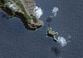
Terihi
- Area
- 0.24 km²
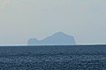
Motu Iti
- Area
- 0.24 km²
- High point
- 144 m
Motu Mokohe
- Area
- 0.11 km²
- High point
- 50 m
Hanakee
- Area
- —
size unknown
Rocks & skerries
On the chart above, at its closest zooms.
Listing 15 of 573; the rest are on the chart.
Figures
Comparative heights
To the same scale
Groups within
Photographs

Southern coastline of Hiva Oa, Marquesas Islands, French Polynesia

The Matau point, with semi-arid climate, on the south-western coast of the island of Ua Huka, Marquesas Islands, French Polynesia.

Vegetation at the edge of the road from Atuona to Puamau, Hiva Oa, Marquesas Islands, French Polynesia. Sight on the "Baie des Traitres" (Traitors Bay) and the Hanakee rock.

View from the mountains of Tahuata

KONICA MINOLTA DIGITAL CAMERA

Vue panoramique de Nuku Hiva

House of Vae Kahn - Marquesas Islands

Plate of a Moray on Nukuhiva (Marquesas Islands).???.

The Wedding Procession, Marquesas Islands, Southeastern Polynesia diorama in the Oceania exhibit at the Milwaukee Public Museum in Milwaukee, Wisconsin (United States).


Ancient Marquesan, Haka-Ui Bay.
Sources
Facts
Photographs
- Hivaoaküste. American at de.wikipedia / CC BY-SA 3.0
- UaHuka Pointe Matau. Sémhur / CC BY-SA 3.0
- HivaOa BaieDesTraitres 20061110. Sémhur ·✉·✍· / CC BY-SA 3.0
- High view in Tahuata. Teaiki / CC BY-SA 3.0
- Ua Pou dikes, Marquesas, French Polynesia. Jeanmi8413 / CC BY-SA 4.0
- Nuku Hiva - Laurent Seignobos. Laurent Seignobos / CC BY-SA 4.0
- PSM V86 D118 House of vae kahn. Unknown authorUnknown author / Public domain
- Moray on Nukuhiva. Wilhelm Gottlob Tilesius von Tilenau / Public domain
- Milwaukee Public Museum February 2023 14 (Oceania--Wedding Procession, Marquesas Islands, Southeastern Polynesia). Michael Barera / CC BY-SA 4.0
- Eastern Pacific lands; Tahiti and the Marquesas islands (1910) (14591694667). Christian, F. W. (Frederick William), b. 1867; Rouse, Martin Luther; Ranfurly, Uchter John Mark Knox. 5th earl of, 1856- / No restrictions
- Ancient Marquesan, Haka-Ui Bay, c. 1910. not given, before 1910 / Public domain
- Marquesas Islands banner. Hiva_Oa_-_Vue_vers_le_sud-est_-_20061110.jpg: Sémhur derivative work: Jjtkk / CC BY-SA 3.0