Wadden SeaGermany, Denmark and Netherlands
53°57′N 8°30′E
Frisian Islands
Friesische Inseln
The Frisian Islands, also known as the Wadden Islands or the Wadden Sea Islands, form an archipelago at the eastern edge of the North Sea in northwestern Europe, stretching from the northwest of the Netherlands through Germany to the west of Denmark.

Chart
Overview
The Frisian Islands, also known as the Wadden Islands or the Wadden Sea Islands, form an archipelago at the eastern edge of the North Sea in northwestern Europe, stretching from the northwest of the Netherlands through Germany to the west of Denmark. The islands shield the mudflat region of the Wadden Sea (large parts of which fall dry during low tide) from the North Sea. The Frisian Islands, along with the mainland coast in the German Bight, form the region of Frisia (German and Dutch: Friesland), homeland of the Frisian people. Generally, the term Frisian Islands is used for the islands where Frisian is spoken and the population is ethnically Frisian. In contrast, the term "Wadden Islands" applies to the entire archipelago, including the Dutch-speaking westernmost islands of Texel and Vlieland, Danish-speaking Danish Wadden Sea Islands further north off the west coast of Jutland and the Islands of Trischen and Neuwerk. Most of the Wadden Sea Islands are environmentally protected areas, and an international wildlife nature reserve is being coordinated between the Netherlands, Germany and Denmark. Natural gas and oil drilling continue, however, and in the vicinity of the Ems, Weser and Elbe estuaries, ship traffic causes tension between wildlife protection and economic values.
From Wikipedia, CC BY-SA 4.0
Census, cataloged
- Major islands14
- Minor islands53
- Islets31
- Rocks & skerries32
Major islands
Texel
- Area
- 159 km²
- High point
- 24 m
Terschelling
- Area
- 85.2 km²
- High point
- 31 m
Terschelling (Dutch pronunciation: [tɛrˈsxɛlɪŋ] ; West Frisian: Skylge; Terschelling dialect: Schylge) is a municipality and an island in the northern Netherlands, one of the West Frisian Islands. It is situated between the islands of Vlieland and Ameland.
Föhr
- Area
- 82.8 km²
- High point
- 11 m
Föhr (German pronunciation: [føːɐ̯] ; Fering North Frisian: Feer; Danish: Før) is one of the North Frisian Islands on the German coast of the North Sea. It is part of the Nordfriesland district in the federal state of Schleswig-Holstein.
Fanø
- Area
- 60.7 km²
- High point
- 21 m
Fanø (pronunciation [ˈfɛːˌnøˀ] ) is a Danish island in the North Sea off the coast of southwestern Denmark, and is the very northernmost of the Danish Wadden Sea Islands. Fanø Municipality (Fanø Kommune) is the kommune that covers the island and its seat is the town of Nordby.
Ameland
- Area
- 57.4 km²
- High point
- 24 m
Ameland (Dutch pronunciation: [ˈaːməlɑnt] ; West Frisian: It Amelân [ət ˈaːməlɔ̃ːn]) is a municipality and one of the West Frisian Islands off the north coast of the Netherlands. It consists mostly of sand dunes and is the third major island of the West Frisians.
Schiermonnikoog
- Area
- 43.7 km²
- High point
- 20 m
Schiermonnikoog (Dutch: [ˌsxiːrmɔnəkˈoːx] ; West Frisian: Skiermûntseach [ˌskiəmuːnˈtsɪəχ] ; Schiermonnikoog Frisian: Schiermonnikeig) is an island, a municipality and national park in the Northern Netherlands. Schiermonnikoog is one of the West Frisian Islands, and is part of the province of Friesland.
Vlieland
- Area
- 38.8 km²
- High point
- 45 m
Vlieland (Dutch pronunciation: [ˈvlilɑnt] ; West Frisian: Flylân [ˈflilɔ̃ːn]) is a municipality and island in the northern Netherlands. The municipality of Vlieland is the second most sparsely populated municipality in the Netherlands, after Schiermonnikoog.
Pellworm
- Area
- 37.6 km²
- High point
- 16 m
Pellworm (German pronunciation: [pɛlˈvɔʁm] ; Danish: Pelvorm; North Frisian Polweerm) is a municipality in the district of Nordfriesland, in Schleswig-Holstein, Germany.
Borkum
- Area
- 34.7 km²
- High point
- 24 m
Norderney
- Area
- 27.9 km²
- High point
- 20 m
Amrum
- Area
- 27.9 km²
- High point
- 32 m
Amrum (German pronunciation: [ˈamʁʊm] ; Öömrang North Frisian: Oomram) is one of the North Frisian Islands on the German North Sea coast, south of Sylt and west of Föhr. It is part of the Nordfriesland district in the federal state of Schleswig-Holstein and has approximately 2,300 inhabitants.


Rømø
- Area
- 129 km²
- High point
- 3 m
Rømø (Danish pronunciation: [ˈʁœːˌmøˀ]; German: Röm, North Frisian: Rem) is a Danish island in the Wadden Sea. Rømø is part of Tønder Municipality. The island had 650 inhabitants as of 1 January 2011, and covers an area of 129 km².
Sylt
- Area
- 57.3 km²
- High point
- 53 m
Sylt (German pronunciation: [zʏlt] ; Danish: Sild; Söl'ring North Frisian: Söl) is an island in northern Germany, part of Nordfriesland district, Schleswig-Holstein, with a distinctively shaped shoreline. It belongs to the North Frisian Islands and is the largest island in North Frisia.
Koresand
- Area
- 22.6 km²
- High point
- 1 m
Minor islands

Langeoog
- Area
- 19.8 km²
- High point
- 20 m

Spiekeroog
- Area
- 18.1 km²
- High point
- 24 m

Juist
- Area
- 14.7 km²
- High point
- 23 m

Süderoogsand
- Area
- 14.6 km²
- High point
- 2 m
Langeneß
- Area
- 10.2 km²
- High point
- 7 m
Norderoogsand
- Area
- 9.4 km²
- High point
- 2 m

Mandø
- Area
- 8.7 km²
- High point
- 10 m

Wangerooge
- Area
- 8.6 km²
- High point
- 17 m

Rottumerplaat
- Area
- 8.3 km²
- High point
- 14 m

Baltrum
- Area
- 6.6 km²
- High point
- 19 m
Hooge
- Area
- 5.7 km²
- High point
- 8 m
Noorderhaaks
- Area
- 4.9 km²
- High point
- 2 m

Mellum
- Area
- 4.7 km²
- High point
- 6 m

Minsener Oog
- Area
- 4.2 km²
- High point
- 12 m

Memmert
- Area
- 4.1 km²
- High point
- 8 m
Japsand
- Area
- 4 km²
- High point
- 2 m
Richel
- Area
- 3.4 km²
- High point
- 5 m
Unnamed island
- Area
- 3.4 km²
- High point
- 1 m

Neuwerk
- Area
- 3 km²
- High point
- 15 m

Rif
- Area
- 2.8 km²
- High point
- 4 m

Kachelotplate
- Area
- 2.7 km²
- High point
- 3 m
Hoher Knechtsand
- Area
- 2.7 km²

Rottumeroog
- Area
- 2.3 km²
- High point
- 9 m
Oland
- Area
- 2.1 km²
- High point
- 7 m
Gröde
- Area
- 2 km²
- High point
- 5 m

Nigehörn
- Area
- 2 km²
- High point
- 5 m

Trischen
- Area
- 1.9 km²
- High point
- 5 m
Nordstrandischmoor
- Area
- 1.6 km²
- High point
- 7 m

Scharhörn
- Area
- 1.4 km²
- High point
- 5 m
Hamburger Hallig
- Area
- 1.1 km²
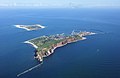
Heligoland
- Area
- 1.1 km²
- High point
- 61 m
Engelsmanplaat
- Area
- 1 km²
Engelschhoek
- Area
- 0.89 km²
Langli
- Area
- 0.73 km²
- High point
- 7 m
Unnamed island
- Area
- 0.67 km²

Süderoog
- Area
- 0.66 km²
- High point
- 5 m

Griend
- Area
- 0.66 km²
- High point
- 5 m

Düne
- Area
- 0.63 km²
- High point
- 13 m
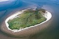
Jungnamensand
- Area
- 0.49 km²
Zuiderduintjes
- Area
- 0.42 km²
- High point
- 4 m
Südfall
- Area
- 0.41 km²
- High point
- 5 m
Unnamed island
- Area
- 0.4 km²
- High point
- 2 m

Blauort
- Area
- 0.4 km²
- High point
- 2 m
Unnamed island
- Area
- 0.23 km²

Uthörn
- Area
- 0.15 km²
- High point
- 4 m
Unnamed island
- Area
- 0.14 km²
Unnamed island
- Area
- 0.1 km²
- High point
- 2 m
Unnamed island
- Area
- —
size unknown
Bant
- Area
- —
size unknown
Buise
- Area
- —
size unknown
North Frisian Barrier Island
- Area
- —
size unknown
Simonszand
- Area
- —
size unknown
Wexalia
- Area
- —
size unknown
Islets
- Norderoog2 m · 0.09 km²
- Habel5 m · 0.07 km²
- Kormoraninsel0.05 km²
- Unnamed island2 m · 0.04 km²
- Unnamed island0.03 km²
- Unnamed island1 m · 0.02 km²
- Lütje Hörn0 m · 0.02 km²
- Unnamed island0.02 km²
- Unnamed island1 m · 0.8 ha
- Unnamed island1 m · 0.8 ha
- Unnamed island1 m · 0.8 ha
- Unnamed island1 m · 0.5 ha
Rocks & skerries
- Unnamed island<0.1 ha
- Unnamed island<0.1 ha
- Hiezel<0.1 ha
- Unnamed island<0.1 ha
- Unnamed island<0.1 ha
- Unnamed island<0.1 ha
- Unnamed island<0.1 ha
- Unnamed island<0.1 ha
- Unnamed island<0.1 ha
- Unnamed island<0.1 ha
- Unnamed island<0.1 ha
- Unnamed island<0.1 ha
Figures
Comparative heights
- Heligoland: 61 m
- Sylt: 53 m
- Vlieland: 45 m
- Amrum: 32 m
- Terschelling: 31 m
- Texel: 24 m
- Ameland: 24 m
- Borkum: 24 m
- Spiekeroog: 24 m
- Juist: 23 m
- Fanø: 21 m
- Schiermonnikoog: 20 m
- Norderney: 20 m
- Langeoog: 20 m
To the same scale
Islands by area
| Texel | 159 km² |
| Rømø | 129 km² |
| Terschelling | 85.2 km² |
| Föhr | 82.8 km² |
| Fanø | 60.7 km² |
| Ameland | 57.4 km² |
| Sylt | 57.3 km² |
| Schiermonnikoog | 43.7 km² |
| Vlieland | 38.8 km² |
| Pellworm | 37.6 km² |
| Borkum | 34.7 km² |
| Norderney | 27.9 km² |
| Amrum | 27.9 km² |
| Koresand | 22.6 km² |
| Langeoog | 19.8 km² |
| Spiekeroog | 18.1 km² |
| Juist | 14.7 km² |
| Süderoogsand | 14.6 km² |
| Langeneß | 10.2 km² |
| Norderoogsand | 9.4 km² |
| Mandø | 8.7 km² |
| Wangerooge | 8.6 km² |
| Rottumerplaat | 8.3 km² |
| Baltrum | 6.6 km² |
| Hooge | 5.7 km² |
| Noorderhaaks | 4.9 km² |
| Mellum | 4.7 km² |
| Minsener Oog | 4.2 km² |
| Memmert | 4.1 km² |
| Japsand | 4 km² |
| Richel | 3.4 km² |
| Unnamed island | 3.4 km² |
| Neuwerk | 3 km² |
| Rif | 2.8 km² |
| Kachelotplate | 2.7 km² |
| Hoher Knechtsand | 2.7 km² |
| Rottumeroog | 2.3 km² |
| Oland | 2.1 km² |
| Gröde | 2 km² |
| Nigehörn | 2 km² |
| Trischen | 1.9 km² |
| Nordstrandischmoor | 1.6 km² |
| Scharhörn | 1.4 km² |
| Hamburger Hallig | 1.1 km² |
| Heligoland | 1.1 km² |
| Engelsmanplaat | 1 km² |
| Engelschhoek | 0.89 km² |
| Langli | 0.73 km² |
| Unnamed island | 0.67 km² |
| Süderoog | 0.66 km² |
| Griend | 0.66 km² |
| Düne | 0.63 km² |
| Jungnamensand | 0.49 km² |
| Zuiderduintjes | 0.42 km² |
| Südfall | 0.41 km² |
| Unnamed island | 0.4 km² |
| Blauort | 0.4 km² |
| Unnamed island | 0.23 km² |
| Uthörn | 0.15 km² |
| Unnamed island | 0.14 km² |
| Unnamed island | 0.1 km² |
| Norderoog | 0.09 km² |
| Habel | 0.07 km² |
| Kormoraninsel | 0.05 km² |
| Unnamed island | 0.04 km² |
| Unnamed island | 0.03 km² |
| Unnamed island | 0.02 km² |
| Lütje Hörn | 0.02 km² |
| Unnamed island | 0.02 km² |
| Unnamed island | 0.8 ha |
| Unnamed island | 0.8 ha |
| Unnamed island | 0.8 ha |
| Unnamed island | 0.5 ha |
| Unnamed island | 0.5 ha |
| Unnamed island | 0.4 ha |
| Unnamed island | 0.4 ha |
| Unnamed island | 0.3 ha |
| Unnamed island | 0.3 ha |
| Unnamed island | 0.3 ha |
| Unnamed island | 0.3 ha |
| Unnamed island | 0.2 ha |
| Unnamed island | 0.2 ha |
| Unnamed island | 0.2 ha |
| Unnamed island | 0.2 ha |
| Unnamed island | 0.2 ha |
| Unnamed island | 0.1 ha |
| Unnamed island | 0.1 ha |
| Unnamed island | 0.1 ha |
| Unnamed island | 0.1 ha |
| Unnamed island | 0.1 ha |
| Unnamed island | 0.1 ha |
| Unnamed island | 0.1 ha |
| Unnamed island | <0.1 ha |
| Unnamed island | <0.1 ha |
| Hiezel | <0.1 ha |
| Unnamed island | <0.1 ha |
| Unnamed island | <0.1 ha |
| Unnamed island | <0.1 ha |
| Unnamed island | <0.1 ha |
| Unnamed island | <0.1 ha |
| Unnamed island | <0.1 ha |
| Unnamed island | <0.1 ha |
| Unnamed island | <0.1 ha |
| Unnamed island | <0.1 ha |
| Unnamed island | <0.1 ha |
| Unnamed island | <0.1 ha |
| Unnamed island | <0.1 ha |
| Unnamed island | <0.1 ha |
| Unnamed island | <0.1 ha |
| Unnamed island | <0.1 ha |
| Unnamed island | <0.1 ha |
| Unnamed island | <0.1 ha |
| SW-Stand | <0.1 ha |
| Unnamed island | <0.1 ha |
| Unnamed island | <0.1 ha |
| Unnamed island | <0.1 ha |
| Unnamed island | <0.1 ha |
| Unnamed island | <0.1 ha |
| Unnamed island | <0.1 ha |
| Unnamed island | <0.1 ha |
| Unnamed island | <0.1 ha |
| Unnamed island | <0.1 ha |
| Unnamed island | <0.1 ha |
| Unnamed island | <0.1 ha |
Groups within
Overlapping groups
Photographs

Aerial image of Ameland (view from the west)

Aerial image of Schiermonnikoog (view from the southwest)

Aerial image of Terschelling (view from the southwest)

Aerial image of Vlieland (view from the west)

Schrägluftbild von Westen über die Insel Pellworm hinweg

Aerial view of the uninhabited Frisian Islands of Süderoogsand, Norderoogsand, Japsand, and Amrum, Germany, with inhabited islands Pellworm and Föhr at the right

Lighthouse on Schiermonnikoog

between Zuid Eierland and De Koog, sheep in the pasture


Aerial view of the inhabited Frisian Islands of Baltrum and Langeoog, Germany


Fanoe Island
Sources
Facts
Photographs
- Aerial image of Ameland (view from the west). Carsten Steger / CC BY-SA 4.0
- Aerial image of Schiermonnikoog (view from the southwest). Carsten Steger / CC BY-SA 4.0
- Aerial image of Terschelling (view from the southwest). Carsten Steger / CC BY-SA 4.0
- Aerial image of Vlieland (view from the west). Carsten Steger / CC BY-SA 4.0
- Luftaufnahmen Nordseekueste 2012-05-by-RaBoe-090. I have published this image as author Ra Boe under the "CC-BY-SA-3.0" in Wikipedia. This means that free, commercial usa / CC BY-SA 3.0 de
- Süderoogsand, Norderoogsand, Japsand, and Amrum. Dicklyon / CC BY-SA 4.0
- Vuurtorenschiermonnikoog. Patlo@mail.com / CC BY-SA 3.0
- Tussen Zuid Eierland en De Koog, schapen in de wei IMG 5999 2020-06-07 10.09. Michielverbeek / CC BY-SA 4.0
- Twee schepen afgemeerd, mogelijk op een van de Waddeneilanden, RP-F-2008-59-19. Rijksmuseum / CC0
- Baltrum and Langeoog, Germany. Dicklyon / CC BY-SA 4.0
- Cykelturister Fohr Schleswig 20160713 0158 (28232396021). Johan Wessman / News Oresund / CC BY 2.0
- Fanoe Island (32479727301). IMBiblio / CC BY-SA 2.0