Germany
54°02′N 8°19′E
Heligoland Bight
The Heligoland Bight, also known as Helgoland Bight, is a bay which forms the southern part of the German Bight, itself a bay of the North Sea, located at the mouth of the Elbe river.

Chart
Overview
The Heligoland Bight, also known as Helgoland Bight, is a bay which forms the southern part of the German Bight, itself a bay of the North Sea, located at the mouth of the Elbe river. The Heligoland Bight extends from the mouth of the Elbe to the islands of Heligoland and lies between the East Frisian island of Wangerooge and the North Frisian peninsula of Eiderstedt. The bight takes its name from the island of Heligoland. It was the location of World War I naval battles in 1914 and 1917. In 1939 it also had a World War II aerial battle named after it. In the Heligoland Basin (Helgoländer Becken), a basin lying directly southwest of Heligoland, the bight is up to 56 metres (184 ft) deep. One of the busiest shipping lanes in the world, from Hamburg and the mouth of the Elbe to the Straits of Dover and the English Channel, runs through the Heligoland Bight. The area also includes nature reserves such as the Heligoland Felssockel and the protected Wadden Sea, in which the Wadden Sea National Parks of Schleswig-Holstein (East), Hamburg (southeast) and Lower Saxony (south) are located. Besides the aforementioned islands of Heligoland, which form the northwestern boundary of the Heligoland Bight, there is the small island of Neuwerk in the southeast, which is located in the Wadden Sea off the Elbe estuary. South of this island is the estuary of the Weser and, to its west, the Jade Bight. Southwest of the Heligoland Bight is the East Frisian island of Wangerooge. East of the bight the Eider enters the sea with, to its north the Eiderstedt Peninsula and, to its south, Meldorf Bay.
From Wikipedia, CC BY-SA 4.0
Census, cataloged
- Major islands6
- Minor islands4
- Islets3
- Rocks & skerries9
Major islands
Neuwerk
- Area
- 3 km²
- High point
- 15 m
2 sq mi) tidal island in the Wadden Sea ("Mudflat Sea") a marginal part of North Sea along the German coast. The population in 2023 was 21. Neuwerk is located 13 km (8 mi) northwest of Cuxhaven, between the Weser and Elbe estuaries. The distance to the centre of Hamburg is about 120 km (70 mi).
Nigehörn
- Area
- 2 km²
- High point
- 5 m
Nigehörn (German pronunciation: [ˈniːɡəˌhœʁn]) is an uninhabited artificial island in the North Sea belonging to the German city of Hamburg.
Trischen
- Area
- 1.9 km²
- High point
- 5 m
5 miles) from the Trischendamm embankment. The island belongs to the municipality of Friedrichskoog and is only occupied from March to October by a bird warden from the Nature and Biodiversity Conservation Union or NABU. Otherwise it is out-of-bounds.
Scharhörn
- Area
- 1.4 km²
- High point
- 5 m
Scharhörn (German pronunciation: [ˈʃaʁhœʁn]) is an uninhabited island in the North Sea belonging to the city of Hamburg, Germany. The once most important daymark on the North Sea coast, the Scharhörnbake, was maintained here by the City of Hamburg from 1440 to 1979.
Düne
- Area
- 0.63 km²
- High point
- 13 m
Düne (German pronunciation: [ˈdyːnə] ; Danish: Dynen; North Frisian: de Halem) is one of two islands in the German Bight that form the Archipelago of Heligoland, the other being Heligoland proper.
Blauort
- Area
- 0.4 km²
- High point
- 2 m
Blauort (German pronunciation: [ˈblaʊˌʔɔʁt]) is one of Germany's uninhabited North Sea sandy islets off the coast of Dithmarschen (near Büsum), and measures about 1,200 m from north to south and 500 metres from east to west.
Minor islands
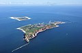
Heligoland
- Area
- 1.1 km²
- High point
- 61 m
Langlütjen I
- Area
- —
size unknown
North Frisian Barrier Island
- Area
- —
size unknown
Tertius
- Area
- —
size unknown
Islets
- Langlütjen II6 m · 0.02 km²
- Unnamed island3 m · 0.01 km²
- Unnamed island0.1 ha
Rocks & skerries
- Unnamed island<0.1 ha
- Unnamed island<0.1 ha
- Unnamed island<0.1 ha
- Unnamed island<0.1 ha
- Unnamed island<0.1 ha
- Unnamed island<0.1 ha
- Unnamed island<0.1 ha
- Unnamed island<0.1 ha
- Unnamed island<0.1 ha
Figures
Comparative heights
- Heligoland: 61 m
- Neuwerk: 15 m
- Düne: 13 m
- Langlütjen II: 6 m
- Nigehörn: 5 m
- Trischen: 5 m
- Scharhörn: 5 m
- Blauort: 2 m
To the same scale
Islands by area
| Neuwerk | 3 km² |
| Nigehörn | 2 km² |
| Trischen | 1.9 km² |
| Scharhörn | 1.4 km² |
| Heligoland | 1.1 km² |
| Düne | 0.63 km² |
| Blauort | 0.4 km² |
| Langlütjen II | 0.02 km² |
| Unnamed island | 0.01 km² |
| Unnamed island | 0.1 ha |
| Unnamed island | <0.1 ha |
| Unnamed island | <0.1 ha |
| Unnamed island | <0.1 ha |
| Unnamed island | <0.1 ha |
| Unnamed island | <0.1 ha |
| Unnamed island | <0.1 ha |
| Unnamed island | <0.1 ha |
| Unnamed island | <0.1 ha |
| Unnamed island | <0.1 ha |
Groups within
Overlapping groups
Photographs

Aerial image of Düne island (view from the southeast)

Fotoflug Nordsee, Scharhörn (vorne) und Nigehörn (hinten)

Fotoflug über das nordfriesische Wattenmeer

Auf der Insel aus Buntsandstein führt ein Rundweg auf dem Oberland entlang der Steilküste in Richtung Lange Anna..

Fotoflug Nordsee, Nigehörn
Ralf Roletschek (talk) - Fahrradtechnik auf fahrradmonteur.de / CC BY-SA 3.0 de

Auf der Insel aus Buntsandstein führt ein Rundweg auf dem Oberland entlang der Steilküste in Richtung Lange Anna..

Leuchtturm mit Vorland

Luftbilder von der Nordseeküste 2012-05. Die Sandbank Blauort.


Sources
Facts
Photographs
- Aerial image of Düne island (view from the southeast). Carsten Steger / CC BY-SA 4.0
- 11-09-04-fotoflug-nordsee-by-RalfR-018. Ralf Roletschek (talk) / CC BY-SA 3.0 de
- 13-09-29-nordfriesisches-wattenmeer-RalfR-11. Ralf Roletschek / CC BY-SA 3.0
- 20260816.Cliffs of Heligoland.-012. Bybbisch94 / CC BY-SA 4.0
- 11-09-04-fotoflug-nordsee-by-RalfR-027. Ralf Roletschek (talk) - Fahrradtechnik auf fahrradmonteur.de / CC BY-SA 3.0 de
- 20260816.Cliffs of Heligoland.-014. Bybbisch94 / CC BY-SA 4.0
- Leuchtturm Neuwerk. Dieter Matthe / CC BY-SA 4.0
- Luftaufnahmen Nordseekueste 2012-05-by-RaBoe-060. I have published this image as author Ra Boe under the "CC-BY-SA-3.0" in Wikipedia. This means that free, commercial usa / CC BY-SA 3.0 de
- 20260816.Helgoland Lange Anna.-011. Bybbisch94 / CC BY-SA 4.0
- 20260816.Helgoland Lange Anna.-013. Bybbisch94 / CC BY-SA 4.0
- 20260816.Lummenfelsen der Insel Helgoland.-012. Bybbisch94 / CC BY-SA 4.0
- 20260816.Lummenfelsen der Insel Helgoland.-013. Bybbisch94 / CC BY-SA 4.0