Wadden SeaNetherlands
53°22′N 5°29′E
West Frisian Islands
Nederlandse Waddeneilanden
Part of Frisian Islands
The West Frisian Islands (Dutch: Waddeneilanden, pronounced [ˈʋɑdə(n)ˌɛilɑndə(n)] ; West Frisian: Waadeilannen) are a chain of islands in the North Sea off the northern Dutch coast, along the edge of the Wadden Sea. They continue further east as the German East Frisian Islands and are part of the Frisian Islands.

Chart
Overview
The West Frisian Islands (Dutch: Waddeneilanden, pronounced [ˈʋɑdə(n)ˌɛilɑndə(n)] ; West Frisian: Waadeilannen) are a chain of islands in the North Sea off the northern Dutch coast, along the edge of the Wadden Sea. They continue further east as the German East Frisian Islands and are part of the Frisian Islands. From west to east the islands are: Noorderhaaks, Texel, Vlieland, Richel, Griend, Terschelling, Ameland, Rif, Engelsmanplaat, Schiermonnikoog, Simonszand, Rottumerplaat, Rottumeroog, and Zuiderduintjes. The Frisian Islands are nowadays mostly famous as a holiday destination. Island hopping is possible by regular ferries from the mainland and by specialised tour operators. Cycling is the most favourable means of transport on most of the islands. On Vlieland and Schiermonnikoog cars are allowed only for regular inhabitants.
From Wikipedia, CC BY-SA 4.0
Census, cataloged
- Major islands5
- Minor islands17
- Islets24
- Rocks & skerries22
Major islands
Texel
- Area
- 159 km²
- High point
- 24 m
Terschelling
- Area
- 85.2 km²
- High point
- 31 m
Terschelling (Dutch pronunciation: [tɛrˈsxɛlɪŋ] ; West Frisian: Skylge; Terschelling dialect: Schylge) is a municipality and an island in the northern Netherlands, one of the West Frisian Islands. It is situated between the islands of Vlieland and Ameland.
Ameland
- Area
- 57.4 km²
- High point
- 24 m
Ameland (Dutch pronunciation: [ˈaːməlɑnt] ; West Frisian: It Amelân [ət ˈaːməlɔ̃ːn]) is a municipality and one of the West Frisian Islands off the north coast of the Netherlands. It consists mostly of sand dunes and is the third major island of the West Frisians.
Schiermonnikoog
- Area
- 43.7 km²
- High point
- 20 m
Schiermonnikoog (Dutch: [ˌsxiːrmɔnəkˈoːx] ; West Frisian: Skiermûntseach [ˌskiəmuːnˈtsɪəχ] ; Schiermonnikoog Frisian: Schiermonnikeig) is an island, a municipality and national park in the Northern Netherlands. Schiermonnikoog is one of the West Frisian Islands, and is part of the province of Friesland.
Vlieland
- Area
- 38.8 km²
- High point
- 45 m
Vlieland (Dutch pronunciation: [ˈvlilɑnt] ; West Frisian: Flylân [ˈflilɔ̃ːn]) is a municipality and island in the northern Netherlands. The municipality of Vlieland is the second most sparsely populated municipality in the Netherlands, after Schiermonnikoog.

Minor islands

Rottumerplaat
- Area
- 8.3 km²
- High point
- 14 m
Noorderhaaks
- Area
- 4.9 km²
- High point
- 2 m
Richel
- Area
- 3.4 km²
- High point
- 5 m

Rif
- Area
- 2.8 km²
- High point
- 4 m

Rottumeroog
- Area
- 2.3 km²
- High point
- 9 m
Engelsmanplaat
- Area
- 1 km²
Engelschhoek
- Area
- 0.89 km²
Unnamed island
- Area
- 0.67 km²

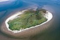
Griend
- Area
- 0.66 km²
- High point
- 5 m
Zuiderduintjes
- Area
- 0.42 km²
- High point
- 4 m
Unnamed island
- Area
- 0.4 km²
- High point
- 2 m
Unnamed island
- Area
- 0.23 km²
Unnamed island
- Area
- 0.14 km²
Unnamed island
- Area
- 0.1 km²
- High point
- 2 m
Unnamed island
- Area
- —
size unknown
Simonszand
- Area
- —
size unknown
Wexalia
- Area
- —
size unknown
Islets
- Unnamed island2 m · 0.04 km²
- Unnamed island0.03 km²
- Unnamed island1 m · 0.02 km²
- Unnamed island0.02 km²
- Unnamed island1 m · 0.8 ha
- Unnamed island1 m · 0.8 ha
- Unnamed island1 m · 0.8 ha
- Unnamed island1 m · 0.5 ha
- Unnamed island1 m · 0.5 ha
- Unnamed island1 m · 0.4 ha
- Unnamed island1 m · 0.3 ha
- Unnamed island0.3 ha
Rocks & skerries
- Unnamed island<0.1 ha
- Hiezel<0.1 ha
- Unnamed island<0.1 ha
- Unnamed island<0.1 ha
- Unnamed island<0.1 ha
- Unnamed island<0.1 ha
- Unnamed island<0.1 ha
- Unnamed island<0.1 ha
- Unnamed island<0.1 ha
- Unnamed island<0.1 ha
- Unnamed island<0.1 ha
- Unnamed island<0.1 ha
Figures
Comparative heights
- Vlieland: 45 m
- Terschelling: 31 m
- Texel: 24 m
- Ameland: 24 m
- Schiermonnikoog: 20 m
- Rottumerplaat: 14 m
- Rottumeroog: 9 m
- Richel: 5 m
- Griend: 5 m
- Rif: 4 m
- Zuiderduintjes: 4 m
- Noorderhaaks: 2 m
To the same scale
Islands by area
| Texel | 159 km² |
| Terschelling | 85.2 km² |
| Ameland | 57.4 km² |
| Schiermonnikoog | 43.7 km² |
| Vlieland | 38.8 km² |
| Rottumerplaat | 8.3 km² |
| Noorderhaaks | 4.9 km² |
| Richel | 3.4 km² |
| Rif | 2.8 km² |
| Rottumeroog | 2.3 km² |
| Engelsmanplaat | 1 km² |
| Engelschhoek | 0.89 km² |
| Unnamed island | 0.67 km² |
| Griend | 0.66 km² |
| Zuiderduintjes | 0.42 km² |
| Unnamed island | 0.4 km² |
| Unnamed island | 0.23 km² |
| Unnamed island | 0.14 km² |
| Unnamed island | 0.1 km² |
| Unnamed island | 0.04 km² |
| Unnamed island | 0.03 km² |
| Unnamed island | 0.02 km² |
| Unnamed island | 0.02 km² |
| Unnamed island | 0.8 ha |
| Unnamed island | 0.8 ha |
| Unnamed island | 0.8 ha |
| Unnamed island | 0.5 ha |
| Unnamed island | 0.5 ha |
| Unnamed island | 0.4 ha |
| Unnamed island | 0.3 ha |
| Unnamed island | 0.3 ha |
| Unnamed island | 0.3 ha |
| Unnamed island | 0.3 ha |
| Unnamed island | 0.2 ha |
| Unnamed island | 0.2 ha |
| Unnamed island | 0.2 ha |
| Unnamed island | 0.2 ha |
| Unnamed island | 0.2 ha |
| Unnamed island | 0.1 ha |
| Unnamed island | 0.1 ha |
| Unnamed island | 0.1 ha |
| Unnamed island | 0.1 ha |
| Unnamed island | 0.1 ha |
| Unnamed island | <0.1 ha |
| Hiezel | <0.1 ha |
| Unnamed island | <0.1 ha |
| Unnamed island | <0.1 ha |
| Unnamed island | <0.1 ha |
| Unnamed island | <0.1 ha |
| Unnamed island | <0.1 ha |
| Unnamed island | <0.1 ha |
| Unnamed island | <0.1 ha |
| Unnamed island | <0.1 ha |
| Unnamed island | <0.1 ha |
| Unnamed island | <0.1 ha |
| Unnamed island | <0.1 ha |
| Unnamed island | <0.1 ha |
| Unnamed island | <0.1 ha |
| Unnamed island | <0.1 ha |
| Unnamed island | <0.1 ha |
| Unnamed island | <0.1 ha |
| Unnamed island | <0.1 ha |
| Unnamed island | <0.1 ha |
| Unnamed island | <0.1 ha |
| Unnamed island | <0.1 ha |
Photographs

Aerial image of Ameland (view from the west)

Aerial image of Schiermonnikoog (view from the southwest)

Aerial image of Terschelling (view from the southwest)

Aerial image of Vlieland (view from the west)

West Frisian Islands/Waddeneilanden. Satellite view. Extreme left: Noorderhaaks (islet: white sandbank) Extreme right: Borkum (German island)

between Zuid Eierland and De Koog, sheep in the pasture

Some West Frisian Islands (Netherlands) and some East Frisian Islands (Germany), from left to right: Rottumerplaat, Rottumeroog (top) with Zuiderduintjes (below), Borkum, Kachelotplate, Juist (top) and Lütje Hörn (below), Memmert

Friesland, The Netherlands. Satellite picture.
Sources
Facts
Photographs
- Aerial image of Ameland (view from the west). Carsten Steger / CC BY-SA 4.0
- Aerial image of Schiermonnikoog (view from the southwest). Carsten Steger / CC BY-SA 4.0
- Aerial image of Terschelling (view from the southwest). Carsten Steger / CC BY-SA 4.0
- Aerial image of Vlieland (view from the west). Carsten Steger / CC BY-SA 4.0
- W W West Frisian Islands. NASA / Public domain
- Tussen Zuid Eierland en De Koog, schapen in de wei IMG 5999 2020-06-07 10.09. Michielverbeek / CC BY-SA 4.0
- Borkum 6.72782E 53.59398N. – (NASA World Wind) / Public domain
- Friesland-5.62E-53.13N. NASA / Public domain
- Texel dunes banner. Danapit / CC BY-SA 3.0