Pacific OceanJapan
25°00′N 124°00′E
Sakishima Islands
先島諸島
Part of Ryukyu Islands
The Sakishima Islands are an archipelago located at the southernmost end of the Japanese archipelago. They are part of the Ryukyu Islands and include the Miyako Islands and the Yaeyama Islands. The islands are administered as part of Okinawa Prefecture, Japan.

Chart
Overview
The Sakishima Islands are an archipelago located at the southernmost end of the Japanese archipelago. They are part of the Ryukyu Islands and include the Miyako Islands and the Yaeyama Islands. The islands are administered as part of Okinawa Prefecture, Japan.
From Wikipedia, CC BY-SA 4.0
Census, cataloged
- Major islands3
- Minor islands42
- Islets126
- Rocks & skerries903
Major islands
Iriomote Island
- Area
- 290 km²
- High point
- 470 m
Iriomote Island (西表島, Iriomote-jima; Yaeyama: Irïmutii; Iriomote: Irimutii; Okinawan: Iriumuti) is the largest of the Yaeyama Islands of Japan, and the second largest in Okinawa Prefecture after Okinawa Island itself.
Ishigaki Island
- Area
- 223 km²
- High point
- 526 m
mä́), -ŋä́-]; Yaeyama: Ishanagï; Okinawan: Ishigachi) is a Japanese island south-west of Okinawa Hontō and the second-largest island of the Yaeyama Island group, behind Iriomote Island. It is located approximately 411 km (255 mi) south-west of Okinawa Hontō. It is within the City of Ishigaki in Okinawa Prefecture.
Miyako Island
- Area
- 159 km²
- High point
- 109 m
Miyako Island (Japanese: 宮古島, Hepburn: Miyako-jima; Miyako: Myaaku (ミャーク); Okinawan: Naaku (ナーク)) is the largest and the most populous island among the Miyako Islands of Okinawa Prefecture, Japan.

Minor islands

Irabu Island
- Area
- 29.2 km²
- High point
- 89 m

Yonaguni
- Area
- 28.9 km²
- High point
- 231 m

Tarama Island
- Area
- 19.8 km²
- High point
- 35 m

Hateruma
- Area
- 12.7 km²
- High point
- 59 m

Kuroshima
- Area
- 10 km²
- High point
- 17 m
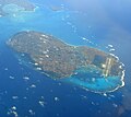
Shimoji Island
- Area
- 9.6 km²
- High point
- 26 m
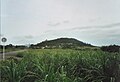
Kohama Island
- Area
- 7.9 km²
- High point
- 99 m

Taketomi Island
- Area
- 5.4 km²
- High point
- 24 m

Uotsuri Island
- Area
- 3.8 km²
- High point
- 362 m

Kurima Island
- Area
- 2.8 km²
- High point
- 48 m

Ikema Island
- Area
- 2.8 km²
- High point
- 31 m

Minna Island
- Area
- 2.2 km²
- High point
- 15 m

Uchibanari island
- Area
- 2.1 km²
- High point
- 192 m

Aragusuku Islands
- Area
- 1.8 km²
- High point
- 15 m
Shimoji Island
- Area
- 1.6 km²
- High point
- 21 m
Kamiji Island
- Area
- 1.6 km²
- High point
- 12 m

Sotobanari
- Area
- 1.3 km²
- High point
- 143 m

Hatoma
- Area
- 0.97 km²
- High point
- 34 m

Kuba Island
- Area
- 0.9 km²
- High point
- 177 m
Minamikojima
- Area
- 0.4 km²
- High point
- 139 m

Kayama Island
- Area
- 0.39 km²
- High point
- 18 m
Unnamed island
- Area
- 0.38 km²
- High point
- 10 m
Small Island
- Area
- 0.37 km²
- High point
- 17 m

Kitakojima
- Area
- 0.31 km²
- High point
- 125 m

Ogami Island
- Area
- 0.28 km²
- High point
- 72 m

Nakanokamishima
- Area
- 0.23 km²
- High point
- 102 m

Yubu Island
- Area
- 0.16 km²
- High point
- 8 m
Unnamed island
- Area
- —
size unknown
Chibei East Islet
- Area
- —
size unknown
Chibei South Islet
- Area
- —
size unknown
Chibei West Islet
- Area
- —
size unknown
Chitou Islet
- Area
- —
size unknown
Dajinguizi Islet
- Area
- —
size unknown
Dongniujiao Islet
- Area
- —
size unknown
Feilong Islet
- Area
- —
size unknown
Longzhu Islet
- Area
- —
size unknown
Niaocao Islet
- Area
- —
size unknown
Niaoluan Islet
- Area
- —
size unknown
Saipanari
- Area
- —
size unknown
Wangchi Islet
- Area
- —
size unknown
Xiaochiwei Islet
- Area
- —
size unknown
Xiniujiao Islet
- Area
- —
size unknown
Rocks & skerries
On the chart above, at its closest zooms.
Listing 45 of 1074; the rest are on the chart.
Figures
Comparative heights
- Ishigaki: 526 m
- Iriomote: 470 m
- Uotsuri: 362 m
- Yonaguni: 231 m
- Uchibanari: 192 m
- Kuba: 177 m
- Sotobanari: 143 m
- Minamikojima: 139 m
- Kitakojima: 125 m
- Miyako: 109 m
- Nakanokamishima: 102 m
- Kohama: 99 m
- Irabu: 89 m
- Ogami: 72 m
To the same scale
Islands by area
| Iriomote Island | 290 km² |
| Ishigaki Island | 223 km² |
| Miyako Island | 159 km² |
| Irabu Island | 29.2 km² |
| Yonaguni | 28.9 km² |
| Tarama Island | 19.8 km² |
| Hateruma | 12.7 km² |
| Kuroshima | 10 km² |
| Shimoji Island | 9.6 km² |
| Kohama Island | 7.9 km² |
| Taketomi Island | 5.4 km² |
| Uotsuri Island | 3.8 km² |
| Kurima Island | 2.8 km² |
| Ikema Island | 2.8 km² |
| Minna Island | 2.2 km² |
| Uchibanari island | 2.1 km² |
| Aragusuku Islands | 1.8 km² |
| Shimoji Island | 1.6 km² |
| Kamiji Island | 1.6 km² |
| Sotobanari | 1.3 km² |
| Hatoma | 0.97 km² |
| Kuba Island | 0.9 km² |
| Minamikojima | 0.4 km² |
| Kayama Island | 0.39 km² |
| Unnamed island | 0.38 km² |
| Small Island | 0.37 km² |
| Kitakojima | 0.31 km² |
| Ogami Island | 0.28 km² |
| Nakanokamishima | 0.23 km² |
| Yubu Island | 0.16 km² |
Groups within
Photographs

Kabira Bay of Ishigaki Island in Ishigaki City, Okinawa Prefecture, Japan. It is one of the Japan's Places of Scenic Beauty.

Large mangrove forest along Urauchi River in Iriomote Island of the Yaeyama Islands, Okinawa, Japan

Yonahamaehama Beach view from Kurima Island in Miyakojima, Okinawa Prefecture, Japan.

Sakishima Islands, Okinawa Prefecture, Japan.

Sakishima Islands, Okinawa, Japan.
Sources
Facts
Photographs
- Kabira Bay Ishigaki Island41s3s4500. 663highland / CC BY 2.5
- Mangrove swamp, Iriomote Island, Okinawa, Japan. Anagounagi / CC BY-SA 4.0
- Yonahamaehama Miyakojima Okinawa Japan06s3s4592. 663highland / CC BY 2.5
- Sakishima Islands ISS039. Image Science and Analysis Laboratory, NASA-Johnson Space Center. "The Gateway to Astronaut Photography of Earth." / Public domain
- Sakishima Islands. NASA, Terra / MODIS / Public domain