East China SeaJapan
24°20′N 124°00′E
Yaeyama Islands
Part of Sakishima Islands
36 mi2). The islands are located southwest of the Miyako Islands, part of the Ryukyu Islands archipelago. The Yaeyama Islands are the most remote part of Japan from the main islands and contain Japan's southernmost (Hateruma) and westernmost (Yonaguni) inhabited islands.

Chart
Overview
The Yaeyama Islands (八重山列島 Yaeyama-rettō, also 八重山諸島 Yaeyama-shotō, Yaeyama: Yaima, Yonaguni: Daama, Okinawan: Yeema, Northern Ryukyuan: やへま Yapema) are an archipelago in the southwest of Okinawa Prefecture, Japan, and cover 591.46 square kilometres (228.36 mi2). The islands are located southwest of the Miyako Islands, part of the Ryukyu Islands archipelago. The Yaeyama Islands are the most remote part of Japan from the main islands and contain Japan's southernmost (Hateruma) and westernmost (Yonaguni) inhabited islands. The city of Ishigaki serves as the political, cultural, and economic center of the Yaeyama Islands. On maps dating to the 1700s, the Yaeyama Group of Islands appears as the "Majico Sima Group", "Nambu-soto Islands", "Nambu Soto", and the "Taipin Islands".
From Wikipedia, CC BY-SA 4.0
Census, cataloged
- Major islands2
- Minor islands17
- Islets75
- Rocks & skerries416
Major islands
Iriomote Island
- Area
- 290 km²
- High point
- 470 m
Iriomote Island (西表島, Iriomote-jima; Yaeyama: Irïmutii; Iriomote: Irimutii; Okinawan: Iriumuti) is the largest of the Yaeyama Islands of Japan, and the second largest in Okinawa Prefecture after Okinawa Island itself.
Ishigaki Island
- Area
- 223 km²
- High point
- 526 m
mä́), -ŋä́-]; Yaeyama: Ishanagï; Okinawan: Ishigachi) is a Japanese island south-west of Okinawa Hontō and the second-largest island of the Yaeyama Island group, behind Iriomote Island. It is located approximately 411 km (255 mi) south-west of Okinawa Hontō. It is within the City of Ishigaki in Okinawa Prefecture.
Minor islands

Yonaguni
- Area
- 28.9 km²
- High point
- 231 m

Hateruma
- Area
- 12.7 km²
- High point
- 59 m

Kuroshima
- Area
- 10 km²
- High point
- 17 m
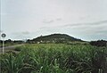
Kohama Island
- Area
- 7.9 km²
- High point
- 99 m

Taketomi Island
- Area
- 5.4 km²
- High point
- 24 m

Uchibanari island
- Area
- 2.1 km²
- High point
- 192 m

Aragusuku Islands
- Area
- 1.8 km²
- High point
- 15 m
Shimoji Island
- Area
- 1.6 km²
- High point
- 21 m
Kamiji Island
- Area
- 1.6 km²
- High point
- 12 m

Sotobanari
- Area
- 1.3 km²
- High point
- 143 m

Hatoma
- Area
- 0.97 km²
- High point
- 34 m

Kayama Island
- Area
- 0.39 km²
- High point
- 18 m
Small Island
- Area
- 0.37 km²
- High point
- 17 m

Nakanokamishima
- Area
- 0.23 km²
- High point
- 102 m

Yubu Island
- Area
- 0.16 km²
- High point
- 8 m
Unnamed island
- Area
- —
size unknown
Saipanari
- Area
- —
size unknown
Rocks & skerries
On the chart above, at its closest zooms.
Listing 19 of 510; the rest are on the chart.
Figures
Comparative heights
- Ishigaki: 526 m
- Iriomote: 470 m
- Yonaguni: 231 m
- Uchibanari: 192 m
- Sotobanari: 143 m
- Nakanokamishima: 102 m
- Kohama: 99 m
- Hateruma: 59 m
- Hatoma: 34 m
- Taketomi: 24 m
- Shimoji: 21 m
- Kayama: 18 m
- Kuroshima: 17 m
- Small: 17 m
To the same scale
Islands by area
| Iriomote Island | 290 km² |
| Ishigaki Island | 223 km² |
| Yonaguni | 28.9 km² |
| Hateruma | 12.7 km² |
| Kuroshima | 10 km² |
| Kohama Island | 7.9 km² |
| Taketomi Island | 5.4 km² |
| Uchibanari island | 2.1 km² |
| Aragusuku Islands | 1.8 km² |
| Shimoji Island | 1.6 km² |
| Kamiji Island | 1.6 km² |
| Sotobanari | 1.3 km² |
| Hatoma | 0.97 km² |
| Kayama Island | 0.39 km² |
| Small Island | 0.37 km² |
| Nakanokamishima | 0.23 km² |
| Yubu Island | 0.16 km² |
Groups within
Photographs

Kabira Bay of Ishigaki Island in Ishigaki City, Okinawa Prefecture, Japan. It is one of the Japan's Places of Scenic Beauty.

Large mangrove forest along Urauchi River in Iriomote Island of the Yaeyama Islands, Okinawa, Japan

内離島坑口(正面浜辺の岩の左側、右側は水浴び場所)、内離島送風用煙突(正面中央部の突起)

浜島(沖縄県八重山郡竹富町)

浜島(沖縄県八重山郡竹富町)

Yaeyama Islands, Ryukyu Islandsin Okinawa, Japan

Native forest of Satake palm trees (Satakentia liukiuensis) with pineapple plantation, Ishigaki Island of the Yaeyama Islands, Okinawa, Japan

八重山の女性と子供の衣服。
Sources
Facts
Photographs
- Kabira Bay Ishigaki Island41s3s4500. 663highland / CC BY 2.5
- Mangrove swamp, Iriomote Island, Okinawa, Japan. Anagounagi / CC BY-SA 4.0
- Uchipanari2. Miyo&SDD34 / CC BY-SA 4.0
- Yaeyama hamajima 2010 1. Paipateroma / CC BY-SA 4.0
- Yaeyama hamajima 2010 2. Paipateroma / CC BY-SA 4.0
- ISS005-E-10686 Yeyama Islands. NASA / Public domain
- Satake palm trees (Satakentia liukiuensis) with pineapple plantation, Ishigaki Island, Okinawa, Japan. Anagounagi / CC BY-SA 4.0
- Aragusuku (Panari) Island Okinawa prefecture Wikivoyage banner. mariemon / CC BY-SA 3.0
- Females and children of the Yaeyama Islands. 鳥居龍蔵 / Public domain